


Some of Iceland’s roads are distinctive enough that travelers understandably take a special interest in them. Below we have picked out the most important ones – in both the ‘paved’ and the mountain category. See what makes each of them stand out, what you’ll find along the way, and what deserves extra attention when you drive them.
Also read the other guides on driving in Iceland linked at the end of the article.
Iceland’s most important paved roads
Iceland’s roads are mostly paved, smooth and straight, and they differ mainly in the quality of the views you get from them.
The exceptions include the shortcut to Egilsstadir – Road 939 in the southeast – steep (17% according to the sign!), winding, narrow and gravel. The last stretch of access Road 218 to Dyrholey near Vik is similar (there is even a ban on driving it without 4×4). And then there’s Road 332 leading to the parking lot and the viewpoint over Haifoss waterfall – also fairly steep (well, not 17%) and narrow gravel. One broad exception is the roads of the West Fjords peninsula – often gravel and quite steep at the same time.
However, the primary road network in Iceland is well-maintained, though rather narrow, paved roads. Except in winter and periods of exceptionally inclement weather, they allow for comfortable travel. Gas stations, small restaurants, parking lots, campsites, stores and hotels – all this infrastructure stands at a fairly high level and is relatively easy to access.
Roads in Iceland are marked with numbers. The more digits, the smaller and less important the road. The most important road in the country – the island’s ring road – is numbered 1, and it is the only road with a single-digit number. The smallest roads have four-digit numbers.
Road No. 1: Iceland’s ring road
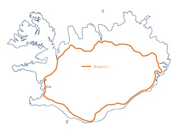 Road No. 1 is about 1,350 km (840 miles) long and circles the entire island, passing through its most important towns. The Ring Road links Reykjavik in the west, Vik in the south, Egilsstadir in the east and Akureyri in the north, among other places. It also runs close to a huge number of Iceland’s most important attractions – we described them in the article Road 1’s biggest attractions (+ 10 extras).

Road No. 1 in southern Iceland
- Golden Circle – a route linking the absolute top attractions near Reykjavik (including Geysir and Strokkur geysers),
- some of the north’s key attractions: the canyon Asbyrgi, the waterfall Dettifoss and the center of whale watching cruises – the town of Husavik,
- the northwestern capes of Snaefellsnes and West Fjords,
- Southwest Cape Reykjanes – famous for its international airport Keflavik, Blue Lagoon, area attractions Grindavik, and more recently from Iceland’s newest volcano: Geldingadalir / Fagradalsfjall,
- Because it loops around the island, Road 1 naturally does not pass through the central part of Iceland either, the so-called interior.
Arctic Promenade: Nordurstrandarleid
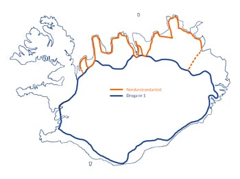 Norðurstrandarleið (Arctic Coast Way) is the name of a group of roads that run along the northern coast of Iceland. The roads have existed for a long time, but as one common road route Nordurstrandarleid was opened on June 8, 2019. The route has a total length of just over 800 km (500 miles) and is marked with special signs.
Moving along these routes, we can admire the beautiful rugged nature of Iceland, especially the abundance of amazing cliffs. If you’re lucky, you can even spot whales swimming in the ocean!
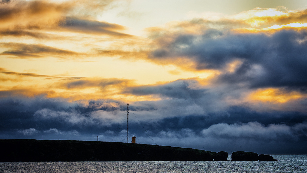
Sunset over Nordurstrandarleid
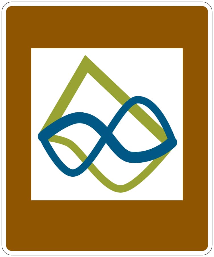
Nordurstrandarleid route sign
On the official website of the trail: Arctic Coast Way you will find extensive and up-to-date information about interesting places to visit there.
If you’re looking for scenery with sweeping cliffs and wilderness, be sure to extend your route with a visit to the West Fjords.
Roads 54 and 574: Snaefellsnes ring road
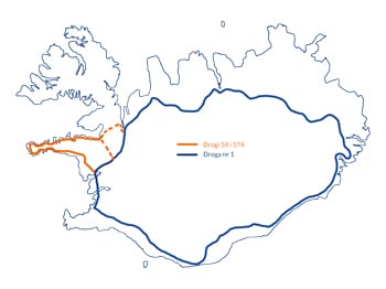 Snaefellsnes is a peninsula often called Iceland in miniature. In a relatively small area you really do find (almost) every type of Iceland’s biggest attractions. Lava fields, beautiful cliffs, waterfalls, a glacier.
Several of the attractions here are absolute top spots that should be seen by anyone who wants to explore Iceland. These certainly include:
- the most beautiful mountain – Kirkjufell;
- the prettiest church – Budakirkja;
- the prettiest cliffs – Arnarstapi;
- one of the most interesting caves – Vatnshellir;
- an unusual crevice Raudfeldsgja;
- a permanent seal colony at Ytri Tunga.
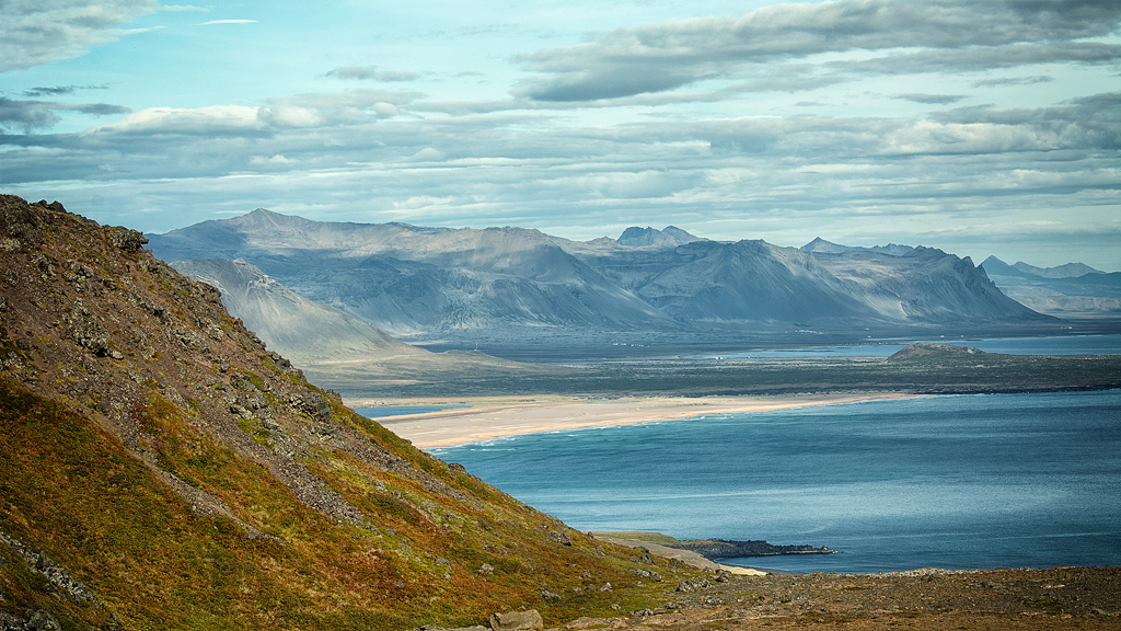
Snaefellsnes coast
Snaefellsnes is a small peninsula, and almost all of its attractions are really interesting. Wanting to collect them into a Top10 list, one would have to list almost all of them 😉 That’s why we don’t have such a list, and if you’re going there, just have a look at all the articles about the peninsula’s attractions: attractions of Snaefellsnes.
Roads 60, 61, 62, 63 and 68: around the West Fjords
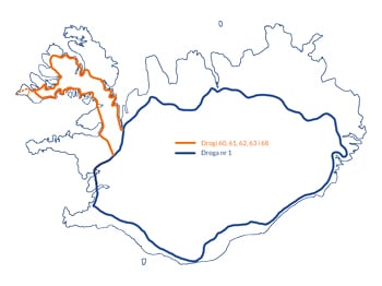 A separate, somewhat particular category is the roads of the West Fjords peninsula.
Until recently, these roads were 100% gravel, but today they are mostly covered with asphalt, although for the sake of balance, the asphalt is often in fairly poor condition. Still, in many places they are very narrow and winding roads. At the same time, they are also extremely photogenic – driving along the edge of the fjord at the foot of hills and cliffs can be truly remarkable.
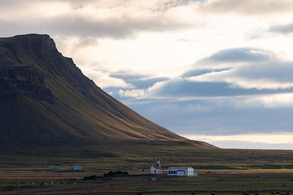
West Fjords landscape
Roads 60 and 61 meet in close proximity to the capital of the West Fjords – Isafjordur. Most of the peninsula’s most popular attractions lie along one of these roads. Only Latrabjarg – the cliffs considered the best place in Iceland to watch puffins – takes you off onto side Road 612. The beach of Raudasandur, close to Latrabjarg, is reached by Road 614. Both are marked on the map with a dashed line in the far west of the peninsula.
Most important mountain roads in Iceland

Mountain road opening dates. [source: road.is]
You can read about the specifics of driving on them, including in particular the basic rules for crossing fords, in this article Iceland’s Roads — What to Expect. In short: always stay alert, check the weather for the next day and stay safe.
Here we will just focus on a fairly concise description of the most important ones.
Road (F)35: Kjalvegur
 The Kjalvegur road is one of the two most important roads connecting the north and south of Iceland. It is the safest of all Icelandic mountain roads.
It is so safe that it has officially lost its F designation and its classification as a mountain road. Officially it is simply Road 35. To put it another way: practically any regular car can handle it, even without all-wheel drive.
There are no water crossings or particularly steep climbs along Road 35. Unless there happen to be some exceptionally adverse weather conditions, you can also manage on it without a 4×4 drive. Road 35 is a safe, well-graded gravel route. Its northern and southern ends are even paved. If you don’t plan to drive off it onto the F347 route leading to Kerlingarfjöll, you’ll drive it with a regular car.
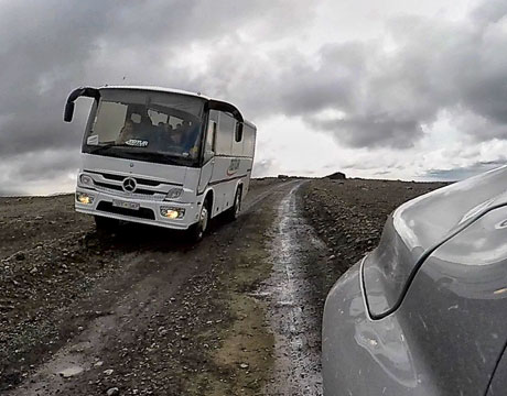
Passing a bus on the F35
On the other hand, an unpleasant surprise you may encounter on this road is an empty tank, so absolutely remember to refuel your car. From the N1 gas station at Geysir all the way to the N1 or OB station in the north at Blönduós, Vidigerdi or Varmahlíð, there is a full 200 km (125 miles) of road with nowhere to refuel. 200 km isn’t very much, of course, but bear in mind that fuel consumption is higher on gravel than on asphalt. Best to set out here simply with a full tank.
Road F26: Sprengisandsleid
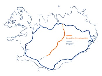 The F26 (isl. Sprengisandsleið) road is, next to the F35, the second most important road through the interior that connects the south to the north of the island. It is much more interesting in terms of scenery than its western sister. However, this is already a genuine off-road route, and only drivers of four-wheel-drive vehicles are allowed on the F26.
Along the route of the F26 road, one has to cross (shallow) river fords or streams several times, as well as negotiate rather steeply sloping sections. For a 4×4 car, however, these are not problematic obstacles, even if the driver has little off-road experience. All you need to do is to be careful and familiar with the operation of your car. You need to know how to engage all-wheel drive, low range and the differential lock.
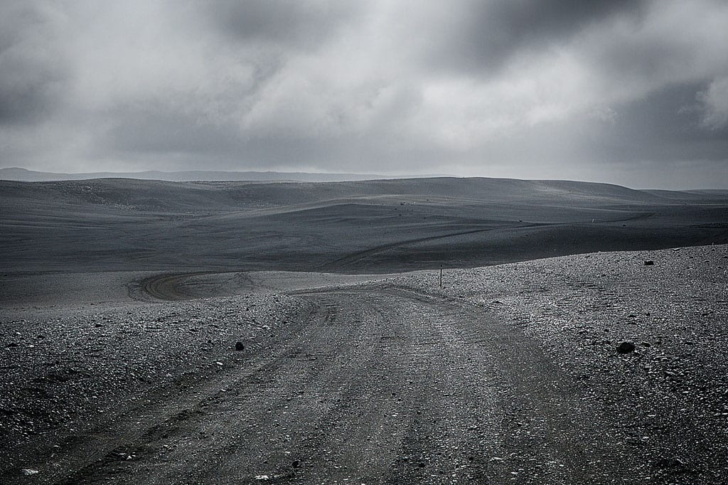
Pumice landscape on the F26 road (A full color photo!)
The strictly off-road stretch, where you will find nowhere to refuel, is about 240 km (150 miles) in total. However, this is a trip you should definitely take if you want to experience the scenery offered by the Icelandic interior.
To the south – near Hrauneyjar – the F26 road connects to the F208 (description below), which in turn can be used to reach Landmannalaugar and further south around Kirkjubaejarklaustur.
In addition to the attractions at both ends of the road, there are sights to see along the way:
- the beautiful waterfall Aldeyjarfoss;
- numerous attractions in the highlands Nyidalur;
- on the F821 side road you’ll find the Laugafell hut (not to be confused with Laugarfell to the east!); here you will find, among other things, a hot spring lying almost perfectly in the middle of the island;
From the F26 you can also descend to the western – the most difficult! – part of the F910 road to Askja.
Road F910: Austurleið
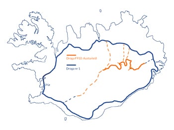 The F910 is one of Iceland’s most interesting mountain roads. Its route runs along the northern edge of the Vatnajökull glacier. The F910 stretches between Road 933 in the east, near Egilsstaðir, and Road F26 in the west, north of Nyidalur.
The F910 road can be divided into 3 parts that are very different from each other:
- Eastern part of the F910
In its initial eastern section, starting at Road 933, the route is covered with asphalt and marked with the number 910, without the letter F. During the period when there is no snow on it, it is passable for all types of cars. However, remember to watch out even then for the phenomenon of so-called black ice, which is simply dangerous, hard-to-see ice on the road. - The middle part of the F910
The middle part of the F910 road leads from the Kárahnjúkavirkjun dam and the Hafrahvammagljúfur canyon to the Dreki hut near the Askja volcano. This is a beautiful route full of amazing views, which, depending on the weather and the type of car, you will cover in 4-6 hours. Along the way you have to cross water several times. These are mostly shallow fords, and the only deep river is spanned by a very solid bridge.In this section, the F910 largely overlaps with the F905 road. It will lead you through an amazing black and gray volcanic wasteland. You’ll also be driving directly over solidified lava, which guarantees some of the most magnificent scenery available on all of Iceland’s mountain routes. From this section you can also drive down the F907 to the famous canyon Studlagil.
A stretch of the middle section of the F910
- Western part of the F910
The western part of the F910 road connects the Dreki hut with the F26 road and along its length the level of difficulty changes significantly. However, this route, while beautiful, is really extreme – full of narrow passes with sharp rocks interspersed with passages where it is very difficult to find the road at all. The road is often closed even in the middle of summer, and only experienced off-road enthusiasts should enter it anyway.Though the western part of the F910 road feels like absolute off-road, remember that even there you are not allowed to drive off the road!This section of the F910 is only 120 km (75 miles) long, but you’ll need up to eight hours to drive it. When driving through this difficult terrain, you usually won’t even be able to drop into second gear. Add to that the safe time for possible breakdowns such as a punctured tire or a lost route. Almost all of the island’s mountain roads are well marked, but this part of the F910, due to its nature, is an exception. The road is often simply not visible and you must rely on compass navigation. In particular, Google Maps won’t help you here, because this part of the road doesn’t exist on those maps at all.
The western part of the F910 road requires preparation and caution also because even if your roadside assistance covers it (which is doubtful), there is no cell coverage on the road, so it is very difficult to call for help. If you have no off-road experience and are only driving one car, it’s best to just take a different route.
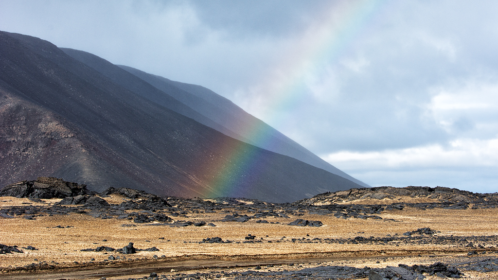
Road F88: Öskjuleið
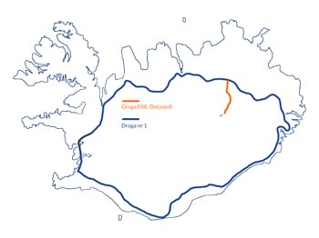 The road designated F88 is only about 80 km (50 miles) long and leads from Road 1 about 30 km (20 miles) east of Myvatn, south to Dreki and the area around the volcano Askja. This is one of two roads leading to Askja – the one that is definitely more difficult (the other is the F905 further east – longer, but faster and without danger).
Although in theory F88 is the shortest connection between Myvatn and Askja, this route is by no means easy or fast. In addition to the standard difficulties typical of mountain roads, on the F88 you have to cross two deep fords. They are specially prepared for drivers – the best line through them is clearly marked and described. Even so, you won’t avoid water up over your wheels, and often – depending on the car and the state of the water – up to the hood. Lines of cars often form at the water’s edge, and if one of them gets stuck there is nothing to be done – you have to turn back and take the long way round.
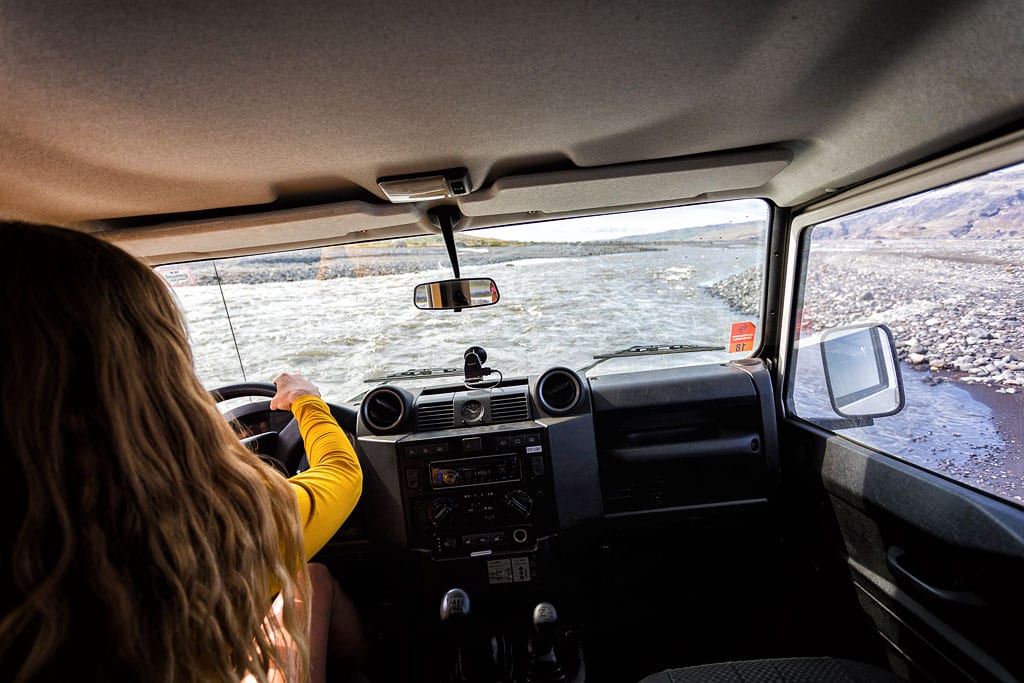
Crossing a deep ford
Before starting the route, ask for information about the water level from the park rangers in Dreki, although you will only know the actual situation on the spot anyway. Keep in mind that with most rental companies this route is excluded from liability cover and roadside assistance, and water damage isn’t covered at all. It is therefore a drive and crossing at your own risk. Especially in case of adverse weather conditions: don’t take any chances. Turning around and going around is always faster than getting stuck in the water and waiting for help.
Alternatively, if you want to explore the F88 road, but don’t have a suitable car or just want peace of mind – you can go to Askja by bus. Special buses with raised 4×4 suspension cross the F88 without any problems. You, on the other hand, then bear no risk as a driver, and you can admire the insane scenery around the road without disturbance. Tours leave Reykjahlid as often as several times a day. The details change from year to year – ask at the campsites in Reykjahlid, for example.
Road F249: Thórsmerkurvegur
 The F249 road leads to the beautiful region of Thorsmork, so its Icelandic name is Þórsmerkurvegur. It starts not far from the waterfall Seljalandsfoss, where it is still plain Road 249, without the letter F. Its further, already mountainous part runs along the valley of the glacial river Krossa and along the northern flanks of the Eyjafjallajökull volcano. This is the same volcano that in 2010 – after its last eruption – paralyzed air traffic throughout Europe. The route ends near the Basar Hut, on the southern outskirts of Thorsmork proper.
Although it is not a long route – only about 30 km (20 miles) from start to finish – it is among the most dangerous roads in Iceland. Conditions on it can be very treacherous and surprise even the most experienced travelers. It is often closed to traffic even in the middle of summer, mainly due to elevated water levels. This is because water from the three surrounding glaciers flows into the valley. Therefore, also in summer, the entrance to it is sometimes closed even for several days. People who are in Thorsmork or the Basar Hut at that time are not free to leave the area.
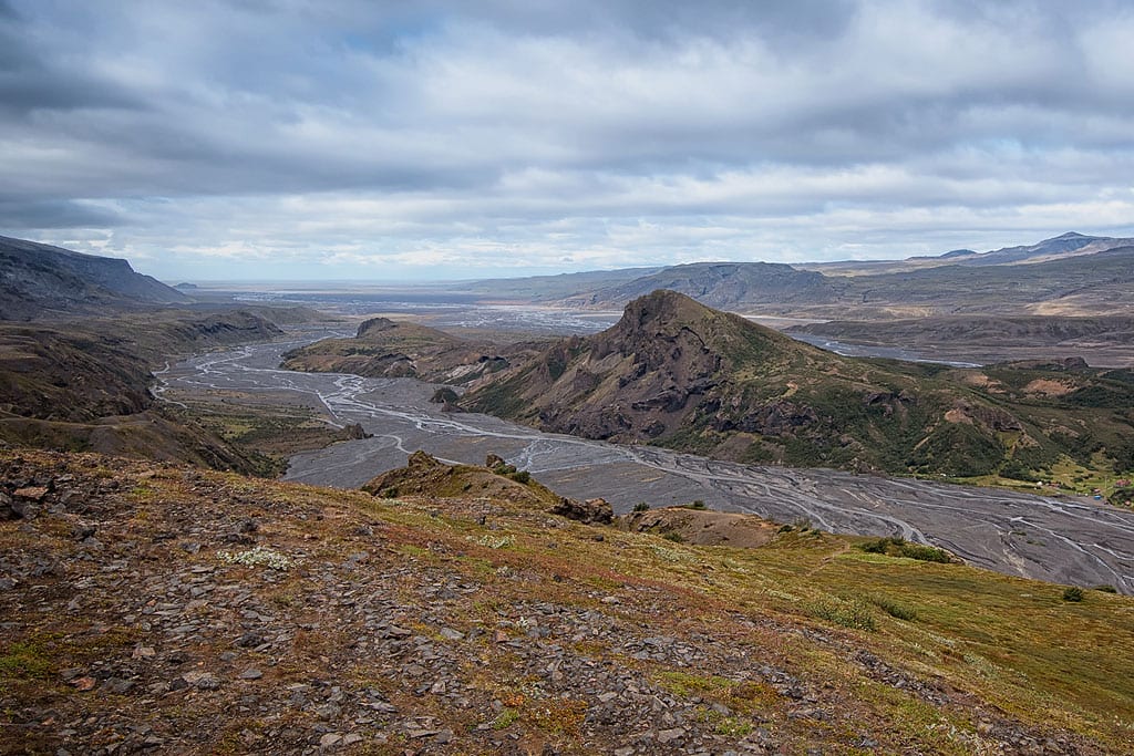
View of Thorsmork and the F249 road
On the other hand, crossing to the north bank of the Krossa River is something else entirely. This is already a crossing only for experienced off-roaders in properly prepared vehicles. The Krossa is a wide and quite deep glacial river. The water flows really fast in it, and the bottom changes frequently. At the same time, the entire F249 road in most rental companies is completely excluded from insurance (as is any damage resulting from submerging the car). It’s great fun to watch a specially adapted bus or so-called “super jeep” drive through the Krossa, but with your own car it’s better not to try.

Mobile footbridge on the Krossa
The difficulties do not deter visitors, however, and the beauty of Thorsmork – exceptionally green for Iceland – brings quite a bit of traffic in the summer season.
Road F208: Fjallabaksleið
 The F208 road is located in southern Iceland, and as its name suggests – it runs through the Fridland ad Fjallabaki reserve, known mainly for the rainbow mountains of Landmannalaugar.
The F208 stretches from the vicinity of Highland Center Hrauneyjar in the north to Road 1 in the south, with which it connects about halfway between Vik and Kirkjubaejarklaustur. The road’s biggest attraction, the just-mentioned Landmannalaugar, lies about a third of the way down from the north, and the second most interesting place, Eldgja and Ofaerufoss, lies about halfway along.

The ford at Landmannalaugar
It’s also along this road that buses from Reykjavik come to Landmannalaugar (you can read more about getting to Landmannalaugar here).
The southern part of Road 208 is already definitely a mountainous section – the F208. It’s a very nice road, allowing you to see, among other things, the beautiful volcanic rift Eldgja and the Ofaerufoss waterfall, but it’s definitely a road for 4×4 vehicles only. It branches off from paved Road 1 to the north between the towns of Vik and Kirkjubaejarklaustur, near the Skaftartunga farm. Along the way there are several fords, narrow and steep climbs (short ones, admittedly) and plenty of very rough sections that are hard on low-slung cars.
Road F210: Fjallabaksleið syðri
 Like F208, F210 is also located in southern Iceland and passes through the Fridland ad Fjallabaki reserve. However, this road heads west, passing south of Hekla and north of Thorsmork. The F233 and F208 diverging from it can be used to reach Landmannalaugar to the south. On the other hand, the southbound F261 will take you to the northern slopes of Thorsmork (but you won’t enter the main valley) and to the Emstrur-Botnar Hut and the Markarfljótsgljúfur.
It is a beautiful road, but dangerous for two reasons. The first is the very frequent, large and deep potholes, or simply huge holes in the road. In places, they really make it impossible for even a large off-road vehicle to drive smoothly.
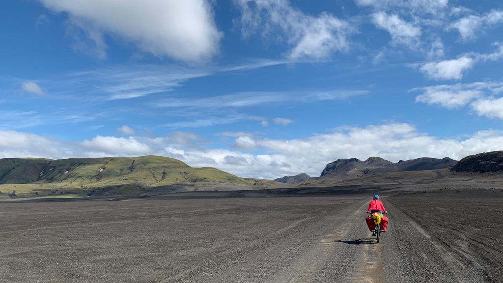
The bravest F210 users
Such a road naturally requires great attention. Wider fords, where you can’t see the bottom, are really worth checking on foot, barefoot (or sending someone from the crew across barefoot…). That way you’ll know how deep the stream is at each point and – just as important! – whether a sandy, unstable bottom is lurking somewhere that your car could sink into.
Remember that most rental companies do not allow you to cross fords where the water reaches above the car’s axles. Only you know if you can handle deeper water.
Other guides on driving in Iceland
If you already know whether you want to visit the mountain roads or stay on the ‘one’, see in the next article what car will best fit your plan and how much the different solutions cost (e.g. car + insurance + accommodation). You can read all about it here: What car to rent in Iceland.
Since the cost of your trip is greatly affected by the level of insurance you take out, while the insurance available in Iceland is a separate big topic, we’ve covered it in a separate article: Car Insurance in Iceland.
Road conditions in Iceland are quite specific. Even in summer, there are many things to watch out for. In addition, some traffic laws are unique, and the amount of fines can knock you off your feet. Since you’re planning to visit Iceland by car, be sure to read our Iceland’s Roads — What to Expect.
We also encourage you to take a look at our list of Iceland’s Greatest Attractions [Top 10] and our detailed and accurate driving plan proposal: Best plan for Iceland (summer, 4×4, 14 days).
