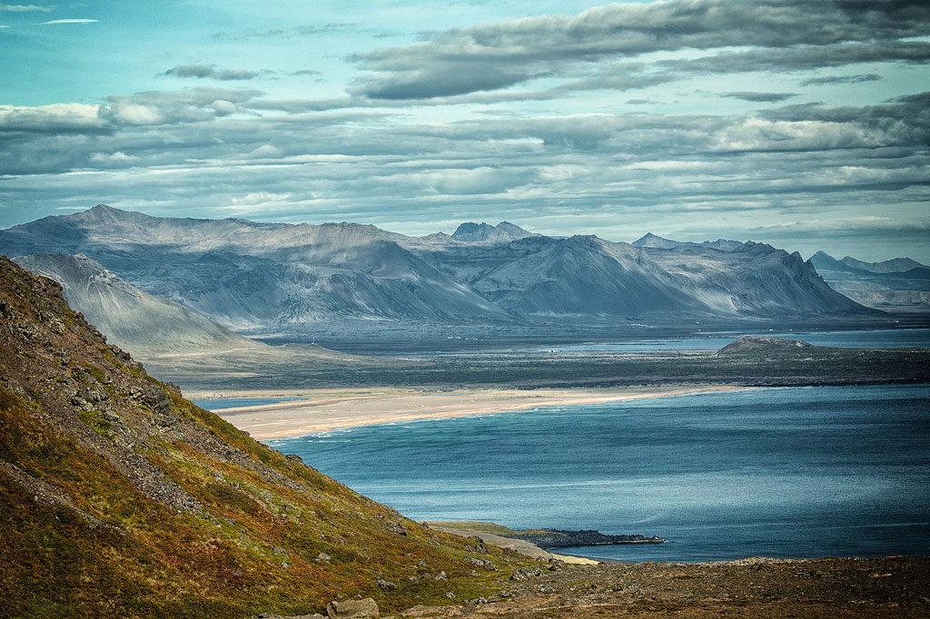
Arnarstapi is a small village in the southwestern part of the Snæfellsnes peninsula. Surrounded by picturesque landscapes and a number of attractive tourist sites, it is a popular stopping or lodging place for tourists visiting the Snaefellsnes peninsula.
Arnarstapi – a treat for fans of picturesque views
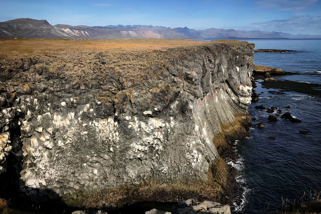
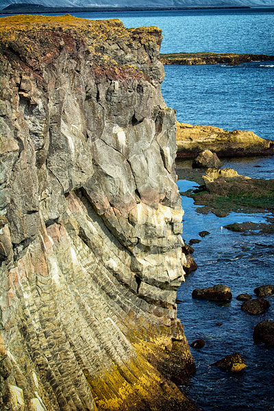
The village of Arnarstapi is famous above all for its coastline. Here columns of basalt drop straight into the ocean, forming a wall of tall vertical pilasters.
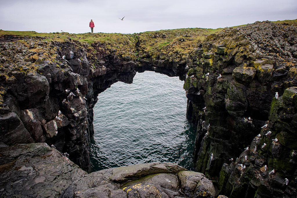
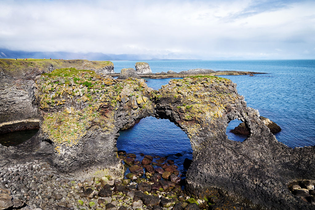
The ocean has also carved two unusual rock arches into these basalt cliffs. One is known simply as the stone bridge; the other has earned a name of its own – Gatklettur. Some people see the shape of a heart in it, others two kissing faces… Together with the waves and the light, it makes a beautiful backdrop for romantic photos.
As you come into Arnarstapi you can leave the car in a convenient parking lot on the right, next to the Arnarstapi Center (the tourist information center), and see the whole village on foot. First take the path to the statue of Bárður, then continue to the cliff viewpoint, and walking on to the east and northeast you will reach Gatklettur and the stone bridge in turn. The whole loop, including the way back to the parking lot, is no more than 1.5 km (about a mile), unless you follow the coast all the way to the harbor – then it grows to about 2 km (just over a mile). If the weather is kind, it is a lovely and scenic walk.
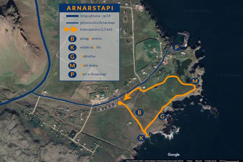
A plan of the walk around Arnarstapi
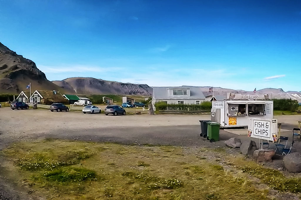
Arnarstapi gives visitors every amenity that matters: restaurants, street-food stalls, places to stay, local guides and tour operators, parking lots and a gas station.
Bardur of Snaefellsnes
On a commanding spot not far from Gatklettur stands an intriguing monument to the giant Bárður, who is now taken for the good guardian spirit of the area. It has to be admitted that it is rather hard to make out a human figure, or even a troll, in this monument – which probably makes it all the more intriguing.
Bardur – the giant guardian of the peninsula
The story of Bárður is told in Bárðar saga Snæfellsáss. Both humans and giants were said to be among his ancestors. According to the saga he was the son of King Dumbur, who ruled the northern waters around Helluland – the sea the saga calls Dumbshaf, after him (some sources link this with one of the early Norwegian petty kingdoms). Bárður is said to have reached Iceland as early as the late 9th century, at the very beginning of the known settlement of the island, and to have built a farm he named Laugarbrekka.
For some reason, as the years passed, there was less and less of the man in him and more of the giant. At the end of his life he vanished into the Snaefellsjokull glacier, but he did not die – he became a local guardian spirit, and people living around the peninsula turned to him for help and protection in all sorts of matters.
Interestingly, the giant’s name is sometimes given wrongly as Bárðar, with the ending -ar. It probably comes from copying the original Icelandic texts without thinking – they often refer, for instance, to the saga of Bárður (Bárðar sögu), where the name stands in the genitive and its ending changes. In the nominative the name is Bárður, not Bárðar.
Statue of Bárður Snæfellsás
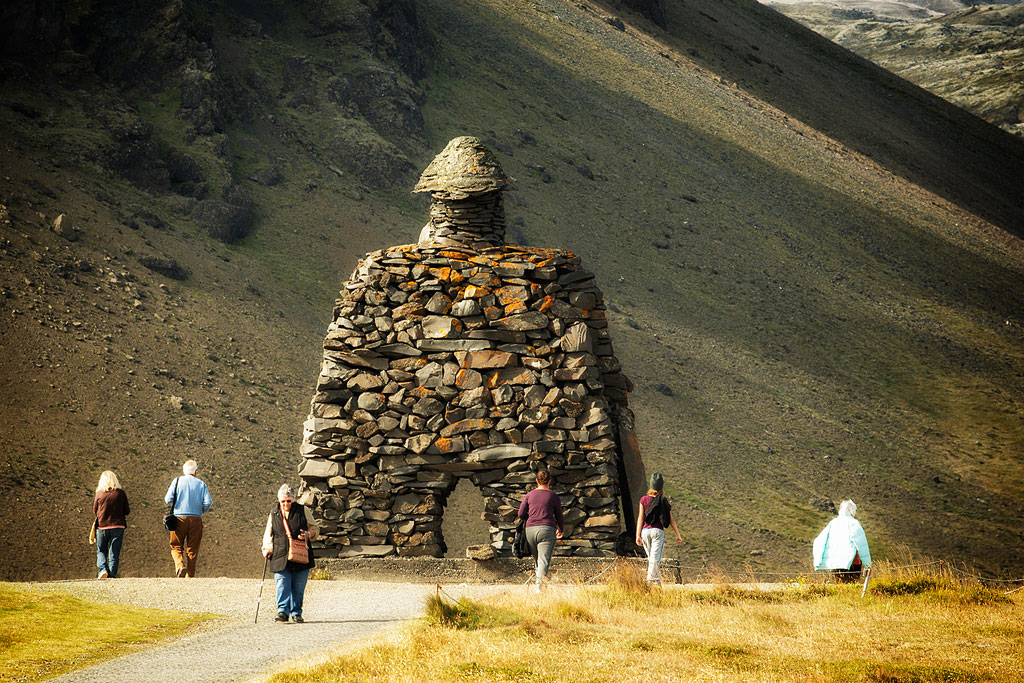
The statue of Bárður Snæfellsás
The statue was made in 1985 by Ragnar Kjartansson, one of the best-known sculptors on the island. It commemorates a couple who lived here, Guðrún Sigurðardóttir (1878 – 1941) and Jón Sigurðsson (1876 – 1956), and their son Trausti, who died of hypothermia on the Jökulháls pass in 1928, aged just 19. The local youth association Trausti is named after him.
The statue stands on the right-hand side of the road, just after you enter the village, between the main road and the parking lots on one side and the shore on the other. You can see it from far away and cannot miss it, but it is easy to take it for a small church or some kind of ornamental gate – it takes a little imagination to see a giant in it.
Attractions near Arnarstapi
Within a radius of less than 5 km (3 miles) from Arnarstapi you will find several very interesting attractions. The most important are:
- Hellnar rock bridge;
you can drive up to it, but the coastal path is a lovely and popular walk (about 2.5 km, 1.5 miles); along the way you pass a small lava field and see many of the basalt columns of the coastal cliffs up close; at the end (that is, halfway) you can rest in a cozy cafe with a great view: Fjöruhúsið café (small beer – $8; fish soup – $23) - a small cave Songhellir
- the magnificent gorge Raudfeldsgja (a hidden gem, but an absolutely necessary stop!)
Slightly further west, 5-10 km (3-6 miles) away, you will find among other things:
- the coastal rock pinnacles of Londrangar
- Jules Verne’s cave – Vatnshellir
- a beautiful black beach with the remains of a ship wrecked there – Djupalonssandur
Just outside Arnarstapi begins the F570 mountain road, which climbs to the pass below the summit of the Snæfellsjökull glacier. Like every F road it is open in summer only and closed to cars without four-wheel drive.
Birdlife along this shore is rich: fulmars, kittiwakes and shags nest on the cliffs, and large colonies of Arctic terns settle near the village.
How to get to Arnarstapi
Arnarstapi lies a little off road 574, which loops around Snæfellsjökull, but it is clearly visible from it – in the southwestern part of the Snaefellsnes peninsula.
It is 50 km (30 miles) to Grundarfjordur, next to the famous mountain Kirkjufell, by the shortest route, and about 70 km (about 45 miles) by road 574 along the coast of the peninsula – though that route has far more to see along the way, so it is much more popular. Reykjavik is about 200 km (125 miles) from here.