


Iceland is visited for its beautiful landscapes and its wonderful hot mineral springs. Both are due primarily to the volcanoes. Although they are a constant threat, without them there would be no such beautiful island. It is the volcanoes (working together with the glaciers) that make up Iceland’s magnificent landscape.
See what volcanoes actually are, how they form and operate, and learn more about some of them. Your trip to Iceland will be much more interesting because of it.
However, let’s start with what a volcano even is…
What is a volcano
Colloquially, we use the word volcano for the part of it that is clearly visible on the surface of the earth. In scientific terms, though, this is only a part of the volcano, called a volcanic mountain. The whole volcano also includes its internal and underground structure, which is often larger than the mountain on the surface.
A single volcano can produce several or even dozens of volcanic mountains (Icelandic examples of such volcanoes are further down in this article). Many individual volcanoes can also be part of a larger volcanic system – in Iceland that is the absolute norm. These differences can lead to misunderstandings, because for a scientist a volcano can have many mountains, and it can also exist without any clearly visible volcanic mountain at all – when the mountain has not formed yet, has already collapsed, or has largely “gone up in the air.” For a tourist, on the other hand, one mountain is one volcano, and if the mountain is not there, we assume the volcano is not there either. Depending on the methodology, anywhere from dozens to hundreds of volcanoes can be counted in Iceland…
So let’s take a closer look at the structure and classification of volcanoes.
Volcano structure
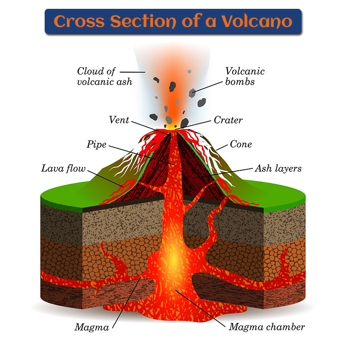
Volcano cross section
The structure of a single volcano is quite simple. Its main engine is the magma chamber (also called the volcanic focus), which lies anywhere from a few to a few dozen kilometers (a few to a few dozen miles) below the crater. This is the place in the Earth’s crust or mantle where molten rock forms magma. The chamber is connected to the Earth’s surface by a long, straight conduit, also called a pipe or channel. The conduit ends in a crater, the final place the magma comes out of. It is usually shaped like a funnel or a bowl and usually sits right in the middle of the volcano.
Magma changes its properties slightly once it reaches the surface, and from then on we call it lava. The crater may be surrounded by a caldera, which is larger than the crater and is formed when rock collapses over a partly emptied magma chamber. The classic picture of a volcano also includes parasitic craters, pushed open by the enormous pressure of magma looking for the easiest way out. Magma cutting across rock layers instead of following them forms very characteristic bodies called dikes, which stand out clearly in the geological record.
An example of a classic volcano is Bardarbunga (Bárðarbunga) in the Vatnajokull (Vatnajökull) massif. This is a huge volcano – its collapsed caldera alone is 8×11 km / 5×7 miles across and 700 m / 765 yards deep (yes, really). The caldera is, by the way, entirely filled with ice from the Vatnajokull glacier. The most recent eruption of Bardarbunga, the one that created one of Iceland’s youngest lava fields – Holuhraun (2015) – came through a parasitic crater that fortunately sat below the main part of the glacier. Thanks to that, the flooding that came with the eruption was at least of limited force.
Nature, of course, completely disregards scientific classifications and descriptions, and produces an enormous number of types, kinds and shapes of volcanoes. Perhaps the fascinating beauty of Iceland comes precisely from the fact that a relatively small island shows such a huge variety of these “volcanic variations.” They are worth getting to know better, because although many of them look beautiful at first glance, they become even more fascinating once you learn what they really are and how they were formed.
Types of volcanoes in Iceland
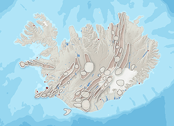
Map of Iceland’s volcanic systems [10]
Volcanic activity in Iceland is currently concentrated in a NE-SW zone. It adds up to about 200 volcanoes clustered in 32 groups (volcanic systems) [10]. About 30 Icelandic volcanoes have shown activity in the last 1,100 years.
It is of course impossible to describe all of Iceland’s volcanoes, but the profiles below cover a few of them, to illustrate their diversity and to show how the different types work in practice.
Volcanoes are described by a number of selected characteristics, and every volcano fits into several such groups of different rank. So it is worth sorting out these terms first.
We can divide volcanoes in five basic ways:
- by place of occurrence
- Surface volcanoes
- Submarine volcanoes
- Subglacial volcanoes
- by type of eruption
- Central volcanoes (eruption occurs from a single location)
- Linear volcanoes (eruption occurs along a longer fissure)
- Mixed volcanoes
- by level of activity [11]
- Active volcanoes – those that have had at least one eruption in the last 10,000 years (in the Holocene);
- Actively erupting – volcanoes where magma is currently reaching the surface
- Dormant (or ‘potentially active’) – are active volcanoes that are not currently manifesting any form of activity
- Extinct – those that have not had an eruption in the last 10,000 years and so are considered without potential to erupt again in future;
- Active volcanoes – those that have had at least one eruption in the last 10,000 years (in the Holocene);
- by material extracted
- Effusive (lava)
- Explosive (ash)
- Mixed (usually these are stratovolcanoes, or layered volcanoes)
- by shape of volcanic mountain
- Disc-shaped (a vast mountain with a low slope)
- Tapered (mountain with steep slopes)
- Table (a cone with an extensive, flat, truncated summit)
The criteria behind these divisions are strongly interrelated. The shape of a volcanic mountain, for example, is influenced by virtually every other feature of a volcano. A complete description of a volcano can therefore include many names, even though each of them still describes the same volcano, simply pointing to a different feature.
For the purposes of this article, we will group Icelandic volcanoes by the products they yield. Besides lava in the typical sense, volcanoes also produce gases and so-called pyroclastic material. That name covers loose fragments of lava shot into the air during an eruption; they solidify in flight or shortly after landing. Pyroclastic material also includes larger pieces of rock that were not melted, torn loose by the magma on its way through the conduit and the crater.
Lava volcanoes
Effusive (lava) volcanoes are the ones that erupt only, or almost only, lava. As a result their eruptions are usually very calm and mild. Lava in such volcanoes can reach temperatures of 1,300 °C / 2,400°F. Very often it is so-called pahoehoe lava – helluhraun in Icelandic – flowing, shiny and smooth. Basalt is formed under these conditions.
Skjaldbreiour
Skjaldbreiour is the flagship volcano of Iceland’s effusive group, you could say. It stands in southern Iceland, about 65 km / 40 miles northeast of Reykjavik, and is 1,016 m / 3,333 ft high and 15 km / 9 miles across. Right next door, only about 5 km / 3 miles east of the foot of the volcano, is the Hloduvellir mountain hut, from which the volcano is beautifully visible. The last activity of Skjaldbreiour is estimated to have taken place about 9,000 years ago.
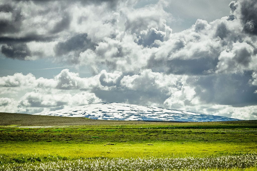
Skjaldbreidur volcano
Because of its shape, Skjaldbreiour belongs to the shield volcanoes. They take the form of flat rises with slopes tilted a few degrees at most. They are often very extensive, their shield is slightly domed or conical, and they frequently have a caldera as well. They are symmetrical, with the crater and the caldera (if there is one) in the center, which also makes them central volcanoes. This type of volcano counts as long-lived – their activity can last for decades!
Laki
Laki is an effusive fissure volcano in the southern part of Iceland, about 30 km / 19 miles north of Kirkjubaejarklaustur. It belongs to the Grímsvötn volcano complex (also called Grímsvötn-Laki) [10].
During eruptions of fissure volcanoes, lava wells up quietly out of the fissures, without major explosions. In Iceland such fissures are called gjá (for example Almannagjá, Flosagjá and Peningagjá in Thingvellir National Park, Grjotagjá and Stóragjá near Lake Myvatn, or Eldgjá quite close to Laki).

Fissure volcano: Laki
In 1783 came the Laki eruption, one of the largest effusive eruptions in recorded history. Lava poured out of a 27-kilometer-long (17 miles) fissure for eight months and flooded some 565 km2 (220 sq mi). The eruption threw 120 Mt of SO2 into the atmosphere and about 14.7 km3 (3.5 cu mi) of lava flowed out. Many craters formed along the fissure; there are about 100 of them there today.
Eldborg
Eldborg is an effusive volcano in the western part of the island, about 75 km / 45 miles north of Reykjavik, and it counts as a central volcano. The distinctive volcanic cone that Eldborg has is called a spatter cone (or spatter ring). It is a specific type of cone volcano whose crater has very steep edges. This peculiar form is built by lava that solidifies almost immediately as it lands on the crater walls, which is why those walls are made of irregular, sharp edges.
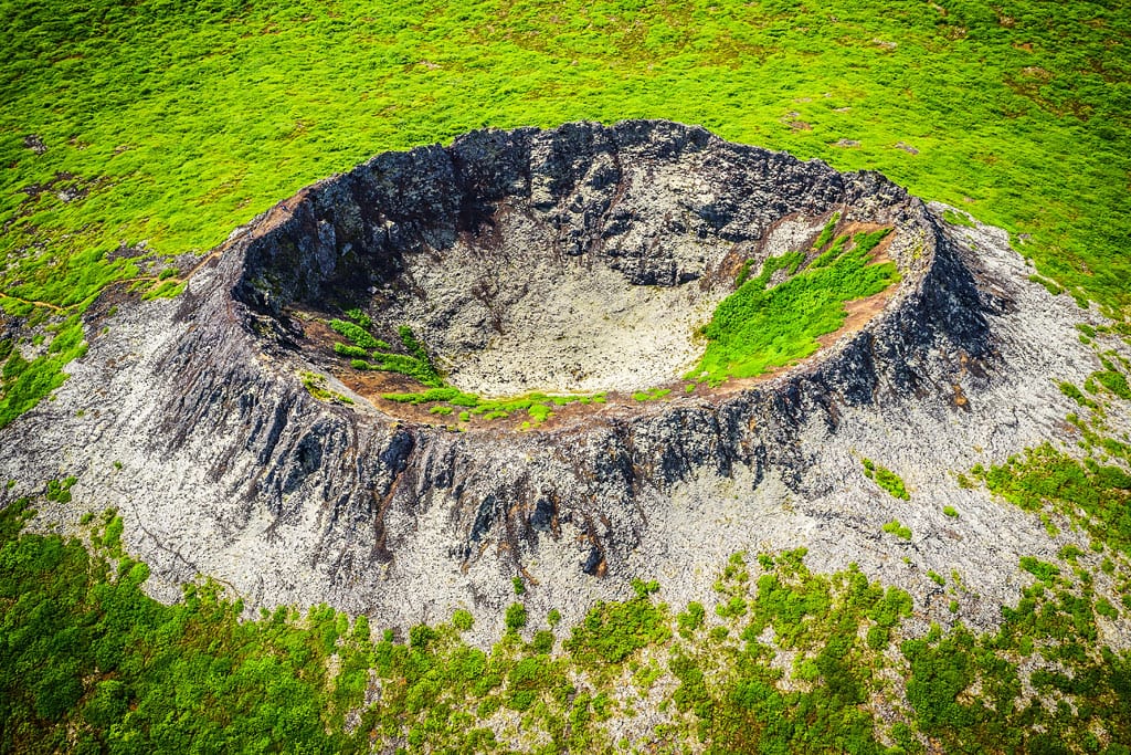
Effusive spatter cone volcano: Eldborg
Volcanoes of this type are small and short-lived (their eruptions last days, or months at most), and their lava fields are relatively small.
Ash volcanoes
Explosive volcanoes are also called ash volcanoes, and there are very few of them nowadays. Their main products are pyroclastic material and volatiles. Eruptions of this type are very violent, and they come with phenomena such as ash flows, avalanches and pyroclastic fallout, as well as so-called glowing clouds. One of the most dangerous of these are ash flows, or lahars. Volcanic ash together with fragments of congealed lava behaves like mud once it is saturated with water. The water can come from a crater lake, from a glacier on the volcano, or from rainfall. A lahar runs down the slopes of the volcano at tens of kilometers per hour, and its flow can reach over a dozen kilometers (about 10 miles) away!
Graenavatn
The Graenavatn volcano lies about 25 km / 15 miles south of Reykjavik and is an example of a rare central, explosive, maar-type volcano. Maars are characteristic craters linked to eruptions of gases released from magma and from groundwater. They have no cone, but a tuff ring surrounding a funnel-shaped depression.

Maar type explosive volcano: Graenavatn
Volcanic tuffs are volcanic ash and sand cemented by water. The diatreme, the volcanic pipe typical of explosive eruptions, is filled here with pyroclastic material cemented back together by volcanic ash – so-called volcanic breccia. Lakes very often form in the depressions left by the explosions.
Hverfjall
Hverfjall lies in the northern part of Iceland, in the south of the complex volcanic system of Krafla, on the western shore of Lake Myvatn. It is a central volcano with a truncated tuff cone 150 m / 500 ft high. The walls of the crater, which is about a kilometer (half a mile) across, are quite steep. Hverfjall was formed by a so-called phreatomagmatic eruption. In this type of volcano the products of the eruption are very small in volume (less than 0.5 km3 / 0.1 cu mi), but the nature of the eruption is very interesting.
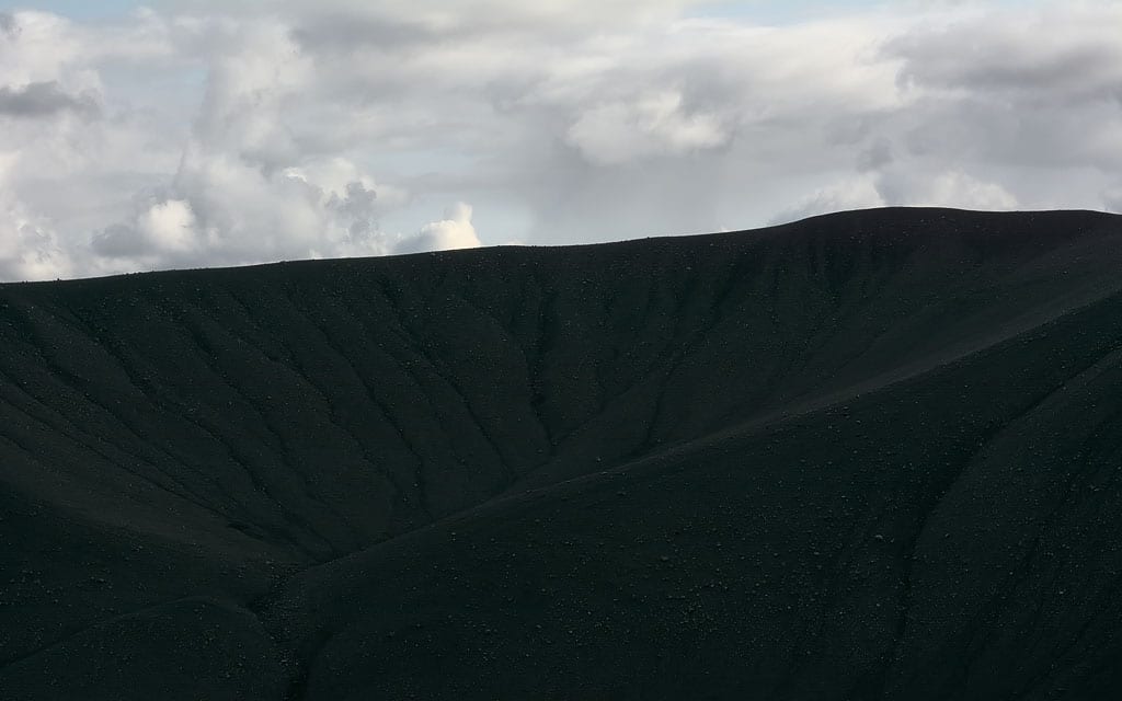
Inside the tuff cone: Hverfjall
Phreatomagmatic eruptions are eruptions caused by direct contact between water and magma, usually in the magma chamber or in the volcanic conduit. Water that touches hot magma turns to steam instantly. If there are channels in the cone for the steam to escape through, it escapes freely; if every outlet is blocked, it collects inside. When there is a lot of it, or when it is produced suddenly, an explosion follows. The main product in such cases is steam, though lava happens too, along with rock material blasted loose during the eruption. The Hverfjall volcano formed during exactly this kind of eruption about 2,700 years ago.
Threngslaborgir
Threngslaborgir (Þrengslaborgir) is a volcano southeast of Lake Myvatn, part of the Heidarspordar (Heiðarsporðar)[10] volcanic system. This is a very active system, which also includes the Ludent volcano – one of the eras in the region’s history is named after its eruptions (see Geological History of the Myvatn Region).
The eruption of Threngslaborgir created completely unusual effects around Lake Myvatn, all of them born of the contact between water and lava: the Skutustadagigar pseudocraters and the Dimmuborgir lava field.
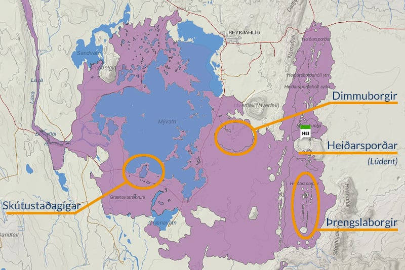
Heidarspordar lavas (own work based on [10])
Surface water – the lake, in this case – naturally heats up and evaporates on contact with lava. If the water is trapped under the incoming lava, however (groundwater flowing from a spring buried by fresh lava, for instance), more and more steam builds up, until its pressure is high enough to burst the lava flowing over it. That is how so-called pseudocraters (rootless cones) are formed. They often appear in whole linear clusters. Unlike true craters, pseudocraters have no connection to the magma chamber, so they do not belong to the volcano. The effects of the Threngslaborgir eruption of about 2,300 years ago can be seen south and east of Lake Myvatn: the linear craters of Threngslaborgir itself (Þrengslaborgir) and the pseudocraters created after its eruption – Skutustadagigar (Skútustaðagígar) and Dimmuborgir (usually described as a lava field, since the craters are hard to make out there today).
Heiðarsporðar is the volcanic system that gave rise to Þrengslaborgir, Dimmuborgir and Skútustaðagígar. Þrengslaborgir is part of a row of craters formed during an eruption called Laxárhraun Yngra, which occurred about 2,300 years ago. Dimmuborgir and Skútustaðagígar are groups of pseudocraters that were formed by the same eruption.
Bergrún Arna Óladóttir [10]
Mixed volcanoes
Mixed volcanoes erupt lava and ash alternately. In doing so they build a distinct volcanic cone whose structure consists of successive alternating layers. They are also known as stratovolcanoes, layered volcanoes or composite volcanoes.
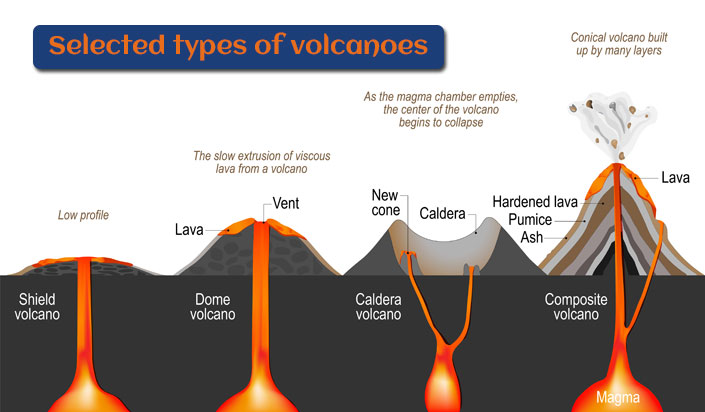
How some types of volcanoes are created
Eldfell
The Eldfell volcano stands on the Icelandic island of Heimaey, in the Vestmannaeyjar, 8 km / 5 miles south of the Icelandic mainland. It is an effusive-explosive volcano: a central volcano with a conical volcanic mountain of the scoria type. The lava coming out of it is typical block lava, called apalhraun in Iceland. Because of its properties its front builds up as it advances, which makes it hit with greater force. You can read more about the different types of lava in the next guide – Stunning Effects of Iceland’s Volcanism.
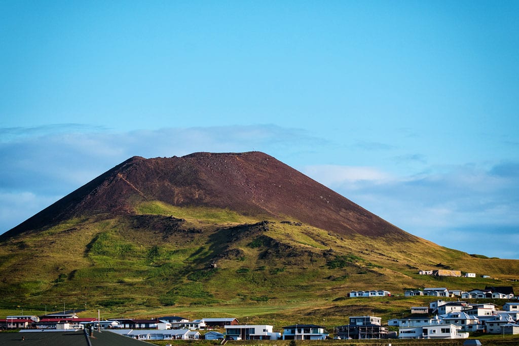
Eldfell volcano
Even today the Eldfell lava field is quite dangerous. The edges of the solidified lava fragments are very sharp and treacherous. The 1973 eruption had a huge impact on the lives of Icelanders and caused great damage. Basaltic lava gushed out of the volcano for more than half a year. Great damage was also done by the pyroclastic material thrown out during the eruption, which buried the nearby town under a layer some six meters (20 ft) thick (the town is named after the archipelago and the volcanic system it sits on: Vestmannaeyjar).
A volcano with characteristics similar to Eldfell – that is, also an effusive-explosive volcano with a scoria-type cone – is Grabrok. This one is much easier to reach: it lies just off Road 1, about 5 km / 3 miles southwest of the junction with Road 60 and about 30 km / 19 miles northwest of Borgarnes, level with the Snaefellsnes peninsula. There is a parking lot near the crater, and comfortable boardwalks lead to the top of the volcano. The volcanic mountain is much lower than Eldfell, so the walk up takes a few minutes. The view from the top is worth it – very clearly visible lava waves from the last eruption, with modern farm buildings “huddled” between them… The Grábrók eruption is dated to about 3,600 years ago [10].
Hekla
Hekla is a famous, powerful and typical mixed volcano. It lies in southern Iceland, about 65 km / 40 miles east of the town of Selfoss and about 70 km / 45 miles northwest of Vik. Its eruptions are effusive and explosive, and besides pyroclastic material it also erupts acidic lava. It is considered a stratovolcano, but it sits in a 5.5 km / 3.5 mile long fissure, so it is not shaped like a typical cone. Hekla looks more like an upturned boat hull – conical from the front, but with long side ridges.

Hekla Volcano
In 1947-1948 Hekla had an eruption that lasted as long as 11 months; in its initial phase the column of pyroclastic material and ash reached 30 kilometers (about 20 miles) high, and the ash travelled as far as Finland. The earliest historical eruption of Hekla is dated to 1104, and it was even stronger: an estimated 2.5 km3 (0.6 cu mi) of dust went into the atmosphere. Since then 23 more eruptions have been recorded (several of them in the late 20th century), which makes Hekla one of Iceland’s most active volcanoes. In total, over 1,000 years Hekla is estimated to have produced 5 km3 (1.2 cu mi) of ash and 13-14 km3 (3-3.4 cu mi) of lava. We write more about Hekla in a separate article: Hekla – Queen of Icelandic Volcanoes.
Eyjafjallajokull
Eyjafjallajökull is one of the volcanoes enclosing the Thorsmork region to the south.
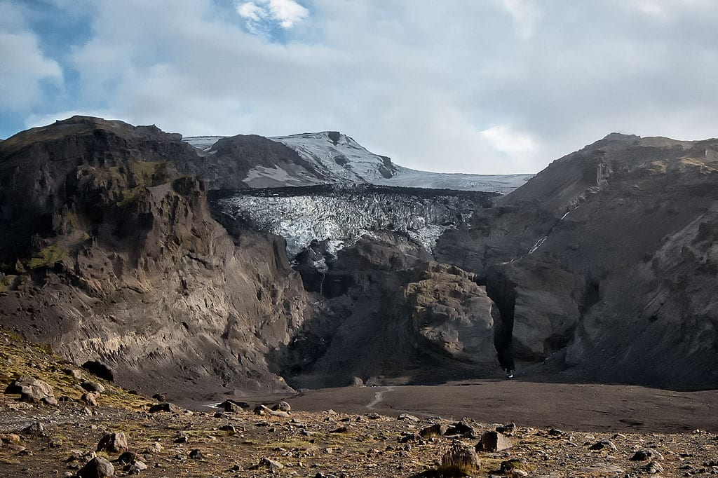
Eyjafjallajokull volcano as seen from Thorsmork
It lies in southern Iceland, about 35 km / 22 miles northwest of Vik and just above Skogar, northwest of Skogafoss. This volcano became widely known in 2010, when it erupted after 187 years of dormancy and blocked air traffic across almost the entire northern hemisphere. The lava fountain was 150 m / 500 ft high and the ash cloud reached 7 km / 4.5 miles, so this is an effusive-explosive volcano. The lava came out of a 100-meter (330 ft) fissure with twelve craters and had temperatures as high as 1,200 °C / 2,200°F. Its slope has an angle of about 6°, and its caldera is 7 to 15 km / 4 to 9 miles across. So it does not fit the basic classification very well: it is a stratovolcano, but it looks more like a shield volcano. What is most interesting about it, though, is that it is a subglacial volcano, unlike all the surface volcanoes described so far.
Blafjall
The Bláfjall volcano lies about 15 km / 9 miles southwest of Lake Myvatn, already mentioned here, in northern Iceland. It is one of Iceland’s many examples of a subglacial volcano. Because of the island’s climate, until very recently on a geological time scale virtually all of Iceland and all of its volcanoes were covered by glaciers. Today the glaciers have largely retreated and only the highest volcanoes are still covered by ice year-round. Most volcanic mountains, Bláfjall among them, have not seen a glacier for a long time. We classify volcanoes as subglacial because of the conditions they formed in, however, not by whether they are under a glacier today. That is why Blafjall belongs to this interesting group as well.
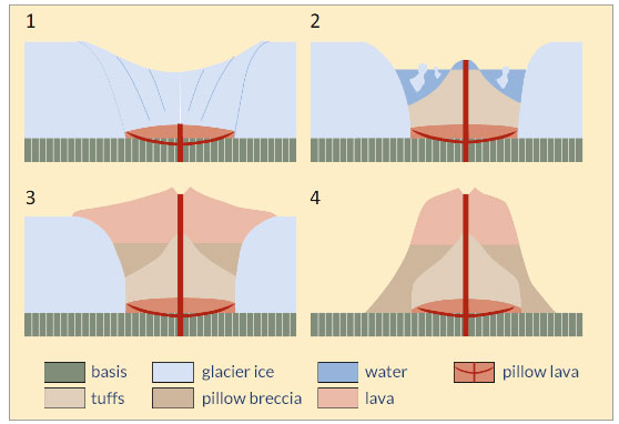
How the ‘table-top’ volcanoes come to be (Fraedrich, 2018)
Eruptions of subglacial volcanoes are completely normal, but the shape of the volcano itself can be different when the lava flows were blocked by the surrounding glacier. In that situation, in the first stage of an eruption, the contact between lava and ice forms so-called pillow lava. It then heats the ice, which melts away, and that creates a space for the lava to move into freely. The final stage is a so-called table mountain – a solitary mountain with very steep slopes and a flattened or truncated top.
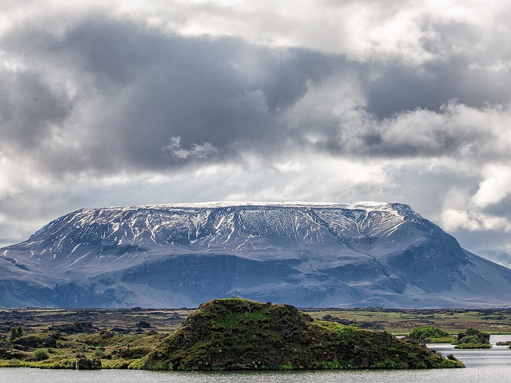
Bláfjall volcano over Lake Mývatn
Another consequence of a volcano erupting under ice can be catastrophic flooding. Icelanders even have a special word for it – jökulhlaup. The remains of a destroyed bridge over the Skeiðará River near the Svartifoss waterfall are the result of exactly such a flood, from 1996.
You can read more about floods and other effects of volcanoes in the next guide in this series: Stunning Effects of Iceland’s Volcanism.
Effects of volcano activity in Iceland
As you can see, a volcano is not only a powerful phenomenon but a very varied one, and so are the effects of its existence and its work. Iceland’s appeal is undoubtedly based in large part on precisely this: there are so many different volcanic formations here, and they are so fresh – sometimes not yet worn down by erosion at all.
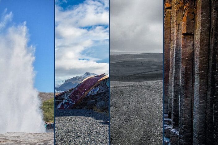
Unusual effects of Iceland’s volcanism
The primary visible effect of volcanoes in Iceland is, of course, the volcanic mountains described in this article. But there are many more effects of their activity, and water heated to 180 °C / 360°F is not the most surprising of them.
Do you know how many earthquakes are recorded in Iceland every single day? Or how the dragonglass from Game of Thrones was created? And what is the fastest way to move a coastline 800 meters / half a mile? You will read about this and many other fascinating, sometimes frightening effects of Icelandic volcanism in the next article: Stunning Effects of Iceland’s Volcanism.
And in the article after that – Iceland’s biggest volcanic eruptions – you will read which volcanic eruption was the biggest, which was the strongest, which was the deadliest and which was the most costly. We present 8 selected volcanoes in Iceland along with their most famous eruptions.
Bibliography
- Czechowski, L. 1994. Tektonika płyt i konwekcja w płaszczu Ziemi (Plate tectonics and convection in the Earth’s mantle, in Polish). Wydawnictwo Naukowe PWN, Warsaw
- Fraedrich, W. 2018. Iceland from the West to the South. Springer International Publishing (27-92)
- Fridriksson, T. 2006. CO2 emissions and heat flow through soil, fumaroles, and steam heated mud pools at the Reykjanes geothermal area, SW Iceland. Elsevier
- Jaroszewski, W., Marks, L., Radomski, A. 1985. Słownik geologii dynamicznej (Dictionary of dynamic geology, in Polish). Wydawnictwa Geologiczne, Warsaw
- Książkiewicz, M. 1979. Geologia dynamiczna (Dynamic geology, in Polish). Wydawnictwa Geologiczne, Warsaw
- Lamur, A. et al. 2018. Disclosing the temperature of columnar jointing in lavas. Nature
- Pożaryski, W. 1977. Islandia w świetle tektoniki płyt (Iceland in the light of plate tectonics, in Polish). Przegląd Geologiczny
- Stanley, S. M. 2002. Historia Ziemi (Earth System History, Polish edition). Wydawnictwo Naukowe PWN, Warsaw
- Thordarson, T., Larsen, D. 2006. Volcanism in Iceland in historical time: Volcano types, eruption styles and eruptive history. Elsevier
- Directory of Icelandic Volcanoes – icelandicvolcanoes.is
- USGS: What is the difference between an active volcano, a dormant volcano, and an extinct volcano?
