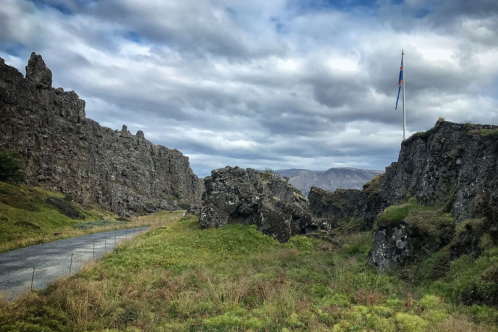
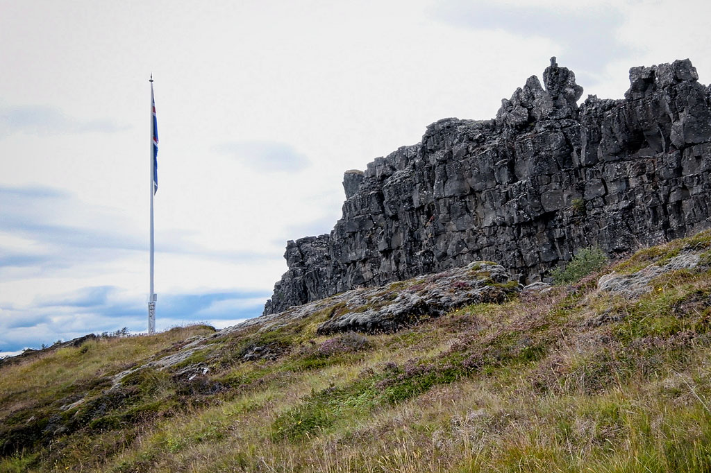
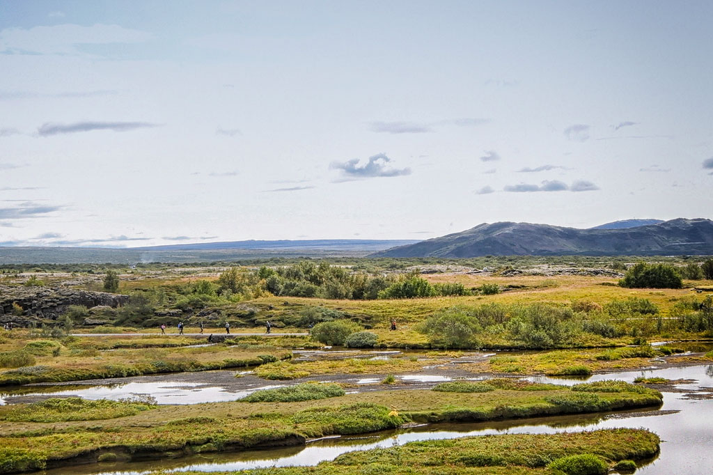
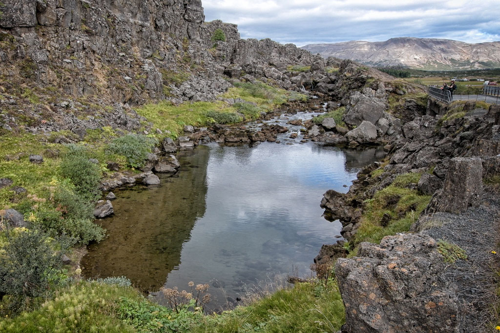
Thingvellir (Þingvellir) is the best place in Iceland (and possibly in the world) to see an oceanic rift (also called a continental rift) up close.
Oceanic rift on Earth’s surface
Iceland owes its existence to two continental plates, the Eurasian and the North American, drifting apart. The same process that pushes the plates apart also builds a distinctive mountain range along their boundary, with a rift (a kind of valley) running along its crest. This range is the Mid-Atlantic Ridge, which, as its name suggests, runs down the middle of the Atlantic almost from pole to pole. The ridge rises above the ocean surface in only a few places: in Iceland, the Azores and a few smaller islands. In Iceland, the best place to see this rift valley above sea level is Thingvellir National Park.

Map of Thingvellir National Park
Download the full map of the national park (jpg, 900 KB).
Download the map of the historic assembly site (pdf, 860 KB).
Thingvellir National Park also has its own mobile app, full of interesting facts. You can download it from the Google Play Store and the Apple App Store.
To learn more about how Iceland was formed, what an oceanic rift is and what Iceland has in common with the Bahamas, read How Iceland was formed – geology of the island in a nutshell.
What to see in Thingvellir
Thingvellir National Park is one of the main stops on the Golden Circle, probably the most popular route in Iceland. No wonder: walking along the (geological) border between Europe and North America is not something you get to do every day.
Video: The highlights of Thingvellir National Park
The park also has several individual attractions that are, in a way, part of the rift itself. The most beautiful of them are:
Almannagjá and Flosagja fissures
Spectacular fissures (the ending -gja means just that: a fissure) filled with crystal-clear water. In Almannagja the water comes from the river Oxara, which pours into the fissure over the Oxararfoss waterfall. One of the park’s main trails runs through Almannagja, and this is where you can walk between the vertical walls of the continental rift. The water in Flosagja, on the other hand, comes from the Langjökull glacier, about 50 km (30 miles) to the northeast. This fissure is best viewed from above.
Peningagjá (Coin Fissure)
This is the eastern part of Flosagjá, where the fissure widens a little and passes under a bridge. It used to be called Nikulásargjá, after Nikulás Magnússon, who drowned here in 1742. However, ever since the bridge was built in 1907, people have believed that if you drop a coin into the water and watch it sink, you can get the answer to any question. If you can see the coin all the way to the bottom, the answer is yes. If you lose sight of it, the answer is no. By the way, there are no such beliefs in native Icelandic folklore, so this custom was surely “imported.”
Öxarárfoss waterfall
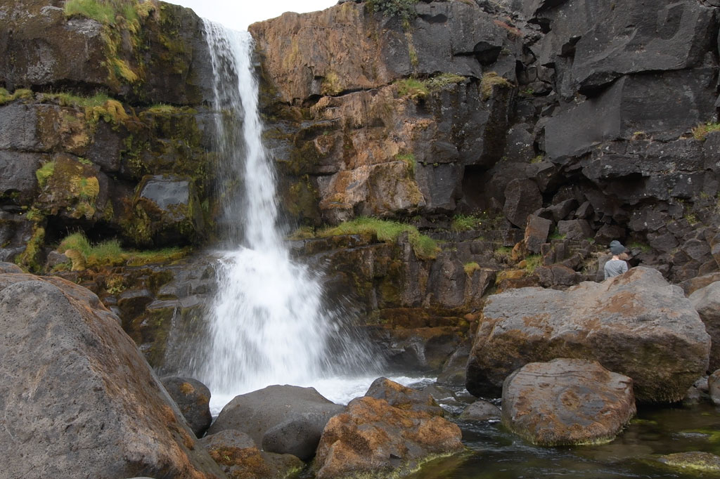
Oxararfoss lies in the northern part of the park, on the river Oxara, which flows into Almannagja. It is not a big waterfall, but it spills beautifully over the rocky wall of the rift. To read more about Oxararfoss, go here: Oxararfoss waterfall.
Silfra
A visit to the park is also a unique opportunity to dive between two of the largest tectonic plates in the world. For details, read this article: Silfra – underwater paradise or tourist trap?
Fauna and flora of Thingvellir
Thingvellir is also a haven for wildlife: unique species of mammals, birds and fish.
As many as 172 species of so-called “higher plants” (vascular plants) have been found here, which is about 40% of Iceland’s flora. Dwarf birch, willows and heather are among the most characteristic features of the landscape. Trout swim in the streams, and birdwatchers can spend hours watching ducks, golden plovers and snipe. White-tailed eagles nest on the slopes of Dráttarhlíð, and around Lake Thingvallavatn you can come across Arctic foxes and mink.
Naturally, most of these animals avoid people and are rather hard to spot, especially in summer, at the height of the tourist season.
Thingvellir historic sites
Thingvellir is not just an impressive natural monument but also a place of great historical and cultural significance. This is where the Althing, the Icelandic parliament, used to gather. Only clan chieftains had a vote in making laws, but anyone could watch the proceedings. It was here that laws were made and the most serious punishments were handed down. The Althing is the oldest (still active) parliament in the world: its first session was held as early as 930, and it met at Thingvellir until 1798! Only later did it move to Reykjavik.
It was also here, in the year 1000, that the Icelanders abandoned Asatru, the Old Norse pagan religion, and embraced Christianity. And it was here again, almost a thousand years later, in 1944, that Icelanders declared independence from Denmark and confirmed the election of their first president.
Several places at Thingvellir are closely tied to the history of Iceland and its parliament, and they are worth a stop as you walk around the park:
Lögberg (the Law Rock)
Logberg is where Althing sessions were opened, speeches were made and verdicts were announced. The assembly usually met in the second half of June and lasted about two weeks. Everyone who took part had the right to stand on Logberg and present their case.
Drekkingarhylur (the Drowning Pool)
A pool where women were once executed.
Until the 16th century, Iceland had practically no death penalty. It was not until 1564 that a law known as the Great Verdict was passed, under which women found guilty of witchcraft, adultery, incest or infanticide were punished by drowning. The sentences were carried out right here in Drekkingarhylur: the woman was tied up, a sack was pulled over her head, and she was pushed into the pool and held underwater with long wooden poles. The first execution took place in 1590 and the last one in 1749. In total, 18 women were drowned here.
Men were executed at several other places in Thingvellir. According to historical records, during the 16th and 17th centuries 30 men were beheaded, 15 were hanged (mostly thieves, whose crimes were considered the most shameful) and 9 were burned at the stake. Lesser crimes were usually punished with fines, flogging or banishment.
Thingvellir Church
According to the traditional Christianity Saga, it was the king of Norway, Saint Olaf, who ordered the first church at Thingvellir to be built in the early 11th century (Iceland itself remained independent until it came under Norwegian rule in 1262). No one knows exactly where that first church stood, but the current church was built in 1859 on the site of a church from the early 16th century. The tower with 3 bells was added in 1907.
In summer (June 1 to August 31), mass is held here on Sundays, and the church is open to visitors daily, usually between 9 a.m. and 5 p.m. with a midday break, as long as a park ranger is on duty (current hours).
Thingvellir: practical tips
The park has a visitor center, parking lots, campsites and public toilets. Entry to the park itself is free, but parking is not.
Parking costs 1,000 ISK (about $8) for a passenger car (current rates). One ticket is valid in all the park’s parking areas, but it is best to leave your car in one place and walk a loop. The loop is no more than 4 km (2.5 miles) long.
Toilets are at the P1 parking area, in the southern part of the park, next to the Visitor Center. They are open from 9 a.m. to 6 p.m. and are free of charge.
There are two campsites near the park, Leirar and Vatnskot:
- Vatnskot is about 2 km (1.2 miles) west of the southern edge of the park, on an abandoned farm by Lake Thingvallavatn. It is open from June 1 to September 15.
- Leirar is much bigger: it is really two campsites (northern and southern). It lies on the northern edge of the park, along Route 36, about 3.5 km (2.2 miles) north of the Visitor Center, and its northern part is open all year round.
If you visit Thingvellir in summer, decent sneakers are enough (you walk on asphalt paths). In winter, of course, it is a good idea to wear shoes that won’t slip, for example on the park’s biggest attraction, the sloping path through Almannagjá.
How to get to Thingvellir
Thingvellir National Park lies on Route 36, about 50 km (30 miles) east of Reykjavik, right on the Golden Circle route.
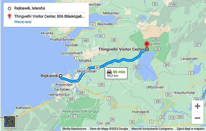
Map: driving route from Reykjavik to Thingvellir — click to open the interactive map
You can enter the park from both the north and the south. Coming from the north, you park at the P2 parking lot near the Öxarárfoss waterfall. Coming from the south, you can choose between the busiest parking lot, P1, by the Visitor Center on the western side, and the only slightly less crowded P5 on the eastern side.
You can easily walk between these parking lots, but you can’t drive between them (you would have to leave the park and go around). Anyway, as I mentioned earlier, it is best to leave your car in one place and take a nice walk through the park. The route is no more than 4 km (2.5 miles) long, so even at a slow pace and with stops along the way, you will finish it in 2 hours tops.