


A volcano is as ordinary a sight in Iceland as a field or a forest is back home – they are practically everywhere once you leave the city. Most of them are of course cones of volcanoes that last erupted thousands of years ago, but remember that to a volcanologist any volcano that has erupted at least once in the last 10,000 years is still an active volcano.
Iceland also has many volcanoes that are active in a much more down-to-earth sense – those whose last eruption took place, say, 100 years ago, or in some cases only 10 or 20 years ago. Between 1920 and 2020 there were 38 eruptions in Iceland, more than one every three years.
In this article, we present these largest and most famous eruptions from historical times.
How many volcanoes are there in Iceland
In everyday language, “volcano” means a mountain visible on the earth’s surface, formed by a volcanic eruption. To a volcanologist, however, that mountain is just a “volcanic cone”, and the volcano is the whole underground system of chambers and channels that collect magma. In this sense one volcano can have – and in Iceland does have – very many cones, or volcanic mountains.
Although almost every mountain you see in Iceland is a volcanic mountain (so there are hundreds, if not thousands of them), according to the classification of the Institute of Earth Sciences at the University of Iceland [8] we distinguish “only” 32 volcanoes in all of Iceland. You could say these are volcanic systems rather than individual volcanoes, but that is the official classification.

32 volcanoes of Iceland
Based on https://icelandicvolcanoes.is/
Here is a list of all the volcanoes in Iceland, ordered according to the Icelandic alphabet (abbreviations of the names in parentheses come from the map above): Askja (ASK), Bárðarbunga (BAR), Brennisteinsfjöll (BRE), Eldey (ELD), Esjufjöll (ESJ), Eyjafjallajökull (EYJ), Fremrinámar (FRE), Grímsnes (GRN), Grímsvötn (GRV), Heiðarsporðar (HEI), Hekla (HEK), Helgrindur (HEL), Hengill (HEN), Hofsjökull (HOF), Hrómundartindur (HRO), Katla (KAT), Krafla (KRA), Krýsuvík (KRY), Kverkfjöll (KVE), Langjökull (LAN), Ljósufjöll (LJO), Prestahnúkur (PRE), Reykjanes (REY), Snæfell (SNF), Snæfellsjökull (SNJ), Tindfjallajökull (TIN), Torfajökull (TOR), Tungnafellsjökull (TUN), Vestmannaeyjar (VES), Þeistareykir (TEY), Þórðarhyrna (THO), Öræfajökull (ORA).
As you can see from the map above, at the time of writing this article, two volcanoes – Krýsuvík and Grímsvötn – were highlighted in yellow. This means that they pose a potential threat to air traffic, due to their ongoing activity.
How often volcanoes erupt in Iceland
From the rock record – by examining layers that lie underground today, for instance – scientists can work out the dates and approximate size of many eruptions from as far back as 100,000 years ago and more.
Naturally, we know far more about the course and the effects of eruptions from the last millennium, since Iceland has been inhabited. Over that time eruptions have occurred on average every 3-4 years, and the more recent the eruption, the more reliable and detailed the descriptions of the events themselves.
Volcanic activity in Iceland of course goes on non-stop, and the smaller effects of it – small earthquakes, for example – are felt daily or almost daily. You can read more about the various effects of volcanism in Iceland other than eruptions in this article: Stunning effects of Iceland’s volcanism. And we wrote about how volcanoes work here: How Iceland’s volcanoes work.
How the force of a volcanic eruption is measured
Volcanic eruptions can be described in a number of ways, but the primary measure is the so-called Volcanic Explosivity Index (VEI), which takes in several parameters of the eruption:
- volume of pyroclastic materials produced,
- the height of the cloud of materials ejected into the atmosphere
- description of the explosion
As of today the index ranks eruptions on a scale of 1 to 8, since no eruption stronger than 8 has yet been recorded. There have in fact been very few VEI 8 eruptions, and all of them a very long time ago: the most recent one, of New Zealand’s Taupo volcano, took place almost 30,000 years ago. The largest relatively recent eruption was that of Indonesia’s Tambora in 1815, rated VEI 7.
The weakness of the VEI index is that it describes eruptions by the pyroclastic material they fire out, and many eruptions produce none at all. These are lava (effusive) volcanoes, which mainly – or only – pour out lava during an eruption. Such eruptions are excluded from the VEI rating altogether, which leaves some leeway in deciding which eruption in history was the largest or the most severe…
From 1982 data describing the strongest eruptions around the world on the basis of VEI, 122 eruptions rated 4 or higher have been recorded since 1500 – as many as 14 of them in Iceland.
Strongest volcanic eruptions in Iceland
The strongest confirmed Icelandic eruptions according to the VEI index are the 1477 Bardarbunga eruption and the 8230 BC Grimsvotn eruption – the one that laid down the Saksunarvatn tephra. Both are rated 6 on the VEI scale [9].
| Iceland eruptions by VEI | ||
|---|---|---|
| Volcano | Year of eruption | Power according to VEI |
| Bardarbunga | 1477 | 6 |
| Grimsvotn | 8230 BC | 6 |
| Askja | 1875 | 5 |
| Katla | 1755 | 5 |
| Katla | 1721 | 5 |
| Katla | 1625 | 5 |
| Oraefajokull | 1362 | 5 |
| Katla | 1262 | 5 |
| Hekla | 1104 | 5 |
| Hekla | 1100 BC | 5 |
| Hekla | 2310 BC | 5 |
| Hekla | 4110 BC | 5 |
| Hekla | 5150 BC | 5 |
| Askja | 8910 BC | 5 |
Icelandic eruptions rated 5 or higher on the VEI scale, after the Global Volcanism Program.
As you can see, most of these strongest eruptions were produced by Hekla – the Queen of Icelandic Volcanoes. The full list adds 38 more eruptions rated 4, 35 rated 3, 183 rated 2 or lower, and 227 with no VEI rating at all.
Hazards associated with volcanic eruptions
The main danger during a volcanic eruption is the pyroclastic material – known as tephra – shooting out of the crater and falling back to the ground. This is all the loose material ejected from the volcano, from so-called volcanic bombs (from 6 cm / 2.5 in to as much as 1 m / 3 ft across!) to very fine ash that can stay in the atmosphere for a long time and, for example, endanger aircraft.
Every volcanic eruption is a dangerous event, but the level of danger depends on several factors:
- The first is how long the eruption lasts and how much ash it throws out.
- The second factor is the height the dust reaches, because that governs how far it spreads across the area, the region and even the world. Atmospheric conditions matter a great deal here: wind (its direction and strength) and rain, which brings the dust down faster and shortens its range.
- Another direct threat is the lava flowing out of the volcano. Depending on its composition it can be thin – in which case it flows fast and leaves far less time to escape – or viscous, creeping slowly down the slopes.
- Lightning is a threat during eruptions too. The discharges can be really strong, and lightning can strike as far as 30 km / 19 miles from the volcano.
- Water pollution, mainly by halides, is also very dangerous. Fluoride, for instance, contaminates the water and is dangerous to humans and animals.
- Some eruptions throw out huge amounts of greenhouse gases such as carbon dioxide and methane. Many other gases spewed from volcanoes pollute the atmosphere as well.
- Finally, there is a hazard that is something of an Icelandic speciality: the very violent glacial floods called jokulhlaups here. Iceland lies far enough north that many of its volcanoes are covered by glaciers. When such a volcano erupts, the heat rising from it melts gigantic areas of the ice. The water often gathers above the crater and does not find a way out straight away; once enough of it has collected, it breaks through one of the caldera walls and a sudden, huge, very fast and catastrophic flood follows – short-lived, but of a force no ordinary flood can match. You can read about the course of one of them, from as recently as 1996, here: Jokulhlaup of the Grímsvötn volcano (1996). The mighty spans of the iron bridge over the Skeidara River, bent to the ground by that flood, can still be seen near the Skaftafell Nature Reserve – and they are worth the stop.

Remains of a bridge destroyed in a glacial flood

When judging how much destruction an eruption caused, it is also worth remembering that eruptions near human settlements are far more severe than those far from them. Eruptions destroy farmland, poison water, and fire burns down buildings and whole settlements. In a country like the Iceland of the past, virtually every major volcanic eruption led to famine.
Iceland’s largest volcanic eruptions
When judging the strength and the significance of an eruption, it is hard to settle on a single criterion. It is easy to find many different “greatest” eruptions, because what counts is not only the sheer force of the explosion – and even that can be measured in several ways – but also the mark it left on life in Iceland, in Europe and in the world. You will find plenty of interesting facts about the history of Icelandic eruptions in this article too: The Stunning Effects of Iceland’s Volcanism.
Below is a list of the most important volcanic eruptions in Iceland due to various factors.
Bárðarbunga – strongest eruption (1477)
 Bardarbunga-Veidivotn is a volcanic system with the central volcano Bardarbunga (Iceland’s second highest peak). It has recorded as many as 24 eruptions since 870, making it the second most active volcanic system in historic times in Iceland. It is estimated that this volcanic system may have undergone up to nearly 400 eruptions in the past 10,000 years.
The main volcano and most of the rift that accompanies it are located under the Vatnajokull glacier, and most volcanic events are described in this area. Their main effect is very extensive glacial floods (jokulhlaups).
The last eruption in this volcanic system ran from 29 August 2014 to 27 February 2015 – the Holuhraun fissure eruption, which left a lava field of almost 85 km2 / 33 sq miles. The one with the highest VEI rating (6), though, happened in 1477. That eruption threw out about 10 km3 of pyroclastic material, which covered all of Iceland with a layer at least 1 cm deep, and about half the island with as much as 10 cm! [8]
Öræfajökull – most ashes (1362)
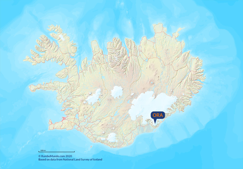 Oraefajokull is Iceland’s highest peak (2,110 meters / 6,920 feet above sea level) and one of six volcanic systems covered by the country’s largest glacier, Vatnajökull.
It is this volcano that is responsible for the largest explosive eruption in historic times in Iceland. It took place in 1362 and is rated 5 on the VEI index [9], lower than the strongest eruptions of Bardarbunga and Grimsvotn. Even so, it was this eruption that threw the largest amount of tephra into the atmosphere: the total volume of ejected steam, gases and volcanic ash is estimated at as much as 10 km3. Current estimates put the height of the ash cloud at up to 35 km / 22 miles, and pyroclastic material from this eruption can be found today in Greenland, Norway and Ireland, among other places.
The 1362 eruption took a huge toll, because the area was quite heavily populated for the time and the eruption destroyed everything within a radius of at least 20 km / 12 miles. Buildings were wrecked over a much larger area, partly because the eruption came with a strong earthquake and glacial flooding, and the immediate surroundings – as far as the town of Hofn – were buried under about 10 centimeters / 4 inches of ash. It is thought to have been one of the deadliest eruptions: between 50 and as many as 300 people lost their lives, and about 30 farms were destroyed along with the homes of their people.
The 1727 eruption (VEI 4) was also similarly strong, though less tragic in its consequences. Three people died because of it, and the most devastating element of this eruption was again the gigantic and very violent glacial floods.
Katla – largest total quantity of magma
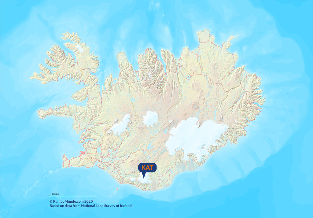 Katla is a volcanic system in the southern part of the island, under the cap of the Myrdalsjokull glacier. It is still active and third most active in historical times: it has erupted at least 21 times since the 9th century, the last of them in 1918. Almost all its eruptions have been fissure, subglacial and phreatomagmatic. Since 870 this volcano has produced as much as 25 km3 of magma – the most in all of Iceland!
The largest eruption of Katla took place in 934 and went on, according to the Global Volcanism Program, until about 940. This is the Eldgjá eruption, named after the fissure it tore open – today one of the great canyons of the highlands [7]. Its VEI rating is 4, lower than the 5 given to several later Katla eruptions, because the index measures explosivity, not how much lava came out.
Since Katla is covered by a glacier, the main danger from its eruptions is jokulhlaups – glacial floods. For all that it is such a dangerous and very active volcanic system, only one death has ever been attributed to it: a person struck by lightning, as far as 35 km / 22 miles from the volcano.
Hekla – most strongest explosions
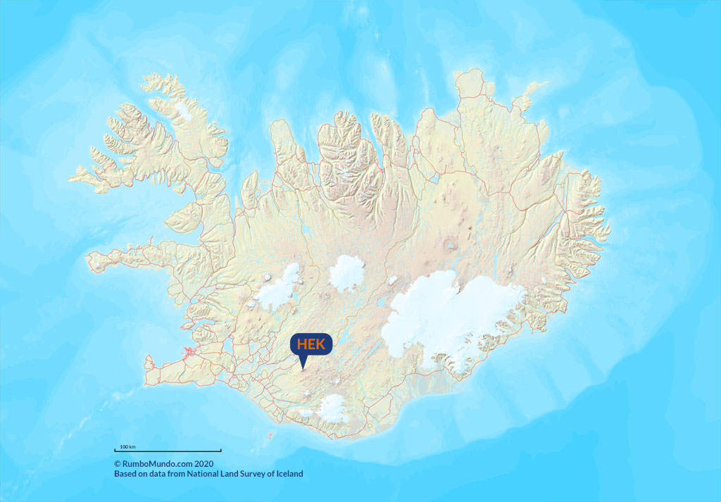 Hekla is one of the most famous volcanoes in all of Iceland, and you could say it made this list for its overall record. As the table above shows, Hekla is responsible for more of the country’s most powerful eruptions than any other volcano. Since 870, 23 eruptions have been recorded here, which puts it third for activity since the settlement. Hekla also erupts fairly regularly: at least once every 50 years over the period studied.
The largest known eruption of Hekla came between 1766 and 1768, when 1.3 km3 of magma was spewed out. The strongest by the VEI index was the eruption of 1104, rated 5. The eruption of 1300 poisoned a great deal of livestock and brought famine to the island. The costliest eruption of Hekla, though, is considered to be the one in 1970, when more than 8,000 sheep died of fluoride poisoning from the volcano and total losses were put at 1-2 million euros.
It is particularly striking that Hekla erupted five times at the end of the 20th century, almost evenly every 10 years: in 1970, 1980, 1981, 1991 and 2000. The eruptions tended to be short (30 minutes to 2 hours) and not very strong (VEI 2-3), and there has not been one yet in the 21st century. The civil protection authorities take Hekla very seriously indeed, because with this volcano the foreshocks and other warning signs have sometimes come only 30 minutes before the eruption.
Grimsvotn-Laki – most deadly (1783)
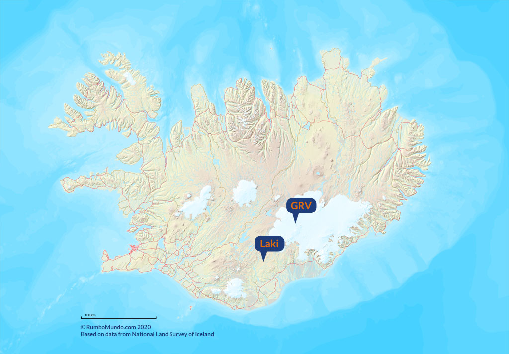 The Grimsvotn volcanic system is the most active volcanic system in all of Iceland. Some 70 eruptions have been recorded here since 870, producing about 21 km3 of magma between them. According to recent studies, around 10,000 years ago this system may have produced several large eruptions rated VEI 5 to 6.
The most recent eruption came in May 2011, when ash plumes rose 15-20 km / 9-12 miles above the volcano, drifted over northern Europe and dropped ash from Reykjavik all the way to the Tröllaskagi peninsula (Global Volcanism Program, checked September 2026). It is not the best known one, though. The eruption described most often, and treated as the largest of all the confirmed ones, happened between 1783 and 1784. It is rated 4 on the VEI index and is commonly known as the Laki eruption.
It came from a fissure 27 km / 17 miles long, on the part of the system that is not covered by ice. That single eruption is estimated to have spewed out 14.7 km3 of magma, spreading over an area of as much as 565 km2 / 220 sq miles. About 120 Mt of sulfur dioxide escaped into the atmosphere as well. The resulting cloud covered about 25% of the entire northern hemisphere and had a very damaging effect on the environment and the climate.
It is also the deadliest eruption in Iceland’s history. Not a single person died during the eruption itself, but a great many farm animals perished, and that caused a huge famine across the country in the years that followed. An estimated 8,700 people lost their lives because of the eruption, and between 1783 and 1786 the population of the whole country fell by as many as 10,500 through famine, epidemics and a drastic drop in births.
Eyjafjallajökull – costliest explosion (2010)
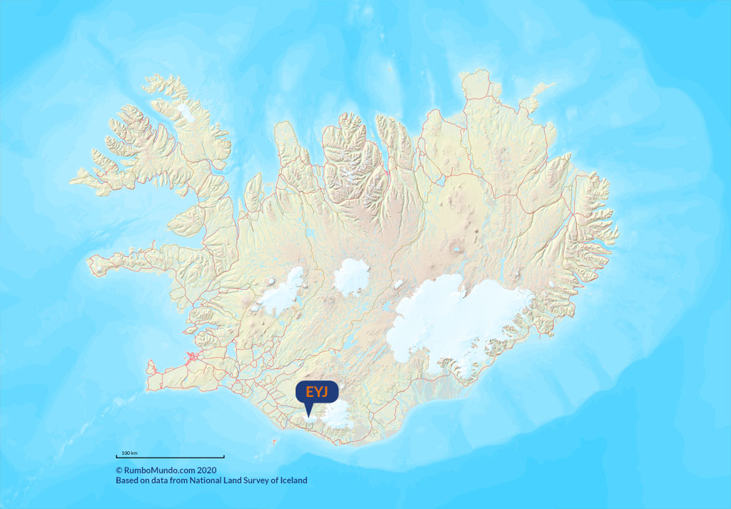 Eyjafjallajokull is an ice-covered stratovolcano and the volcano behind what is probably the best-known eruption ever to happen in Iceland.
It erupted after 187 years of dormancy, quite recently: on March 20, 2010. The whole thing began with a small earthquake, after which a 150-meter / 490-foot fountain of lava rose from a 100-meter / 330-foot fissure and from its 12 craters at once. The lava was 1,200 °C (2,190°F) and the dust cloud climbed to 7,000 meters / 23,000 feet. The whole outpouring lasted three and a half weeks, and 500 people had to be evacuated because of it.
About a month later, on April 14, 2010, there was another eruption, this time from the very top of the volcano, under the glacier of the same name. It was a so-called phreatomagmatic eruption: once the relevant part of the glacier had melted, a huge ash cloud shot into the stratosphere under high pressure. The cloud disrupted air traffic across virtually all of Europe, and since Iceland lies right on the route of planes flying between Europe and North America, connections to the US and Canada were paralyzed as well.
It is estimated that up to nearly 50% of all passenger flights worldwide were canceled in the dozen or so days after the eruption. Some 10 million passengers were unable to make or continue their journeys. Losses to airlines are estimated at 1.5-2.5 billion euros [6].
Compared with the eruptions of the 18th or the 14th century, the Eyjafjallajokull eruption was not particularly large. It produced “only” 0.27 km3 of pyroclastic material and about 0.023 km3 of lava. What mattered was that the ash from this eruption was very fine, so it stayed in the air for a very long time – right in the middle of the busiest air corridor in the world and over much of Europe.
Krafla – the terror of the north
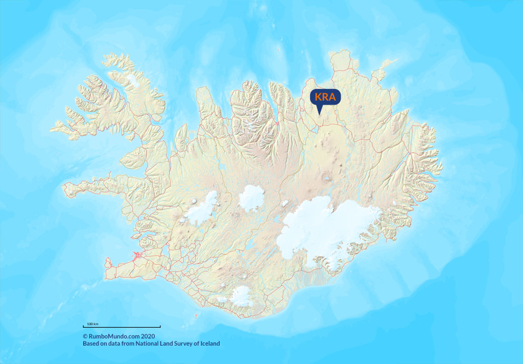 Krafla has had only two so-called episodes in its history. Both took place in the last 250 years, and both were devastating for the local community.
The first, from 1724-1729, is called the Myvatn Fires, and the second, from 1975-1984, is called the Krafla Fires. A total of about 5 km3 of magma was ejected during both events. The eruptions during both episodes were related to the outflow of lava itself (associated with rift expansion), making most of them not included in the VEI index at all (and those that are included there are given an index of 0 or 1).
Nobody was hurt in either episode. The Myvatn Fires, according to contemporary accounts – primarily those of Pastor Jon Saemundsson [10] – brought not only the lava flow itself but also strong earthquakes that destroyed many buildings, killed livestock and forced people to move out of the area. With the population thin on the ground and little in the way of expensive buildings or infrastructure to destroy, though, the total damage from the Myvatn Fires stayed limited.
The eruption of 1975-84 was far more costly. The total damage was put at as much as 70 million euros, a large share of it structural damage to a geothermal power plant then under construction nearby – Kröflustöð, Iceland’s largest geothermal power plant. The damage delayed its full start-up by two decades.
For the scientific world, however, it was a very valuable eruption. It yielded a great deal of information on the mechanics of volcanoes in Iceland’s rift zone.
Vestmannaeyjar – creator of its own archipelago
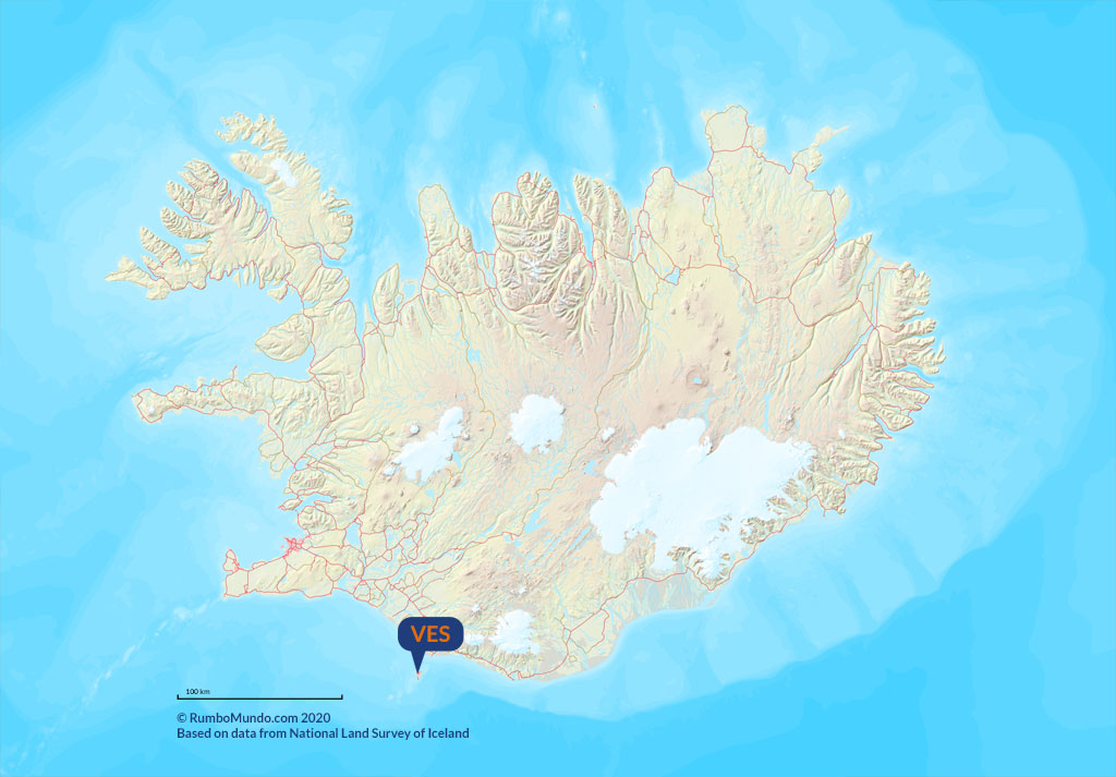 Vestmannaeyjar is Iceland’s youngest volcanic system. It lies in the so-called eastern volcanic zone and takes its name from the archipelago it created, a group of basalt islands and underwater cones on Iceland’s southern shelf. Being so young, it is the site of a great many famous eruptions from the 20th century.
The first of the famous Vestmannaeyjar eruptions ran from 1963 to 1967 and built, in front of the whole world, the island of Surtsey. It has been protected from the moment it was born, scientists have been studying it since 1964, and in 2008 it went onto the UNESCO World Heritage List. Only a narrow circle of scientists may set foot on it, and it serves as a natural laboratory for how plants and animals colonize newly erupted ground.
The second famous eruption was the one in 1973, on the archipelago’s main island, Heimaey. In places the volcanic fissure was only 200 meters / 660 feet from the nearest buildings, so it is no surprise that the eruption caused extensive damage in the town. 400 buildings were buried under a 6-meter / 20-foot layer of lava and pyroclastic material. Many burned to the ground, set alight by the hot lava, and roofs collapsed in others under a particularly thick layer of tephra.
Because the eruption happened in thoroughly modern times, it was documented in, among other things, many harrowing photographs. The Eldheimar Museum – also known as the Fire Museum, the Lava Museum or the Volcano Museum – brings the eruption to life for visitors and is a must on any trip to “Vestmany” (see Vestmannaeyjar – islands off the south coast of Iceland).
Meradalir – latest popular eruption
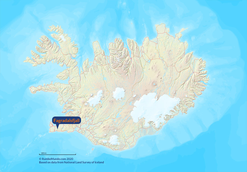 On August 3, 2022, after several weeks of light tremors and a few days of very frequent and quite strong ones, the Krýsuvík (Krýsuvík-Trölladyngja) volcanic system on the Reykjanes peninsula erupted again. In 2021 it had created an extremely spectacular and popular crater in the Geldingadalir valley, on the slopes of Fagradalsfjall. The 2022 eruption was a fissure eruption and ran through the neighboring valley, Meradalir, lasting just under three weeks – until August 21, 2022.
The 2022 eruption was considerably stronger than the one in 2021, but it lasted only 3 weeks against 6 months. It also sat a little further from the roads and parking lots, so the walk out to it was about 1.5 km / 1 mile longer.
Thanks to the reasonably easy access and the gentle course of it, the eruption became a huge tourist attraction all over again. We rarely get the chance to watch fresh lava flowing from a volcano at close range, and without traveling to the other side of the world at that. Meradalir valley lies about 20 km / 12 miles southeast of Keflavik International Airport, about 30 km / 19 miles southwest of downtown Reykjavik and only about 10 km / 6 miles east of the popular Blue Lagoon spa. The walk from the nearest parking lot is about 6 km / 3.7 miles one way.
The 2022 eruption, like the 2021 one, was one of the small, quiet ones – which is exactly why it was relatively harmless and could be seen up close, with your own eyes, in relative safety. No wonder it drew so many tourists, and was just as big an attraction for Icelanders themselves.
Read more about that eruption in a separate article: Iceland’s newest attraction – the Meradalir eruption.
Bibliography
- Gudmundsson, Magnus & Larsen, Guðrún & Hoskuldsson, Armann & Gylfason, Ágúst. (2008). Volcanic hazards in Iceland. Jökull 58.
- Thordarson, Thorvaldur & Self, S. (1993). The Laki (Skaftár Fires) and Grimsvotn eruptions in 1783-1785. Bulletin of Volcanology 55, 233-263. doi:10.1007/BF00624353.
- Thordarson, Thorvaldur & Larsen, G. (2007). Volcanism in Iceland in historical time: Volcano types, eruption styles and eruptive history. Journal of Geodynamics 43, 118-152. doi:10.1016/j.jog.2006.09.005.
- Newhall, Chris & Self, Stephen. (1982). The Volcanic Explosivity Index (VEI): An Estimate of Explosive Magnitude for Historical Volcanism. Journal of Geophysical Research 87, 1231-1238. doi:10.1029/JC087iC02p01231.
- Fraedrich, Wolfgang & Heidari, Neli. (2019). Geology of Iceland. doi:10.1007/978-3-319-90863-2_4.
- A. R. Schmitt and A. Kuenz. A reanalysis of aviation effects from volcano eruption of Eyjafjallajökull in 2010. 2015 IEEE/AIAA 34th Digital Avionics Systems Conference (DASC), Prague, Czech Republic, 2015, pp. 1B3-1-1B3-7. doi:10.1109/DASC.2015.7311335.
- Oppenheimer, C., Orchard, A., Stoffel, M. et al. The Eldgjá eruption: timing, long-range impacts and influence on the Christianisation of Iceland. Climatic Change 147, 369-381 (2018). doi:10.1007/s10584-018-2171-9.
- Icelandic Met Office, Catalogue of Icelandic Volcanoes.
- Global Volcanism Program, 2026. [Database] Volcanoes of the World (v. 5.4.0; 7 Aug 2026). Distributed by Smithsonian Institution, compiled by Venzke, E. doi:10.5479/si.GVP.VOTW5-2026.5.4 – including the profile Grimsvotn (373010).
- K. Gronvold. Myvatn fires 1724-1729. Chemical composition of the lava. (PDF) Nordic Volcanological Institute 8401, University of Iceland, Reykjavik 1984.
