


The Bardarbunga (Bárðarbunga) volcano created the Holuhraun lava field – the largest to form in Iceland in more than 200 years. Its last eruption ended in 2015, but the volcano is still very active. Here’s how you can see it.
A giant volcano covered by a glacier
All of Iceland’s largest volcanoes are covered by glacial ice caps, and Bardarbunga is no exception. It’s the second-highest peak in Iceland and lies within the massif and under the ice cap of Vatnajokull, the largest glacier in Europe. The summit of Bardarbunga reaches 2,000 m (6,562 ft) above sea level (other sources say 2,009 m / 6,591 ft), and its name could be translated as Bárður’s Dome (a rather large one, admittedly).
Bardarbunga is a stratovolcano. It lies where the eastern and northern volcanic rift zones meet and is the crowning peak of a huge volcanic complex. Its main caldera lies about 25 km (16 mi) east of the Nyidalur Valley and measures as much as 8 by 11 km (5 by 7 mi), although its total area is “only” 65 km2 (25 sq mi). It’s 700 m (2,300 ft) deep and completely filled with ice [1] [2]. The volcano’s side fissures, Veidivötn and Trollagigar, stretch as far as 100 km (60 mi) to the southwest and 50 km (30 mi) to the northeast. The Loki-Fögrufjöll volcanic system to the south is also part of the Bardarbunga system [1].
Bardarbunga’s largest and most recent eruptions
Partly because of its enormous size, Bardarbunga is responsible for a great many eruptions, including some in recent years. As many as 55 are currently attributed to it [1].
Bardarbunga’s largest eruption took place about 8,600 years ago. Lava poured out of the Veidivötn fissure system and flowed all the way to the south coast. It was the largest known lava flow on Earth in the last 10,000 years: more than 21 km3 (5 cu mi) of molten rock covered an area of about 900 km2 (350 sq mi). The lava finally reached the ocean as far as 130 km (80 mi) from its source – near Eyrarbakki and Stokkseyri, south of today’s Selfoss [4].
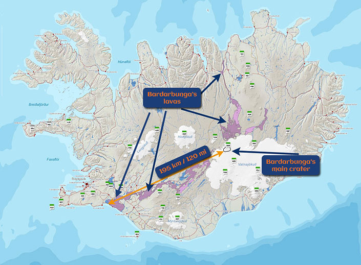
Lava extent of the Bardarbunga volcano [4]
source: Catalogue of Icelandic Volcanoes
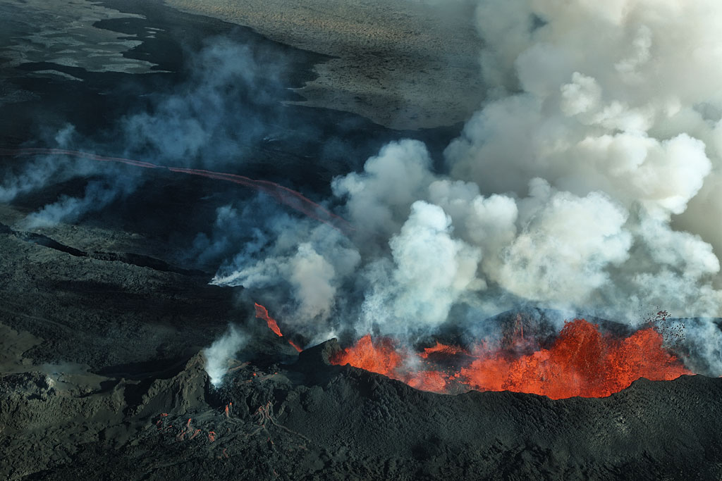
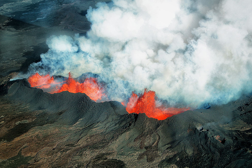
The most recent eruption lasted from August 29, 2014, to February 27, 2015. The volume of lava is estimated at 1.4 km3 (1/3 cu mi). Although the eruption was several times larger than, for example, the famous 2010 eruption of Eyjafjallajökull, it went almost unnoticed outside Iceland. The main reason was that it was a lava eruption, not an ash eruption, so its “effects” simply flowed down the mountainside, bothering practically no one.
What’s more, the eruption fortunately poured out lava through a side fissure outside the glacier, not through the main crater, so it didn’t cause catastrophic flooding either. And (as lava eruptions often are) it was drawn out over a long time, which made it less violent.
Between the end of the eruption and February 2017, 51 earthquakes stronger than magnitude 3 were recorded at the volcano [3] – though that’s nothing unusual in seismically active Iceland.
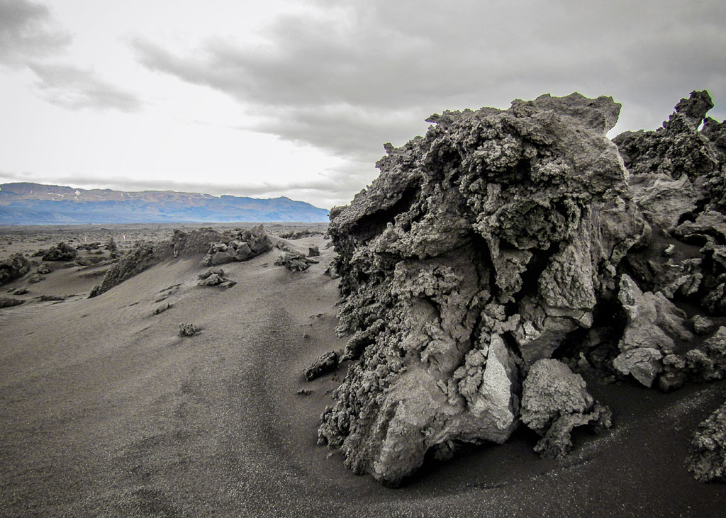
Holuhraun – the lava field from the 2014-2015 eruption
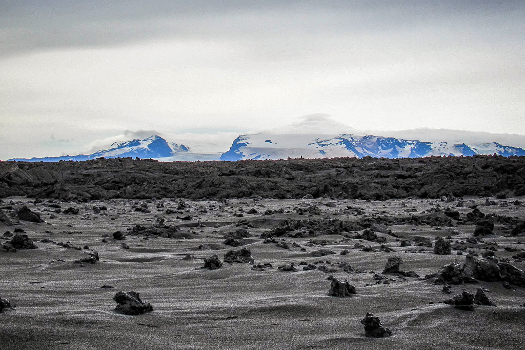
The 2014-2015 eruption created today’s Holuhraun lava field. It lies on the northern slopes of Barðarbunga, at the edge of the Dyngjujökull glacier (one of the outlet glaciers of Vatnajökull), about 41 km (25 mi) northeast of the volcano’s caldera. It’s the largest lava field (85 km2 / 33 sq mi) to form in Iceland since 1783 – Vatnajökull National Park calls it the country’s largest lava eruption in 230 years. According to various reports, the lava was still cooling in 2017.
The lava flow did, however, go hand in hand with the gradual collapse of the Bardarbunga caldera: according to the Icelandic Met Office, its floor sank by up to 65 m (210 ft), accompanied by a remarkable series of earthquakes [2]. No one died in the eruption, but over the following year… many sheep did. The cause was toxins in the soil. Toxic gases also caused breathing problems, especially for sensitive people.
Interestingly, another volcano, Askja, is much closer to Holuhraun than Bardarbunga – only about 15 km (9 mi) away. The recent Bardarbunga eruption buried rocks from the 1797 Askja eruption. In fact, today’s Holuhraun consists of many layers of lava that flowed into the area over the following centuries and millennia.
Because Bardarbunga lies under the Vatnajökull glacier, the area has also been swept by glacial floods (jokulhlaup) many times.
How to get to Bárðarbunga
The volcano’s caldera lies high in the mountains under a glacier. It’s hard to reach without a helicopter, and walking on the ice cap would be very dangerous.
You can, however, easily drive fairly close to the volcano from the valley and hut of Nyidalur, almost in the middle of the interior – and of the whole island. Heading east from there, you can reach two parking lots, Gjosta and Svarthofdi, on the northern and southern edges of the Vonarskard caldera. This is already the Bardarbunga system, right next to the main massif.
How to get to Holuhraun
The Holuhraun lava field lies about 15 km (9 mi) south of Askja crater and the Dreki hut. The F910 mountain road (its western section) runs through it and joins the F26 farther west. On the lava field itself, you may walk only on the marked trail from the Holuhraun parking lot – this is how the national park protects the thin, fragile lava crust. The F910 offers truly amazing views and Iceland’s newest hot spring suitable for bathing, but it’s very, very difficult!
The route is only about 120 km (75 mi) long, yet driving it can take 7 hours or more – that says it all. It’s difficult because in many places it’s narrow, steep and full of sharp rocks, and elsewhere it crosses fresh lava, where the track is practically invisible and it’s very, very easy to get lost.
Although off-road driving is banned all over Iceland, the western part of the F910 certainly qualifies as a tough off-road route. If you want to drive it, go with at least 2 cars, bring enough water, food and gas, and make sure you have everything you need to tow a car, change a tire or, if necessary, spend the night in your vehicle.
Photos of Bardarbunga and Holuhraun
Sources
- Global Volcanism Program: Bárðarbunga, Smithsonian Institution.
- Icelandic Met Office: On the Bárðarbunga gradual caldera collapse (August 4, 2016).
- Global Volcanism Program, 2017. Report on Bardarbunga (Iceland) (Venzke, E., ed.). Bulletin of the Global Volcanism Network, 42:2. Smithsonian Institution. https://doi.org/10.5479/si.GVP.BGVN201702-373030.
- Volcanic system: the Bárðarbunga system. Edited by Gudrún Larsen and Magnús T. Gudmundsson; Institute of Earth Sciences, University of Iceland; August 25, 2014 (Catalogue of Icelandic Volcanoes).
You can find more facts and trivia about Icelandic volcanoes and their effects in these articles:
