Askja is a volcanic caldera in northern Iceland. It’s famous for the chance to swim in a warm (but not hot) lake right inside a volcano’s crater.
Bathing in the volcanic lake in Askja
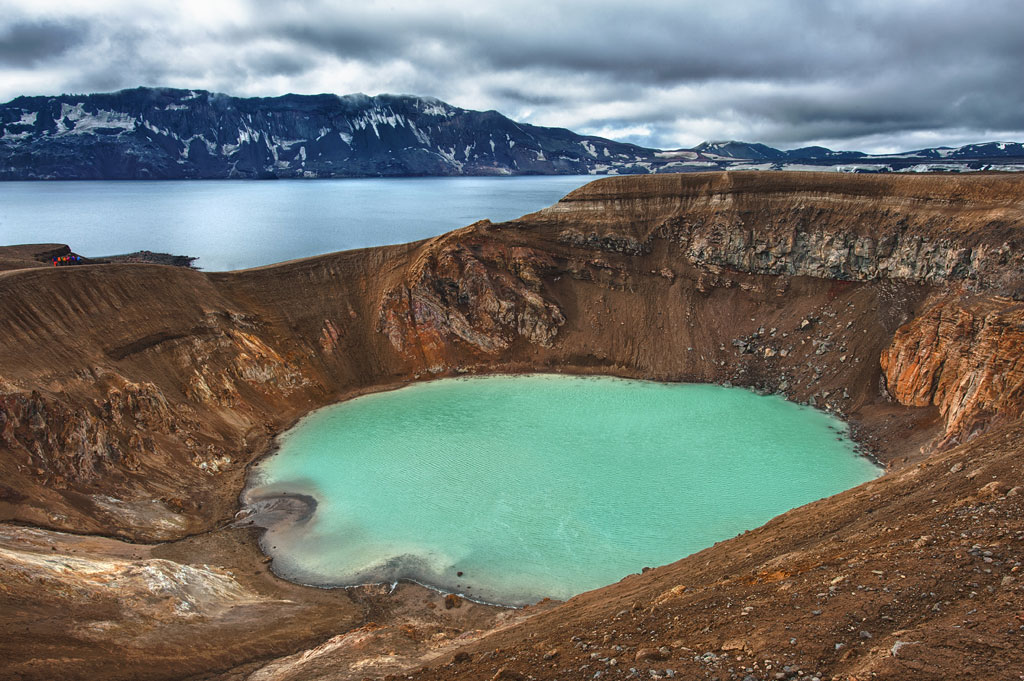
There are two very famous lakes in Askja. The larger one, Öskjuvatn, is 220 m (720 ft) deep, making it the second deepest lake in Iceland. Its surface lies about 50 m (160 ft) below the floor of the main caldera, and it covers about 12 km² (4.6 sq mi). Interestingly, the lake stays frozen for most of the year.
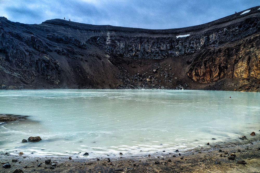
The smaller lake, Viti, looks like… a natural Blue Lagoon. It’s so much smaller than Öskjuvatn that less detailed maps don’t show it at all… It’s more than 8 m (26 ft) deep in the middle and filled with cloudy green-turquoise water at about 22 °C (72°F). This is where you can bathe in a lake inside a volcano’s caldera. And – technically speaking – an active volcano, which is what keeps the water warm.
The fairytale atmosphere of Viti is somewhat spoiled by the pungent smell of sulfur, the very steep path down to the lake and the fact that its name means… hell.
Of course (?), there are no showers, changing rooms or any other facilities for bathers in the caldera. It’s a purely natural experience.
The Askja volcanic system
Askja volcano lies in northern Iceland, about 65 km (40 mi) south of Lake Myvatn, in the Dyngjufjöll mountains. In the old days, the volcano itself was called Dyngjufjoll, a name that now refers to the whole surrounding range. Like all mountains in Iceland, it’s volcanic in origin.
The Askja volcanic system covers an area of about 50 km² (20 sq mi). The top of the caldera reaches 1,516 m (4,974 ft) above sea level, and the floor of the main crater lies at about 1,100 m (3,600 ft). Together with lakes Öskjuvatn and Viti and the surrounding craters and lava fields, it makes up the Askja volcanic system.
Askja is rated as moderately active, although there may have been as many as 200 eruptions here over the past 7,000 years, at least 40 of the surrounding calderas are estimated to be less than 1,100 years old, and the last (small) eruption happened in 1961 (that’s when the Vikrahraun lava field formed by the Vikraborgir craters). Naturally – as almost everywhere in Iceland – minor earthquakes are recorded here almost constantly.
How today’s volcano formed
The caldera now filled by Lake Öskjuvatn formed over the 40–50 years following the 1875 eruption, which also created the Viti crater at its end. Besides shaping today’s landscape, that eruption poisoned the land and groundwater, killed many animals and triggered… a wave of mass emigration of Icelanders to the United States. Interestingly, ash from the eruption reached as far as Scandinavia, northern Germany and Poland. The main Askja caldera itself formed mostly at the end of the Ice Age, and the neighboring smaller calderas are estimated to be about 11,000 years old.
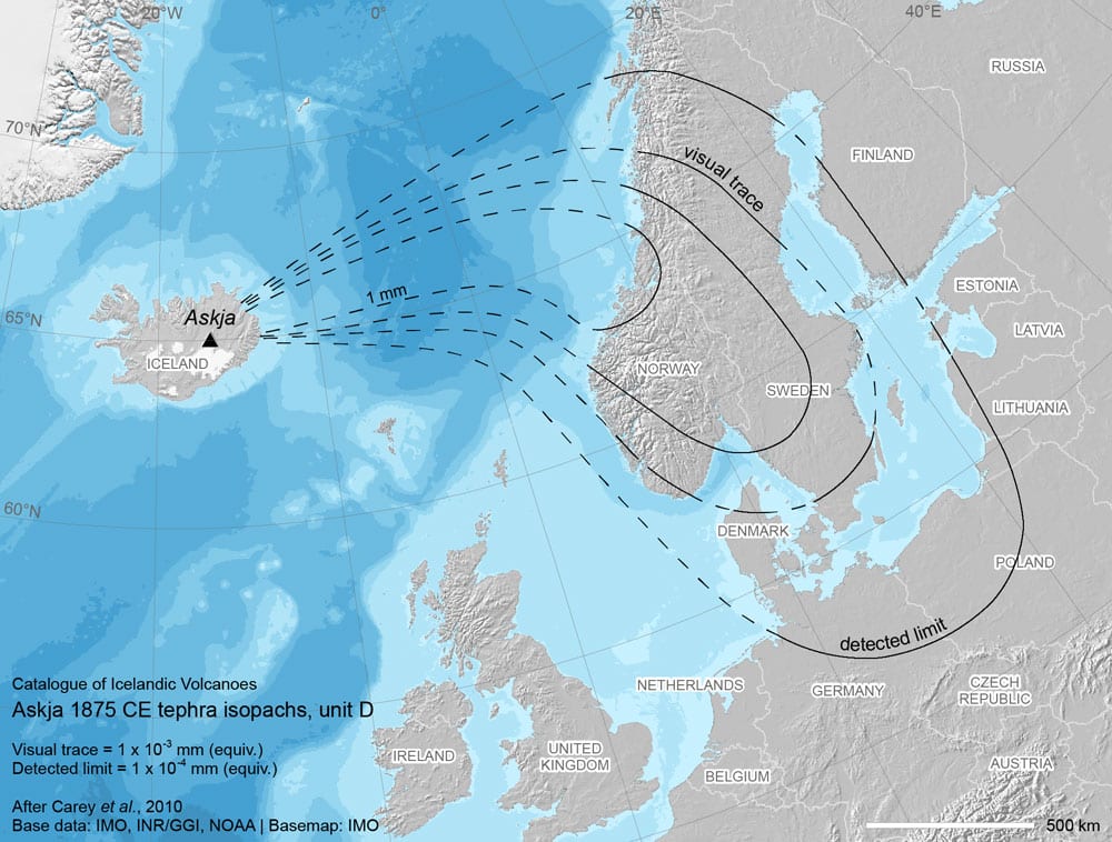
Ash fall from the 1875 Askja eruption
source: Catalogue of Icelandic Volcanoes
In 1978, Askja was declared a natural monument and placed under protection; today it lies within Vatnajökull National Park.
Around Askja
Askja is a mountain massif that clearly dominates the area, but beyond the caldera itself there are several other interesting places in the immediate vicinity.
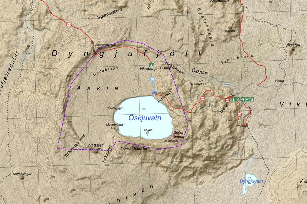
You can download a detailed hiking map from the national park website: Askja and Kverkfjöll hiking map (PDF, 1.5 MB).
Dreki
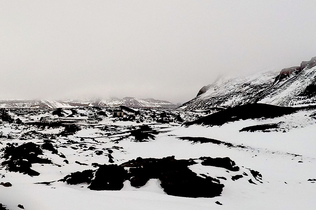
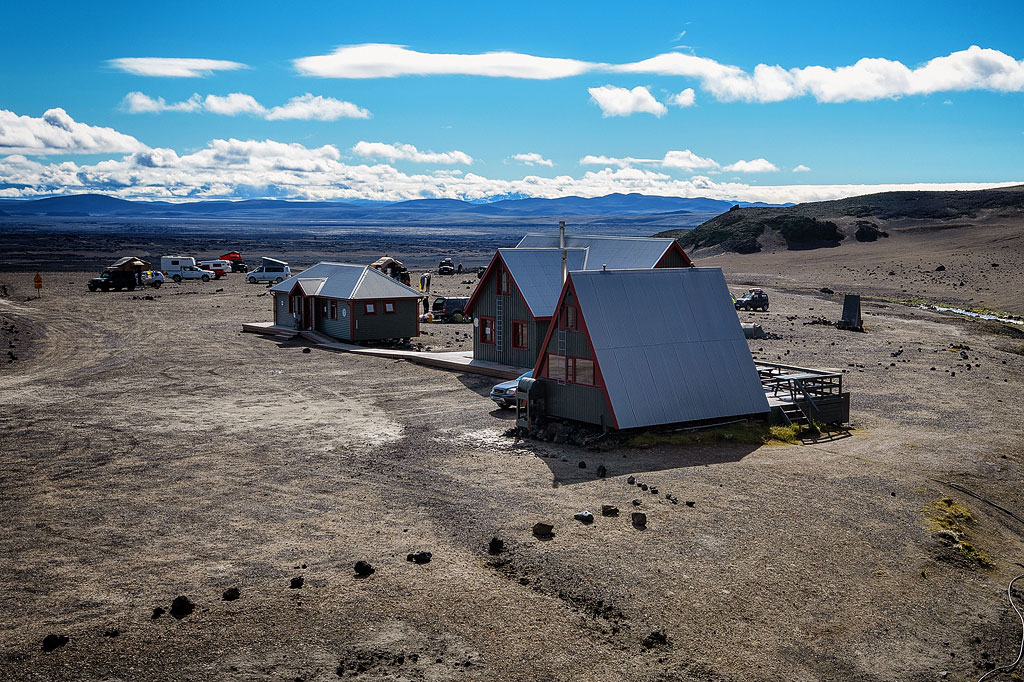
About 6.5 km (4 mi) east of the caldera, where the F910 and F894 roads meet, you’ll find the Dreki mountain hut and campsite. The hut is small (55 beds) and has basic facilities, though there are toilets with showers. Don’t expect grass at the campsite – it’s just a fairly level patch of lava cleared of stones. Dreki is run by the Touring Club of Akureyri (FFA: Ferðafélag Akureyrar). You can book by email or phone: [email protected], +354 462 2720 (weekdays, 11 a.m. to 1 p.m.).
There’s a parking lot next to the hut that anyone can use.
In summer, Vatnajökull National Park rangers and mountain rescue volunteers are on duty here.
Drekagil Canyon
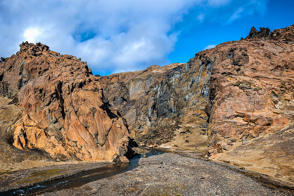
A small but charming canyon. It starts right by the Dreki hut and leads toward the Askja caldera. The trail through the canyon and up to the Viti crater is a much more interesting way to the top of Askja than the road through the Vikraborgir lava field.
The trail is about 8 km (5 mi) long, so be careful and well prepared. The stream in the canyon often floods and washes out the path, and you have to cross the stream itself several times, which isn’t always possible without getting your feet wet.
Vikraborgir lava field
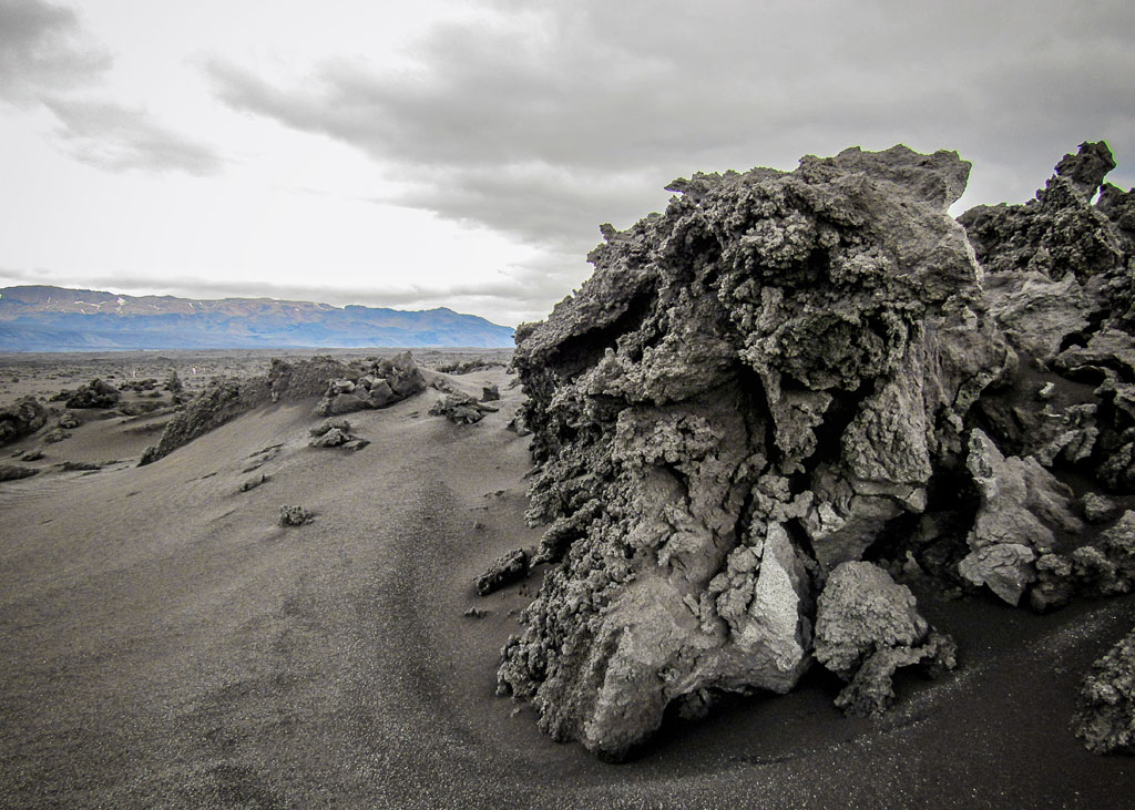
Vikraborgir is a row of craters and a small but very fresh lava field (from the 1961 eruption) at the top of Askja. This is where you’ll find the upper parking lot at the end of the F894 road (with toilets), from which you walk (about 30 minutes) to the crater itself and both lakes.
Dyngjuvatn Lake
Dyngjuvatn is a small, shallow lake about 5 km (3 mi) south of Dreki, at the start of the difficult western section of the F910 road. During the spring thaw, the lake can grow up to 6 km (4 mi) long. In the dry summer season, it’s much smaller.
Holuhraun lava field
Holuhraun is a vast lava field from the 2014–2015 eruption – according to the national park, Iceland’s largest lava eruption in 230 years. As late as 2017, its rocks were still warm. You may only walk on the lava along the marked trail from the Holuhraun parking lot. I wrote more about it in a separate article about the volcano that created it: Bardarbunga – an active volcano under the Vatnajokull ice cap. Holuhraun lies about 25 km (15 mi) south of Dreki.
Dyngjufjalladalur Valley
A small valley (about 15 km / 9 mi) west of the Askja crater. It’s home to the tiny Dyngjufell hut (16 people), run by FFA. A trail leads to the hut from Dreki and continues north to Botni (another FFA hut).
Herdubreid Mountain
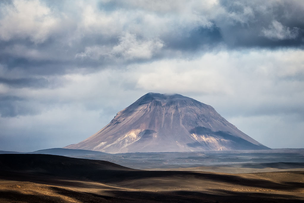
Herdubreid is a volcanic mountain about 20 km (12 mi) northeast of Askja, clearly visible from the F88 road. It’s a beautiful example of a mountain formed by a subglacial volcano – a so-called table mountain, or tuya (more on this in How Iceland’s Volcanoes Work). It’s 1,682 m (5,518 ft) high and is often called the Queen of Icelandic Mountains. In 2003, Herdubreid was voted Iceland’s national mountain.
How to get to Askja
Whichever route you choose, you’ll need a 4×4 vehicle to reach Askja on your own. You can get there from three directions: from the north, the east and the southwest.
The F-roads to Askja usually don’t open until June – between 2017 and 2021, the F905 opened June 11 at the earliest and June 30 at the latest. Before that the roads aren’t drivable, and in May Viti is probably still under snow (more in Iceland’s roads in winter, summer and on the F-roads).
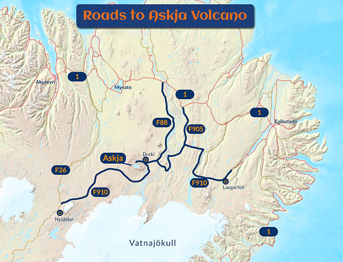
Roads to Askja; own work
© Based on data from National Land Survey of Iceland
- Access from the north
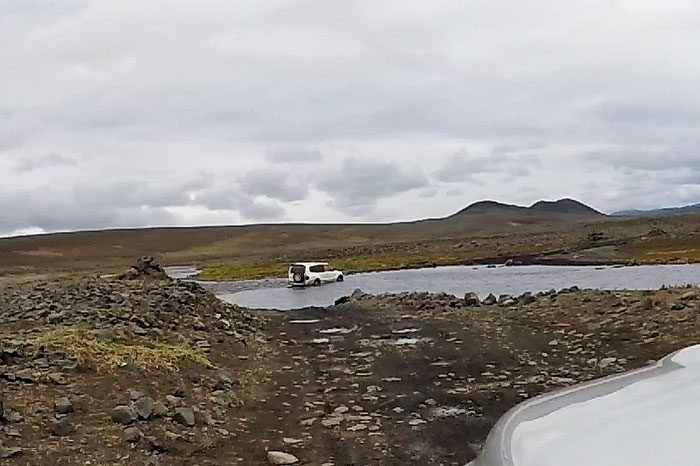
is the main route. Tour buses and day tours from Akureyri and Myvatn also come this way. You can choose a shorter but more difficult route along the F88 (2 deep fords) or a slightly roundabout route along the F905 (which shares sections with the F910 and F901). The F88 leaves Route 1 about 30 km (20 mi) east of Myvatn/Reykjahlid, and the F905 another 30 km (20 mi) further southeast. The F905 is passable for any 4×4 car. - Access from the eastfollows the F910 from the area around the Laugarfell mountain hut and the Kárahnjúkar dam (Hafrahvammagljúfur) – so from the direction of Egilsstadir and road 910; you can also reach the F910 from the east via roads 907 and 923. The F910 from the east usually isn’t difficult: there are no steep climbs, and the two fords you have to cross are usually no problem (although, unfortunately, they’re sometimes deep or tricky). The route offers beautiful views and, unless the water is particularly high, any 4×4 can handle it.

one of the fords on the F905
- Access from the southwest
follows the western part of the F910, starting on the F26 about 6 km (4 mi) north of the Nyidalur hut. Although the drive from Dreki to Nyidalur is only about 120 km (75 mi), it realistically takes 6 hours or more – and that’s assuming you don’t get lost or get a flat tire. Don’t attempt this route with a single vehicle or without serious off-road experience (driving off the road is forbidden, but this road is pure off-road).
From the Myvatn area (Reykjahlid and other villages) and from Akureyri, there are daily bus tours to Askja (in 4×4 coaches with high clearance). If you don’t have a 4×4, a tour is worth considering, although it isn’t cheap – prices start at about 20,000 ISK (about $165) per person.
The FFA has also marked a five-day hiking trail that crosses the Askja caldera: The Askja Trail. It runs between these mountain huts: Thorsteinsskali (Þorsteinsskáli) – Braedrafell (Bræðrafell) – Dreki – Dyngjufell – Botni – Svartárkot. Unfortunately, you have to arrange transport to and from the trail yourself. The first hut is on the F88, and the trail ends at the Svartárkot farm in the Bárðardalur valley.
You’ll need good hiking boots when visiting Askja. Snow can fall here even in midsummer.