Krafla is one of Iceland’s most striking and active volcanoes. Its heat also drives the Krafla geothermal power plant (Kröflustöð), which has been generating electricity since 1978.
Krafla volcano
Krafla’s crater belongs to a larger volcanic system of the same name, located north of Lake Mývatn in the northern part of the island. The oldest rocks of the central Krafla volcano are as much as about 300,000 years old, but most of the rock is a bit “younger” – formed between 200,000 and 100,000 years ago.
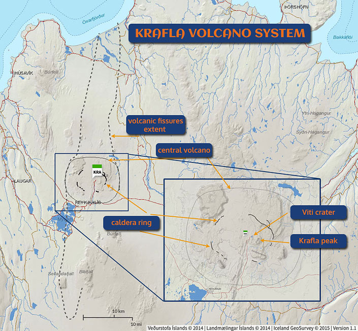
Map of the Krafla volcanic system
Own work. © Based on data from National Land Survey of Iceland
Catalogue of Icelandic Volcanoes
Krafla doesn’t look like what we usually picture as a volcano. It is not a lone, tall, steep mountain with a blunt, cut-off summit. Quite the opposite – Krafla is sprawling, and its telltale volcanic shape has been worn away by numerous eruptions and erosion. The rim of the main caldera (to simplify a bit: the top ring of the crater) is about 10 km (6 mi) across (!), while the underground structure of the main volcano is about 20 km (12 mi) wide, and the Krafla fissure swarm (where numerous eruptions have occurred through smaller craters) stretches as far as 100 km (60 mi) from north to south.
Krafla is considered a moderately active volcano. Its largest explosive eruption (mainly gases) occurred about 110,000 years ago, and its largest effusive eruption (mainly lava) about 12,000 years ago – it formed the Gjástykkisbunga lava field north of today’s Viti crater. In the Holocene (the current geological epoch, which began about 12,000 years ago), 29 eruptions of Krafla have been documented.
Although, from a volcanologist’s point of view, Krafla doesn’t erupt very often, two of its recent eruptions took place in historical times. They caused extensive damage but were also quite well documented. The first, the Myvatn Fires, lasted a little over 5 years, from 1724 to 1729. The second, the Krafla Fires, lasted nearly 9 years, from 1975 to 1984 – practically in our own time. Because of these two episodes, Krafla has a grim reputation as an unpredictable and dangerous volcano.
Krafla shaped much of the landscape north of Lake Myvatn. It’s hard to get to the very top, but on its slopes you can see a striking lava field, Leirhnjukur, and a small lake, Viti, nestled in one of the side craters. The equally beautiful Hverfjall near the lake is also part of the Krafla volcanic system.
To learn more about the history of volcanic eruptions and the landscape around Krafla and Lake Myvatn, see our separate guide: Geological History of the Myvatn Region.
Where I book my own Iceland trips
Best Iceland deals
Selected partner sites, best prices
Viti crater and lake
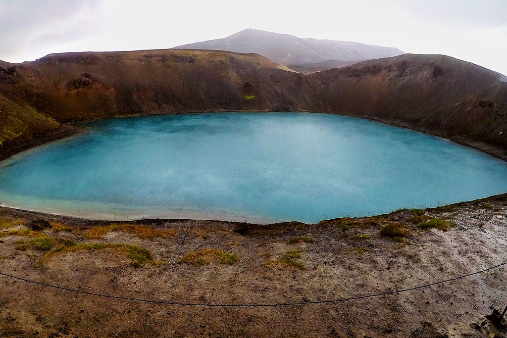
Viti crater with Krafla peak in the background
Viti’s distinguishing feature is its milky-blue water, accompanied by an unmistakable faint smell of sulfur. Small as it is, the whole place has a very special charm.
Leirhnjukur – crater with a beautiful lava field
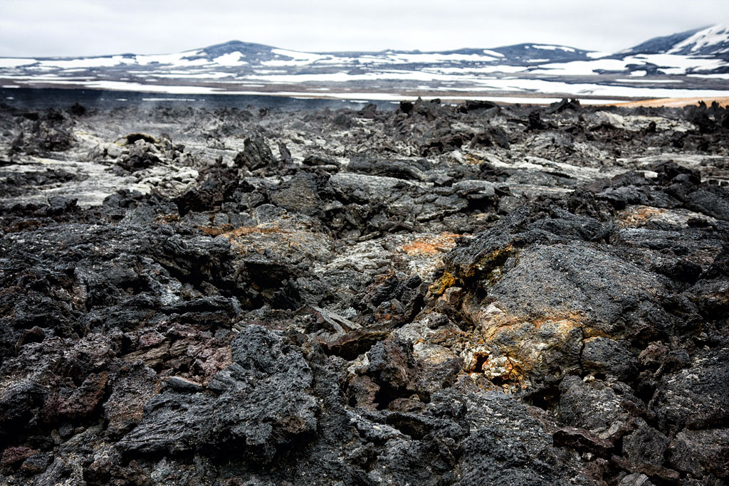
Leirhnjukur
There are more lava fields in the area, but Leirhnjukur stands out for its unusual and very varied structure. As a result, volcanic activity has produced particularly interesting and diverse forms here.
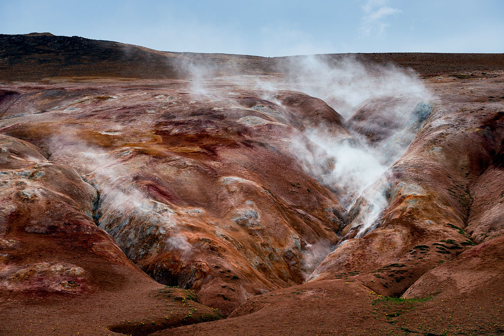
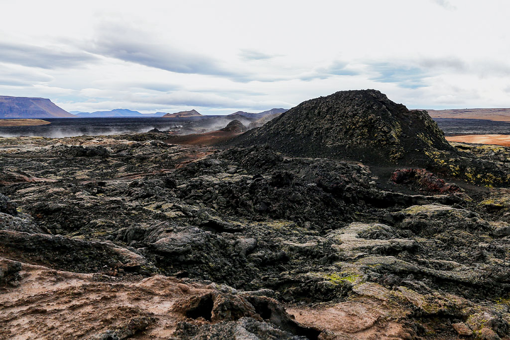
Colorful rhyolite rocks and volcanic ponds lie scattered between still-fresh patches of lava. You can clearly trace the lava flows and the successive stages of moss and lichen growth, as well as all kinds of shapes formed by solidified magma. This rugged yet very colorful landscape makes the area truly “otherworldly.” It’s definitely worth comparing with the nearby Dimmuborgir lava field and the Namafjall Hverir geothermal area. The Leirhnjukur lava field combines many of the most exciting elements of both places.
Around Leirhnjukur, in an area of no more than 1 km2 (0.4 sq mi; the so-called small loop takes 1 hour to walk), you can see a multitude of rock formations: rhyolite hills, solidified lava fields, fissures and open lava tubes, still-steaming fumaroles (or rather solfataras and mofettes), bubbling mud pots, and even a hot lake (but you mustn’t bathe in it!). The area’s signature feature is the smell of sulfur hanging in the air. If you have a few hours, you can even do a 5-hour hike here.
The area around Leirhnjukur is bare rock, scree and often muddy sand. In some places, boardwalks have been built – to protect nature and for visitors’ convenience. Still, you can choose fairly freely where to go and for how long. In many places you can, and even have to, step off the boardwalks. But always be careful: never touch spots where steam is coming out, and better yet, don’t go near them, especially if the sand is steaming. Don’t climb the rocks or go into lava tubes. Sturdy hiking boots are a good idea, even though flip-flops would do for the boardwalks alone (but I don’t recommend them!). On a rainy day, almost the whole area can be very slippery.
Kröflustöð – Krafla geothermal power plant
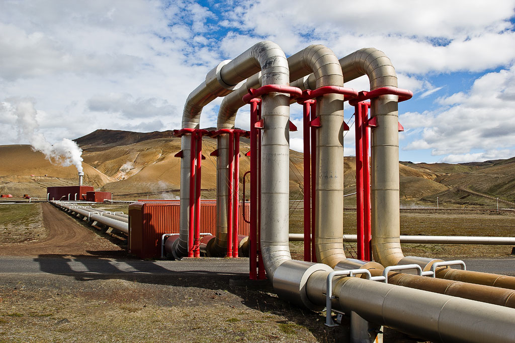
Krafla Power Plant
Kroflustod has an installed capacity of 60 MW (source: Landsvirkjun). Compared with large coal-fired power plants, that is rather modest, but for a geothermal plant it is quite big – although not the largest in Iceland: the Hellisheiði Power Plant east of Reykjavik has 303 MW (source: ON Power). Krafla generates about 465 GWh of electricity a year with two 30-megawatt double-flow turbines with a double pressure inlet. The turbines are driven by steam from 18 boreholes, and a total of 44 high-temperature boreholes have been drilled in the area.
The red buildings, usually topped by a massive cloud of white steam, and the distinctive “gate” of pipes running over the road are a unique and memorable sight.
Building the Krafla Power Plant was a pioneering project, hampered for years by political disputes, volcanic eruptions and technical problems. Construction began in 1974 with test boreholes, but because of volcanic activity in the region, the work went slowly. The plant was completed in 1977 and put into service a year later. In 1996 a second steam turbine was installed, and since 1999 the plant has been running at its full capacity. Originally the facility was owned by the state; in 1985 it was bought by Landsvirkjun, the National Power Company, which has operated it ever since.
The power plant has a visitor center with an exhibition on geology, geothermal energy and the history of its use in Iceland. It is open on weekdays 12:30-3:30 p.m. and on weekends 1-5 p.m. – but, according to Landsvirkjun, it is closed in winter and was also closed in summer 2026 due to construction work at the power station, so check before you go.
Practical tips
You can pay with the EasyPark app (but not Parka) – it’s zone 665 (‘Leirhnjukar & Viti’). You pay once for the whole zone, which includes the parking lot at Viti, the one at the start of the Leirhnjukur trail and the scenic parking lot on a small hill opposite it.
- The Krafla viewpoint is at the end of the paved section of Road 863, which turns north off Road 1 about 5 km (3 mi) east of Reykjahlid and Lake Myvatn. From here you can admire the Viti crater and lake, while the neighboring parking lot (about 1 km / 0.6 mi earlier, southwest of Viti) is the starting point of a trail to the amazing lava field formed by the Leirhnjukur volcano.
- The parking lot near Leirhnjukur is about 1 km (0.6 mi) north of the Krafla Power Plant (Kröflustöð) – it is small and part of the paid zone described above. The trail from the parking lot to the main part of the lava field is about 1 km (0.6 mi) long, but the beautiful views start much sooner.
- From the Leirhnjukur parking lot you can take 2 hiking routes. The small loop takes about 1 hour, while the big loop can take up to 5 hours. If you want to explore the area thoroughly, allow about 2 hours.
- Naturally, if there is snow on the ground, it may hide the colors of the rocks, making the whole area a little less spectacular.
- The best view of the Krafla Power Plant is on the way to Leirhnjukur and the Viti crater. Leave Road 1 and turn north onto Road 863 near Namafjall Hverir, about 5 km (3 mi) east of Reykjahlid and Lake Myvatn. After about 7 km (4 mi), you pass the plant and drive under the “gate” of pipes.
Photos of Krafla, Viti, Leirhnjukur and Kröflustöð