


Certainly the best known hiking trail in Iceland is the famous Laugavegur. Together with the adjacent Fimmvorduhals and Hellismannaleid trails, it is Iceland’s most popular hiking trail. See what it looks like and what it’s famous for.
In this article, we focus on what the Laugavegur trail itself is like and what you need to know before you set out. In separate articles we cover, among other things:
- How to pack for the Laugavegur (and neighboring) trail: How to prepare for a hiking trip in Iceland;
- What all the hostels and campsites along the route look like and offer: Laugavegur campsites and hostels;
- What the neighboring trails look like and what they offer: Fimmvorduhals and Hellismannaleid;
If you prefer a video version, check out this YouTube video:
Video: Everything you need to know about the Laugavegur, Fimmvorduhals and Hellismannaleid trails
What is the Laugavegur trail
Laugavegur is a hiking trail connecting two beautiful and famous places in the Icelandic interior: Thorsmork (or more precisely: Langidalur campsite) and Landmannalaugar. Each of these places is a gem worth visiting, and we have described each of them in separate articles.
Not surprisingly, a trail connecting such great attractions quickly gained enormous popularity. Today it is certainly the most popular multi-day hiking trail in Iceland. It is also one of the few trails that can be conveniently reached by bus – and in fact the only one where your luggage can travel by car from one overnight stop to the next while you walk through the mountains with only a small, light daypack.
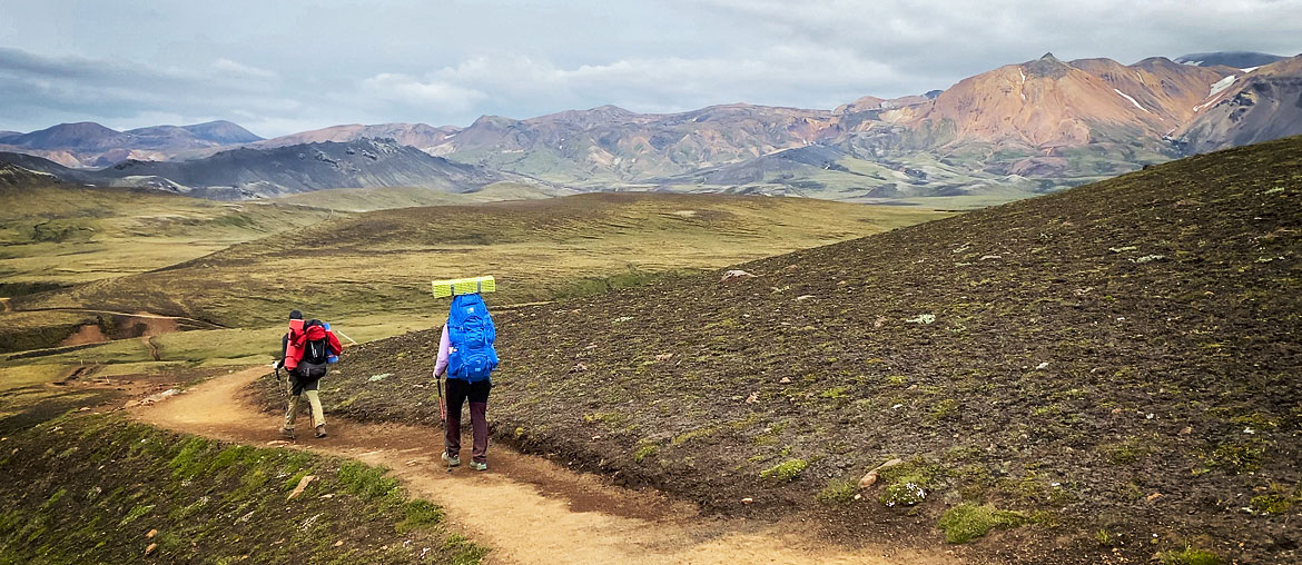
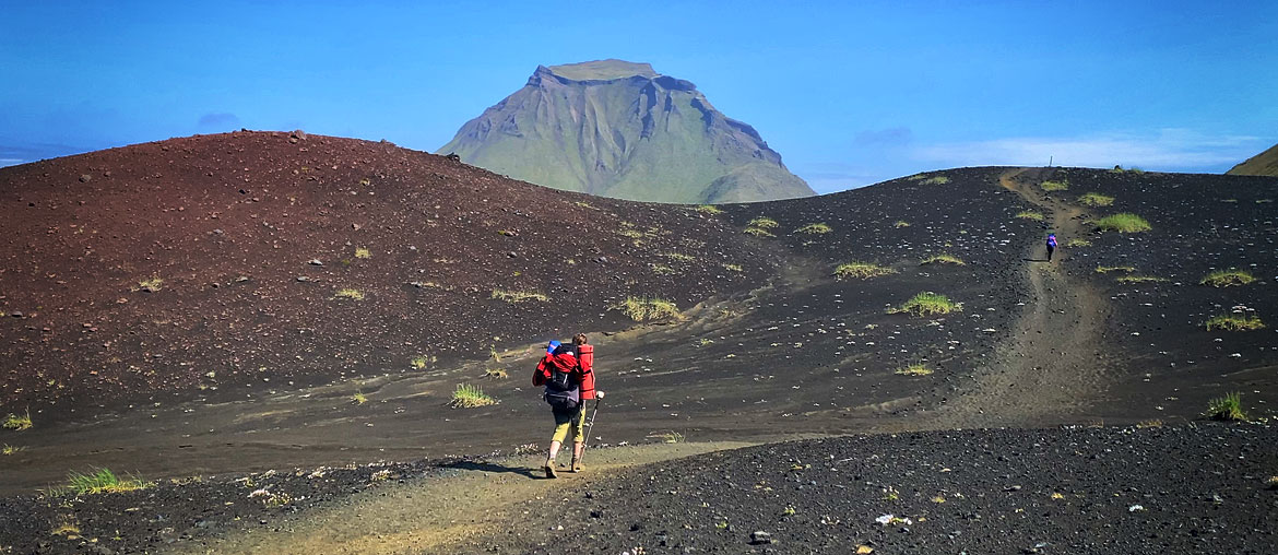
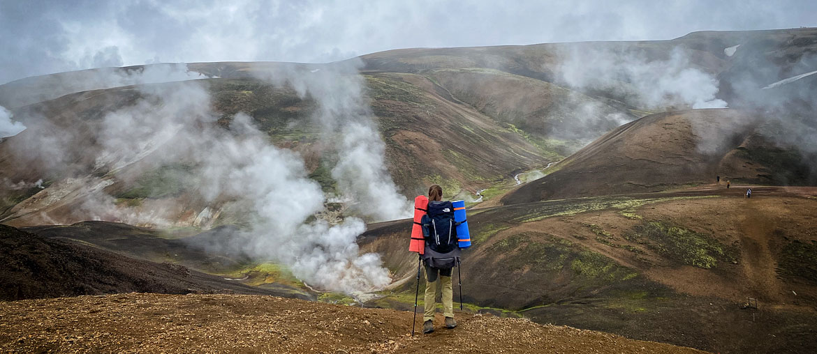
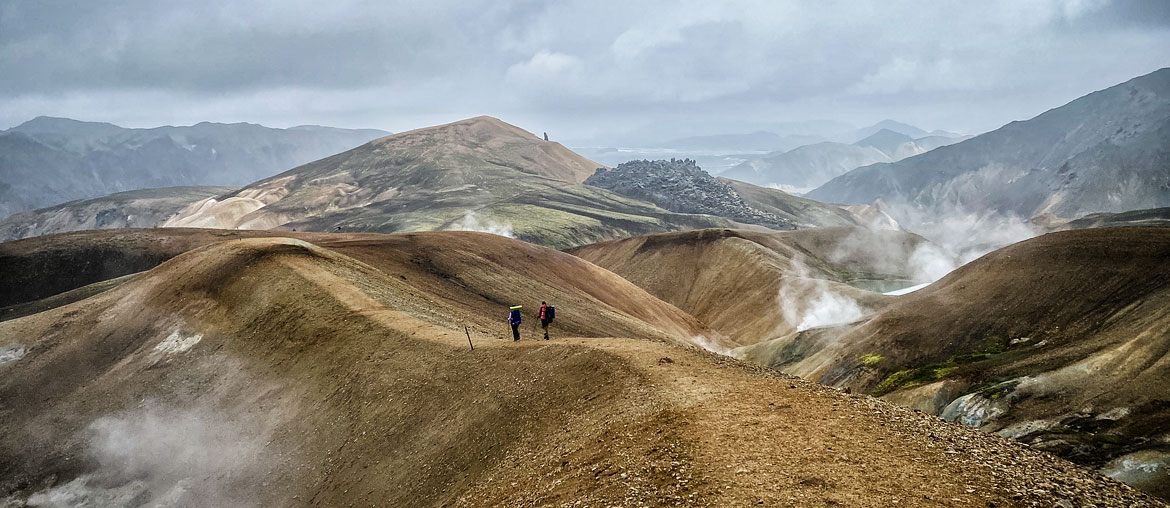
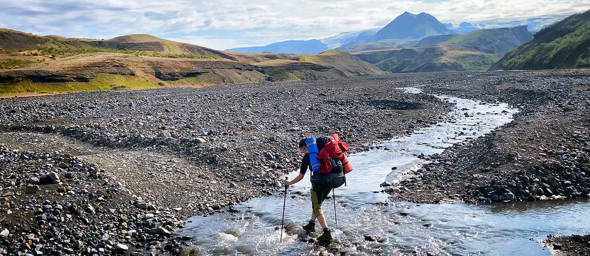
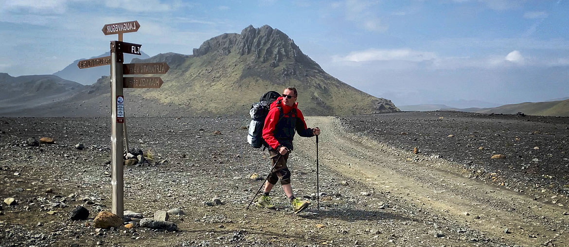


The name of the trail could be translated as “hot springs trail,” but such a name would be somewhat misleading, as the only hot spring you can bathe in along the route is in Landmannalaugar itself. Also, the smaller hot springs and lakes that we can only see lie only near this northern end of the trail, and not along its entire length.
While certainly the most interesting and beautiful parts of the trail are precisely the ends of the trail – the colorful rainbow mountains in Landmannalaugar and the dense green slopes of Thorsmork – Laugavegur provides beautiful and unique views along its entire length. Here you will see, among other things, hot springs, plains of volcanic cinders (and ashes), unusual colorful hummocks, perhaps the largest easily accessible obsidian field in Iceland, green groves of dwarf birch, smaller and larger gorges, and icy mountain streams through which the trail leads.
Almost every overnight stop along Laugavegur is relatively easy to reach by 4×4. Therefore, if you don’t have the stamina, the equipment, the time or simply the desire to hike for several days, but you want to see the most interesting places along the route – there is no big problem with that. You just need to go to Iceland in summer (when the F roads are open) and have a 4×4 car at your disposal (preferably not a crossover, but at least something like the ‘iconic’ Dacia Duster).
The only exception to the above rule is Hrafntinnusker, located on a high pass, and – to some extent – the hostels and campsites Langidalur and Volcano Huts located in Thorsmork, but on the north bank of the Krossa River (see more in the articles about these campsites and in the general article about Thorsmork).
Where I book my own Iceland trips
Best Iceland deals
Selected partner sites, best prices
Course and length of the Laugavegur trail
The Laugavegur trail itself connects the Landmannalaugar and Langidalur campsites (in Thorsmork). In this basic version, the trail is about 53 km (33 mi) long, which equals 65 or 68 effort kilometers depending on which way you go (see the box below).
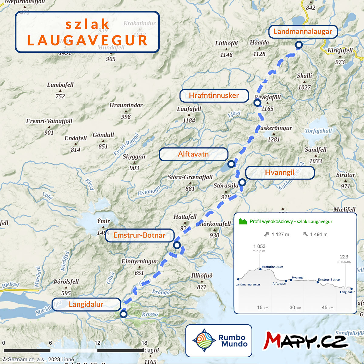
Map of the Laugavegur trail (mapy.cz)
The trail actually runs from southwest to northeast, but when talking about it, the east-west dimension is practically always ignored, and the course of the trail and the direction of walking are defined only on a north-south line. The total ascent, depending on which way you go, is about 1,100 m / 3,600 ft (going south from Landmannalaugar) or 1,500 m / 4,900 ft (going north from Langidalur).
The northern end of the trail is not in doubt – it is the Landmannalaugar campsite. The southern end, on the other hand, is formally Langidalur campsite, but it can be replaced by Volcano Huts or Basar Hut campsite. Both of these campsites are within 2 km (1.2 mi) of Langidalur and may be better in some situations. Volcano Huts offers more comfort, while Basar Hut is a better base for the Fimmvorduhals trail. All of these campsites can be reached by bus from the BSÍ bus terminal in Reykjavik.
How long the whole trail takes depends on your fitness, on the weather and on whether you want to walk it as quickly as possible or slowly and leisurely. Traditionally, Laugavegur is walked from north to south, because that way there is almost 400 m (1,300 ft) less climbing. However, on the scale of the entire route this difference is negligible, and there are some arguments for going from south to north after all (more on this later in the article). Most hikers advanced enough to undertake such a multi-day trek move through the mountains at about 4 effort kilometers per hour. The fastest will approach 5 per hour (although that’s rather difficult in Icelandic conditions and on long routes), while those who are calmer, weighed down by a heavy backpack or walking in bad weather will probably manage closer to 3 per hour.
The basic plan for Laugavegur is spread over 4 days and assumes an overnight stay at each campsite along the way (except Hvanngil and Alftavatn, of which you choose only one). In this plan, the daily distances, effort kilometers and estimated walking times are as follows:
| Daily sections on the Laugavegur trail (4-day version) | ||||
|---|---|---|---|---|
| Heading south | Heading north | |||
| Landmannalaugar -> Hrafntinnusker | 10 km (6 mi), 15 effort km, 4–5 h | Langidalur -> Emstrur-Botnar | 16 km (10 mi), 22 effort km, 6–7 h | |
| Hrafntinnusker -> Hvanngil* | 15 km (9 mi), 17 effort km, 4–6 h | Emstrur-Botnar -> Alftavatn* | 16 km (10 mi), 19 effort km, 5–6 h | |
| Hvanngil -> Emstrur-Botnar | 12 km (7.5 mi), 13 effort km, 3–4 h | Alftavatn -> Hrafntinnusker | 11 km (7 mi), 17 effort km, 4–6 h | |
| Emstrur-Botnar -> Langidalur | 16 km (10 mi), 20 effort km, 5–7 h | Hrafntinnusker -> Landmannalaugar | 10 km (6 mi), 10 effort km, 2.5–3 h | |
| TOTAL | 53 km (33 mi), 65 effort km | TOTAL | 53 km (33 mi), 68 effort km | |
For a sense of scale: 22 effort km is, for example, a 12 km (7.5 mi) hike with 1,000 m (3,300 ft) of climbing – a solid full day in the mountains.
If the weather is bad (or about to turn), and almost 30 effort km in one day doesn’t scare you, you can skip the overnight stay at Hrafntinnusker and walk the entire route in 3 days. It’s a pretty intense 3 days of walking, but quite a few people choose this option. Laugavegur spread over 3 days means the following daily sections:
| Daily sections on the Laugavegur trail (3-day version) | ||||
|---|---|---|---|---|
| Heading south | Heading north | |||
| Landmannalaugar -> Alftavatn | 21 km (13 mi), 27 effort km, 7 h | Langidalur -> Emstrur-Botnar | 16 km (10 mi), 22 effort km, 5.5 h | |
| Alftavatn -> Emstrur-Botnar | 16 km (10 mi), 18 effort km, 4.5 h | Emstrur-Botnar -> Alftavatn | 16 km (10 mi), 19 effort km, 5 h | |
| Emstrur-Botnar -> Langidalur | 16 km (10 mi), 20 effort km, 5 h | Alftavatn -> Landmannalaugar | 21 km (13 mi), 27 effort km, 7 h | |
| TOTAL | 53 km (33 mi), 65 effort km | TOTAL | 53 km (33 mi), 68 effort km | |
On the other hand, if you’re going north, you probably won’t explore Landmannalaugar on that last day, and it will be difficult to catch the evening bus, too. So you’ll have to plan one more day there anyway, and you basically gain nothing from skipping Hrafntinnusker… On the other hand, if you’re going south and arrive in Landmannalaugar on the morning bus, you can start your route around 11:00–11:30 a.m. If you walk fast, you’ll arrive at Alftavatn campground at a pretty reasonable hour. But you will only “run” through the entire beautiful Landmannalaugar, perhaps the most beautiful place in all of Iceland! Is it worth planning a trip like this? You will really get a lot more out of it if you walk only to Hrafntinnusker on that first day and spend the ‘saved’ time hiking up Blahnukur or walking through Sudurnamur (or both). Alternatively, set out on the trail only the next day and spend your whole first day hiking in and around Landmannalaugar itself.
When planning your trip to Laugavegur, keep in mind that both ends of the route – both Landmannalaugar and perhaps even more so Thorsmork – are so beautiful and interesting that it’s worth spending at least 1 extra day in each. In such a plan, the tour extends to 5-6 days. It is worth planning it this way also because it creates a certain weather buffer. Then you have some minimal flexibility in the implementation of the route and you can adjust at least a little to the weather. It is worth remembering that in Iceland, as a rule, so-called wild camping is allowed, i.e. accommodation in a tent outside the campsite (but only in a tent pitched on the ground). Excluded from this rule are national parks and nature reserves. This means that outside the Friðland að Fjallabaki reserve, i.e. south of Alftavatn, we do not have to use campsites and can pitch a tent wherever we want. Campsites, of course, provide some minimum comforts, but there is no obligation to use them.
Huts and campsites on the Laugavegur trail
There are 6 campsites along the Laugavegur trail, and if you take the southern end of the trail a little more casually, there are up to 8. We describe each of them in detail in separate articles (links next to the names), and below we collect only their most important commonalities and the biggest distinguishing features of each.


Each site has a hut and a campsite. At each you will also find a small store (basic food, gas for the kettle, snacks, drinks), and in Landmannalaugar even two stores. You’ll find a restaurant at Alftavatn and Volcano Huts and Basar Hut, as well as at Landmannalaugar (although it’s more of a bar and a small one at that).
There are no showers at Hrafntinnusker, and no ‘canteen’ tent for campers at Alftavatn. In addition, Alftavatn and Hvanngil lie so close to each other (no more than a 2-hour walk) that, in practice, everyone stays overnight at one of these places and avoids the other.
The hostels along the route are very similar to each other and offer a similar range of services. Accommodation in them needs to be booked quite far in advance, we can use a fully equipped kitchen on site, mattresses are available, but we need to have our own sleeping bag (one with a comfort rating of 10 °C (50°F) is completely sufficient). Most accommodations are single bunks, but there are also double bunks, multiple bunks, and sometimes mattresses are simply spread out on the floor.
No one is allowed into the huts unless they have booked a bed there. Those sleeping in their own tent, for example, cannot use the hut’s kitchen or drying room. There is no way to charge a phone at the campsites. There are no outlets available to tourists. The exceptions to this are the store in Landmannalaugar (charging for a fee) and the Volcano Huts campsite (free). There is running water for washing up in the huts, but no bathrooms or toilets. Those sleeping in the huts use the same sanitary facilities as those sleeping in the campground. It is a separate room, container or small building.
A night in your own tent costs 3,600 ISK (about $30) per person everywhere, while a night in a hut costs 18,000 ISK, or about $150 per person. A shower is an extra 1,100 ISK ($9), which buys you 4 to 5 minutes of hot water. These are prices for the 2027 season (FÍ price list); in earlier years it was cheaper, of course. However, each of the campsites is distinguished by something, whether for good or bad. You’ll read the details in separate descriptions of each, but here’s a look at their biggest distinctions in super-short order:
- Landmannalaugar
Hot spring, hot water for washing up, terribly hard ground at the campground, best-stocked store on the entire route (actually, two stores); wonderful views on several trails in the area; - Hrafntinnusker
the windiest and coldest of the campsites, because it’s the highest; the only one with no showers, and the toilets are only “dry” (outhouses); there are no trash cans – you carry your trash with you to the next stop (even if you sleep in a hut!); a bad-weather shelter under construction (it should be fully operational in 2024); a campground on obsidian deposits – it glitters beautifully in the sun, but quite uncomfortable to sleep in; a curiosity nearby – ice caves (unfortunately, collapsed in 2023); - Alftavatn
small restaurant at the campground (for everyone); no tent or room to prepare a meal or wait out the worst of the weather for those outside the shelter; in windless weather, flies can be a problem, very fond of living – and feeding – on the shores of the lake; no shelter from the wind; the boundary of the Friðland að Fjallabaki reserve runs in the hills north of Alftavatn; - Hvanngil
state-of-the-art (built in 2023) sanitary facilities; several spots in rock hollows protect tent from even the worst wind; former barn (usually) made available to tourists as a canteen; - Emstrur-Botnar
huts with viewing terraces (to the south); campsite on very rough terrain – between several small hills and ravines; as of 2023, it is not allowed to leave garbage here – everyone carries their trash to the next stop; a huge attraction nearby: the Markarfljotsgljufur canyon; - Langidalur
sizable hostel, but a small campsite, although very nice and green; crossing the Krossa (behind the campsite / south of it) on distinctive bridges; crossing the Krossa only for the largest 4×4 cars; bus stop to Reykjavik (when the water level is high, stop on the south bank of the river); close to the routes to Tindafjoll (a smaller or larger loop) and Valahnukur (one of the key viewpoints of the Krossa valley); - Volcano Huts
the most comfortable, and not at all the most expensive of the campsites (campsite: 2,800 ISK (about $23), with sauna and unlimited showers included; a bed in the hut: 9,000 ISK (about $75), which is cheaper than on the ‘main’ Laugavegur; chalets: 31,000 ISK (about $260) for 4 to 5 people); hot spring, sauna, showers at no extra charge or time limit, power for charging phones, wifi and a real restaurant; also a bus stop to Reykjavik and right next to the scenic peak of Valahnukur; - Basar Hut
the easiest campsite to get to in Thorsmork; sprawling, green, between groves of dwarf birch; a lot of Icelandic families come here; there is a restaurant; best start to the Fimmvorduhals trail and to Hvanargil and Strakagil canyons (both beautiful);
Top attractions near Laugavegur
The entire Laugavegur trail is beautiful and really rich in amazing views. In addition, both ends of it – the beautiful Thorsmork and Landmannalaugar – deserve an absolutely huge mention. However, in addition, it is possible to point out (only?) two places that are particularly worth visiting, but require going off the main trail. These are the Markarfljotsgljufur canyon near the Emstrur-Botnar campsite and the ice caves at Hrafntinnusker.
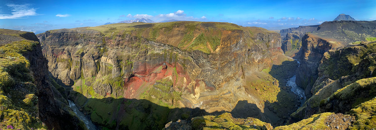
Panorama of Markarfljotsgljufur from the viewpoint
Markarfljotsgljufur is certainly one of Iceland’s largest and most beautiful canyons. It is extremely deep, steep and has beautifully colored walls. Unfortunately, we view it only from above, but it is still very impressive (in good weather). Viewing it requires going off the trail for about 1 hour. During this time you will have time to visit both main viewpoints and feast your eyes on the views.
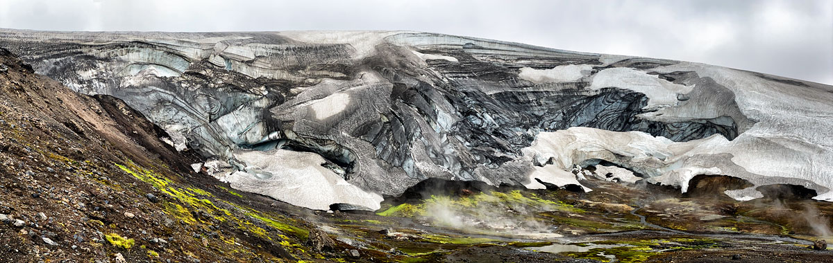
Remnants of the Hrafntinnusker ice cave
The ice caves at Hrafntinnusker are a peculiar effect of hot springs melting the glacier from below. The glacier grew, so to speak, above the nearest hot springs. Unfortunately, as of 2023, you have to use the past tense here, because the vault of the cave thus formed collapsed in the spring of 2023. It is still an interesting and pretty place – you can see, among other things, beautifully cut ice layers – but it has certainly lost some of its beauty. It’s also a hike of about 1 hour, but it leads, among other things, through a rather treacherous ice cap at the top of Hrafntinnusker, where crampons or an enormous amount of caution (or preferably both at once) will come in handy. Therefore, it is certainly a “less mandatory” point of the program than Markarfljotsgljufur.
Of course, there are also very interesting additional trails at the beginning and end of Laugavegur – in Thorsmork and Landmannalaugar – as well as two more connecting mountain trails, Fimmvorduhals and Hellismannaleid (see the linked articles for details).
Connecting Laugavegur with other trails
It’s really worth combining Laugavegur with the neighboring trails: primarily the Fimmvorduhals to the south, but also the Hellismannaleid to the north/west. We have described both of these trails separately in the linked articles, and below we only discuss what adding them to a Laugavegur trip involves.
Laugavegur and Fimmvorduhals
Fimmvorduhals is a trail that runs south of Laugavegur, from Skogar to Basar Hut, and is about 26 km / 16 mi long (35–37 effort km). It is almost as popular as Laugavegur, and according to many tourists, even nicer and more interesting than its “big brother.” The passage of this trail is best planned for 2 days, although it can also be done in 1 day. We described the trail itself quite comprehensively in the article Fimmvorduhals – the trail of 20 waterfalls (and more…). Therefore, here we will describe only what walking both trails together involves.
Both ends of such a combined route can be easily and conveniently reached. But you can return comfortably only from Landmannalaugar – the return from Skogar is surprisingly poorly organized. Therefore, the combined routes of Fimmvorduhals and Laugavegur are definitely better walked from the south (Skogar) to the north (Landmannalaugar). In this direction, the route does have 6 more effort kilometers, but on the scale of the entire trip, this amount is completely negligible. In addition, in Landmannalaugar there is a store and a hot spring waiting for us, so it’s really a great place to end the trek. Well, and then in Landmannalaugar you can decide whether to add Hellismannaleid to the trip as well…
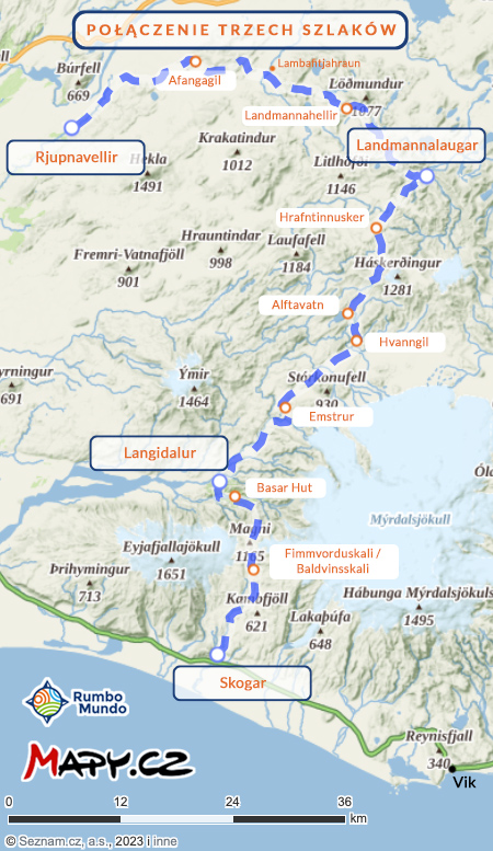
Map: Fimmvorduhals + Laugavegur + Hellismannaleid
If you walk fast (and a lot) and are not interested in side trails in Thorsmork or Landmannalaugar, you can theoretically walk such a combined route in 4 days. Then your optimal stops would be Skogar -> Basar Hut -> Emstrur-Botnar -> Alftavatn -> Landmannalaugar, respectively. But this is really an express version of this route. Exhausting and not giving the possibility to change plans, for example, in case of bad weather or some minor injury. In addition, it is really, really worth adding to such a plan at least 1 day for trekking on various trails in Thorsmork and another one (or at least half) for “going around” additional trails in Landmannalaugar. Such additional days will also work well as a ‘reserve’ in case of rain, very strong winds or unpleasant foot abrasions. In such an ‘expanded’ and calm version of the plan, your next overnight stays are: Skogar -> Baldvinskali (or Fimmvorduskali) -> Basar Hut -> Langidalur -> Emstrur-Botnar -> Alftavatn (or Hvanngil) -> Hrafntinnusker -> Landmannalaugar. In this plan, the day you walk from Basar Hut to Langidalur (only 2 km / 1.2 mi apart as the crow flies) is a day dedicated to walking the trails in Godaland and Thorsmork.
Leaving Landmannalaugar is best planned for the day after you get there, so that you have the aforementioned ‘buffer’ for bad weather or injury. And if nothing bad happens along the way, you have an extra day to hike the trails in Landmannalaugar (it’s worth it – see the article about this campground for more details: Landmannalaugar – rainbow mountains like a fairy tale).
So the full version of this plan takes 8 days. On the morning of the first day you leave Reykjavik (and reach Baldvinskali), and on the evening of the eighth day you return.
Combining Laugavegur, Fimmvorduhals and Hellismannaleid
If you are already trekking to Iceland, it would be a shame to pass Fimmvorduhals and Laugavegur and not see the very interesting Hellismannaleid.
The Hellismannaleid is a 3-day trail leading west from Landmannalaugar, so from the northern end of Laugavegur. Its other end is the Rjupnavellir campsite on Road 26, at the foot of the Hekla volcano. To some approximation, the entire trail is just the route to and around Hekla. See its extensive description here: Hellismannaleid – a trail through truly wild Iceland.
The Hellismannaleid trail is much less popular than the Fimmvorduhals and Laugavegur, though also beautiful and interesting. Its distinguishing features are lava fields and valleys and plains strewn with volcanic ash and cinders. You also pass some really beautiful lakes on the trail. The low popularity of the trail gives you a sense of solitude in the Icelandic mountains – a feeling quite typical of all mountain trails in Iceland, with the exception of Laugavegur and Fimmvorduhals. At the same time, due to its lower popularity, the rules for tourists here are noticeably more lenient and, for example, charging your phone isn’t as much of a problem, and showers (usually) don’t have to be limited to 4 or 5 minutes. In its standard version this trail adds another 54 km / 34 mi (62 to 66 effort km); it joins Laugavegur at the Landmannalaugar campsite and runs west from there.

Elevation profile: Fimmvorduhals, Laugavegur and Hellismannaleid
So the Laugavegur trail alone is 65–68 effort km, combined with Fimmvorduhals it’s 99 to 105, and if you add Hellismannaleid to those two trails, you’re looking at a total of about 166 effort km (±1, depending on which way you go). You’ll cover Laugavegur in 3 or 4 days, Fimmvorduhals in 1 or 2, and Hellismannaleid in 2 or 3. The location of campsites and shelters along the way is also matched to all these combinations (except Hellismannaleid in 2 days).
In addition, it is really worth adding one day between each of the trails. Such extra days are your reserve for a small injury or bad weather, but also a chance to see the most interesting “side” trails in Thorsmork and Landmannalaugar.
So all in all, the shortest trip is an express 3 days on Laugavegur alone, but the longest is up to 11 days (or more 🙂 ) on the Fimmvorduhals + Laugavegur + Hellismannaleid combo.
Which way to walk Laugavegur
Should you walk Laugavegur from north to south or from south to north? It is a surprisingly popular topic in online discussions about planning the trek: should you start in Thorsmork and end in Landmannalaugar, or start in Landmannalaugar and walk to Thorsmork? In our opinion the question is generally overstated and not that important, but below we present the arguments for going from north to south and those for the opposite direction.

Why walk Laugavegur from north to south
The basic or classic arguments for walking Laugavegur from north to south are:
- Laugavegur from north (Landmannalaugar) to south (Thorsmork) has almost 400 m (1,300 ft) less ascent (according to mapy.cz, exactly 1,127 m / 3,698 ft of ascent, which is 368 m / 1,207 ft less than heading north);
- Huts can only be booked in order from north to south;
- Most hikers just go from north to south. Walking in the same direction, you will meet on the route only those who are walking clearly faster or clearly slower than you. On the other hand, you will only pass those who are walking in the opposite direction;
- After passing the volcanic-cinder-sand section of the northern part of the trail, the entrance at the end to the green Thorsmork, full of trees and bushes, is incredibly impressive. It feels like we have reached an oasis in the desert.
People who want to sleep in huts or go with an organized group basically have no choice – they have to go from north to south. And in principle there is nothing wrong with that. But for those who want to sleep in a tent or combine sleeping in a tent and in hostels, the strength of these arguments is rather average, especially when juxtaposed with the opposite.
It seems that the opinion that Laugavegur needs to be crossed from north to south is being strongly promoted by companies organizing tours with overnight stays in hostels. They want to convince customers that their offer is the only reasonable solution.
Why walk Laugavegur from south to north
Here are the reasons why it is better to walk Laugavegur (and neighboring trails) from south to north (and possibly west):
- The difference in climbing is negligible
On Laugavegur alone, it’s less than 400 m (1,300 ft), or less than 10% of the total in effort kilometers. For the combined Fimmvorduhals and Laugavegur, the difference depending on walking direction is also less than 10% of the total. And if you combine all 3 trails described here, the difference in total climbing drops to 1.2%, or basically disappears. - Descents are more of a worry than climbs
The two steepest parts of Laugavegur you go up if you are going north and descend them if you are going south. On the surface, this may sound like an argument for heading south, but these descents are then so steep as to be potentially dangerous. Especially in bad weather, it is certainly safer to climb these steep slopes than to descend them. That is, it is safer to go north. - Best to sleep in a tent
Of course, sleeping in hostels has its advantages – mainly that it is dry and warm. However, these accommodations are really expensive, have to be booked early and offer (almost) no opportunity to change the route. In practice, they are also crowded and bustling, it’s hard to get a room without a snorer, and there is often a line for the kitchen. As a change, a chance to dry your clothes or a refuge from bad weather, it is worth considering 1 or 2 nights, especially in the highest huts (Hrafntinnusker, Fimmvorduskali, Baldvinskali). However, an entire route (or three) with overnight stays in hostels is definitely not a good idea for those seeking peace, quiet or solitude in the mountains. - Going north you have better views
Of course, you can always turn around – and it’s often worth it – and you have beautiful views not only in front of you and behind you, but of course also on the sides. However, when you go north you have the sun constantly behind your back – it doesn’t blind you and nicely illuminates the landscapes in front of you; and when you go south, unfortunately, it shines constantly in your eyes, and the landscapes viewed under the sun lose their appeal; in addition, on Fimmvorduhals going north you see each successive waterfall fairly far away and you walk quite a long way up to it; while going south you will see it only when you reach it (and turn around); and on the same Fimmvorduhals going north you can see the beautiful Krossa valley and Thorsmork in front of you (almost) all day long; meanwhile, going south you have to keep turning around – in practice you won’t, and you’ll miss a lot of views; - Landmannalaugar is a better end of the route
Of course, Landmannalaugar is a remarkable place both at the beginning, end and middle of any route. However, the hot spring, the not badly stocked store, the well-maintained showers – all of these things become more meaningful when you end the tour, not when you start it. And also the ‘rainbow mountains’ themselves are a rarity, which are great as a tour destination, and probably less so as a tour start. It’s better to walk toward such a major attraction than away from it. - The return from Skogar is quite a hassle
The access is good to any nodal point of the trail, but the return from Skogar is clearly more troublesome. So it’s better not to end the trip in Skogar, because the campground there is “so-so” at best, and getting out of there to Reykjavik is a bit more difficult than from other nodal points on these trails. Therefore, if you want to cross (also) Fimmvorduhals, it’s definitely better to do it from south to north, and this also determines the direction of walking on the other trails; - Hellismannaleid is best left for last
The virtues of the Hellismannaleid trail become more valuable against the backdrop of Laugavegur and Fimmvorduhals. If you have plans to walk the Hellismannaleid, it is certainly better to start in Skogar (or Thorsmork) and finish in Rjupnavellir, not the other way around;
So all in all, we strongly recommend crossing all three trails and starting in Skogar and finishing in Rjupnavellir.
Hazards on the Laugavegur trail
Laugavegur is a well-defined and popular trail. There are no very serious dangers on it, and in case of need, help can get here relatively quickly (but never underestimate these mountains!). The main difficulties we have to reckon with on the trail are:
- strong wind
strong wind is a feature of all of Iceland, but in the highlands it is stronger, and sometimes even hurricane force; the Hrafntinnusker campsite is particularly prone to strong winds – it is here that the famous “nights of flying tents” happen, and if it blows really hard, the staff sends tourists to campsites lower down; the wind can cause real danger to your tent (although this is rare), constantly causes you to get colder faster on the trail (a hat and warm gloves are a year-round necessity), plus in many places it lifts volcanic ash from the ground, which some tourists ignore, but others protect their mouths and eyes with scarves because of it; - steep slopes
north of Alftavatn and south of Emstrur lie two large and really steep slopes; going north you will ascend them, going south – descend; on the ascent (so going north) they are a hindrance, but not a danger; while on the descent (going south) you have to be really very careful on them (be sure to bring poles!) – a fall here can end very badly; - crossing streams
only the stream south of the Hvanngil campsite is sometimes really deep – after major rainfall you need to go about 100 m (330 ft) north/northeast, to a shallower ford (if you are walking from the north – ask at the hut about the condition of the ford, if you are walking from the south – ask people walking from the north); the water in the other fords very rarely reaches above the knees, but even such fairly shallow water usually flows very fast and is really icy; in addition, the bottom of the streams is uneven and often rocky – it’s really worth taking water shoes and trekking poles with you – both are great for crossing the streams smoothly and without problems;
Getting to the Laugavegur trail
You can get to both Thorsmork and Landmannalaugar by bus from Reykjavik before noon and set off on the trail right away, or – better – spend half a day hiking in the area and set off on the long trail the next morning. The buses are quite accommodating for tourists. They leave Reykjavik as early as 6:30 a.m. and return as late as 10 p.m. You can also book the ride back from a different place than the one you arrived at – for example, go to Skogar and return from Landmannalaugar or Rjupnavellir. Or vice versa.
Cost of hiking Laugavegur
Bookings for the 2027 season are already open, and they opened unusually early — see which packages are available and what they cost.
If you go to Iceland just to hike Laugavegur, it will be quite an expensive trip. But if the trail crossing is just a supplement to a larger trip to Iceland, it won’t add too much to the cost of the trip, and it will make it immensely more attractive. The biggest potential costs of such a trip are equipment (if you don’t have it and have to buy or rent it specifically for this trip) and accommodation in hostels, if you choose to do so. You will consume some gas for your stove (small cartridge: about 1,000 ISK (about $8), large cartridge: about 1,800 ISK (about $15)), plus some candy bars, sweets, sunscreen and so on. Not including these costs (and the price of the flight), the approximate costs of the trip are as follows:
| Costs of going to Laugavegur | |||
|---|---|---|---|
| Laugavegur | Laugavegur +Fimmvorduhals | Laugavegur +Fimmvorduhals +Hellismannaleid | |
| Planned number of days | 5 | 7 | 10 |
| Bus there and back (2024 prices, per adult) | ~$200 | ~$175 | ~$175 |
| Huts (2024 prices, per adult) | ~$410 | ~$620 | ~$840 |
| Tent (2024 prices, per adult) | ~$75 | ~$110 | ~$165 |
| Daily hot shower (where available) | ~$45 | ~$60 | ~$75 |
| Freeze-dried food | ~$85 | ~$120 | ~$175 |
| Travel insurance | ~$11 | ~$15 | ~$21 |
| TOTAL: huts TOTAL: tent | ~$760 ~$420 | ~$990 ~$480 | ~$1,280 ~$610 |
An interesting option – and probably a sign of the times – is luggage transport along the entire Laugavegur route. Every morning you hand over your luggage (backpack or bag) to a special car that takes it to the next campsite. And you walk the trail completely ‘light’. This is not only a way to walk without a (large) backpack. After all, in such a variant you don’t have to worry at all about even the weight of your tent and mattress, and you don’t have to limit yourself to freeze-dried food either. After all, the car will easily carry cans, jars, charcoal and everything else needed for luxury camping – glamping…
The service is not cheap: it costs 10,000 ISK (about $85) for each piece of luggage and each day. But you can imagine a group that nevertheless carries most of the ‘usual’ stuff on their backs, but, for example, a bag with food, a large tent and self-inflating mattresses is carried in just such a ‘cab’. It may sound strange, but it is quite popular. For those interested, here is the link: Luggage Transport for Laugavegur.