Landmannalaugar is a rather vast, stunningly beautiful area located in the southern part of the Icelandic Highlands (Icelandic: Hálendið), in the Friðland að Fjallabaki nature reserve. For centuries it has been a place of refuge and respite for travelers, and today it is one of the most popular destinations, attracting lovers of beautiful views and hiking.
Landmannalaugar – beautiful rainbow mountains
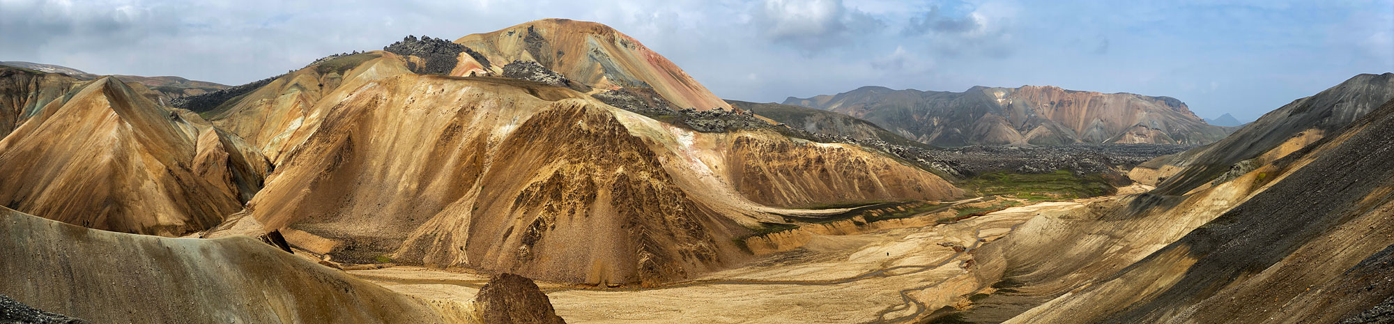
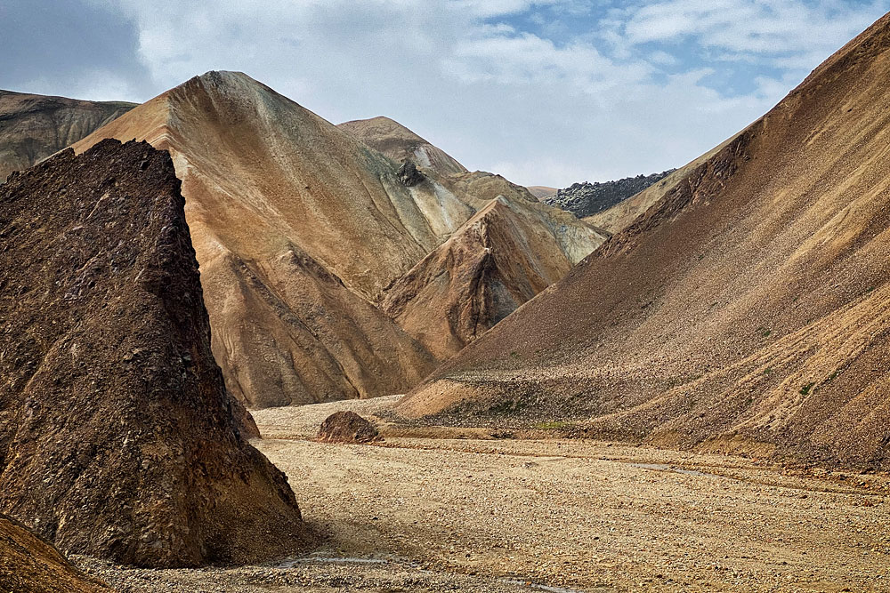
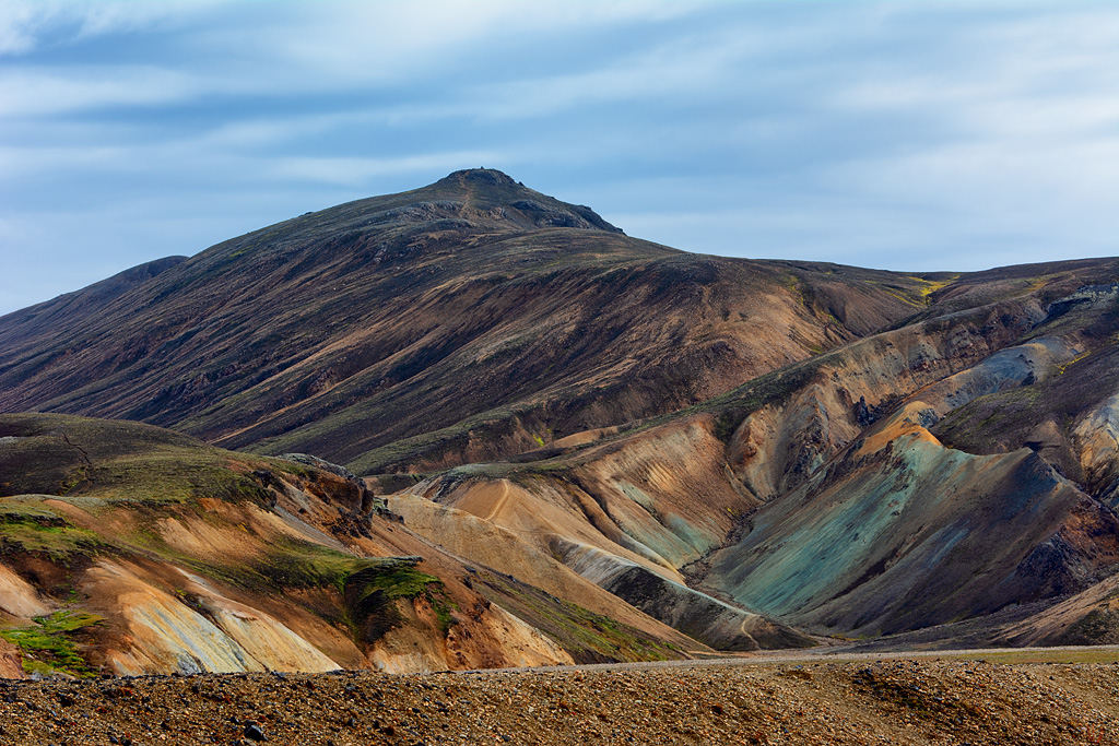
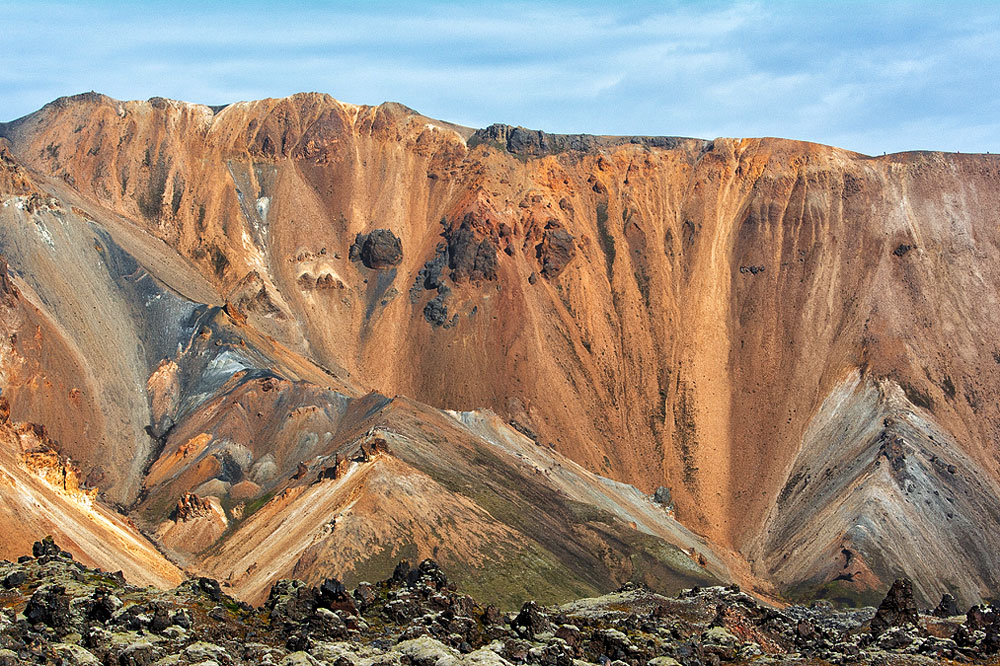
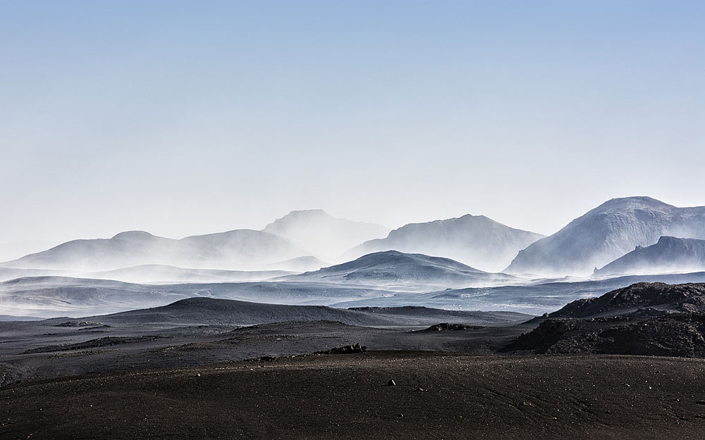
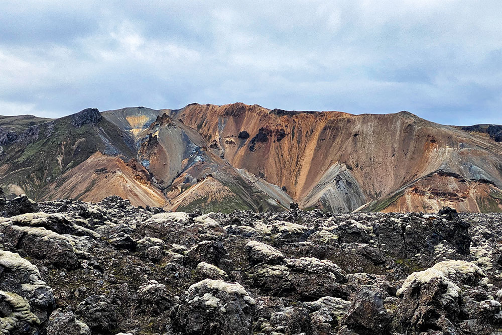
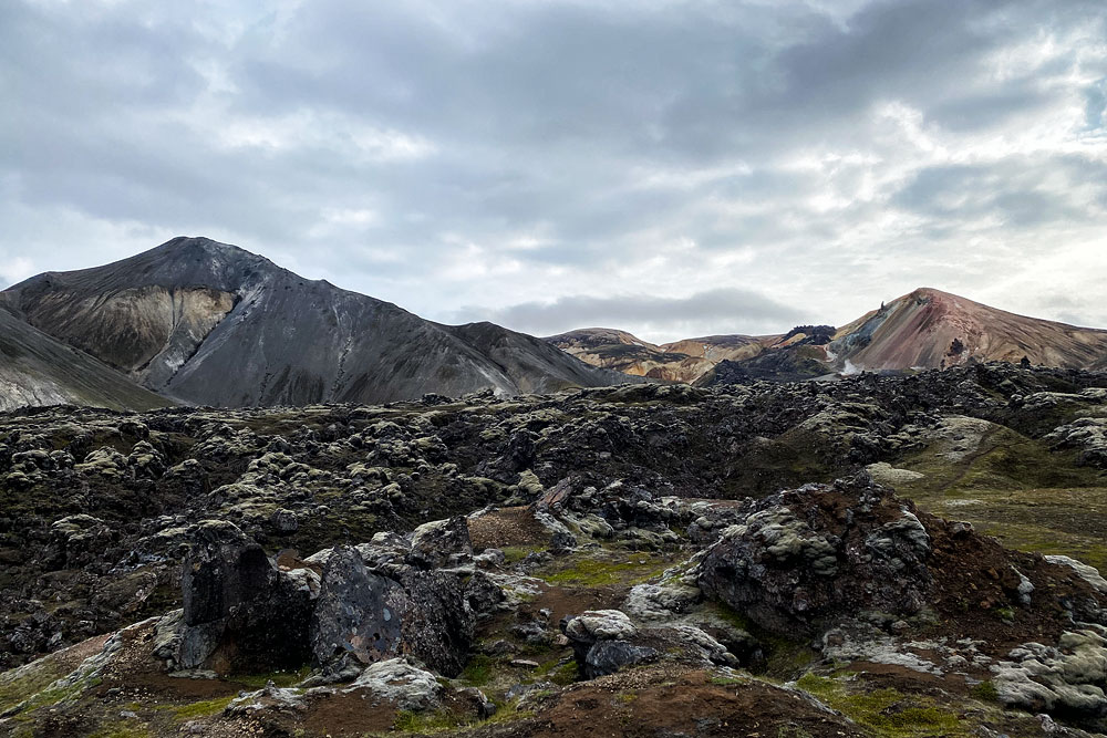
Landmannalaugar is truly unique, both geologically and aesthetically. It consists of windswept rhyolite mountains (of volcanic origin), creating an extraordinary spectrum of colors – from shades of red and pink, through greens and blues, to golden yellow. At the foot of the mountains, in turn, lies the ebony-black Laugahraun lava field – a vast area of cooled magma from the eruption of the Brennisteinsalda volcano around 1477.
The area around Landmannalaugar is also home to gyrfalcons and ptarmigan – two of Iceland’s best-known species of mountain birds. Ptarmigan are an important food source for the falcons, especially in spring, when the winter-white plumage of the male stands out against the dark ground. Ptarmigan may be hunted in late autumn; the gyrfalcon has been protected by law since 1940.
Ornament of the area – Brennisteinsalda
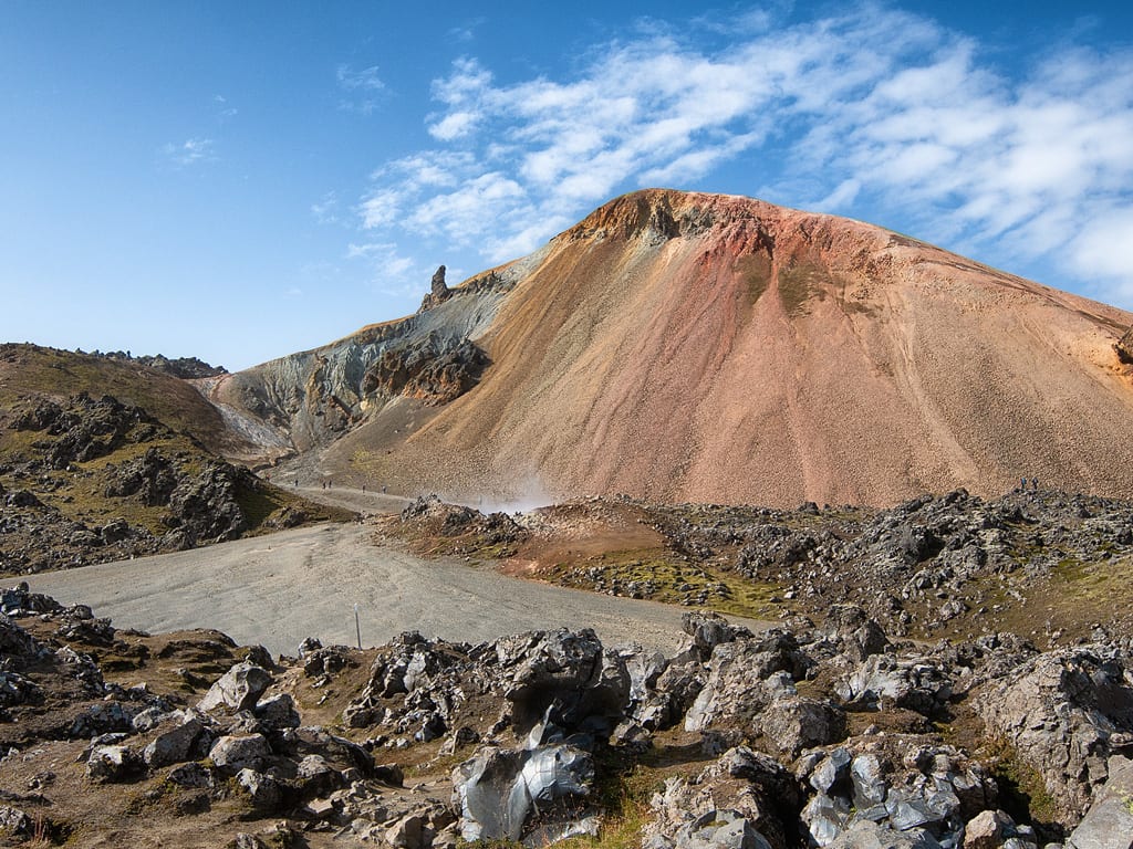
Brennisteinsalda Volcano
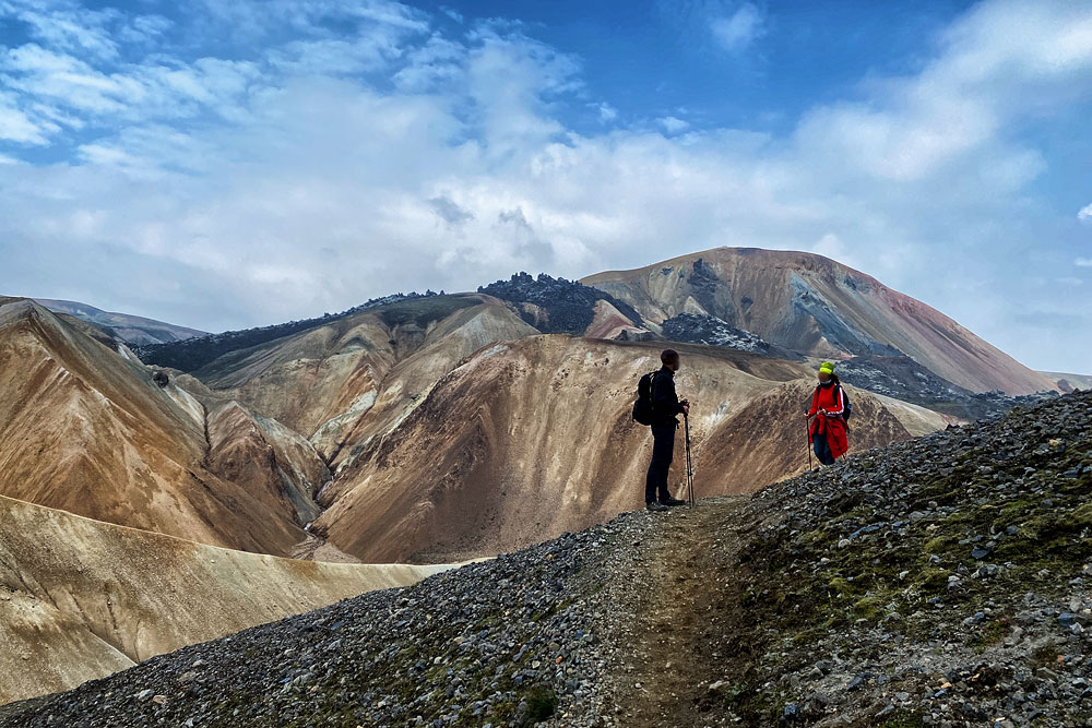
The distinctive feature of this mountain is precisely its magnificent coloration. Blue ashes, black lava, green mosses and red islands formed by iron make this place truly picturesque. From the top of the hill there is a magnificent view of Landmannalaugar and its surroundings.
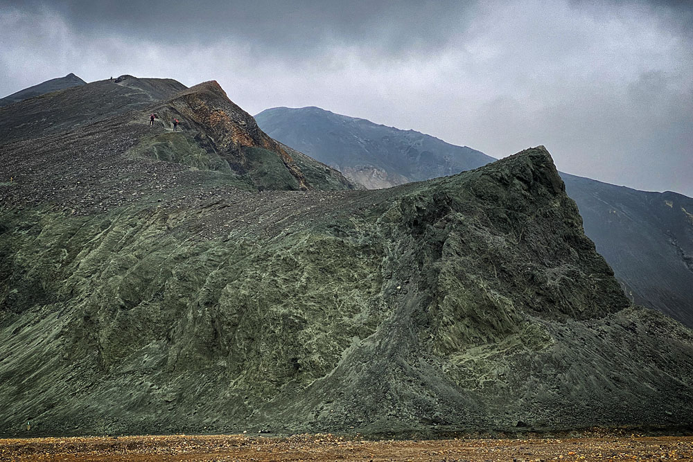
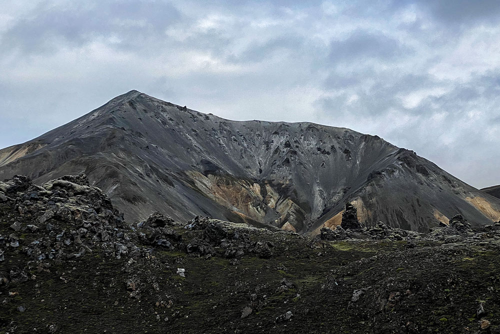
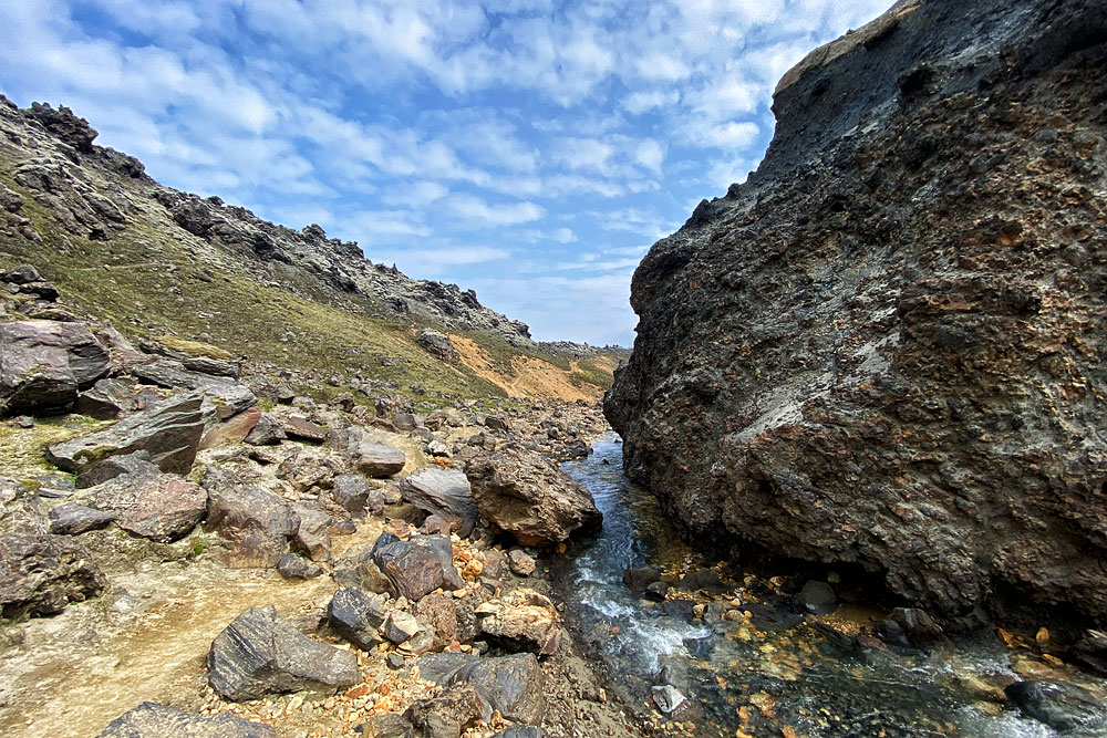
Other most distinct and picturesque elements of this landscape are: Sudurnamur – a “wall” of colorful mountains north of Brennisteinsalda, Blahnukur – a beautiful, completely black volcanic peak on the south side, Graenagil – a small stream gorge at the foot of Blahnukur and the lava field itself lying in a cauldron between all these attractions – Laugahraun.
The hot spring at Landmannalaugar
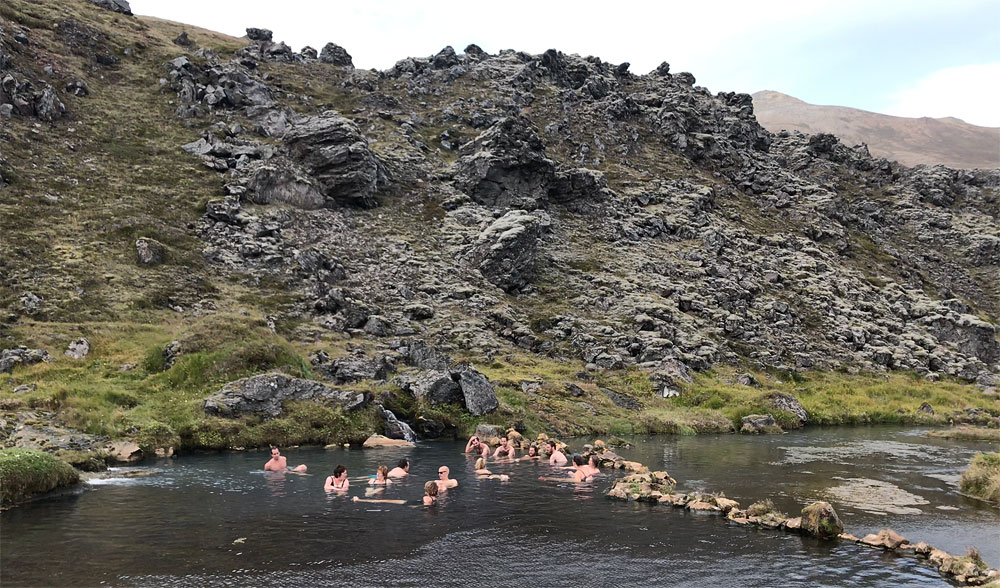
Complementing the unique climate of Landmannalaugar is an extremely charming hot spring. A nice and practically completely wild, and extremely photogenic hot pond has been created at the place where the hot and cold streams join their waters, just below the roughly 15-meter (50 ft) high wall of solidified Laugahraun lava. A wooden platform with benches and hangers was built next to it for the convenience of tourists, but the pond itself remains completely natural.
Video: Camping and the hot spring at Landmannalaugar.
Accommodation in Landmannalaugar
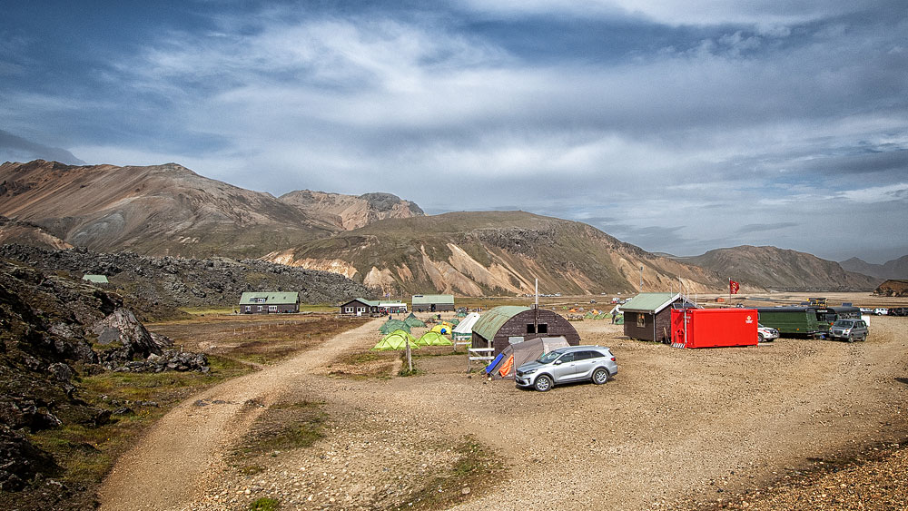
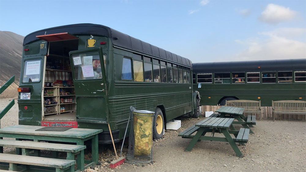
From mid-June to mid-September a hut, a campsite, a shop and a small restaurant – the last two in suitably converted army-surplus buses – operate right next to the lava field.
The hut
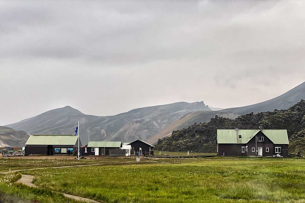
Landmannalaugar hut (far right)
The standard of bedroom does not differ from that found in other FI huts. Instead of separate single beds you get a kind of platform. Individual mattresses are laid on it right next to each other, without any partitions or dividers. On the ground floor there is one very large room (about 30 people, and here the platforms are stacked in two tiers); upstairs there are three smaller rooms. In the bedrooms there are also tables with benches that allow you to comfortably eat, play cards or repack your backpack.
In addition, on the ground floor there is a spacious hall with a drying room and a large, fully equipped kitchen with kitchen utensils and access to hot and cold water as well as tables and benches for dining. You can go out to a kind of terrace, directly from the kitchen, where guests can also use the barbecue.
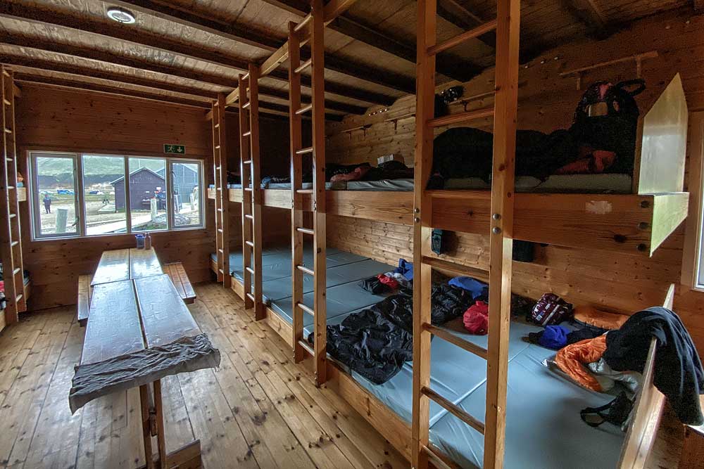
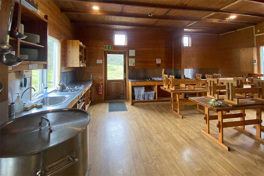
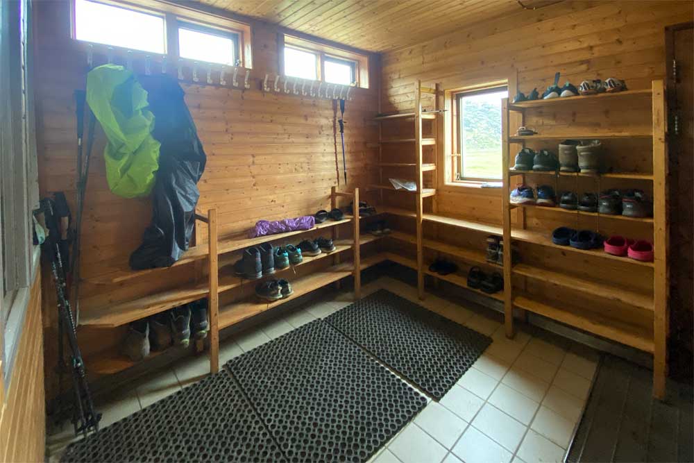
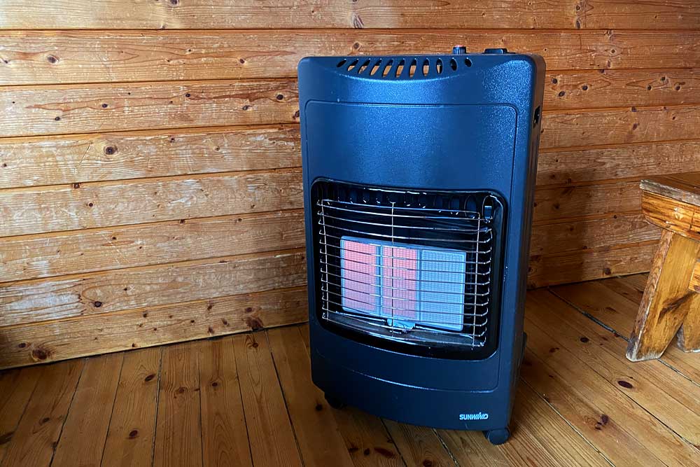
The hut is heated, but not always – depending on weather. Sometimes additional gas stoves are available.
There are no showers or toilets in the hut. Guests use the same amenities as everyone else, in a separate building. The shower is extra as well (1,100 ISK / about $9), the same as for everyone. On the other hand, people who do not stay overnight in the hut are not allowed to enter and cannot use the kitchen or drying room.
There are also no electric sockets in the hut for guests use. This is standard in mountain huts in Iceland, but it is worth remembering. You can charge your phone at the bus shop, for a fee.
Landmannalaugar is a popular starting point for the Laugavegur trail. Many organized groups start their Laugavegur tour with an overnight stay in this hut. In many of these groups people hike from hut to hut with minimum backpacks, and their luggage is transported to the next hut by an accompanying super jeep. So they have a lot of luggage (incl. food) and if more than one such group is staying at the hut, the kitchen gets very busy and crowded easily.
Accommodation in the hut costs the same as in other huts on the Laugavegur trail, i.e. 17,000 ISK – about $140 per person per night (2026). Reservations can be made via Ferðafélag Íslands.
The campsite
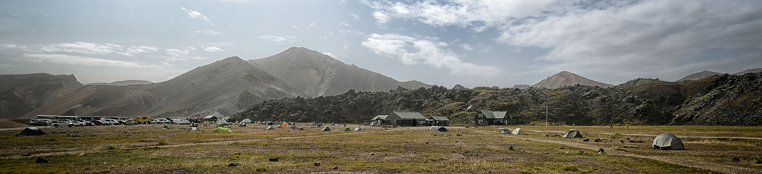
Landmannalaugar campsite (in Google Maps marked as Brennisteinsalda camping) has a lot of advantages, but also some disadvantages.
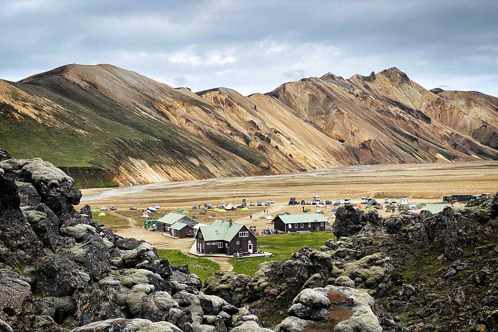
view of the campsite from Laugahraun
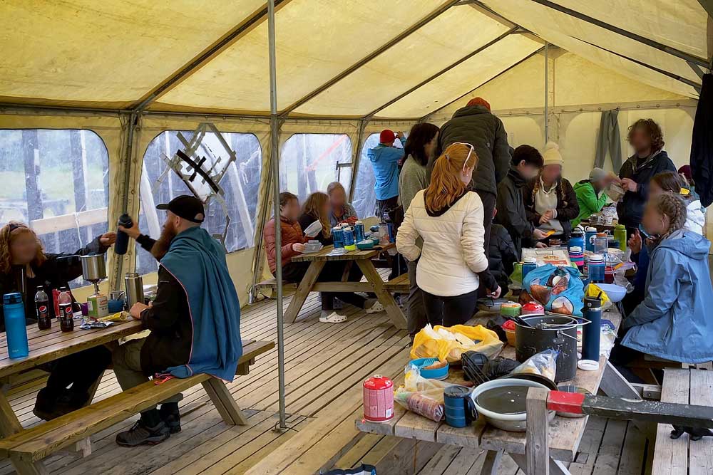
There is also a ‘canteen’ tent for all hikers, which provides good protection against rain, moderate protection against wind, and quite negligible against cold. The mere existence of this tent is certainly an advantage (at Alftavatn, for instance, there is no covered place for hikers to cook and eat at all), but given the popularity of this campsite, such a tent is definitely too small and “at peak hours” it is quite crowded.
The list of advantages is complemented by a quite large shop (or even two), a bar/restaurant, the option of getting here by scheduled bus and quite decent 4G coverage (a rare thing in the interior). In the shop (for a fee) you can also charge your phone – a rare exception by interior standards.
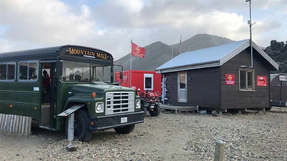
There is also a mountain rescue team here, so help is close at hand if needed. The rescue team’s office is next to the main/old shop. It is easy to recognize by the rescue quads and off-roaders parked nearby, and by the license plates decorating one of its corners (lost by tourists in the ford in front of the campsite).
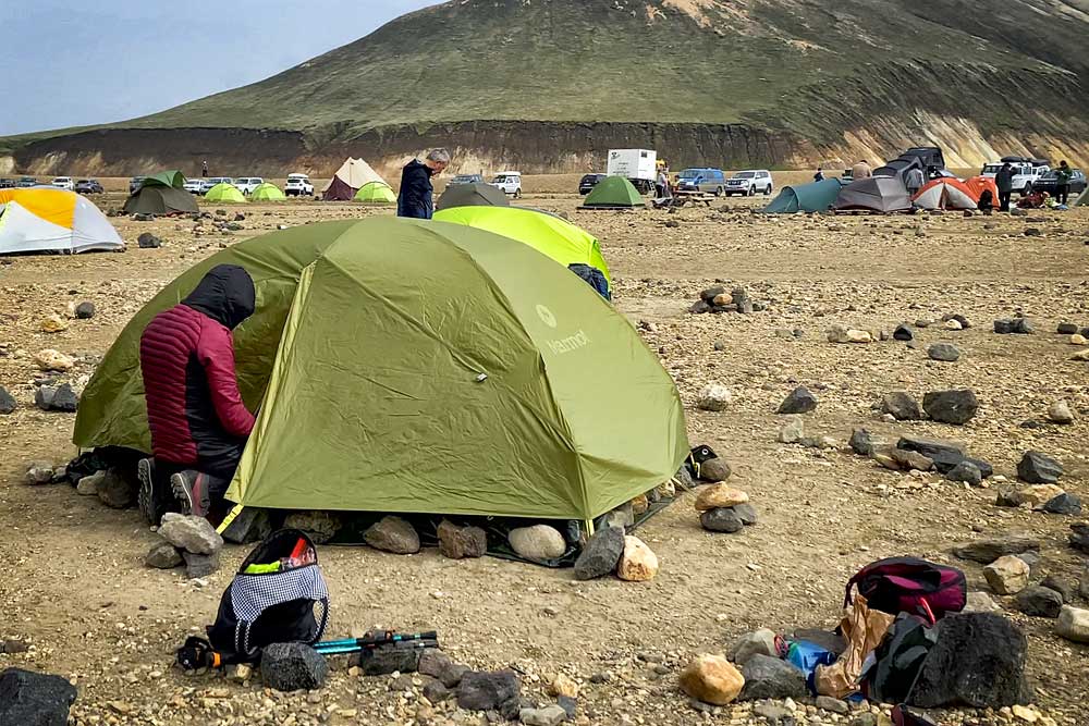
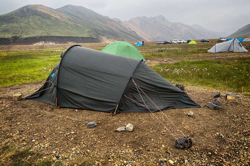
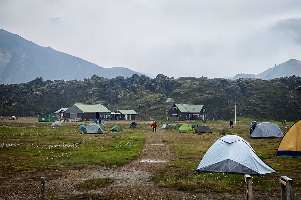
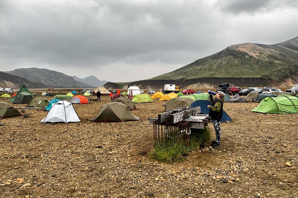
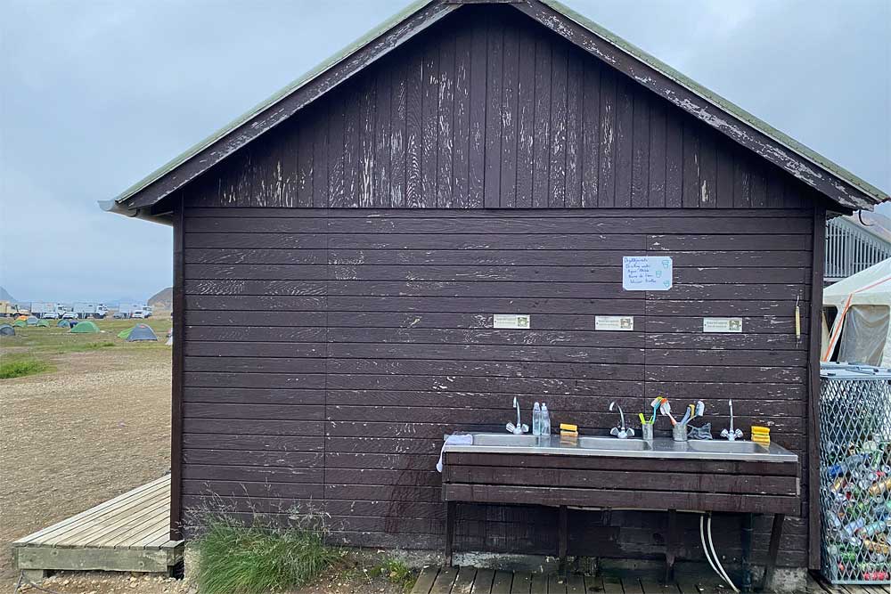
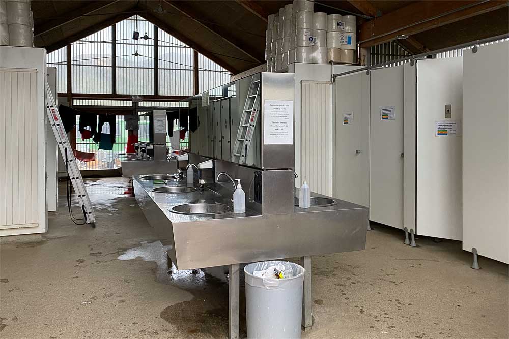
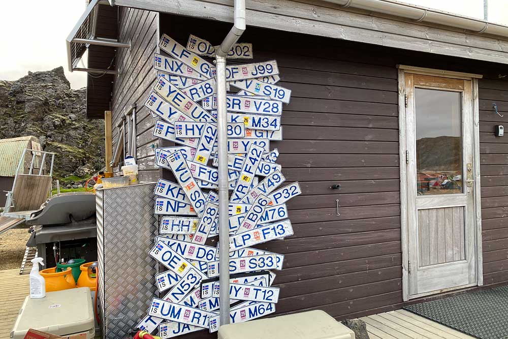
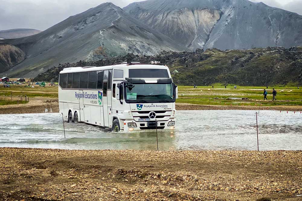
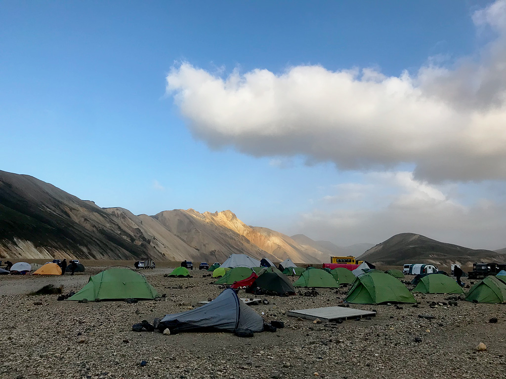
On the downside the campsite itself should be noted. People sleeping in motorhomes may not even notice it, but pitching a tent on the ground is a bit of a challenge here. The ground is stone and gravel and very hard, and it is really difficult to drive a tent peg into it. The northern part of the campsite is a bit greener / with more grass, but the ground is also very hard. That’s why stones are used a lot – either to add weight to poorly holding pegs, or simply to replace them. There are plenty of stones to use, and the information that they should be returned to special crates is a kind of a legend – no one bothers to do that and it would be counter-productive, TBH.
Unfortunately, the campsite is quite open to north and south winds, so it can get very windy here. You can see some tents that couldn’t cope with the wind…
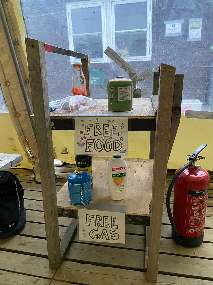
The shelf with leftover food and gas, which we can use for free, is usually empty or almost empty. Remember that for majority of tourists, this campsite is the beginning of the journey, not the end, so no reason to leave food or camping gas behind.
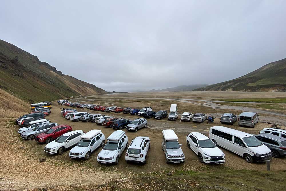
If you get here with your own car, you can drive into the special camping parking lot or leave the car (and also stay overnight) in the parking lot before the fords. This way you can get here without crossing any water. If you stay overnight, you are charged the same fee as other campsite users – register at the reception desk.
A night at the campsite costs 3,400 ISK ($28) per person, and the shower costs an additional 1,100 ISK ($9) for 4 minutes of hot water. Day visitors who use the facilities at FI huts pay a facility fee of 700 ISK (about $6), but not here: FI says that at Landmannalaugar the fee is included in the parking charge collected by Parka in summer. You pay by card at the reception, but the terminals do fail now and then – cash is not strictly necessary, yet it can come in handy.
People who spend the night in the hut, on the campsite or only use the amenities, after registration and payment at the campsite reception, receive a special waterproof wrist band in the color corresponding to the purchased “package”. In practice, however, few people wear these bands and they are not enforced in any way…
Shops and the restaurant
There are two shops and one “micro-restaurant” on the campsite.
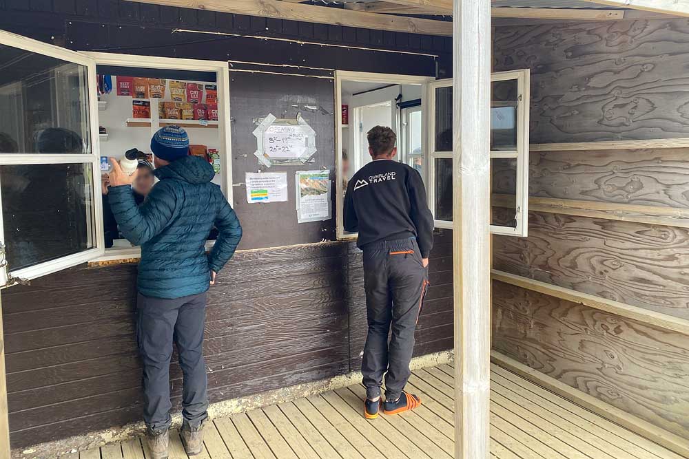
The first shop, as at many other campsites, operates at the reception desk. You can buy sweet and salty snacks (500-2,000 ISK / $4-15), several types of freeze-dried meals (3,500 ISK / $27), soft drinks (500 ISK / $4), light beer (2%, 900 ISK / $7), camping gas (jetboil, 230 g, 2,700 ISK / $20), maps, toothbrushes and toothpaste, and even hats, socks, gloves, towels, earplugs or playing cards… The choice is very limited, but the prices are not overly high.
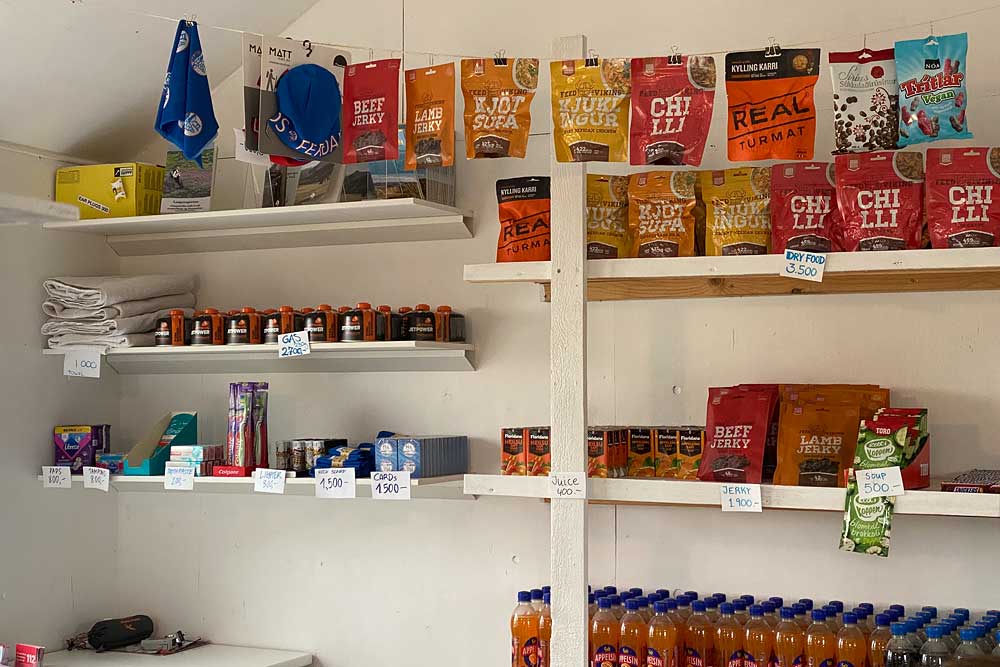
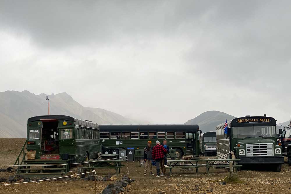
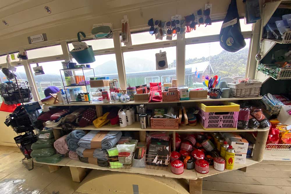
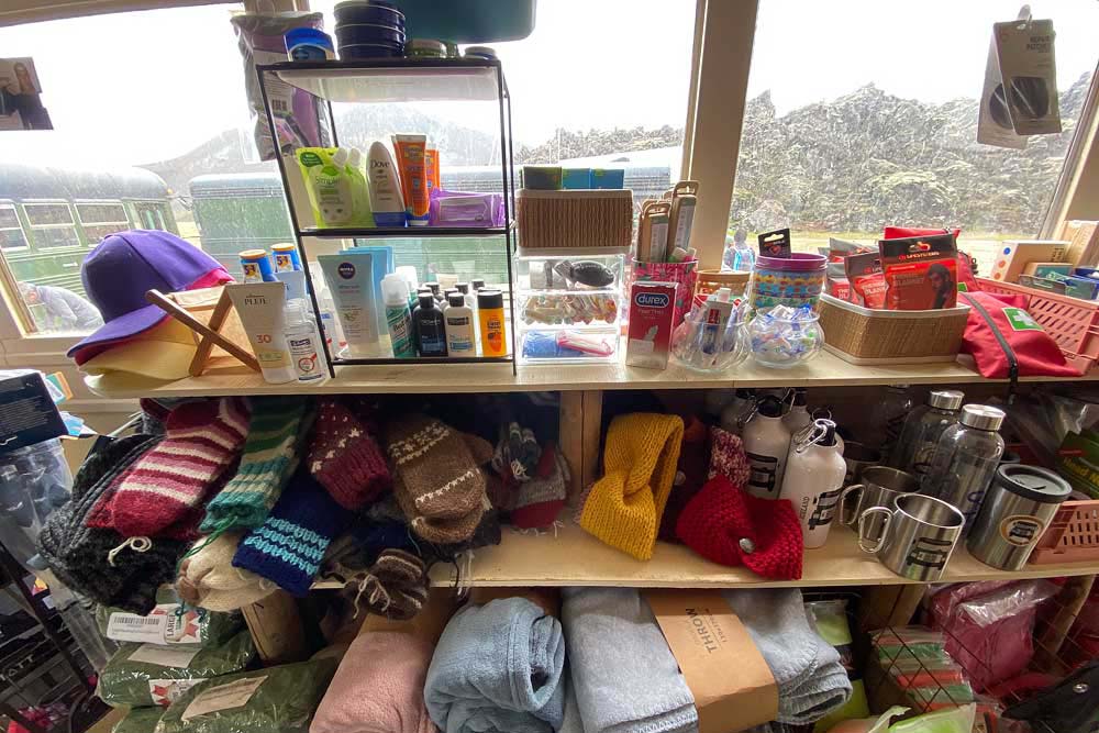
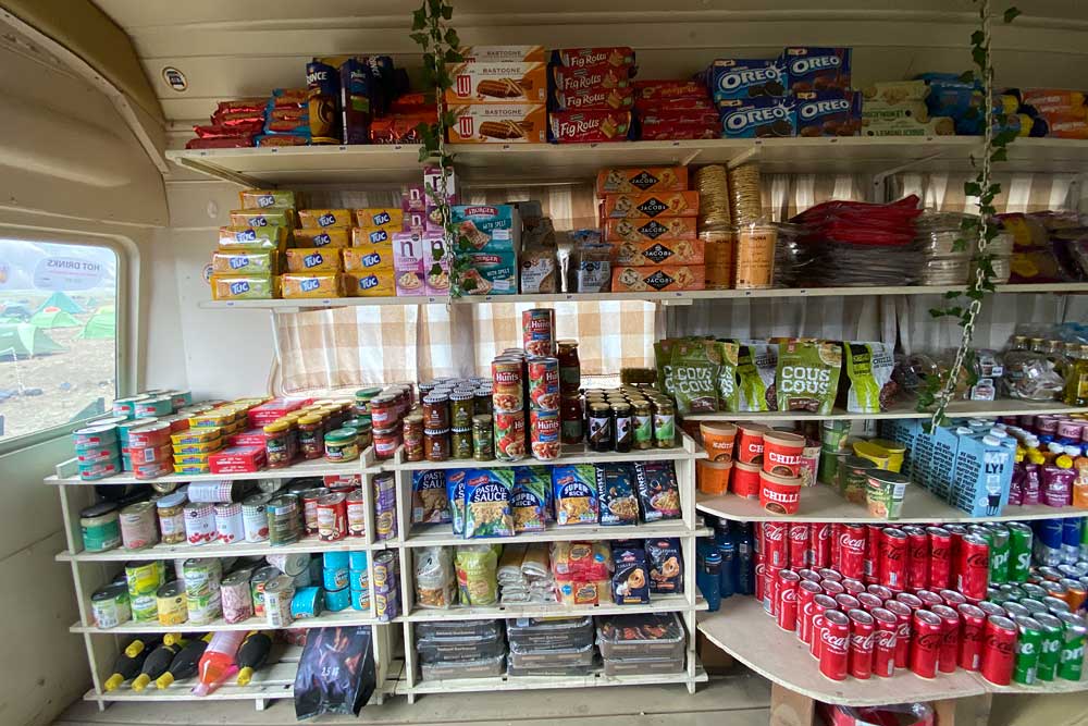
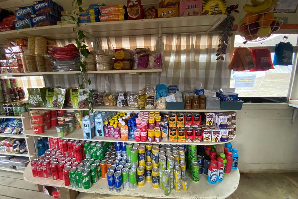
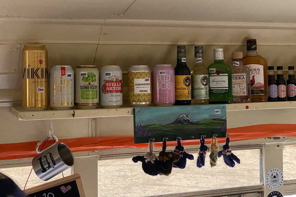
The second, much larger shop operates at the southern end of the campsite, in one of the characteristic old green buses. What’s interesting – it’s a family shop operating in this place since 1992. Here, the selection of goods is much wider: snacks, cookies, even several types of pesto and pasta sauces, a selection of pasta and rice (700-800 ISK / $5-6), canned fish, olives, canned corn and beans (350 ISK / $2.50 for a small can), energy bars, freeze-dried meals, instant noodles, even some fresh fruit, packaged bread, briquettes and barbecue lighters etc. The selection of cosmetics, hiking accessories, towels, socks, sunglasses, etc. is also much wider here. You can also charge your phone for a fee. There is even something completely useless for tourists available here, i.e. alcohol, including the strong types, and also sold as single shots… (there is more on offer than you can see in the photo above).
The prices are of course quite high (although similar to those in the shop at the reception), but considering that the nearest Bonus shop is over 100 km (60 miles) away, you can say they are reasonable.
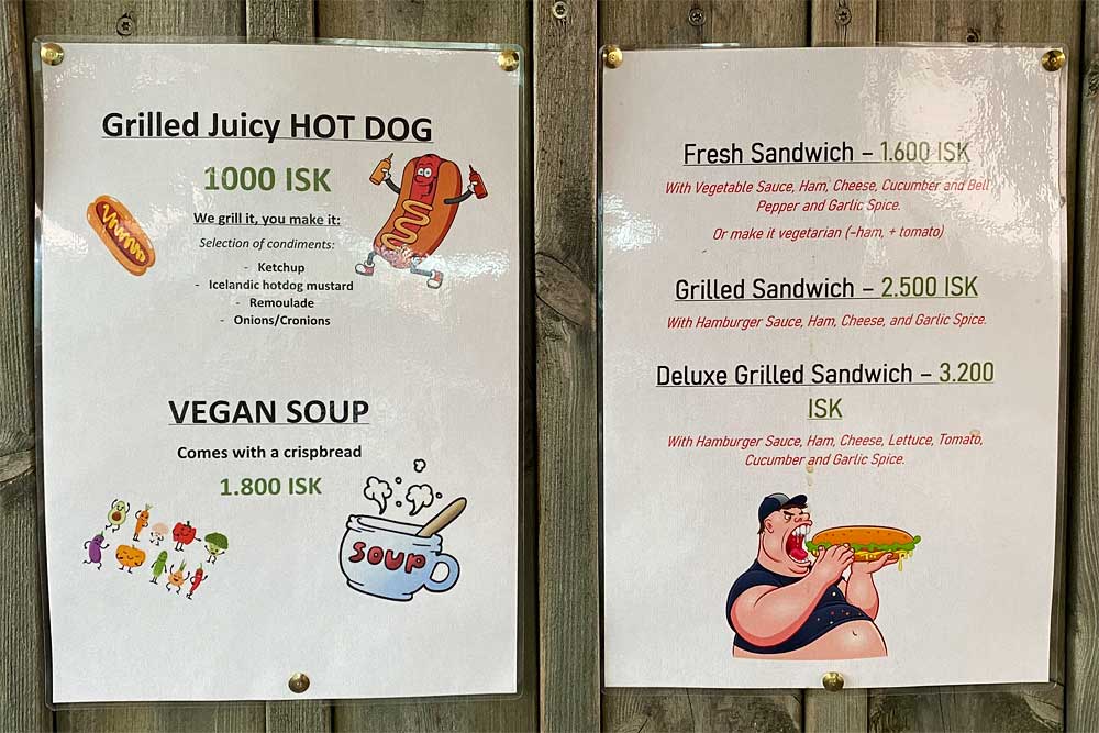
Right next to this shop, in the neighboring bus, there is a small restaurant, or rather: a bar. It serves vegetable soup with bread (ISK 1,800 / $14), hot dogs (ISK 1,000 / $7.50) and a selection of sandwiches for between ISK 1,600 and ISK 3,200, i.e. about $12-24.
Short hiking trails in Landmannalaugar
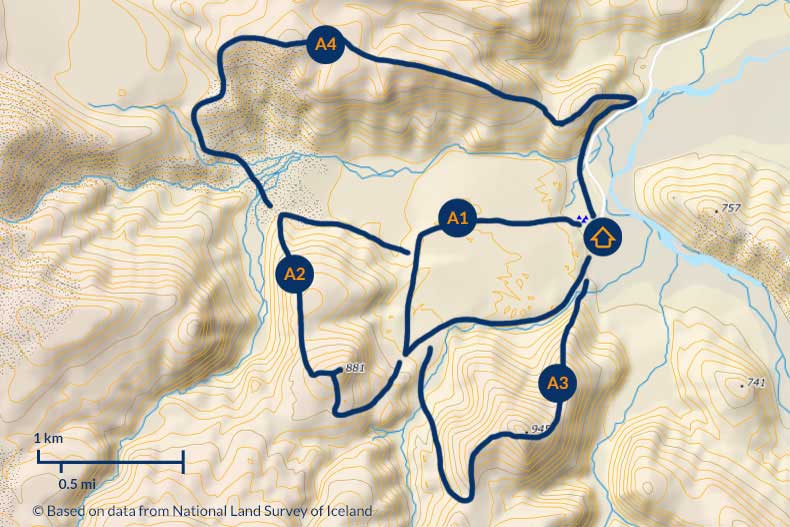
Landmannalaugar short trails map
© Based on data from National Land Survey of Iceland
You can buy a small map of the area (500 ISK, about $4) at the campsite information desk. You can also download the full campsite trail map here: Landmannalaugar trail map (PDF).
- A1: Laugahraun
Taking the shortest trail around the Laugahraun lava field and without climbing any peaks can take no more than an hour, and will allow you to see most of the area’s attractions. However, you are sure to stop more than once along the way to admire the views, so reserve up to two hours for this trip. - A2: Brennisteinsalda / Sulphur Wave Trail
If you have about 2-3 hours at your disposal, you can extend the Laugahraun hike by climbing to the top of Brennisteinsalda and possibly also bypassing it from the other, western side. The path can be steep, narrow and loose – if you plan to climb to the top, be sure to wear suitable footwear. - A3: Bláhnúkur
If you are in the mood for even more – go to the Blue Peak (isl. Bláhnúkur). This is already a real “piece of mountain”. It measures 945 meters (3,100 ft) above sea level and is a beautiful, quite powerful and extensive massif. A trip along this route is already approx. 3-4 hours, but on a sunny day with good visibility the effort will repay with beautiful views. - A4: Sudurnamur
The route through the rainbow peaks themselves – Sudurnamur (Suðurnámur – “southern quarries”) – is also similar in length. This route is also beautiful and offers unique views, but the nature of the mountains is probably such that they are best viewed from the neighboring hills…
As you can see from the plan, these 4 routes – Laugahraun, Brennisteinsalda, Bláhnúkur and Suðurnámur – can be combined quite freely. If you have more time and want to go through all of them it’s probably best to go counter-clockwise – start from Blahnukur, go to Brennisteinsalda and decide there whether you return via Laugahraun (by a shorter or longer route) or make a full circle via Sudurnamur.
If you have even more time – probably two days or at least a day and a half – you can choose one of the longer routes described below.
Hiking full-day trails from Landmannalaugar
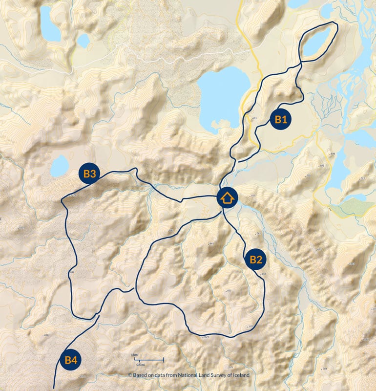
Long day hiking trails in Landmannalaugar
© Based on data from National Land Survey of Iceland
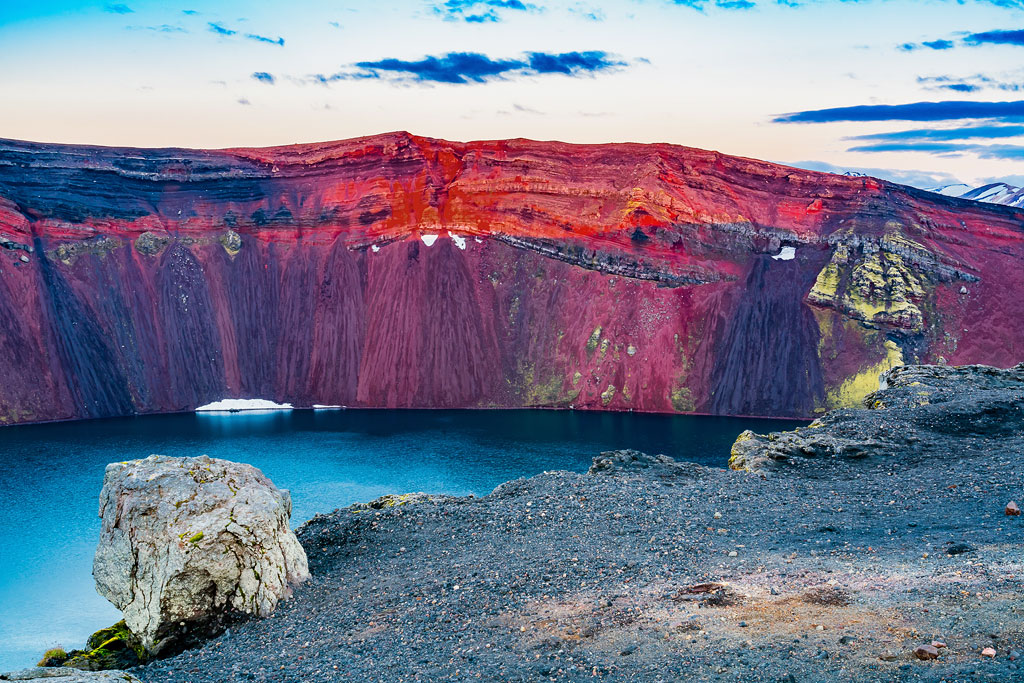
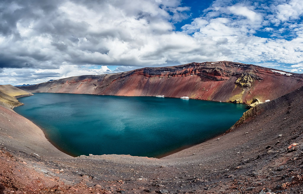
- B1: Ljótipollur (approx. 4-6 h); the name of this lake should be translated as ‘ugly puddle’, but it is completely unjustified. The lake is beautiful, and the trail itself abounds with lovely views as well. You can read more about the place here: Ljotipollur Lake.Ljótipollur can also be reached by car. If you come to Landmannalaugar with your 4×4 car, be sure to visit this “ugly puddle” on your way.
- B2: Skalli is already a 7 to 8 hour hike
- B3: Háalda will take us up to 9 hours
- B4: Laugavegur
Those who want to backpack around Iceland can set off from Landmannalaugar on the Laugavegur – arguably Iceland’s most popular hiking trail. It connects Landmannalaugar and Thorsmork – two places considered by many to be the most beautiful on the entire island. It will take 4 days to walk this trail, and you will have to spend the night in small huts (reservations are required very far in advance!) or in your own tent, at the adjacent campsites (no reservations). - Hellismannaleid
To the west of Landmannalaugar runs the Hellismannaleid trail. It connects Landmannalaugar, Landmannahellir, Afangagil and Rjupnavellir. The trail is much less traveled than Laugavegur, but also offers spectacular views – including the surrounding lakes and post-volcanic landscapes around the Hekla volcano. Due to the very small number of tourists on the trail, you can feel here like on most Icelandic trails: alone in an unending space.
B2 and B3 are certainly full-day routes, and poorly marked ones at that – in bad weather it is worth telling the rescue team at the campsite where you are going before you set out.
How to get to Landmannalaugar
Aside from hiking here, Landmannalaugar can be reached by a four-wheel-drive car or by a scheduled bus. Driving here really does take four-wheel drive – if your car or motorhome does not have it, you will have to cover at least the last stretch by bus (see the bus section further down).
The parking reservation system applies to anyone driving their own car onto the campsite during the summer season (in 2026 from June 20 to September 13), from 9 a.m. to 4 p.m. The fee is 1,500 ISK (about $13) for a passenger car carrying up to 5 people and 2,450 ISK (about $20) for a 6-9 person car, and it covers one day at most, until midnight. You book and pay on the Parka website; the rules are published by Náttúruverndarstofnun, the Nature Conservation Agency of Iceland (in Icelandic).
Arrive after 4 p.m. (or before 9 a.m.) and you need no reservation at all, even if you then stay for several days – but the parking fee itself is charged on all vehicles around the clock. The reservation covers the parking spot only, not a pitch at the campsite – so it does not apply to anyone arriving by bus, by bike or on foot.
Getting to Landmannalaugar by car
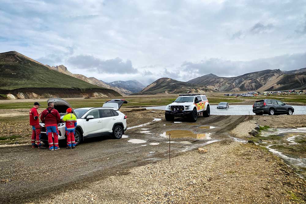
A modern Toyota RAV4 flooded their engine
When assessing the depth of water in the streams you need to cross, remember that it can change during the day – even in a few hours. Just because you get into a campsite doesn’t necessarily guarantee that you’ll be able to get out of it as well. On the other hand, let’s not get crazy either – the water in these fords often reaches up to your knees at most, and motorcyclists also pass through them. Just be careful here.
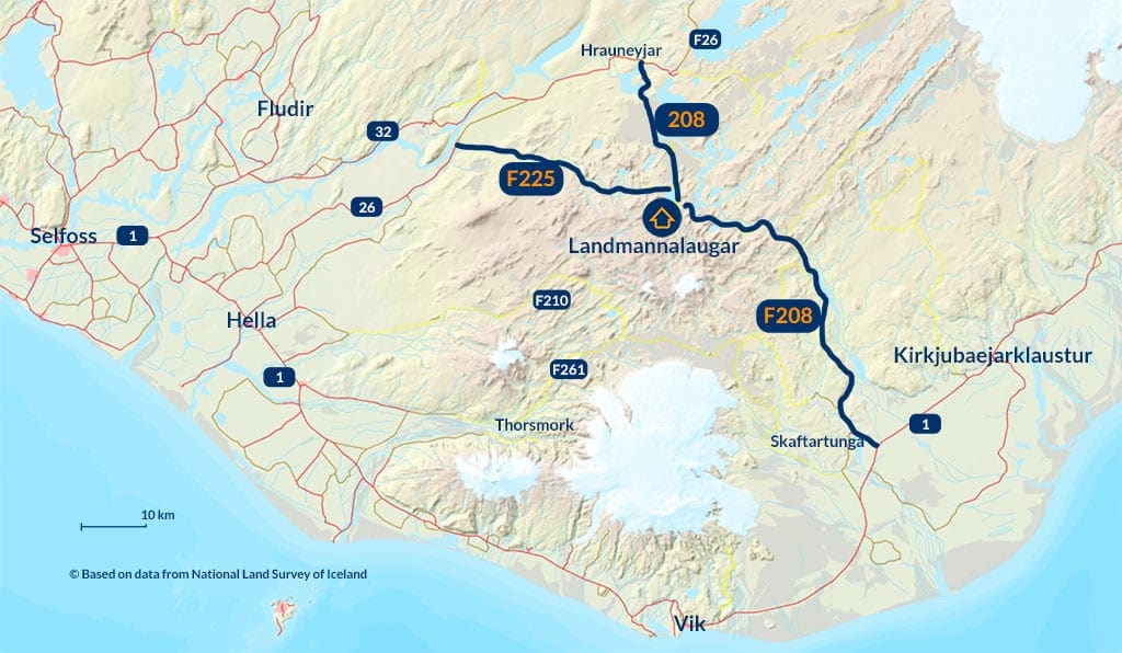
Roads to Landmannalaugar© Based on data from National Land Survey of Iceland
I give the distances and times below from the asphalt exit, so getting there via Route 208 from the north will not always be the fastest.
- Access from the north: road 208, about 30 km (20 mi), 1 h
This is the easiest and most popular access. From the asphalt, you exit south at a junction slightly east of the Highland Center Hrauneyjar. In this section, the road officially (that is, according to road.is) has no mountain road status and is ‘simply’ numbered 208. Despite this, however, in the field and on Google Maps it is still marked as F208.As a rule, rental companies do not allow cars without four-wheel drive onto this road, so confirm with yours whether your insurance treats it as a mountain road and whether you are allowed to drive this way at all. If you are coming in one of the smallest 4×4 cars, or you simply would rather not drive through streams, this is the only road to consider. Without four-wheel drive you won’t get to the campsite itself anyway, because about 500 m (0.3 mi) before it you have to cross 2 rather deep streams (i.e., more or less knee-deep, although it depends on many things, of course). Slightly before these fords – at the height of Lake Frostastaðavatn – another difficulty awaits: a rather steep and winding climb. If the road is empty – any car will get in without trouble. If you have to pass someone, then although those entering have priority, for example, buses have even more priority, so you have to expect to have to stop and start uphill on the gravel. It can be done, but without 4-wheel drive it can be a bit of a challenge.
The F208 road is worth a stop at the Sigöldugljufur canyon. The gravel path to the canyon begins at the parking lot, located about 6.5 km (4 mi) south of the F26 road exit (about 3 km / 2 mi past the bridge at the Sigöldustöð hydroelectric power plant). This is one beautiful, intimate place that most tourists skip as they rush to the famous Landmannalaugar. - Access from the west: F225, about 50 km (30 mi), 1.5 h
The name of this road is Landmannaleid. From paved road 26, it departs slightly northwest of the Hekla massif and in its initial phase leads along the northern edges of the massif. Here you can turn off the F225 road to the south and drive up to Hekla itself and the surrounding hills (see more in the article: Hekla – Queen of Icelandic Volcanoes); - Access from the south: F208, about 75 km (45 mi), 2 h
This part of Road 208 is already definitely a mountain section, so here there is no doubt and both officially and unofficially it is a mountain road: F208. It’s a very nice road, allowing you to see, among other things, the beautiful volcanic rift Eldgja and the Ofaerufoss waterfall, but it’s definitely a road for 4×4 vehicles only. It branches off from paved Road 1 to the north between the towns of Vik and Kirkjubaejarklaustur, near the Skaftartunga farm. - Access from the southwest: F210 and F261, about 160 km (100 mi), 4 h
The last option to reach Landmannalaugar is the F210 and F261 roads leading from near the town of Hella. They lead on – respectively – the north and south sides of the Tindfjallajokull glacier and connect with the F208 road about 2.5 km (1.5 mi) south of the road to Eldgja and Ofaerufoss. This is the longest of the ways to get to Landmannalaugar, so if you’re going for it, it’s not likely to be for the sake of getting there efficiently, but for the sake of making the road as beautiful and potentially most difficult as possible – I respect that! 🙂 If so, in addition to seeing Eldgja and Ofaerufoss, consider taking the F261 much earlier – to Emstrur-Botnar Hut and walking to Markarfljótsgljúfur canyon (eh, those Icelandic names…). The views are certainly not to be forgotten, and you can read more about the canyon here: Markarfljotsgljufur – a beautiful but difficult to access canyon in the mountains.
Getting to Landmannalaugar by bus
A few companies run daily connections from Reykjavik. The buses leave from the Laugadalur campsite, from the city center and from the BSI terminal, and you can also board at intermediate stops – Selfoss, Hella or Rjupnavellir. The best known of these services is The Highland Bus. The entire trip (one way!) takes 4 hours and costs about $75, but Landmannalaugar is really worth the effort.
If you leave Reykjavik at 7 a.m., you’ll get there as early as 11 a.m. and you’ll have up to 7 hours until the last return bus (you’ll be back in Reykjavik around 10 p.m.). These 7 hours are certainly enough to enjoy the beauty of Landmannalaugar and to spend a while in the hot spring, but be sure to buy your tickets well in advance. You can of course also stay the night here – at the campsite or in the hut – and go back the next day. The campsite needs no reservation (but you do need your own tent); the hut does, usually two to three months ahead. And you have to bring your own food and sleeping bag.
Rjupnavellir is a convenient and very green campsite on Road 26. You can park a motorhome there, pitch a tent, or rent a bed in one of the rather nice cabins. Scheduled buses to Landmannalaugar stop here at 8:20, 9:20, 9:45 and 14:45 and reach Landmannalaugar about an hour and a half later. Return runs leave Landmannalaugar at 14:30, 15:45, 16:30 and 18:00. The first and the last bus are of course the busiest, and tickets for them have to be booked ahead. Remember that the bus may not pull in at the Rjupnavellir stop at all unless you have bought a ticket saying that this is where you want to board!
Starting from Rjupnavellir you can spend almost 8 hours in Landmannalaugar or – probably better – stay the night and return to Rjupnavellir the next day.
Alternatively there’s plenty of private day trips to Landmannalaugar in a rather broad price range. See the top selection here: Landmannalaugar Day Trips.
Photos from Landmannalaugar