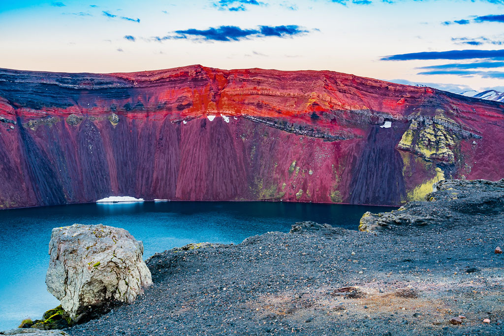
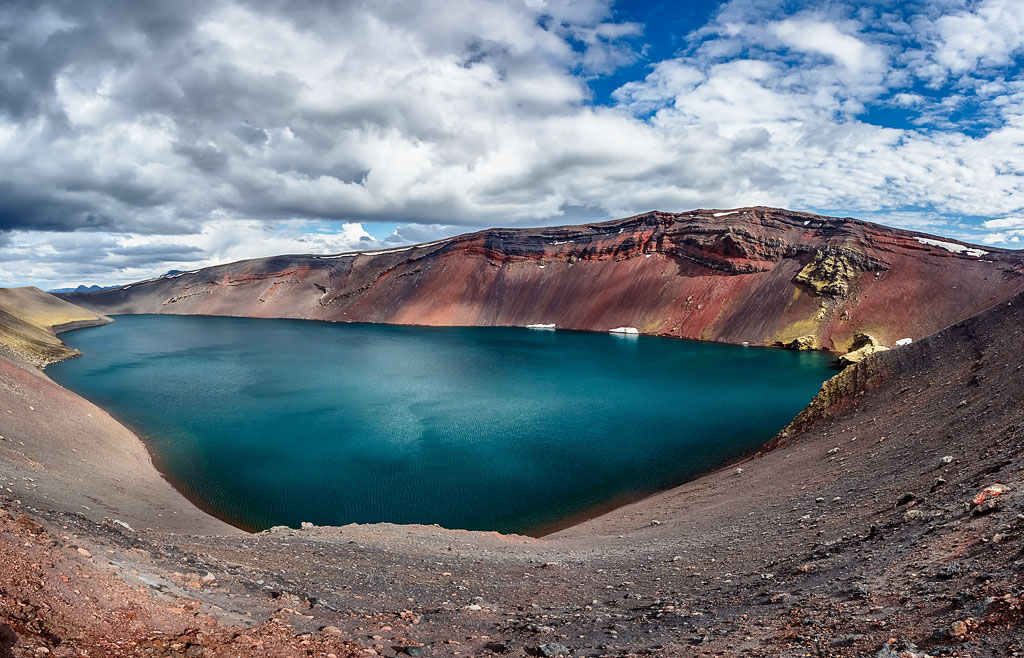
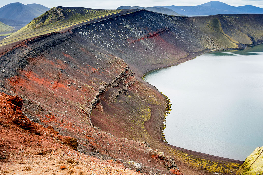
Ljótipollur is a crater lake near Landmannalaugar, in the Fjallabak nature reserve (Friðland að Fjallabaki). Its name and its looks seem to be completely at odds…
Ljotipollur – a beautiful lake and ugly puddle rolled into one
Ljotipollur is a charming crater lake with crystal-clear water. It fills a crater formed by the great Veiðivötn eruption of 1477, when the Bárðarbunga volcanic system and the Torfajökull volcano erupted at the same time (source: Náttúruverndarstofnun). Because of its volcanic origin, the mountainsides that drop into the lake are nearly vertical and very colorful. The crater itself is about 1.5 km (1 mi) long, with walls that are both steep and tall.
The lake looks amazing at any time of day, but at sunrise and sunset, when the sun’s rays glide over the very rim of the crater, the sight of Ljótipollur is truly breathtaking. Red lava rocks, layers of volcanic deposits, green vegetation and turquoise water – in good light this place is a paradise for photographers.
The surrounding rhyolite mountains, green hillsides, visible layers of solidified lava and hot springs also offer wonderful hiking, at every level of difficulty.
Like the neighboring lake Hnausapollur, Ljotipollur belongs to the Veiðivötn volcanic fissure system. It is less than 10 km (6 mi) from the very popular Landmannalaugar campsite, and a decent, albeit gravel, road will take you there (all roads in the area are classified as F, that is mountain roads – open only in summer and only for 4×4 vehicles).
Ljótipollur — practical tips
- Ljótipollur – just like the entire Landmannalaugar area – is accessible only in summer and only for 4×4 vehicles (or a suitable motorbike, a bicycle or, of course, on foot).
- There is a parking area on the northwest side of the crater. The short access track from road F208 is sometimes closed, though (it was in the summer of 2022) – in that case use the marked parking lot on the left side of F208 (heading toward Landmannalaugar), from which a marked trail leads to the lake.
- The road to Ljótipollur turns off to the east from the main F208 road, at the same junction where F225 (Landmannaleið) turns off westward, leading to Landmannahellir and farther on to Road 26 near the volcano Hekla.
- It is about 40 km (25 mi) to Highland Center Hrauneyjar and less than 10 km (6 mi) to the campsite at Landmannalaugar.
- You can also reach the crater on foot, following the road from Landmannalaugar. The hike takes about 2.5 hours one way.
- Within the reserve, flying a drone is banned from June 15 to September 15 without a permit, and you may spend the night only in the huts and at the designated campsites – Landmannalaugar, Landmannahellir and Hrafntinnusker; camping anywhere else has to be agreed with a ranger (special rules of the reserve, PDF, 0.3 MB).
How to get to Ljótipollur
Ljótipollur – like the entire Landmannalaugar area and the Fjallabak nature reserve – is accessible only in summer and only for 4×4 vehicles (or, of course, on foot, by bicycle or on a suitable motorbike).
The Ljótipollur crater and lake lie very close (less than 2 km, about 1 mi) to a junction of three roads:
- the northern section of F208, coming from the Hrauneyjar highland center and road F26; it is the most used, fastest and safest way to get here – about 40 km (25 mi) from Hrauneyjar and one (beautiful!) hour of driving;
- the southern section of F208, which joins Road 1 between Vik and Kirkjubaejarklaustur; about 80 km (50 mi) and 2 hours of rather demanding driving over rough terrain (or more, because it is worth taking a detour to see Eldgja and Ofaerufoss);
- road F225, called Landmannaleið, which leads west to Road 26 near Hekla. Along this road you can stay at the Landmannahellir campsite, far less crowded than Landmannalaugar. If time permits, it is also worth driving up to Hekla to see the Rauðaskál crater.