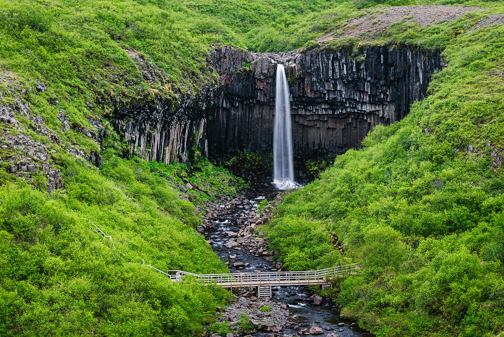
Svartifoss is a stunningly beautiful waterfall in the Skaftafell Nature Reserve (now part of Vatnajökull National Park) – a remarkable area of glacier tongues and lagoons, birch woods, lava fields, rivers and streams.
The beauty of Svartifoss waterfall
Despite being only 20 m (65 ft) high, Svartifoss is one of Iceland’s most popular waterfalls thanks to its beauty and location. Its hallmark is the hexagonal basalt columns that frame it; some of them lie broken at its base. Basalt columns like these are quite common in Iceland and have inspired many artists and architects. The best-known example is Hallgrímskirkja, the largest church in Reykjavik, whose architecture echoes basalt columns. Water also pours over similar basalt columns at the larger but harder-to-reach Aldeyjarfoss in the north of the island.
Avid hikers, photographers and nature lovers consider the entire Skaftafell area a true gem of Icelandic nature.
Where I book my own Iceland trips
Best Iceland deals
Selected partner sites, best prices
Hiking trails around Svartifoss – Skaftafell
Around Svartifoss, several hiking trails start near the Skaftafell parking lot and campsite, leading up the mountain slopes known as Skaftafell Heath (Skaftafellsheiði) and toward the nearby Skaftafellsjökull glacier. The trails take anywhere from 1 to as many as 10 hours and are marked with the letters S and M. You can combine them quite freely, depending on your fitness and plans.
Trail maps: overview and close-up


Download the official Skaftafell hiking map (PDF, 12 MB) from Vatnajökull National Park – it is a large file, so it is best to download it over Wi-Fi rather than mobile data. All of the park’s maps, including 3D maps of the hiking areas, are on its maps page.
You can – and should – get detailed, up-to-date information on each trail and its current conditions from the park rangers or the visitor center. Trail lengths and times below are given according to Vatnajökull National Park (checked September 11, 2026). Here is a quick overview:
S1: Skaftafellsjökull
length: 4.1 km / 2.5 miles
time: 1-1.5 h
difficulty: easy
This trail, set slightly apart from the others, leads to the foot of the Skaftafellsjökull glacier. It starts at the visitor center and follows a paved path that turns into a clearly marked gravel trail toward the end. If you want to get close to the glacier or step onto it, be sure to follow the warnings and instructions on the signs at the end of the trail.
Skaftafellsjökull is a glacier tongue flowing from Vatnajökull, Iceland’s largest ice cap, which covers about 7% of the island (around 7,500 km2 / 2,900 sq mi in 2023, according to Vatnajökull National Park).
S2: Svartifoss-Sjónarsker-Sel
length: 5.8 km / 3.6 miles (loop)
time: 2 h
difficulty: easy
This is the basic and shortest trail to Svartifoss. It starts at the visitor center, passes through the campsite and climbs toward the Hundafoss and Magnusarfoss waterfalls. After about 1.5 km (0.9 mi), it reaches a viewpoint above Svartifoss, then drops a little into the ravine, crosses it on a footbridge and climbs the basalt-column steps on the other side toward the Sjonarnipa viewpoint. Further down, it passes the traditional turf house at Sel and returns to the visitor center. Alternatively, you can take a slightly shorter way back via the S3 route, straight down, skipping Sel.
S3: Skaftafellsheiði
length: 16.6 km / 10.3 miles
time: 5-6 h
difficulty: demanding
This is the main and longest loop around the surrounding peaks. It starts like S2, but above Magnusarfoss it crosses a footbridge and heads straight for Sjonarsker hill (you can also stay on S2 and join S3 higher up, after seeing Svartifoss).
Further on, the trail makes a large loop past Skerholl hill and on to Fremri-Hnaukur and Nyrdri-Hnaukur. In this area, you can switch to the harder S4 trail and climb Kristinartindar (1,126 m / 3,690 ft above sea level), the peak towering over the area.
The trail then continues to Glama hill, runs along the Skaftafellsjökull glacier and returns via the Sjonarnipa viewpoint to the center of Skaftafell.
S4: Kristínartindar
length: 18 km / 11 miles
time: 6-8 h
difficulty: difficult
This trail is really a variant of S3 – an extension with a side trip up the highest peak in the area, Kristinartindar (1,126 m / 3,690 ft).
It starts and ends exactly like S3 and only branches off in the middle, farthest section, climbing steep scree to the top of the ridge.
Because of melting snow, the trail is often closed until the end of June.
S5: Sjónarnípa
length: 6.5 km / 4 miles
time: 2-2.5 h
difficulty: demanding
The trail climbs the same way as S2, S3 and S4, but fairly early – at the junction for Svartifoss and Sjonarnipa – it turns northeast (right) toward Sjonarnipa.
If you want to see both Svartifoss and Sjonarnipa, take the S6 trail.
The S5 trail climbs along the Eystragil canyon and returns from Sjonarnipa by the southern path along the Austurbrekkur slope.
S6: Svartifoss and Sjónarnípa
length: 7.1 km / 4.4 miles
time: 2.5-3 h
difficulty: demanding
The trail starts like S2 and follows it up to the viewpoint above Svartifoss (ignore the first signpost at the bottom pointing to Sjónarnípa).
After seeing Svartifoss, head east (right) toward the S5 trail and follow it to Sjonarnipa and back to the Skaftafell visitor center.
M1, M2 and M3: Morsardalur and Iceland’s highest waterfall – Morsárfoss

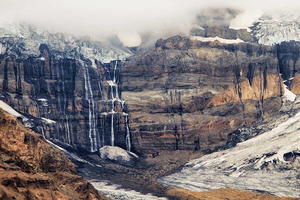
Morsarjokull Glacier and Morsarfoss Waterfall as seen from the S3 route
Trails from Skaftafell also lead into the Morsardalur valley. They head northwest from Skaftafell and go around the massif on its other, western side. They are very flat but can be tricky to navigate – the terrain often makes it hard to mark trails and paths clearly and permanently. These routes are a good choice if you are staying in Skaftafell for several days, as they take 4 to 10 hours of walking.
M1: Bæjarstaðarskógur, 15.3 km / 9.5 miles, 4-5 h
M2: Morsárjökull, 19.5 km / 12.1 miles, 6-7 h
M3: Kjós, 30 km / 19 miles, 8-10 h
Walk to the Skaftafellsjökull glacier
Iceland’s glaciers, including Skaftafellsjökull, are sadly a prime example of how climate change is affecting our planet. Although Iceland has taken many, sometimes quite decisive, measures to protect glacier tongues like this one, they keep steadily retreating.
Older photos sometimes show them reaching right up to the parking lots, so you could step onto the ice almost straight from the road. Today, especially in summer but also in spring, they have retreated deep into the valley, and by the parking lots you will first find a fairly large bay or lagoon rather than the glacier itself.
Despite this, or perhaps because of it, the area around the glacier is excellent for hiking and enjoying Iceland’s natural beauty (even if you now see the glacier itself from quite a distance). Depending on your experience, fitness and the time you have, you can take an easy walk below and alongside the glacier or even climb onto its surface. Glacier trips, however, are best done in an organized group with an experienced guide. The glacier surface is full of crevasses and moulins, and falling into one can cause serious injury. To stay safe, walk only on designated paths and follow the instructions on warning signs.
From Skaftafell, you can go on a guided glacier hike, try ice climbing or even visit a beautiful ice cave. Here’s a selection of tours run by certified professionals in the area:
- Skaftafell 3-Hours Glacier Hike ($105 pp);
- Skaftafell 5-Hour Adventure Glacier Hike ($145 pp);
- Skaftafell Blue Ice Cave & Glacier Hike ($170 pp; October through April only);
- Skaftafell Ice Climbing & Glacier Hike ($215 pp);
Remnants of the bridge over the Skeiðará River
5 km (3 mi) south of the Skaftafell campsite, on Road 1, you can see a reminder of the great glacial flood of 1996. After the eruption of the Grímsvötn volcano, meltwater from the glacier poured down the valleys of the Gígjukvísl and Skeiðará rivers on November 5, 1996, at a combined rate of more than 50,000 m3/s (1.7 million cu ft/s).
The bridge that stood over the Skeidara River at the time was swept away, and only fragments of its piers remain. It’s worth seeing how large these piers are to better understand the force of the water that rushed down from the glacier.
Suffice it to say that the flood pushed the coastline 800 m (2,600 ft) out into the ocean, adding about 7 km2 (3 sq mi) of new land to Iceland.
You can read more about this flood and other unusual effects of volcanoes in Iceland in a separate article: Stunning effects of Iceland’s volcanism.
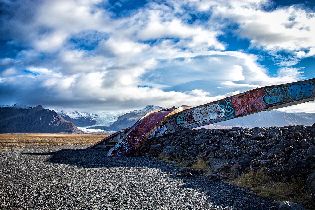
Remains of the Skeidara River bridge destroyed in the 1996 glacial flood
How to get to Svartifoss
Svartifoss is about 20 km (12 mi) northwest of the settlement of Hof, in South Iceland. From Road 1, turn onto Road 998, and after about 2 km (1.2 mi) you’ll reach a convenient parking lot. The way is clearly signposted, but the access road to the upper parking lot shown on Google Maps is closed.
The walk from the parking lot to the waterfall takes just over half an hour and is fairly easy, but you’ll need proper hiking shoes. Along the way, you can admire smaller waterfalls – Hundafoss and Magnúsarfoss.
If you have a free hour, you can also hike a little further northeast (route S1) and see the Skaftafellsjökull glacier up close.