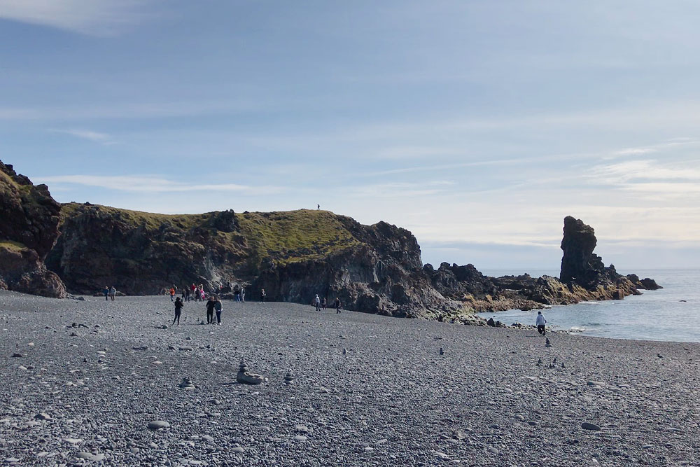
Dritvík Djúpalónssandur (freely translated: deep sandy bay near Dritvik) is a bay with dark cliffs and black sand, located on the Snaefellsnes Peninsula in western Iceland. Referred to as a lava wonderland, it captivates with its harsh and dangerous beauty and hides at least two stories: a fishing station that vanished and a shipwreck whose iron still lies on the sand.
The forgotten fishing village
First of all, the neighboring cove of Dritvik – a 20-minute walk along the coast – was once home to a busy fishing station. From the middle of the 16th century until the middle of the 19th it was the largest and most productive spring fishing station in Iceland: 40 to 60 boats put out from here with 200 to 600 seasonal fishermen, and the cove held as many as ten turf huts, whose outlines can still be made out (source: Snaefellsjokull National Park). Remnants of that period are the four stones lying on the beach, between high rocks: Amlóði (23 kg / 51 lb), Hálfdrættingur (54 kg / 119 lb), Hálfsterkur (100 kg / 220 lb) and Fullsterkur (154 kg / 340 lb). As the stories go, they were used for… testing the strength of fishermen. Today’s tourists usually find it difficult to pick up even the smallest of them. It’s equally hard to believe that the strongest fishermen once lifted the largest one…
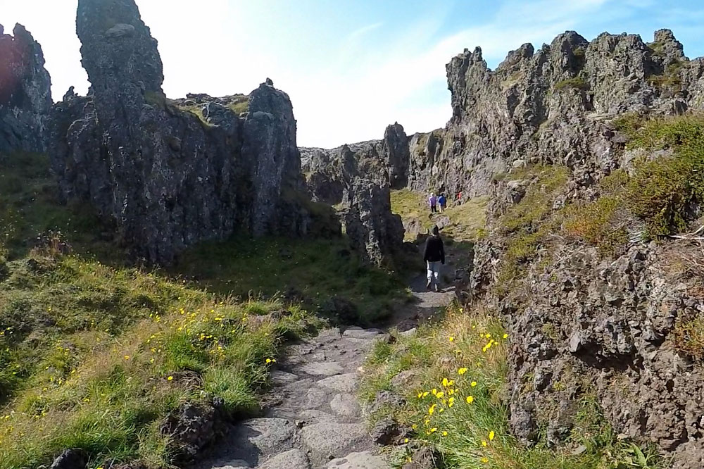
In the rocks between which we walk to the beach from the parking lot are two freshwater lagoons: Djúpalón and Svörtulón – the beach takes its name from the first of them. They were once said to be bottomless, although they have since been measured at about 5 meters (16 feet). Modest as they look, they kept the fishing station alive: every drop of drinking water used in Dritvik had to be carried from here.
The area’s natural monument is Söngklettur, or Singing Rock – a large lava rock with a reddish hue that resembles an elfin church. Nearby are other rock formations of folkloric appearance, including the alleged troll-turned-rock Kerling and Lóndrangar (note: most of the lonely rocks on the Icelandic coast are, according to legend, trolls turned into rock).
Remains of a British ship
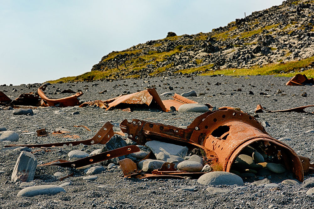
A curiosity that attracts tourists here are the remains of a British trawler scattered on the sand – the Epine GY-7. The ship ran aground east of Dritvik on the night of March 13, 1948. Although nearby rescue teams arrived to help, due to severe weather conditions, only five people out of a crew of 19 survived the disaster.
Scattered on the beach, the ship’s remains are a picturesque but nonetheless grim reminder of the disaster.
Dritvik Djupalonssandur – practical tips
When walking on Djúpalónssandur beach, use extreme caution. Iceland’s oceanic waves can be very treacherous, especially during windy, stormy weather.
Do you like the glistening pebbles that make up the beach (djúpalónsperlur – “pearls of Djúpalón”)? Remember that you are in a national park – Þjóðgarðurinn Snæfellsjökull – and that the stones are protected by law and cannot be taken from the beach.
Out of respect for the sailors who died in the shipwreck, tourists are also asked to leave the remains of the ship alone.
How to get to Dritvik Djupalonssandur
To get to Dritvík Djúpalónssandur you need to drive to the very end of the Snaefellsnes peninsula – its south-western corner. From the main road of the peninsula, Route 54, you turn onto Route 574 (Útnesvegur), which loops around the tip, and from it onto Route 572 (Dritvíkurvegur), a 2-kilometer (1.2-mile) side road signposted to Djúpalónssandur. You can leave your car in a convenient, though often crowded, parking lot, from which a clearly marked path leads to the beach. The toilets and a second parking lot are up by the main road, with a 2-kilometer lava trail leading down from there.
From the beach a marked trail continues to Dritvik itself: 1 kilometer (0.6 miles), about 20 minutes, rated demanding by the park – and it is there, not on Djúpalónssandur, that the outlines of the fishermen’s huts lie.
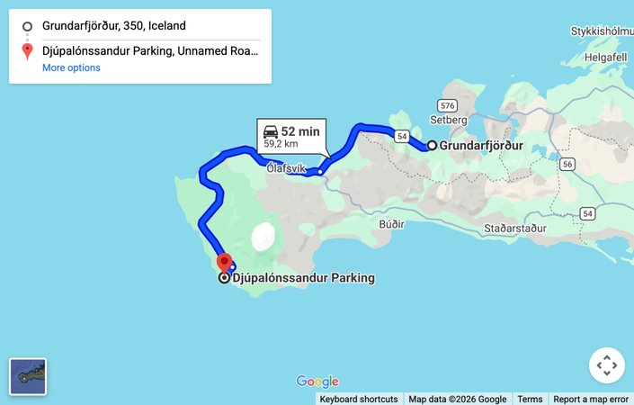
Map: driving route from Grundarfjordur to Djupalonssandur — click to open the interactive map
Photos from Dritvik Djupalonssandur