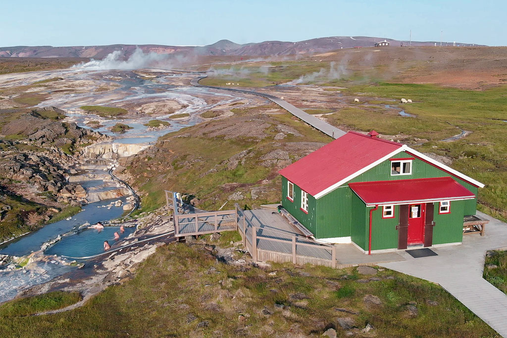
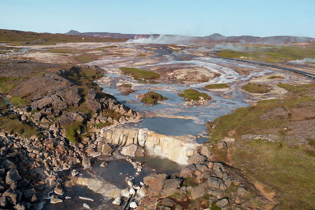
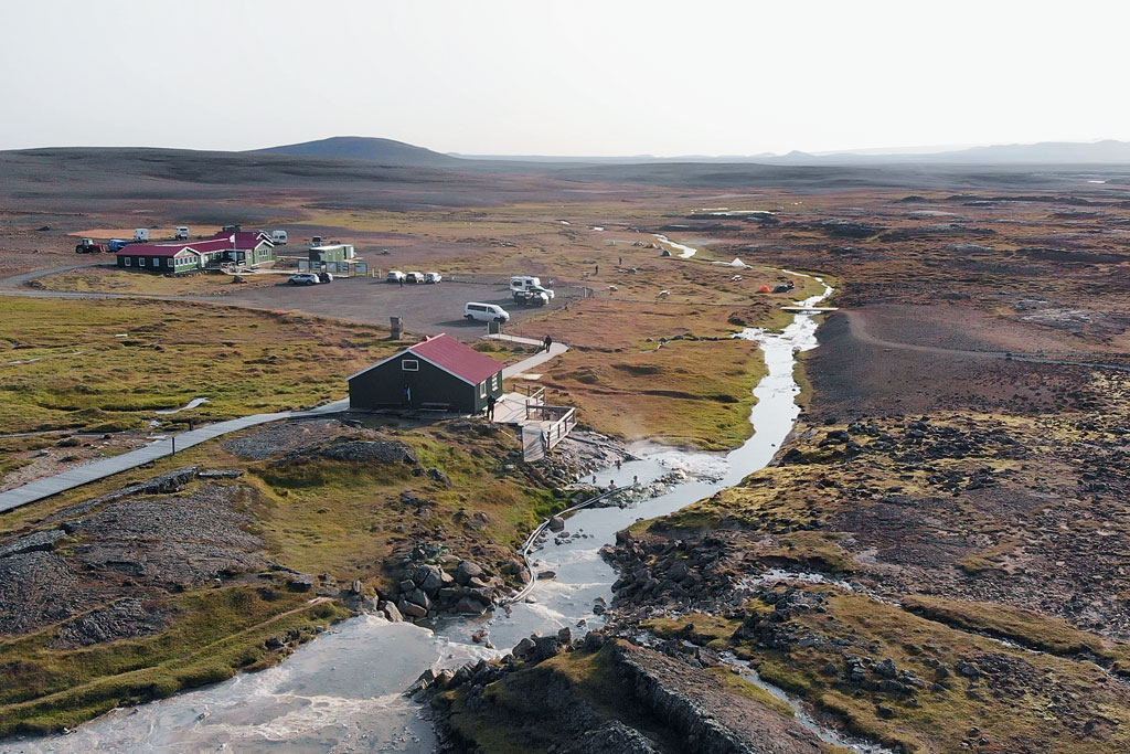
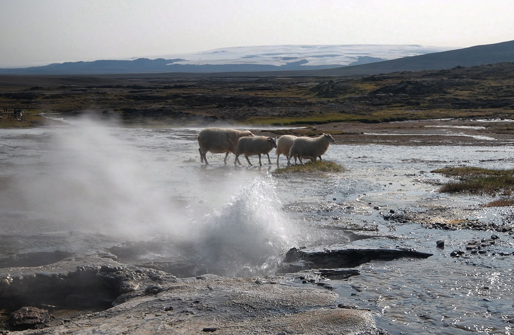
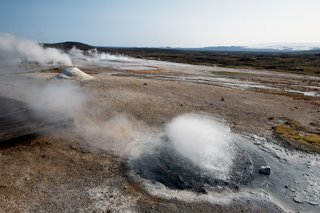
Hveravellir (freely translated, the name simply means ‘hot springs’) is a beautiful intimate geothermal area located in the central part of Iceland, not far from Road 35 – roughly halfway between Reykjavik and Akureyri, about 200 km (125 miles) in either direction.
Hveravellir Nature
The Hveravellir area lies about 630 meters (2,070 feet) above sea level, is protected as a natural monument and is often considered the most beautiful geothermal area in Iceland.
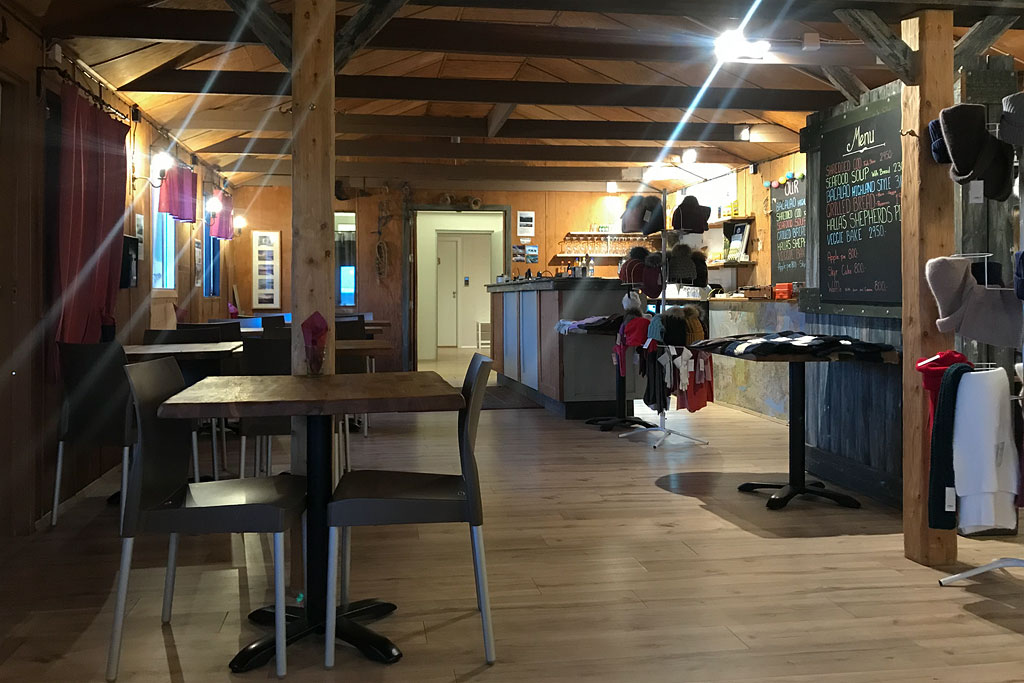
It is certainly one of the country’s off-the-beaten-path gems. Beautiful hot springs with bubbling ponds and smoky fumaroles, a great restaurant, wide views of the surrounding Langjökull and Hofsjökull glaciers and a natural geothermal pool you can actually bathe in create a wonderful oasis, conducive to relaxation and respite in the middle of Route 35, through the middle of Iceland’s interior.
The vegetation of Hveravellir is primarily alpine species adapted to the specific harsh conditions. The most common are creeping sibbaldia (Sibbaldia procumbens), dwarf cudweed (Omalotheca supina), alpine lady’s mantle (Alchemilla alpina), common cotton grass (Eriophorum angustifolium), marsh arrowgrass (Triglochin palustris) and Iceland moss (Cetraria islandica) – the last one a lichen rather than a plant.
Hveravellir has been a protected area since 1960, when it was declared a natural monument due to its uniqueness. As a result, it is strictly forbidden to damage the local nature, the hot springs above all – stay on the marked paths and bathe only in the nature pool by the huts, where the water holds about 38-40 °C (100-104°F).
Near Hveravellir is the beautiful Kaldidalur Pass picturesquely located between the Þórisjökull and Langjökull glaciers. To the east of Langjökull lies Lake Hvítárvatn, with an area of about 30 square kilometers (12 square miles). It is the fifth largest lake in the country, with an average depth of 28 meters (92 feet) and the deepest point at 84 meters (276 feet). While in the area, it is worth seeing.
The oldest description of the area comes from an expedition led by scientists Eggert Ólafsson and Bjarni Pálsson in 1752. As an interesting aside, it is also worth mentioning that around 1760, Iceland’s most famous outlaw couple – Fjalla-Eyvindur and his wife Halla – stayed in the Hveravellir area. If stories are to be believed, they hid there for as long as twenty years.
Hveravellir – tips and practical information
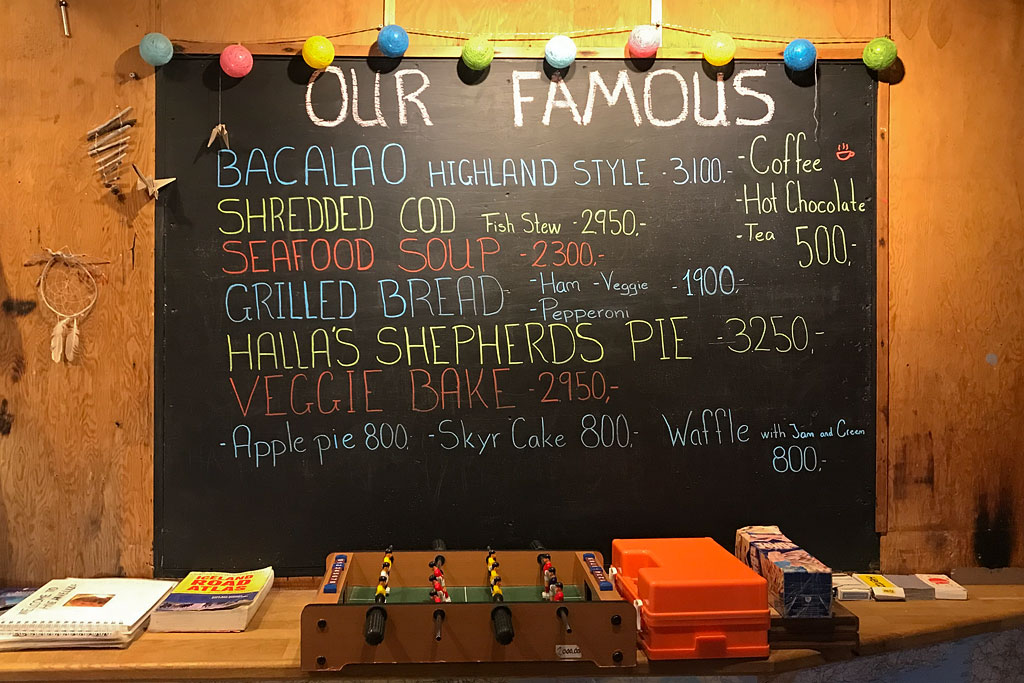
- There is a small mountain lodge in Hveravellir with a campsite, a cabin for rent, private rooms of a high standard and a restaurant serving excellent cuisine (the dishes have been developed and the staff trained by one of Reykjavik’s well-known chefs). Breakfast is served from 8 to 10 a.m., the kitchen works until 9 p.m. and the bar keeps serving sandwiches until 10 p.m.
- Only the old hut has a shared kitchen. Guests of the new hut eat in the restaurant, and campers prepare their meals at the wooden picnic tables and grills outside. The showers and toilets are shared by everyone and stand next to the campsite, and every overnight guest is welcome in the geothermal nature pool.
- People who do not stay here overnight pay a service fee of 500 ISK ($4) per person, which covers the toilets, the showers and the nature pool (maintaining all of it this far from civilization is neither easy nor cheap). Guests staying overnight are exempt from the fee.
- Example stay prices (from the lodge’s price list, September 2026):
-private room in the new building, up to 3 people, made-up beds and breakfast for two included: 36,900 ISK ($310) per night per room, third person 7,100 ISK ($60);
-bed in the old building (sleeping-bag accommodation, 8-, 10- and 12-bed dormitories): 10,900 ISK ($90) per night, per person; bed linens 2,400 ISK ($20);
-camping: 2,800 ISK ($23) per night, per person
-breakfast: 3,200 ISK ($27) per person - Reservations should be made through:
-the booking form on the page of the new hut or the old hut
-mail info[at]hveravellir.is
-telephone: +354 452 4200
-camping does not require reservations – there is always free space
Hiking trails in Hveravellir
Three interesting hiking trails start at the Hveravellir hut – at the reception you can ask about conditions and buy a small map of them:
- Green Trail (Eyvindarrétt Circle)
A roughly 3-kilometer (2-mile) loop for about 30-40 minutes. The trail passes through a moss-covered lava field and leads to the cave where Eyvindur and Halla (Icelandic: Eyvindarhellir; English: Eyvindur’s cave) hid. Along the way you can see the hot spring named after him (Eyvindarhver), the volcanic stones of Eyvindur’s sheep pen (Eyvindarrétt) inside which sheep were supposedly kept, and the turf-covered building put up in later times. - Red Trail
This is the route to Strytur (Strýtur) – the shield volcano whose eruption produced the Kjalhraun lava field about 8,000 years ago. The trail is about 12 kilometers (7.5 miles) long, with 240 meters (790 feet) of elevation gain, and will take about 3-4 hours to complete. If you want to go around the crater and descend into it, you will extend the trip by about 2 kilometers (1.2 miles). The route leads through a lava field already partially overgrown with moss, past small streams and fumaroles (volcanic ‘valves’ that release steam from underground). On this trail you can really feel that you are in a completely remote area, surrounded only by glaciers. - Orange Trail
This trail leads to Thjofadalir (Þjófadalir), or the Valley of Thieves, who are said to have hidden here as well. The route is easy and flat, but a bit longer – 21 kilometers (13 miles) in length, 145 meters (475 feet) of elevation gain and about 4-5 hours of walking. It passes through both lava fields and flowery meadows. The trail also passes the Þjófadalir mountain hut run by the Iceland Touring Association – Ferðafélag Íslands (FÍ).
How to get to Hveravellir
You can get to Hveravellir by car or bus. The gravel Kjölur route (road 35) runs about 200 kilometers (125 miles) across the highlands, from Gullfoss in the south to the Blöndudalur valley in the north, and Hveravellir lies about 90 kilometers (55 miles) from Gullfoss.
Fill up the car before you enter the highlands. The nearest gas stations are about 100 km (60 miles) from Hveravellir: in the south near the Geysir geysers, and in the north on Road 1 – in Blonduos and Varmahlid (both about 100 km / 60 miles) or in Víðigerði (135 km / 84 miles).
If you drive your own car, you turn off Road 35 (formerly F35) onto road F735 to the southwest and follow it for about 2 kilometers (1.2 miles). That last short stretch is formally an F-road – it is neither steep nor difficult and there are no river crossings on it, but if your rental contract rules out F-roads, those two kilometers put you outside its terms.
During the summer months the road is passable for most types of cars, although being a gravel road it is not recommended for the smallest ones. Road 35 across Kjölur is not formally a mountain road, and you ford no rivers along the whole of it – but some sources and even some signs on the ground still mark it as F35, and rental companies treat it differently, so ask yours directly whether you may take your car there. Unfortunately, you won’t get here if you are required to drive only on paved roads (as most large campers and motorhomes are).
Until recently SBA-Nordurleid ran a summer bus service on the Kjölur route, with daily departures from Reykjavik and Akureyri. Today there is no scheduled bus over Kjölur at all, so you need your own car or an organized tour.
Photos from Hveravellir