


Godafoss (Goðafoss) is a waterfall in northern Iceland. Falling from a height of 12 meters (about 40 ft) and 30 meters (about 100 ft) wide, it lies on the Skjálfandafljót River – the fourth longest river in Iceland. Called the Waterfall of the Gods or also the Waterfall of the Priests, it is one of the most famous waterfalls on the island.
Legend of Goðafoss
According to legend, Godafoss owes its name to an event that took place in the year 1000. At that time Thorgeir (Þorgeir Þorkelsson), a chieftain (goði) from Ljosavatn and the lawspeaker of the Icelandic parliament – the Althing – was given the momentous task of deciding whether Icelanders should embrace the Christian faith. He decided that they should, and once his decision had been formally adopted, he went home, took his statues of pagan gods and threw them into this very waterfall as a farewell to the pagan faith of his ancestors (today, the most popular religion in Iceland is Lutheranism).
Two main falls
Godafoss flows over a 30-meter (100 ft) horseshoe-shaped rock ledge that splits it into two main falls, with a small “island” in the middle. According to the protection notice (PDF, 0.8 MB, in Icelandic only), the two falls are 9 to 17 meters (30 to 56 ft) high. When the flow of water in the river is high, several smaller falls appear as well, adding even more magic and beauty to the surroundings.
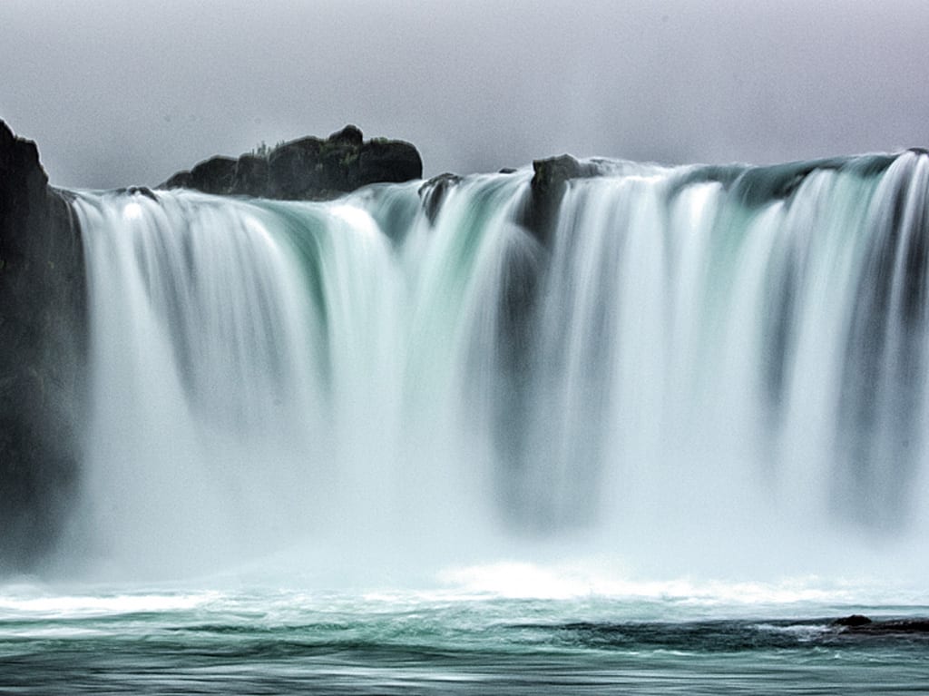
Godafoss up close
Godafoss – practical information
Godafoss is located almost directly on Road 1, between Akureyri and Lake Myvatn, at the point where two roads branch off to the south: 842 on the western side of the river and 844 on the eastern side. Both lead to the Aldeyjarfoss waterfall and further to the famous F26 road – Sprengisandsleid (4×4!). Road 842 is in better condition and is usually the recommended one; 844 is a bit rougher.
There are two parking lots at the waterfall – on its western and eastern banks. You can drive from one to the other by getting back onto Road 1 for a moment, but you can also walk: a separate pedestrian bridge links the viewpoints on both sides of the river. The view from both banks is equally attractive, but the main, better parking lot is on the eastern side, right where road 844 starts by the N1 gas station. From there you can walk down to the very foot of the waterfall, where most photos of Godafoss are taken.
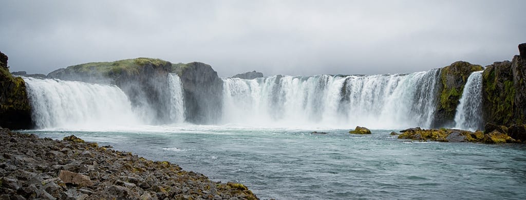
Panorama of Godafoss
By the Fosshóll farm there is a restaurant, a souvenir shop and toilets, and from the parking lots on both banks wheelchair-accessible paths lead to the viewing platforms. In winter, use the eastern side: according to the management plan (PDF, 3.9 MB – a large file and in Icelandic only), the paths and the parking lot on the western bank are not maintained in winter, while the steps down to the river on the eastern side are closed for safety reasons.
When walking on the rocks at the waterfall, use extreme caution. The waterfall creates a mist, so it can be very slippery everywhere, even in sunny, dry weather.
Other waterfalls nearby
Right next to Godafoss is a second, smaller waterfall – Geitafoss. By the time you get this far north in Iceland, you’ll probably have seen so many waterfalls that Geitafoss won’t impress you, and a glimpse of it from the bridge over the river will be enough.
On the other hand, about 40 km (25 miles) to the south, right by the F26 road, lies the beautiful Aldeyjarfoss waterfall. If you have a 4×4 car and umferdin.is (road.is) shows that the F26 is open, it is worth considering a detour there – it is one of the most beautiful waterfalls in Iceland. Allow about 2-2.5 hours to get there and see it. Without a 4×4, we don’t recommend it: rental companies don’t allow cars without four-wheel drive on F roads, and there is a fairly steep climb on the last stretch.
