


Kálfshamarsvík is a cove with beautifully shaped cliffs and basalt columns that formed about two million years ago. According to many tourists, it is precisely these basalt rocks that are the most amazing on the whole island.
History of Kálfshamarsvík
Around 1900 the village of Kálfshamarsvík (its name comes from the name of the cove) was a busy and vibrant fishing place. The local factory produced salted cod for the Mediterranean market. Later, a school was built here, followed by a community house and small shops. Local people bred cows, sheep and even goats here.
Sadly, as a result of the Great Depression of 1930-1940 the village suffered greatly. Due to problems with exports, unemployment soared and the economy weakened. By 1940 the village was nearly deserted (the last inhabitant left in 1961). Another reason that led to the collapse of this place was a rival port that was built near the village of Skagaströnd. You will still find ruins of many households in the area.
Kálfshamarsvík offers a spectacular view of the bizarrely shaped rocks and cliffs on the ocean shore. Today, this place is especially appealing for photographers as its basalt columns form a multitude of angles, shapes and all that comes with a picturesque backdrop. If you want to take photos, remember that the landscape of Kálfshamarsvík is ruled by the tides and any change in water levels will drastically affect the mood of your pictures.
Kálfshamarsvík — practical tips
Kálfshamarsvík is a small cove on the northwest coast of the Skagi peninsula, a short way north of the town of Skagaströnd.
From road number 1 turn north in Blonduos onto road 74, and in Skagaströnd continue on road 745 (Skagavegur), part of the scenic route Nordurstrandarleid, now better known as the Arctic Coast Way. From the ring road it is about 40 km (25 miles) and 40 minutes of driving one way.
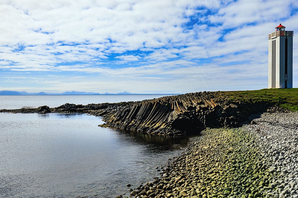
There is an interesting lighthouse on the headland at Kálfshamarsvík. The square concrete tower, 16.3 m (53 ft) tall, was built in 1940 but only lit in 1942, because its lighting apparatus could not be obtained any earlier; the first lighthouse here, a Norwegian cast-iron lantern, had stood on the point since 1913, writes the lighthouse register Sjóminjar Íslands. One has to admit it looks really striking on this fragment of coast.
On the way back to route 1 you pass Thristapar, the three hillocks where the last execution in Iceland took place, and a little farther west, on the Vatnsnes peninsula, stands the rock troll Hvitserkur.
