


Hljodaklettar is a picturesque cluster of diverse rock formations in the Jökulsárgljúfur canyon, part of Vatnajökull National Park, between Dettifoss and Asbyrgi.
The howling rocks
The landscape created by the columnar formations of Hljodaklettar is truly remarkable. Vertical, horizontal and diagonal columns, left where magma cooled inside the volcanic vents, are arranged in a variety of shapes. They form rosettes, swirls, spirals and honeycombs, livening up the traditional, somewhat dull rock shapes.
The effect of the arranging chaos created by nature is the unique acoustic properties of the place – amazing echoes and reverberations. Sound bounces in all directions, traveling from one rock wall to another, like a sonorous spider web. It is this unusual phenomenon that gave birth to the Icelandic name: hljóð means sound, so Hljóðaklettar are the rocks of sound. The national park translates it as Echo Rocks; we have stayed with the howling rocks.
The first rock that shows its face upon entering Hljodaklettar is Kastali (Castle). It is located at the riverbank, and its two main pillars give it a fortress-like form. The next formation is the Tröll (or Troll, of course) guarding the castle, and the next is the Kirkja (Church). It looks like… a perfectly symmetrical arch and is located at the entrance to the cave. In addition to the aforementioned most distinctive rocks, there are several others in the Hljodaklettar area that are definitely worth seeing.
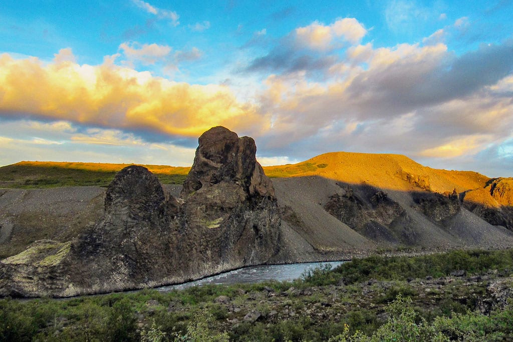
Hljodaklettar at sunset, with the Jökulsá á Fjöllum river below
Walking paths at Hljodaklettar
The picturesque surroundings of Hljodaklettar are conducive to walking. The park has marked five short trails in Vesturdalur, from 1 km (0.6 miles) to 5 km (3 miles); depending on your preference and physical condition, two of them will do for most visitors.
The blue-colored path is about 1 km (0.6 miles) long and should not cause difficulties for anyone, even the elderly and those who do not do any activity on a daily basis. The red path is more difficult and slightly more demanding, and the walk along it takes about 2 hours.
This red path leads to Raudholar (Icelandic: Rauðhólar, literally: Red Hills). This is an elongated line of craters on the bank of the Jökulsá á Fjöllum River, wrapped in a red and black coat of scoria – this is how the whole crater row looked before the river stripped the rest of it bare. It is a place of unusual and unprecedented color in the area – another Martian or lunar face of Iceland.
Hills like these, and even bearing the same name, are also found in the Heiðmörk Nature Reserve, on the southeastern outskirts of Reykjavík.
How to get to Hljodaklettar
Hljodaklettar is located in the valley of the Jökulsá á Fjöllum River, on Road 862, between the waterfall Dettifoss (about 15 km or 9 miles south) and the canyon Asbyrgi (about 9 km or 5.5 miles north). That road is paved the whole way between Mývatnsöræfi and Kelduhverfi, but in winter it gets only limited service, and the gravel road 864 on the eastern bank of the river closes as soon as the snow arrives.
The campsite in Vesturdalur, right by the rocks, is for tents only and open from early June to mid-September. There is drinking water and there are toilets, but no electricity, no hot water and barely any phone coverage.
The red and black slopes of Raudholar can be seen from nearby, and from the parking lot it is a short drive to the rest of the canyon: Selfoss lies just upstream of Dettifoss, and the whole of Jökulsárgljúfur belongs to Vatnajökull National Park.
