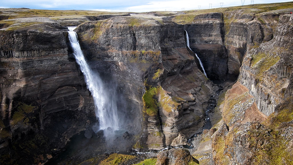
Háifoss, or High Waterfall, is Iceland’s fourth-highest waterfall and certainly one of the prettiest. It’s a bit off the beaten track, but well worth a look – especially since you’ll find several other attractions nearby.
The beautiful High Waterfall with… a neighbor
Haifoss (literally: High Waterfall) is 122 m (400 ft) high (according to Visit South Iceland), which makes it the fourth-highest waterfall in Iceland. It’s clearly lower than the top three: Morsárfoss (240 m / 790 ft), Glymur (198 m / 650 ft) and Hengifoss (128 m / 420 ft). Still, it’s by far the easiest of the four to reach. Morsarfoss is basically inaccessible to tourists – it lies high in the mountains, on a glacier (which is why it was discovered only recently). Seeing Glymur takes a hike of several hours, and Hengifoss also requires a walk up a trail. Meanwhile, the Haifoss parking lot is no more than 100 m (330 ft) from the viewpoint, so seeing the waterfall really is easy.
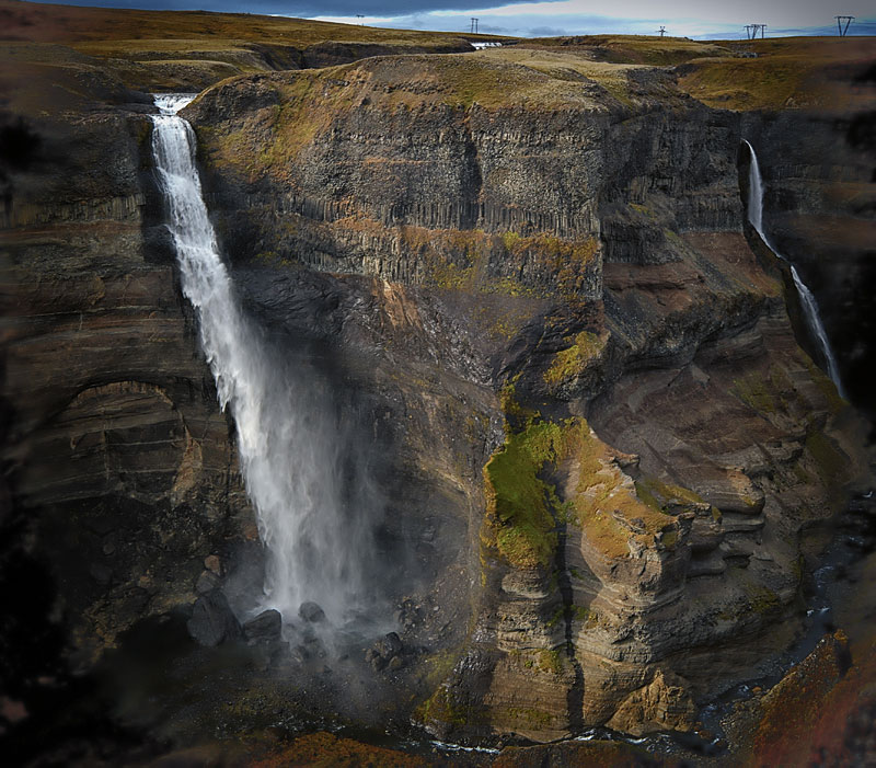
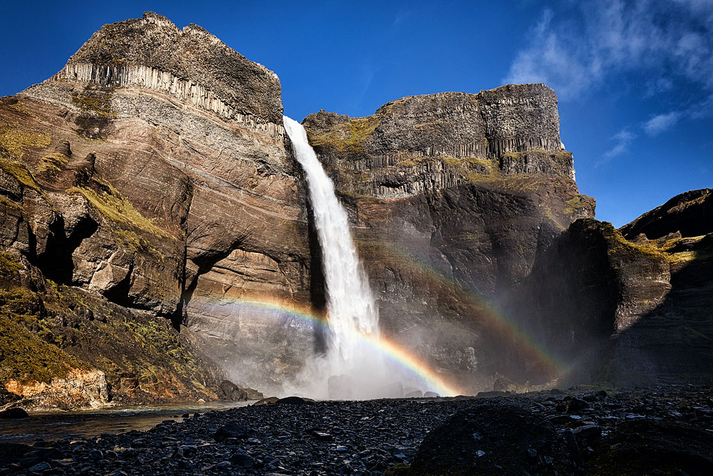
Besides, even if Haifoss isn’t the highest, it’s still very impressive. Luckily, the viewpoint is in a spot from which the waterfall looks truly beautiful. The striking layers of rock in the cliff it drops from add to its charm. These rocks are nearly 2 million years old and, of course, volcanic in origin.
The “godfather” of the waterfall is Icelandic geologist Helgi Pjeturss (1872–1949). Interestingly, Pjeturss was the first Icelander to earn a doctorate in geology. It was he who, as late as 1912, gave the previously nameless waterfall the name Háifoss (formerly: Háafoss). The neighboring, smaller waterfall was named Granni (literally: neighbor) by Pjeturss’ colleague, the Frenchman André Courmont. Both waterfalls are on the same stream, which splits in two only about 500 m (1,600 ft) before the falls. Since 2020, Háifoss and Granni have been protected as a natural monument within the Þjórsárdalur landscape protection area (Náttúruverndarstofnun).
Because of the weather and ease of access, summer is the best time to visit Haifoss.
Attractions near Háifoss
Haifoss lies near the distinctive bend of Roads 32 and 26, east of the town of Fludir and north of Hvolsvöllur. This is the route almost everyone takes to get to Hrauneyjar and then south to Landmannalaugar or north along the F26 (Sprengisandsleid) toward Myvatn. Tourists driving from the Golden Circle toward Vik, however, usually skip this area. And yet, coming here you can see not only Haifoss itself but also several other attractions nearby.
Certainly the most important, largest and most distinctive thing you’ll see on a trip to Haifoss is Hekla. Of course, like everywhere in Iceland, there are many volcanoes scattered around Háifoss, but none of them can compare with the mighty and somewhat solitary Hekla, clearly visible south of the waterfall. It’s one of Iceland’s best-known and most explosive volcanoes, and it was still erupting quite regularly in the late 20th century. If you’re heading its way, be sure to read our separate article: Hekla – the Queen of Iceland’s Volcanoes. The road that takes you to the area around Hekla – from where you can even climb up to the volcano’s ridge – begins about 10 km (6 mi) south of the turnoff to Haifoss.
Besides Hekla, you’ll find these other notable places near Haifoss:
- the historic Viking Age longhouse at Stong (destroyed by hot ash from Hekla nearly 1,000 years ago);
- the low but curiously wide Gjain waterfall, in a beautiful fairytale valley;
- the pretty double waterfall Hjalparfoss;
- Thjofafoss – Thieves’ Waterfall, a little further south, accessible from Road 26;
- also worth a stop: Highland Center Hrauneyjar – the last outpost of civilization before the wild interior, with its distinctive sign “next gas station in 243 km” (151 mi).
How to get to Háifoss
Haifoss is in the Fossárdalur valley in South Iceland, roughly halfway between Fludir and Hrauneyjar.
There’s a parking lot near the top of the waterfall, and a short path leads from it to the viewpoints. Be extremely careful here – in bad weather, but in good weather too!
You reach the parking lot via Road 332, which branches off north from Road 32. In winter, neither road is cleared of snow in this area, so you may not be able to get there when there’s snow on the ground.
In summer, Road 32 (paved) is easily passable for any car, while Road 332 is gravel and somewhat steep in places. A 4×4 will handle it without the slightest problem, but a regular car should make it too, as long as you drive carefully (the road is about 8 km / 5 mi long).
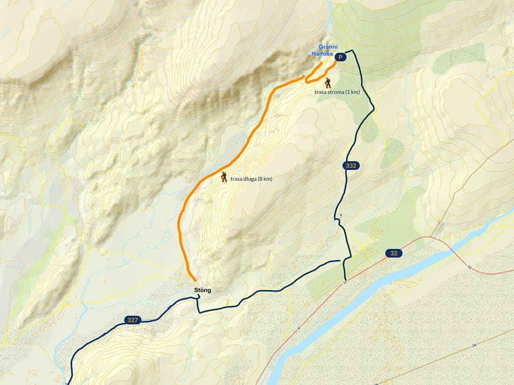
Map of the Haifoss waterfall area
© Based on data from National Land Survey of Iceland
Trails to the foot of Háifoss
You can also see Haifoss from below, but it takes some effort. Two trails lead to the foot of the waterfall.
The shorter but steeper route to the foot of Haifoss starts at the parking lot at the top. It heads about a kilometer (0.6 mi) southwest along the edge of the canyon to a spot where you can finally descend the slope. The descent is steep: you drop almost 100 m (330 ft) over about 300–400 m (1,000–1,300 ft). The path is narrow, sandy and gravelly, so watch your step on the way down. At the bottom of the canyon, the trail turns back northeast toward the waterfalls, and after about 500–800 m (1,600–2,600 ft) you reach the foot of Haifoss. You return to the top the same way, and the round trip takes about 1–1.5 hours (with almost 150 m / 490 ft of elevation gain).
The gentler trail starts near the historic Stong longhouse on Road 327. Unfortunately, from this side you have to walk as much as 8 km (5 mi) one way, and only the first 2–2.5 km (1.2–1.6 mi) follow a comfortable path. Beyond that, the route enters the stream valley and you’re on your own, most likely fording the stream more than once. The final 2 km (1.2 mi) are especially demanding: there the stream flows through a narrow gorge with a fast, strong current. All in all, it’s quite a difficult hike taking almost half a day.
Whichever route you choose, the view of the waterfall from below and the walk through the valley that leads to it are sure to make for an unforgettable experience. Just remember to bring a rain jacket – it’s hard to stay dry when you’re watching the waterfall from below…
Photos of Háifoss
Haifoss is really big, and the canyon it plunges into is very impressive too, although that scale is hard to capture in photos. Look for the tiny red dot in the corner of one of the photos – it’s a hiker, and it gives you an idea of how big this place is.