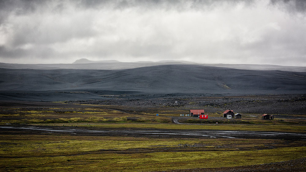
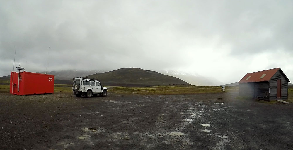
Nýidalur is a great place to stop while traveling across the Icelandic highlands. It is the perfect place to experience the truly remote, often extreme conditions of the Icelandic interior. See what unique attractions it offers.
A valley in the highlands – a beautiful, intriguing place
 Nyidalur (New Valley) or Jokuldalur (Glacier Valley) are two names for the same valley in the Icelandic highlands, jutting into the Tungnafellsjokull glacier massif, between the larger ones: Vatnajokull to the east and Hofsjokull to the west. The valley lies about 820 meters (2,700 feet) above sea level and is already inside Vatnajokull National Park.
Travelers have been crossing Sprengisandur for centuries, but the valley itself is a fairly recent discovery. The old route through the desert ran considerably further west, so Nyidalur stayed unknown until farmers from Bardardalur went looking for their sheep further than usual. They called it Jokuldalur, others later called it Nyidalur, and both names are in use to this day.
The volcano Bardarbunga (Bárðarbunga) can also be seen from here. Its latest eruption, which lasted from August 2014 to February 2015, was the largest lava eruption in Iceland in some 230 years. To this day, smaller earthquakes are recorded there almost constantly.
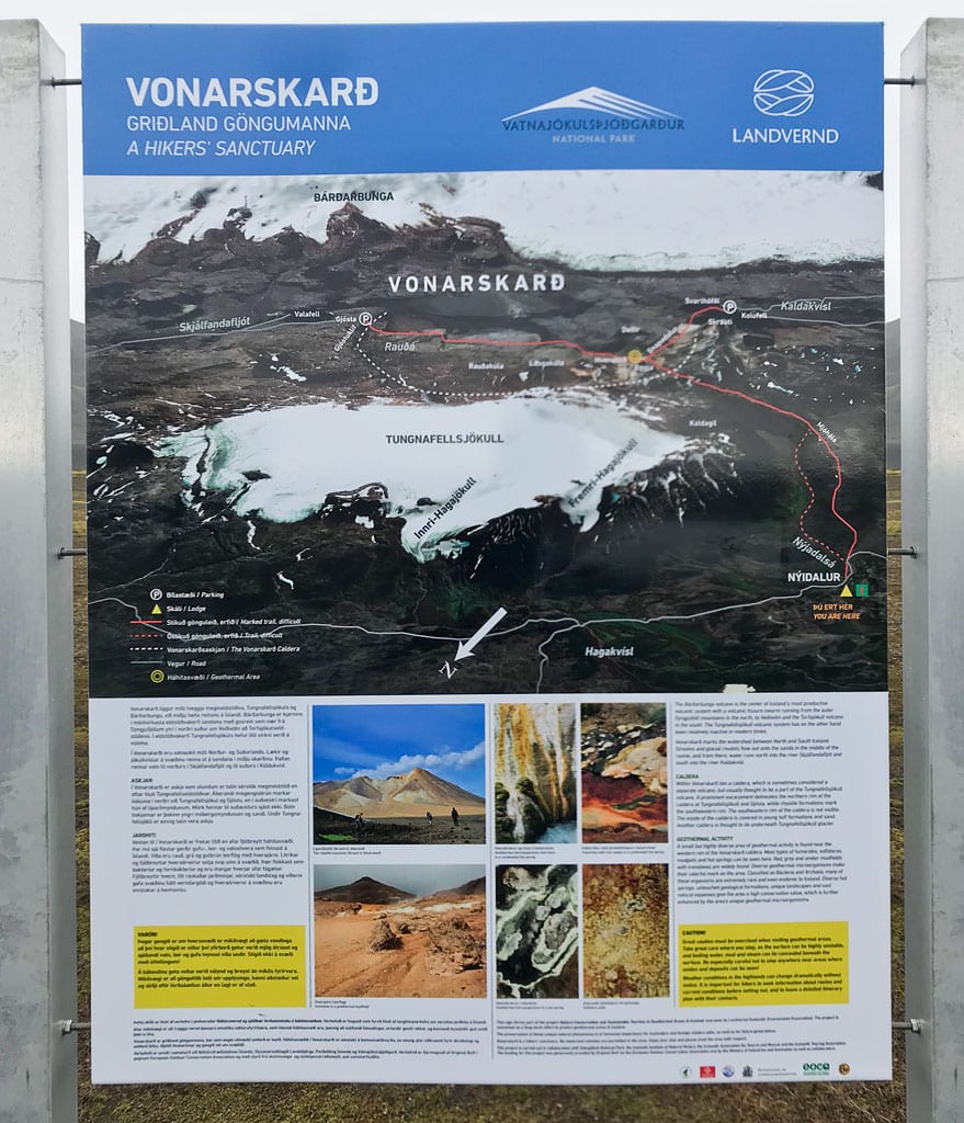
To the east of the hut lies the Vonarskard caldera, with many beautiful places around it. These include the Hverabotn hot springs, the “smoking” little valley of Snapadalur, the mountain lake Kviarvatn and a good number of small volcanic cones. You can take in the surroundings from two parking areas – Gjósta and Svarthöfði.
It is worth spending at least one or two nights here, camping or renting a bed in the hut. All the more so because the hut is an excellent base for hiking – to the geothermal areas in and around Vonarskard, for instance, or further afield among the top places of the Icelandic interior.
The FI hut and campsite at Nyidalur
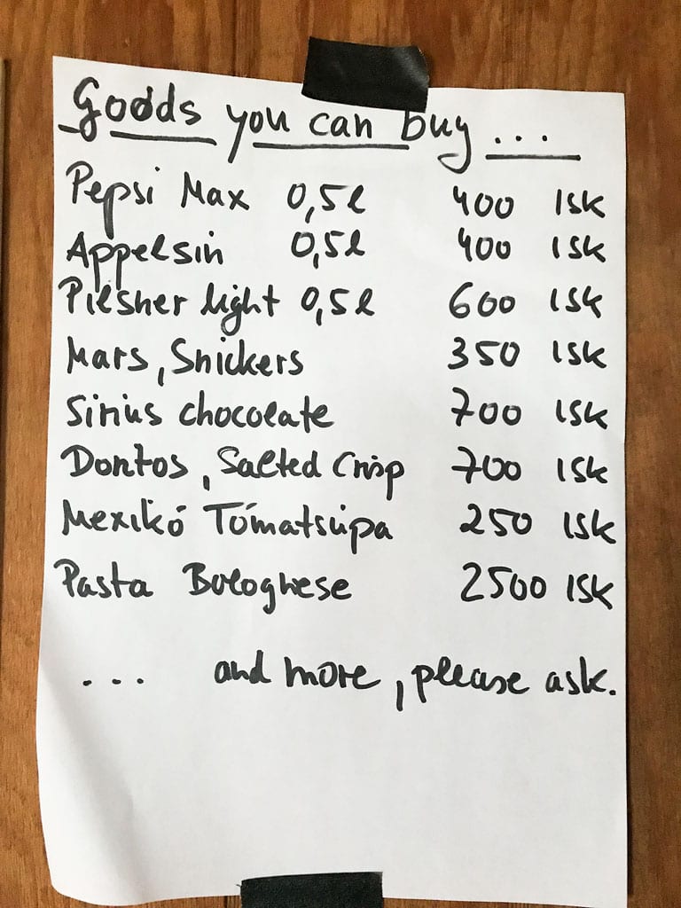
Menu at the Nyidalur hut
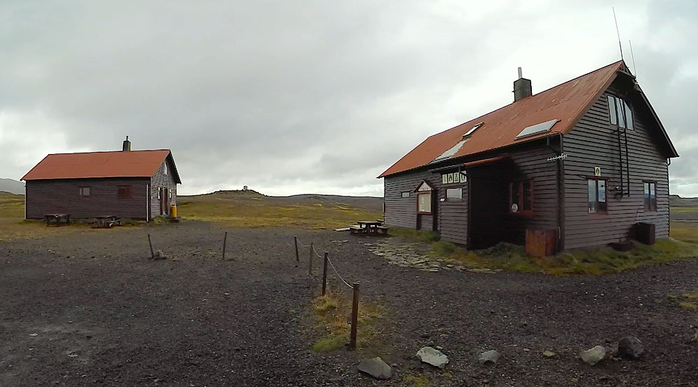
The Iceland Touring Association (FÍ – Ferðafélag Íslands) runs the hut at the mouth of the Nýidalur valley. The two buildings are built in a similar way and sleep 54 people in total; the first of them went up in 1967. On the ground floor there is an entrance, a well-equipped kitchen, a large dorm with bunk beds and the warden’s room, and upstairs are sleeping lofts with mattresses.
A campsite also operates next to the huts. As befits the middle of the wild interior, neither the hut nor the campsite offers any luxuries. Simple but clean bathrooms are set up in a separate building close by. A small kitchen and a dining room in the hut are available for guests’ use.
Contact for the hut: +354 860 3334 (a warden is present only during the season). Vatnajokull National Park rangers have a base here too and will tell you about routes and conditions – +354 842 4377.
The hut also offers a narrow selection of the most basic supplies – sodas, candy bars, canned soup, pasta and the like, depending on availability. That little shop and a storeroom take up part of one of the two buildings, which is why neither building can be rented whole – and in this corner of the highlands the hut is the only roof there is.
Nevertheless, you will pay for EVERYTHING at the hut by card.
Prices for overnight stays (2026)
- hut: 15,000 ISK ($125) per person;
- campsite, your own tent: 3,400 ISK ($28) per person;
- shower: 1,100 ISK ($9);
- facility fee for day visitors using the toilets: 700 ISK ($6) – included in the hut and campsite price.
Price list of the Iceland Touring Association, valid from May 1, 2026 to April 30, 2027 (prices September 2026).
Hiking routes from the FI Nyidalur hut
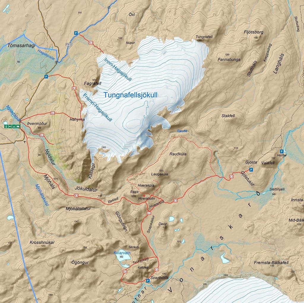
Map of Nyidalur area
- Route: Nýidalur
Length: 3 km (1.9 miles); time: 1-2 hours; difficulty: demanding (red)
The shortest trail near Nýidalur and an easy walk in itself – the red grade comes from the streams you have to wade. - Route: Tómasarhagi – Háhyrna – Nýidalur.
Length: 10 km (6.2 miles); time: 3-4 hours; difficulty: difficult (black)
Route to the summit of Háhyrna via Thvermodur (Þvermóður) or Fremri-Hagajökull; elevation difference of about 750 m (2,500 feet). Beautiful views of the mountain and the Tungnafellsjökull glacier and highlands. - Route: Innri-Hagajökull
Length: 2 km (1.2 miles) one way; time: 2 hours; difficulty: demanding (red)
A pleasant ascent on a gentle slope, between glacial moraines to Innri-Hagajökull. Passing near the glacial tongue. - Route: Nýidalur – Vonarskarð – Nýidalur.
Length: 12.5 km (7.8 miles) one way; time: 10 hours; difficulty: demanding (red)
The most interesting, though challenging and all-day route. The trail leads along the Mjóháls ridge to the Vonarskarð caldera and on to the Hverahlíð geothermal area, with its characteristic rock formations. Beautiful views of Nýidalur and Tungnafellsjökull. - In summer, the Nýidalur hut organizes a short walk with a park ranger every day at 8:30 pm. The guide walks with guests through the area for 30-60 minutes, describing the nature and history of the area. He also points out worthwhile attractions and interesting routes for the following days.
Due to the short distance, such a tour will also be great for children and the elderly.
How to get to Nyidalur
Nyidalur is located almost in the middle of the F26 road cutting Iceland in half, in a north-south direction. Getting here is only possible in a four-wheel-drive car, but the streams and fords on the road are not particularly difficult or deep (but it’s wild Iceland, so anything is possible), so it doesn’t need to be a particularly powerful or high-clearance car.
The huts are usually open from early July to early September, and the exact dates depend on when the Icelandic Road Administration opens the F26 after the winter (Ferðafélag Íslands).
Coming from the south you pass the Highland Center Hrauneyjar, where the national park and the Environment Agency keep an information desk in summer. When driving on the F26, it’s worth deviating to the F752 and F881 roads if possible, and resting at the hot spring by the Laugafell hut.
In summer you could once get here by bus as well, on the route from Reykjavik and Landmannalaugar to Myvatn via the Sprengisandur route, the F26 road.
Photos from Nyidalur