B
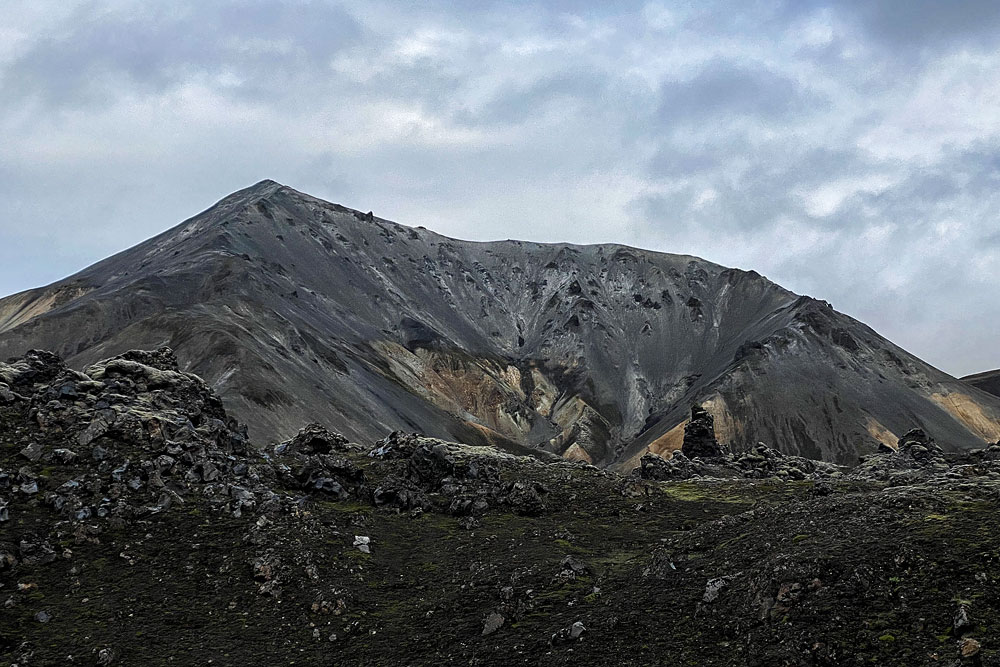
rennisteinsalda as much as possible counts as an active volcano – its last eruption took place in 1961….

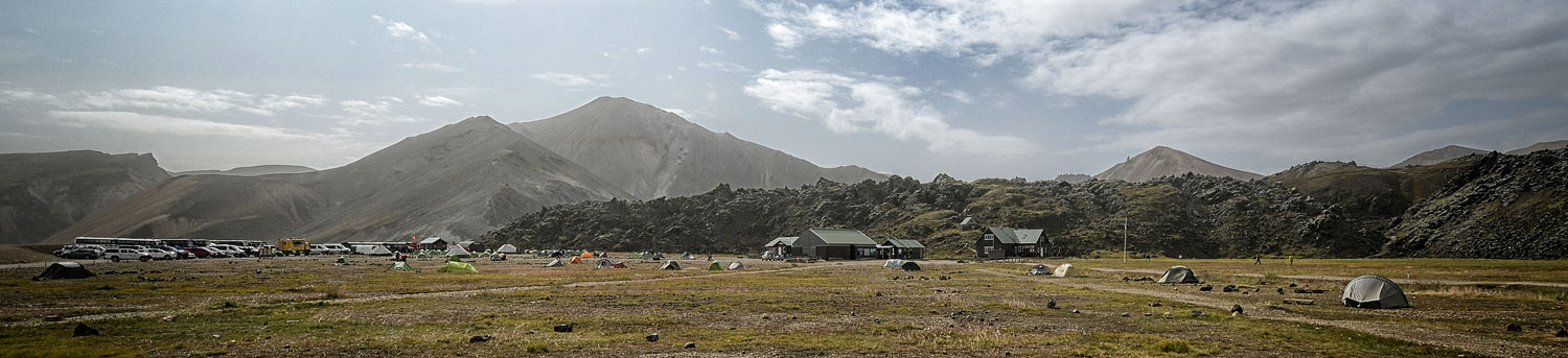
Landmannalaugar is a rather vast, stunningly beautiful area located in the southern part of the Icelandic Highlands (isl. Hálendið, in the Friðland að Fjallabaki nature reserve. For centuries it has been a place of refuge and respite for travelers, and today it is one of the most popular destinations, attracting lovers of beautiful views and hiking.
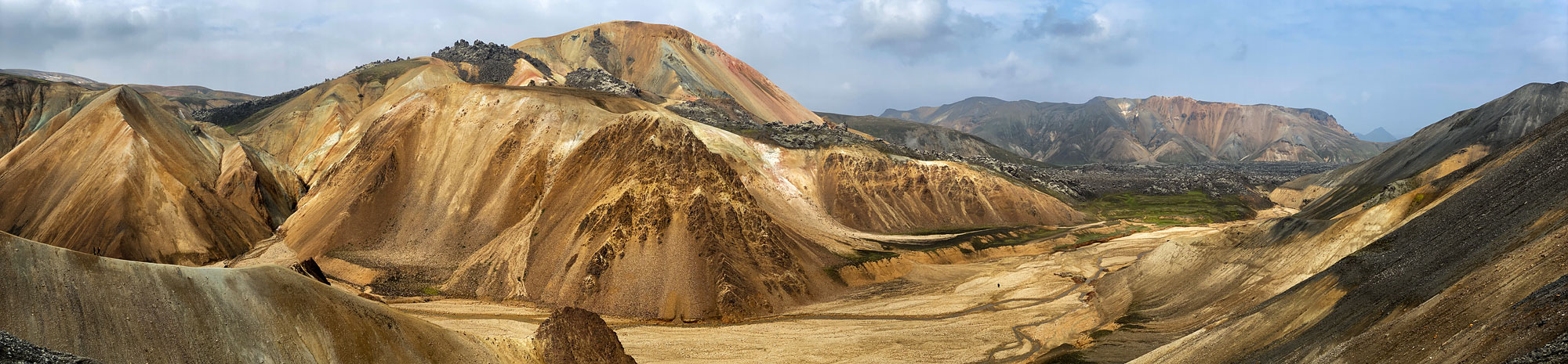
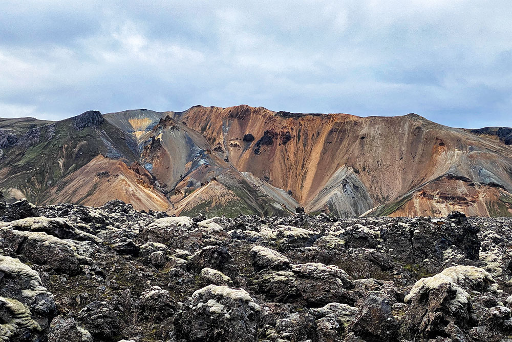
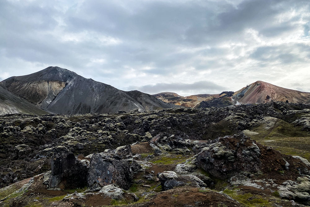
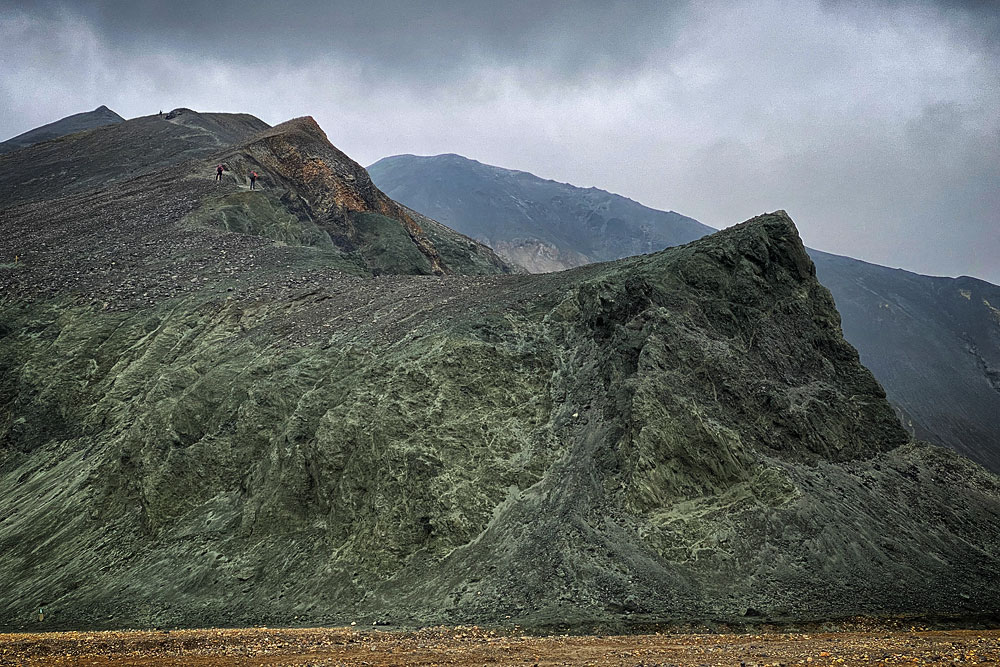
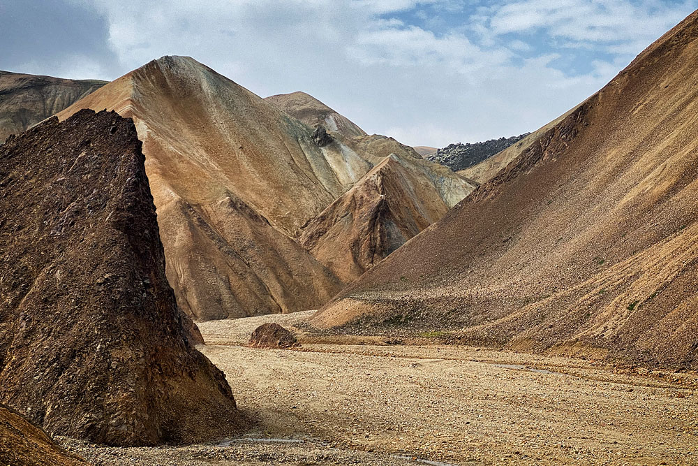
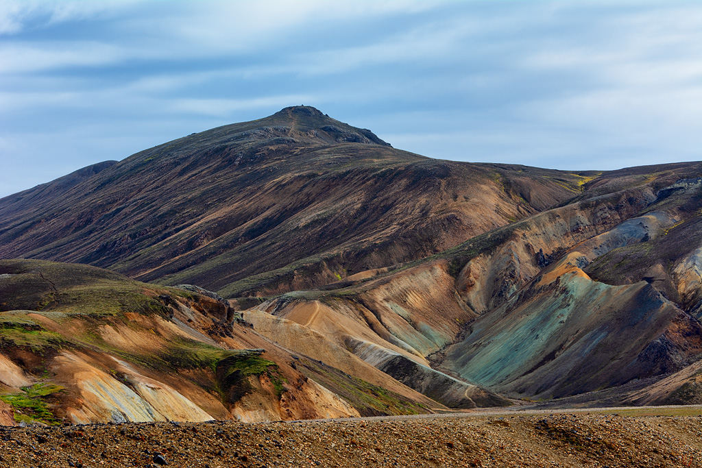
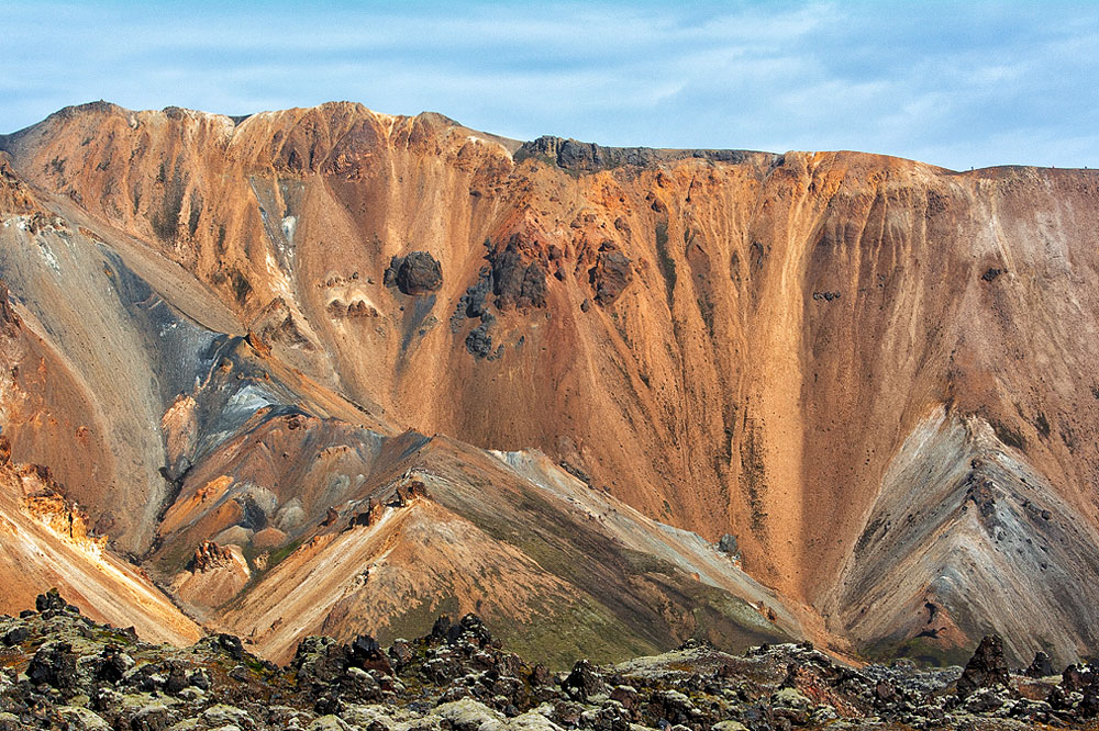
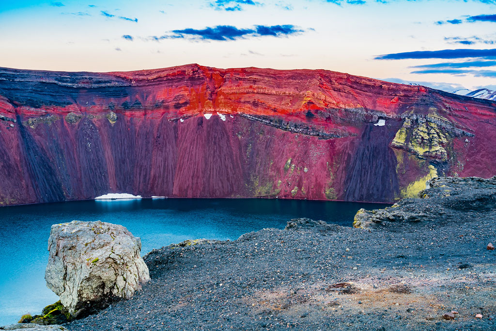
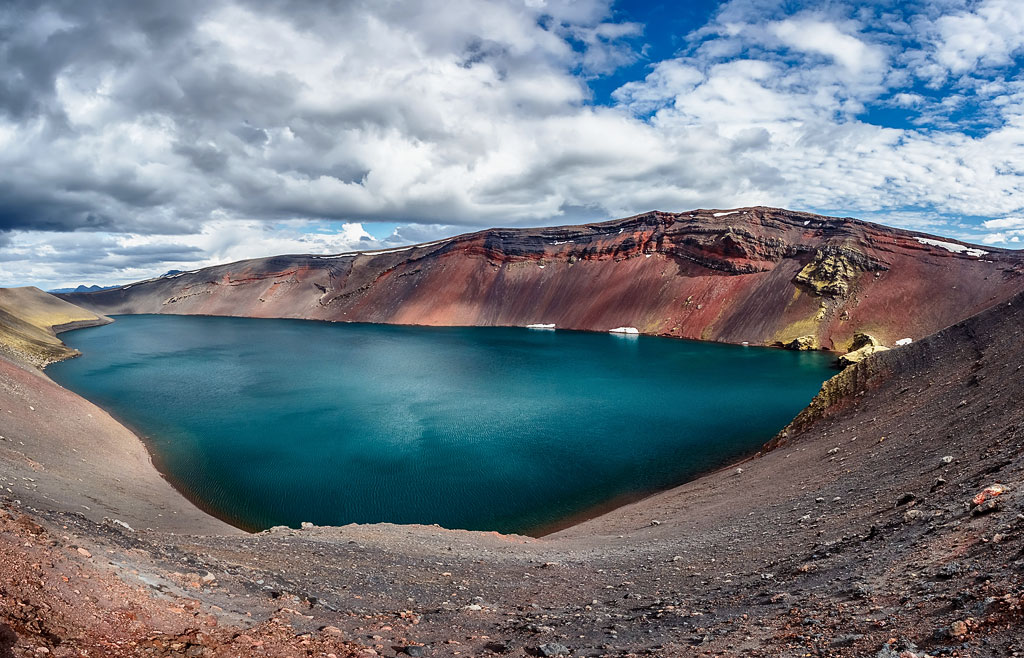
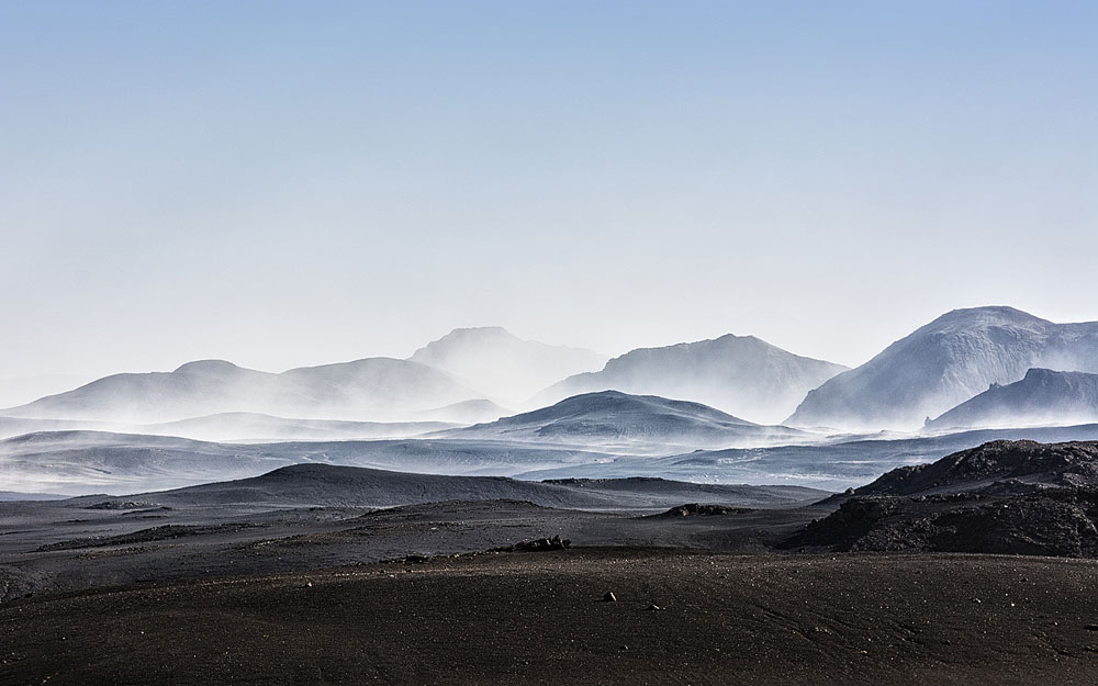
Landmannalaugar is truly unique, both geologically and aesthetically. It consists of windswept rhyolite mountains (of volcanic origin), creating an extraordinary spectrum of colors – from shades of red and pink, through greens and blues, to golden yellow. At the foot of the mountains, in turn, lies the ebony-black Laugahraun lava field – a vast area of cooled magma from the eruption of the Brennisteinsald volcano around 1477.
The area around Landmannalaugar is also home to falcons and pardvas – two of Iceland’s best-known species of mountain birds. Pardvas are an important food source for falcons, especially in spring, when the winter-white plumage of the male pardva stands out against the dark ground. The parda birds can be hunted in late autumn. Falcons, on the other hand, have been protected by law since 1940.
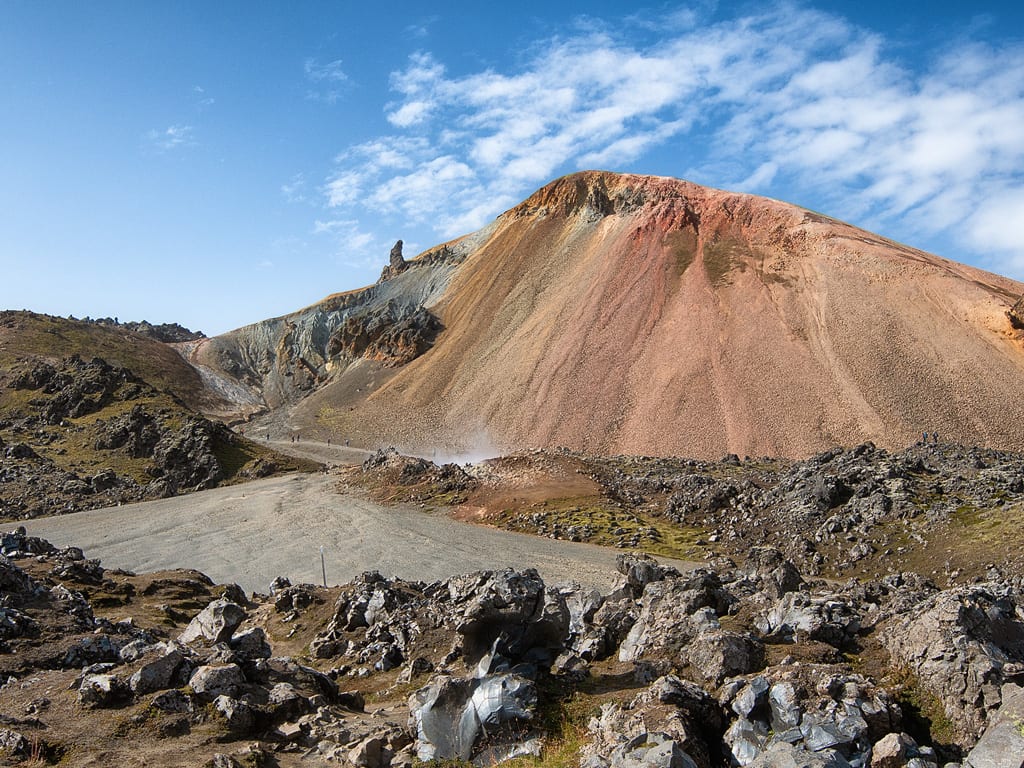
Brennisteinsalda Volcano
The distinctive feature of this mountain is precisely its magnificent coloration. Blue ashes, black lava, green mosses and red islands formed by iron make this place truly picturesque. From the top of the hill there is a magnificent view of Landmannalaugar and its surroundings.
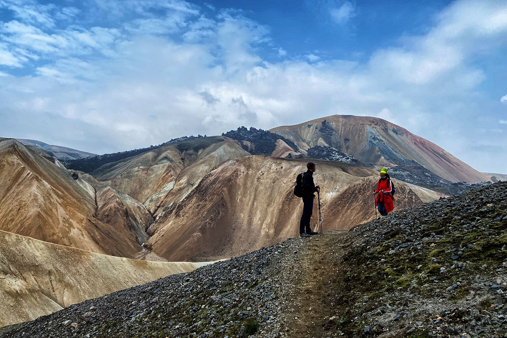
Other most distinct and picturesque elements of this landscape are: Sudurnamur – a “wall” of colorful mountains north of Brennisteinsalda, Blahnukur – a beautiful, completely black volcanic peak on the south side, Graenagil – a small stream gorge at the foot of Blahnukur and the lava field itself lying in a cauldron between all these attractions – Laugahraun.
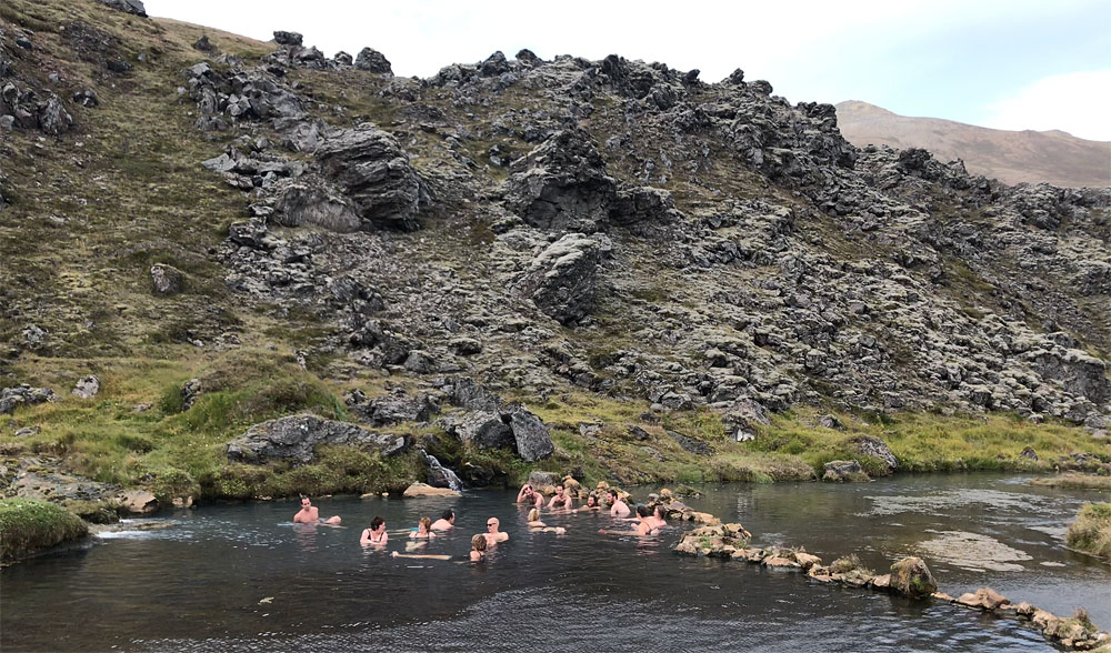
Complementing the unique climate of Landmannalaugar is an extremely charming hot spring. A nice and practically completely wild, and extremely photogenic hot pond has been created at the place where the hot and cold streams join their waters, just below the about 15-meter high wall of solidified Laugahraun lava. A wooden platform with benches and hangers was built next to it for the convenience of tourists, but the pond itself remains completely natural.
Video: Camping and the hot spring at Landmannalaugar.
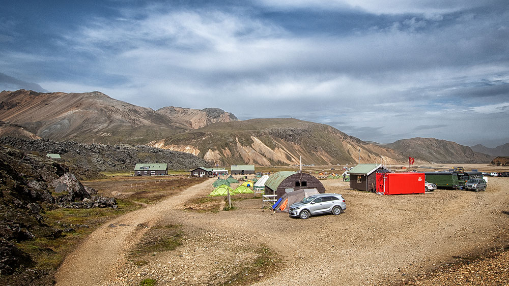
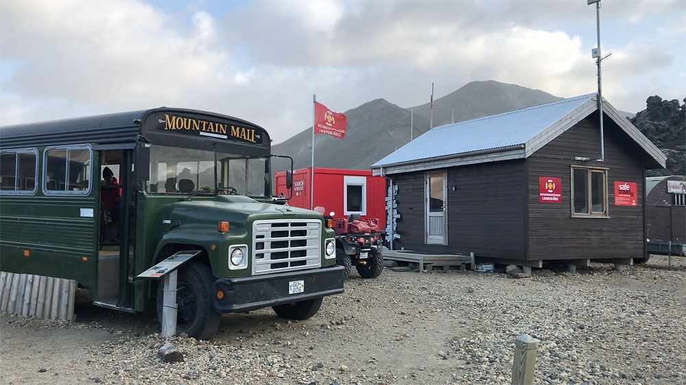
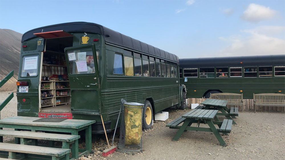
From mid-June to mid-September, a hostel, a campground, as well as a store and a small restaurant in suitably converted demobilized buses operate right next to the lava field.
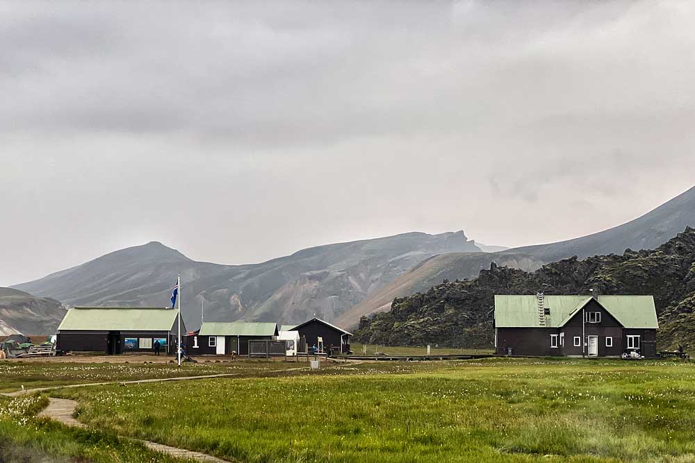
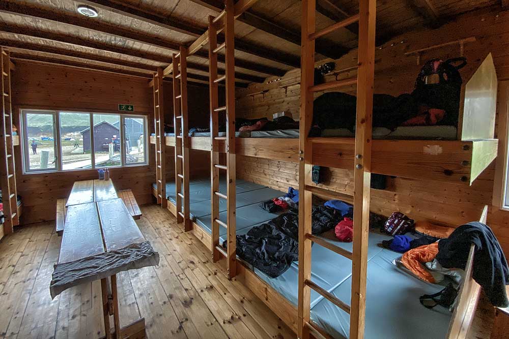
Landmannalaugar hut (far right)
The standard of bedroom does not differ from that found in other FI huts. The bunk beds are set on a kind of platforms. On these platforms, individual mattresses are placed right next to each other, without any partitions or divisions. On the ground floor there is one very large room (about 30 people, here the platforms are two-story), and on the first floor there are three smaller rooms. In the bedrooms there are also tables with benches that allow you to comfortably eat, play cards or repack your backpack.
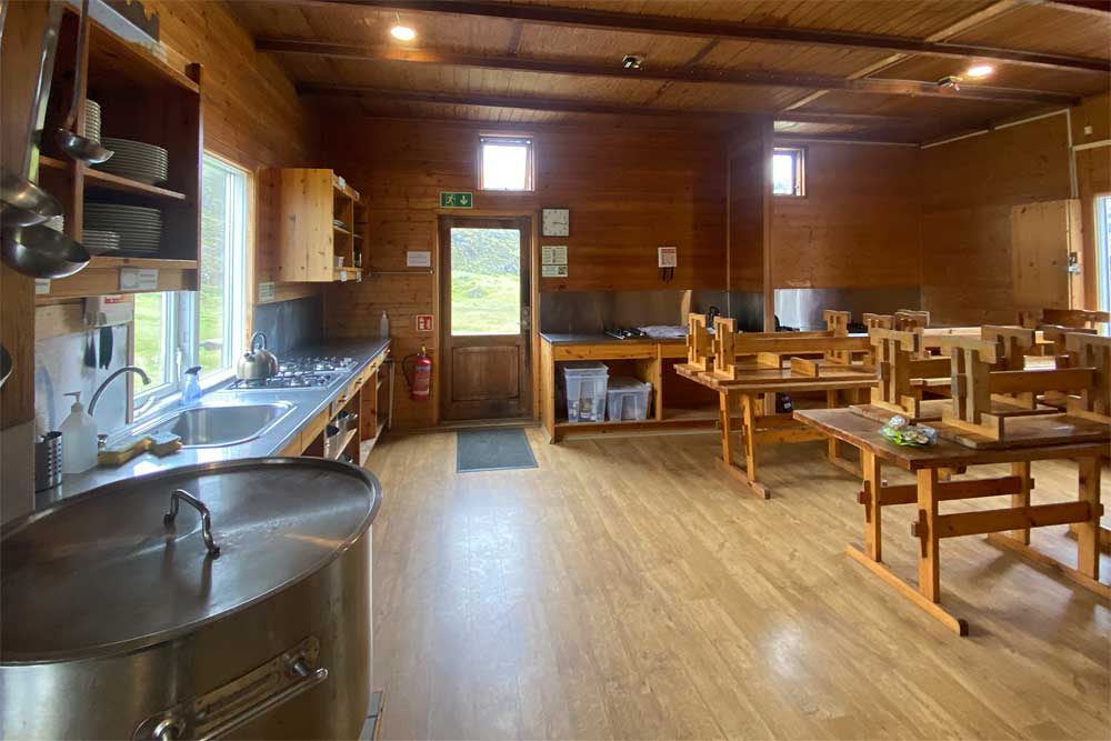
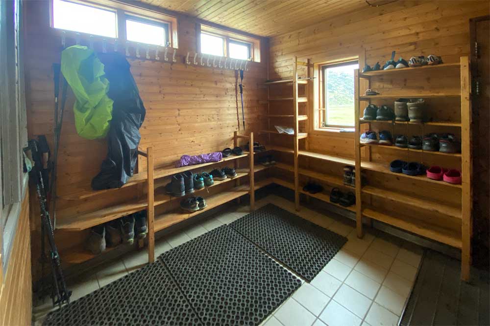
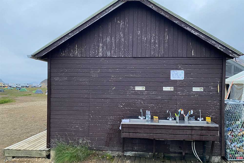
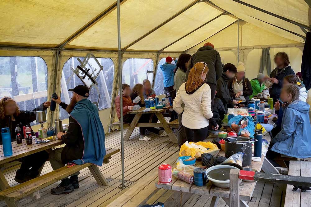
In addition, on the ground floor there is a spacious hall with a drying room and a large, fully equipped kitchen with kitchen utensils and access to hot and cold water as well as tables and benches for dining. You can go out to a kind of terrace, directly from the kitchen, where guests can also use the barbecue.
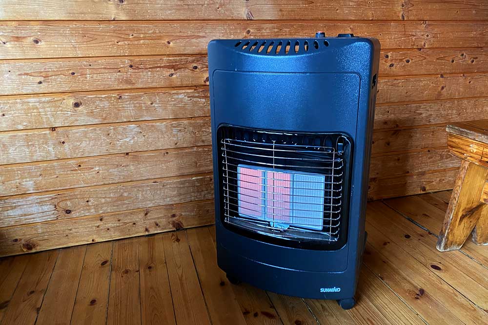
The hut is heated, but not always – depending on weather. Sometimes additional gas stoves are available.
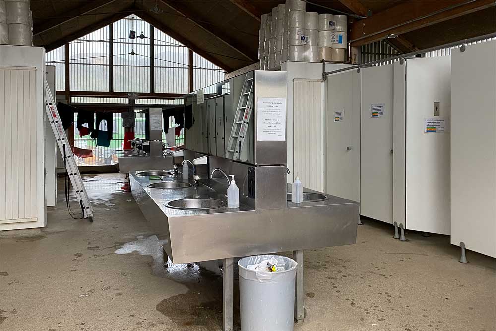
There are no showers or toilets in the hut. Guests use the same amenities as everyone else, in a separate building. The shower is also extra (500 kr), same as for everyone. On the other hand, people who do not stay overnight in the hut are not allowed to enter and cannot use the kitchen or drying room.
There are also no electric sockets in the hut for guests use. This is standard in mountain huts in Iceland, but it is worth remembering. You can charge your phone at the bus store, for a fee.
Landmannalaugar is a popular starting point for the Laugavegur trail. Many organized groups start their Laugavegur tour with an overnight stay in this hut. In many of these groups people hike from hut to hut with minimum backpacks, and their luggage is transported to the next hut by an accompanying super jeep. So they have a lot of luggage (incl. food) and if more than one such group is staying at the hut, the kitchen gets very busy and crowded easily.
Accommodation in the hut costs the same as in other huts on the Laugavegur trail, i.e. 11,000 ISK – about $85 per person per night (2023). Reservations can be made via Ferðafélag Íslands.
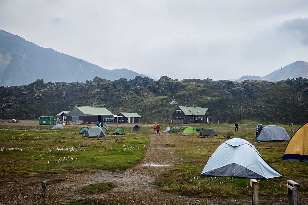
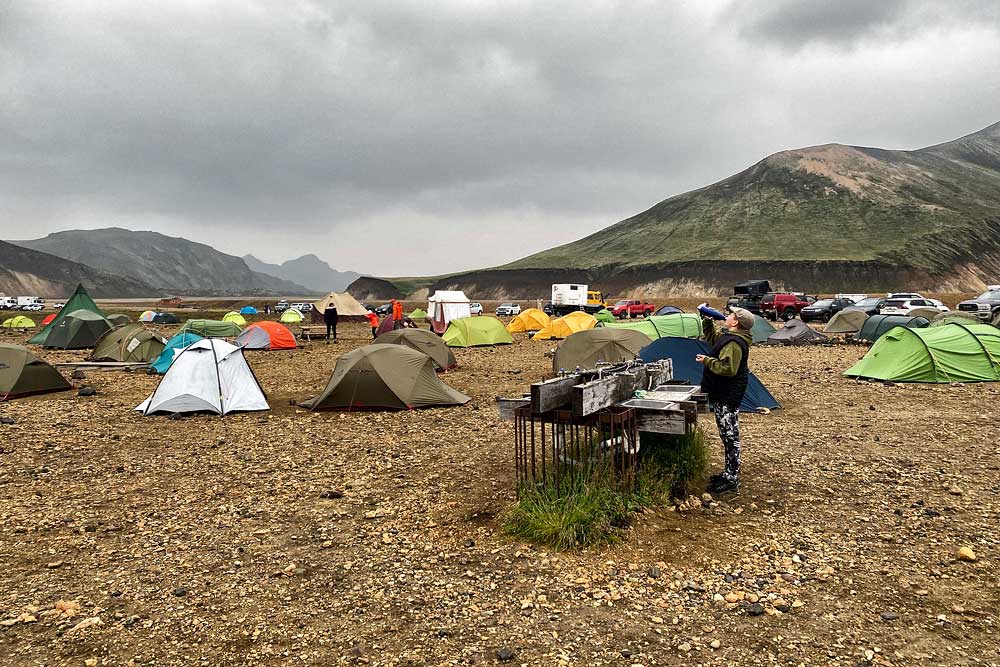
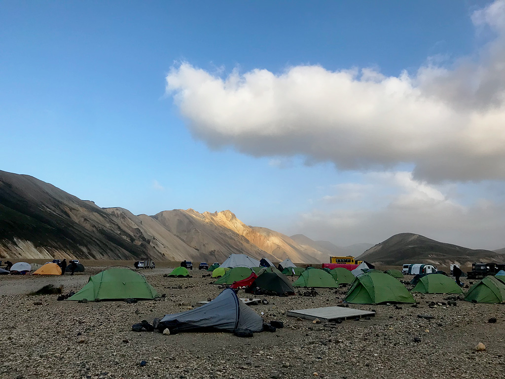
Landmannalaugar campsite (in Google Maps marked as Brennisteinsalda camping) has a lot of advantages, but also some disadvantages.
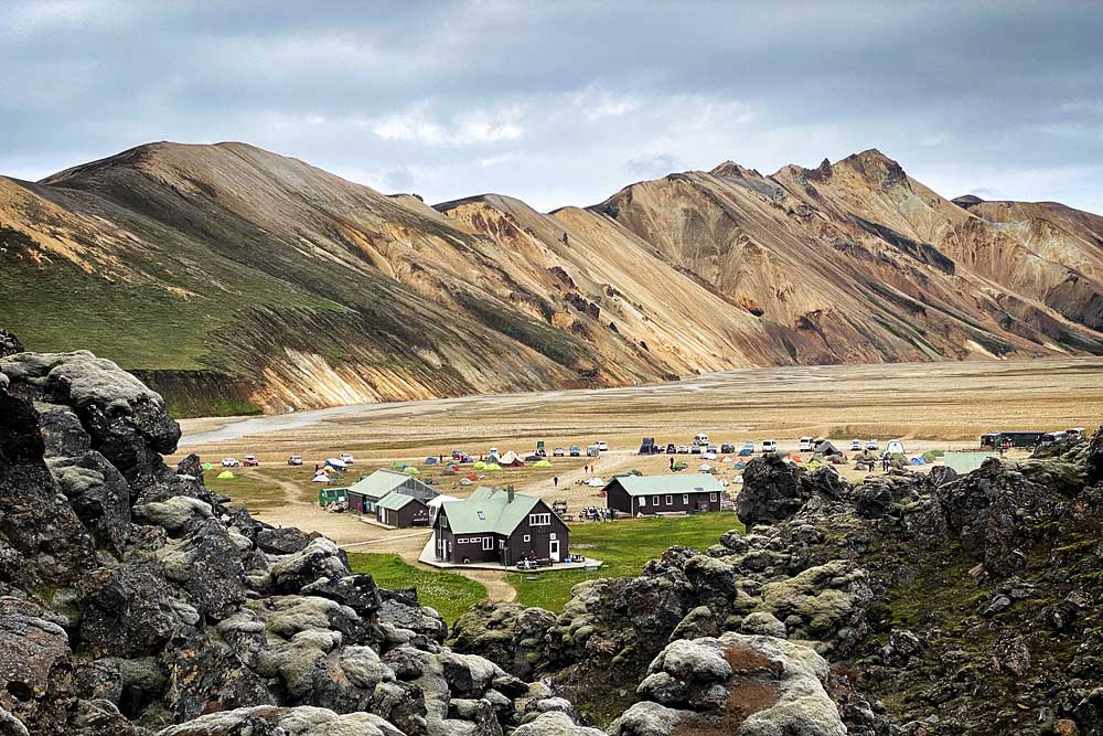
view of the campsite from Laugahraun
There is also a ‘canteen’ tent for all hikers, which provides good protection against rain, moderate protection against wind, and quite negligible against cold. The mere existence of this tent is certainly an advantage (e.g. in Alftavatn there is not a covered place for hikers to cook and dine), but given the popularity of this campsite, such a tent is definitely too small and “at peak hours” it is quite crowded.
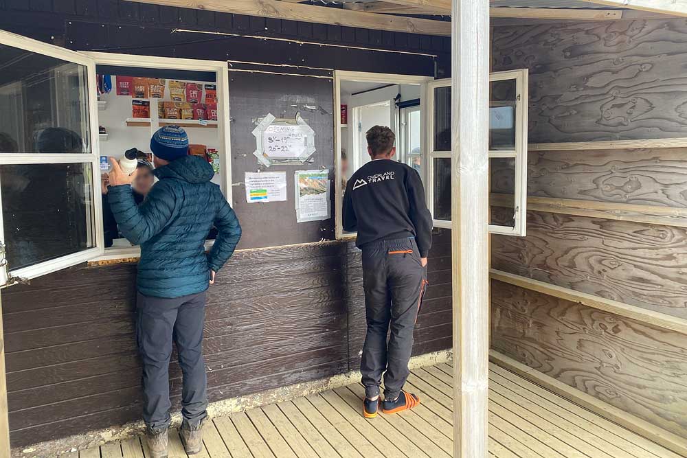
The list of advantages is complemented by a quite large shop (or even two), a bar/restaurant, the possibility to get here by regular buses and quite well-functioning 4G coverage (rather rare a thing in the interior). In the store (for a fee) you can also charge your phone, which is a unique exception above the interior standards.
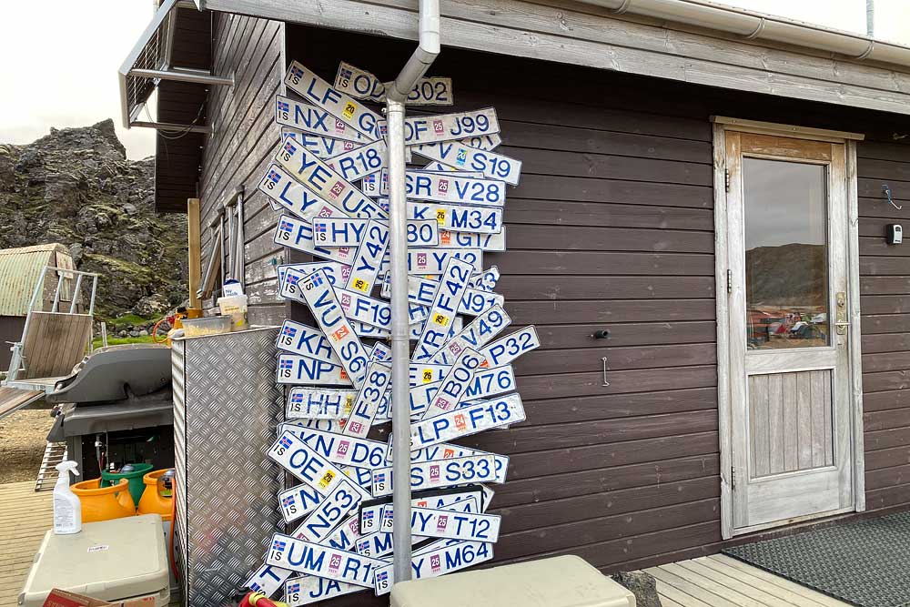
There is also a mountain rescue team here, so help is close at hand if needed. The lifeguards office is located next to the main/old store. It is easy to recognize by the rescue quads and off-roaders parked nearby, and by the registration plates decorating one of its corners (lost by tourists in the ford in front of the campsite).
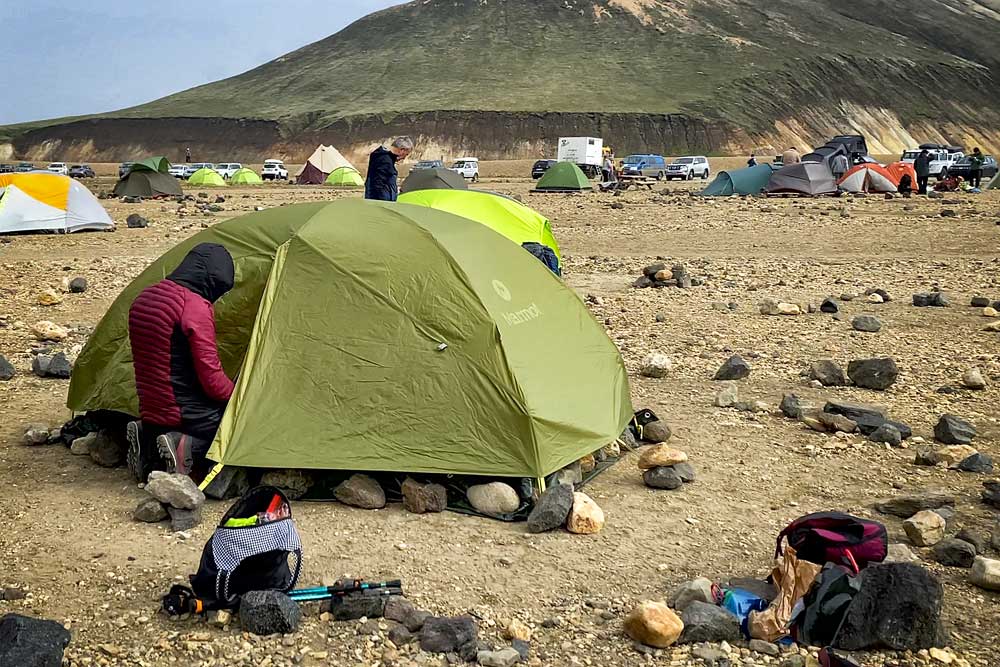
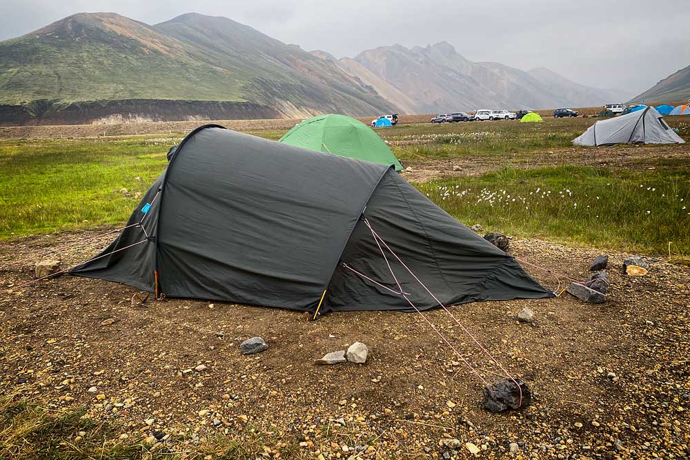
On the downside the campsite itself should be noted. People sleeping in motorhomes may not even notice it, but pitching a tent on the ground is a bit of a challenge here. The ground is stone and gravel and very hard, and it is really difficult to drive a pin or a peg into it. The northern part of the campsite is a bit greener / with more grass, but the ground is also very hard. That’s why stones are used a lot – either to add weight to poorly holding pegs, or simply to replace them. There are plenty of stones to use, and the information that they should be returned to special crates is a kind of a legend – no one bothers to do that and it would be counter-productive, TBH.
Unfortunately, the campsite is quite open to north and south winds, so it can get very windy here. You can see some tents that couldn’t cope with the wind…
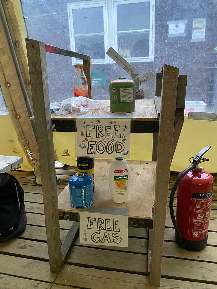
The shelf with leftover food and gas, which we can use for free, is usually empty or almost empty. Remember that for majority of tourists, this campsite is the beginning of the journey, not the end, so no reason to leave food or camping gas behind.
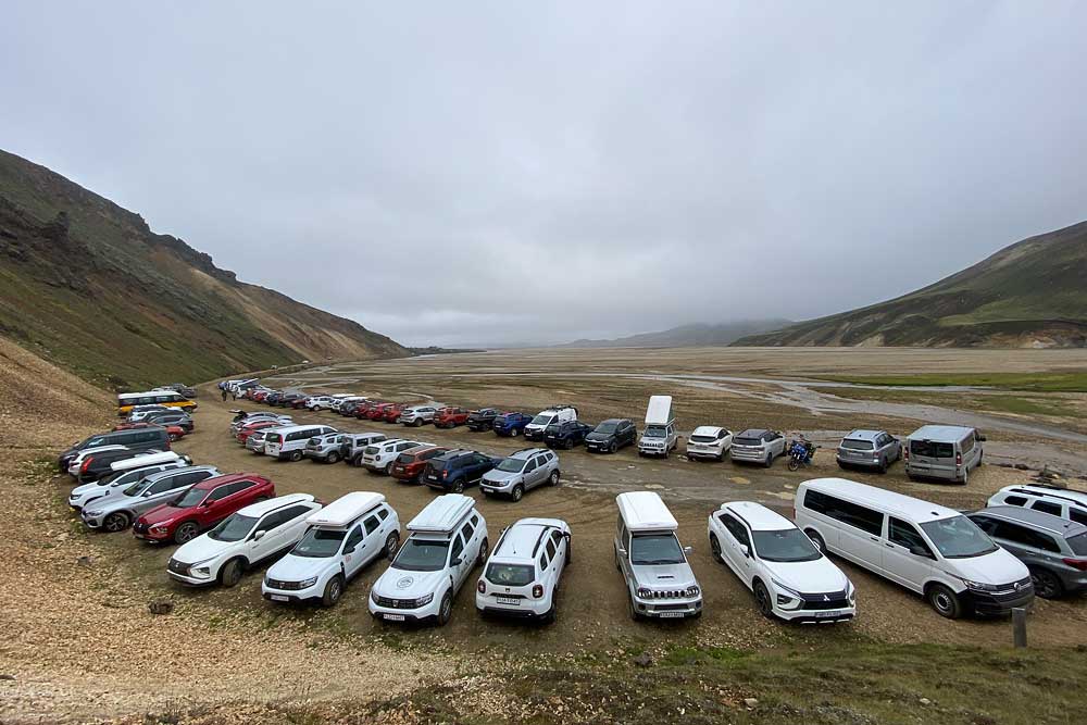
If you get here with your own car, you can drive into the special camping car park or leave the car (and also stay overnight) in the car park before the fords. This way you can get here without crossing any water. If you stay overnight, you are charged the same fee as other campsite users – register at the reception desk.
A night at the campsite costs 2,500 ISK ($20), and the shower costs an additional 500 ISK ($4) for 4 minutes of hot water. If you do not stay overnight, but do use the amenities, you must also pay a fee of ISK 500 at the campsite reception (that’s separate from the shower fee).
People who spend the night in the hut, on the campsite or only use the amenities, after registration and payment at the campsite reception, receive a special waterproof wrist band in the color corresponding to the purchased “package”. In practice, however, few people wear these bands and they are not enforced in any way…
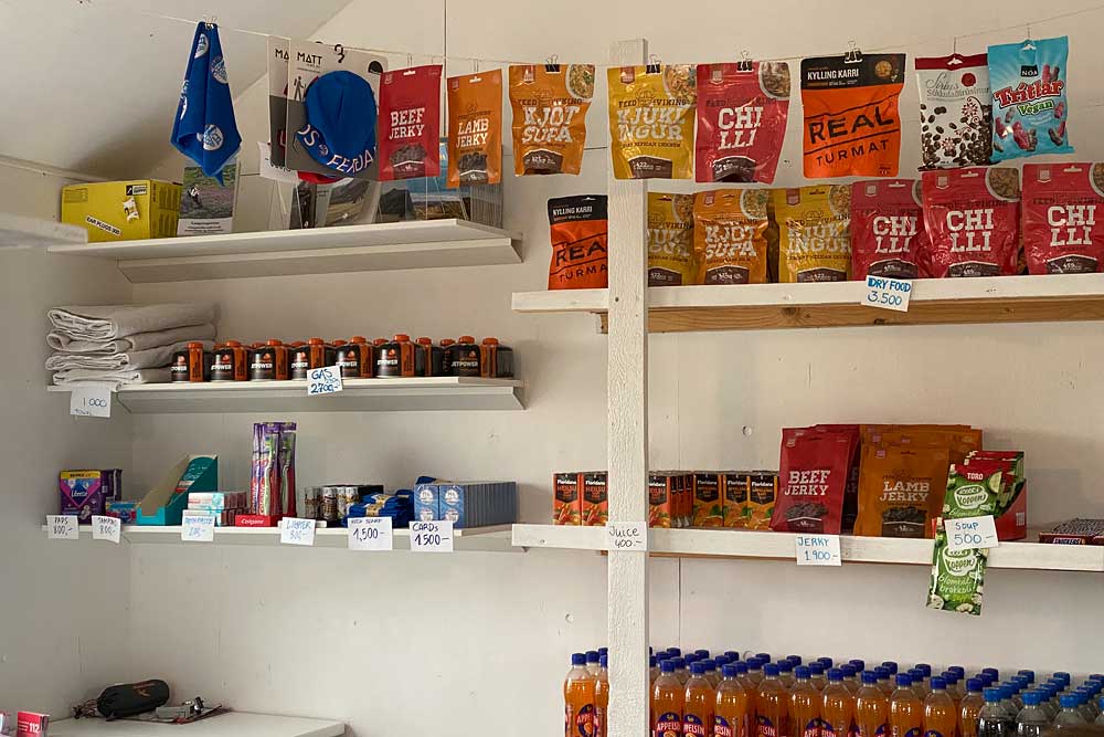
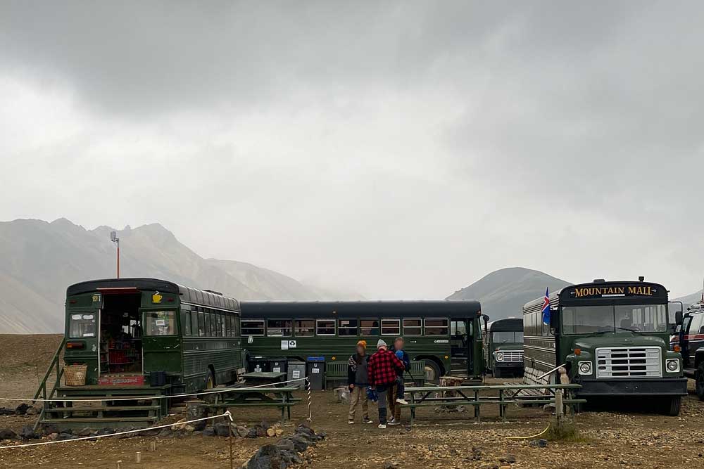
There are two shops and one “micro-restaurant” on the campsite.
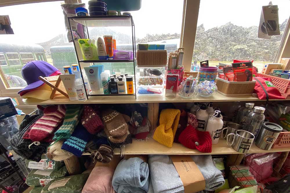
The first shop, as at many other campsites, operates at the reception desk. You can buy sweet and salty snacks (500 – 2000 kr / $4-15), several types of freeze-dried meals (3500 kr / $27), soft drinks (500 kr / $4), light beer (2%, 900 kr / $7), camping gas (jetboil, 230 g, 2700 kr / $20), maps, toothbrushes and toothpaste, and even hats, socks, gloves, towels, earplugs or playing cards… The choice is very limited, but prices are not overy high.
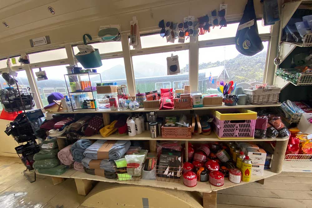
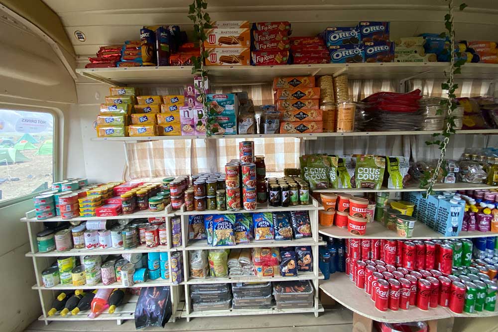
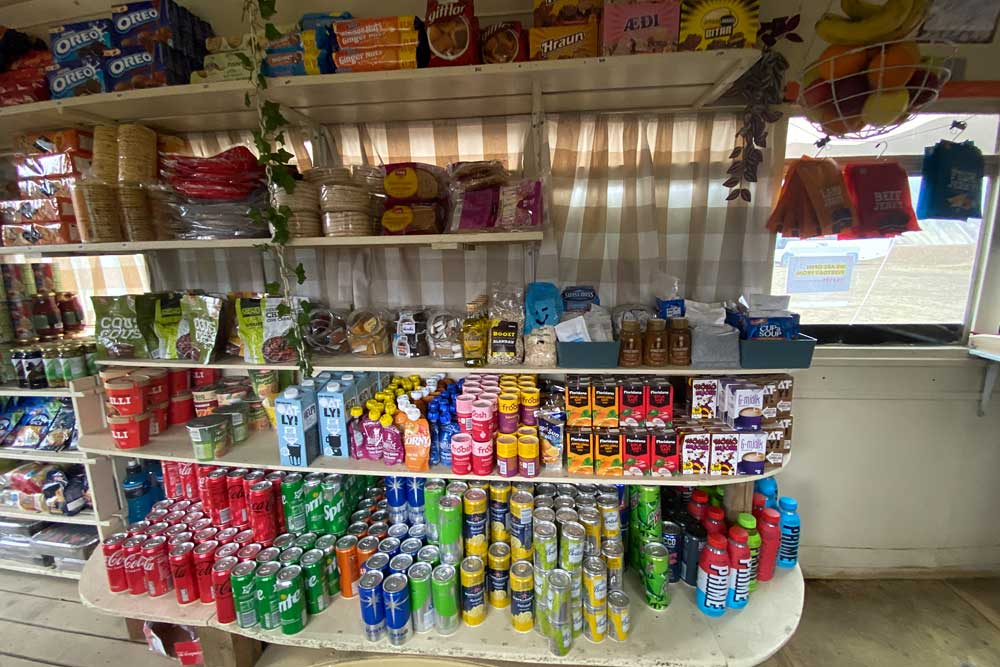
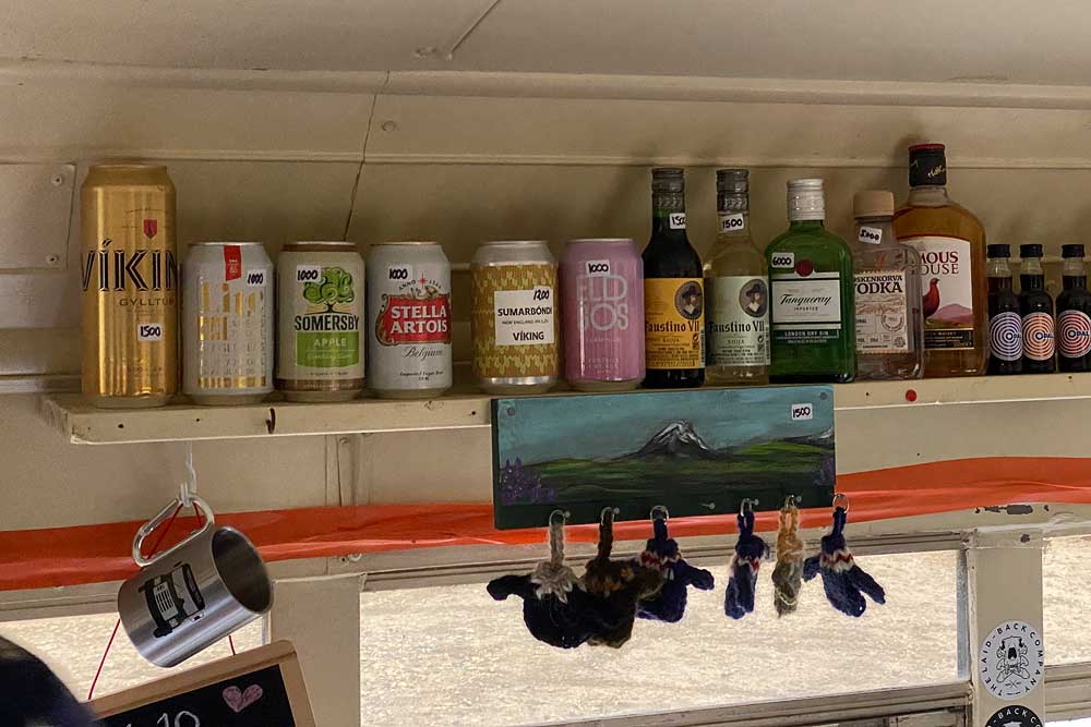
The second, much larger shop operates at the southern end of the campsite, in one of the characteristic old green buses. What’s interesting – it’s a family shop operating in this place since 1992. Here, the selection of goods is much wider: snacks, cookies, even several types of pesto and pasta sauces, a selection of pasta and rice (700-800 kr / $5-6), canned fish, olives, canned corn and beans (350 kr / $2.50 for a small can), energy bars, freeze-dried meals, instant noodles, even some fresh fruit, packaged bread, briquettes and barbecue lighters etc. The selection of cosmetics, hiking accessories, towels, socks, sunglasses, etc. is also much wider here. You can also charge your phone for a fee. There is even something completely useless for tourists available here, i.e. alcohol, including the strong types, and also sold as single shots … (there is more on offer than you can see in the photo above).
The prices are of course quite high (although similar to those in the shop at the reception), but considering that the nearest Bonus shop is over 80 miles away, you can say they are reasonable.
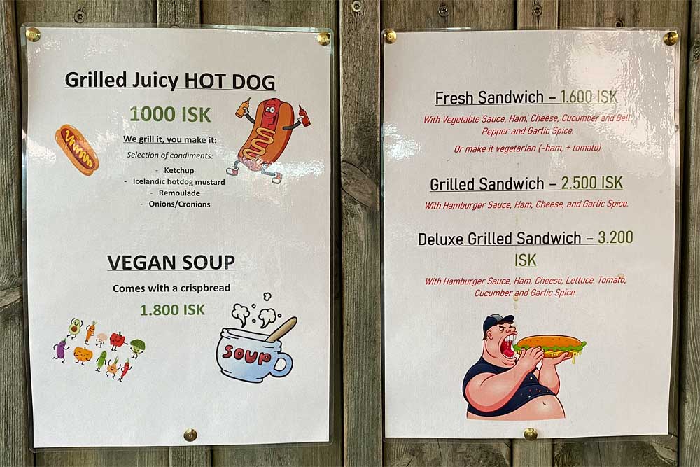
Right next to this shop, in the neighboring bus, there is a small restaurant, or rather: a bar. It serves vegetable soup with bread (ISK 1,800 / $14), hot dogs (ISK 1,000 / $7.50) and a selection of sandwiches for between ISK 1,600 and ISK 3,200, i.e. about $12-24.
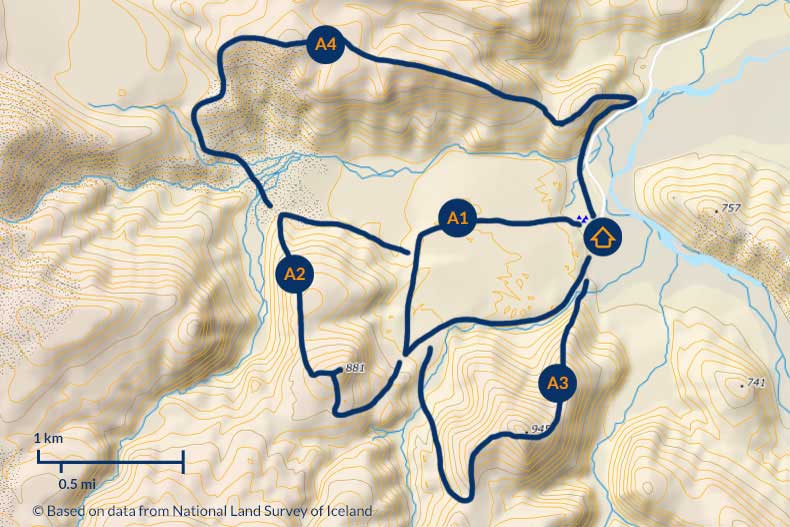
Landmannalaugar short trails map
© Based on data from National Land Survey of Iceland
You can buy a small map of the area (350 kr or about $2) at the campsite information desk.
As you can see from the plan, these 4 routes – Laugahraun, Brennisteinsalda, Bláhnúkur and Suðurnámur – can be combined quite freely. If you have more time and want to go through all of them it’s probably best to go counter-clockwise – start from Blahnukur, go to Brennisteinsalda and decide there whether you return via Laugahraun (by a shorter or longer route) or make a full circle via Sudurnamur.
If you have even more time – probably two days or at least a day and a half – you can choose one of the longer routes described below.
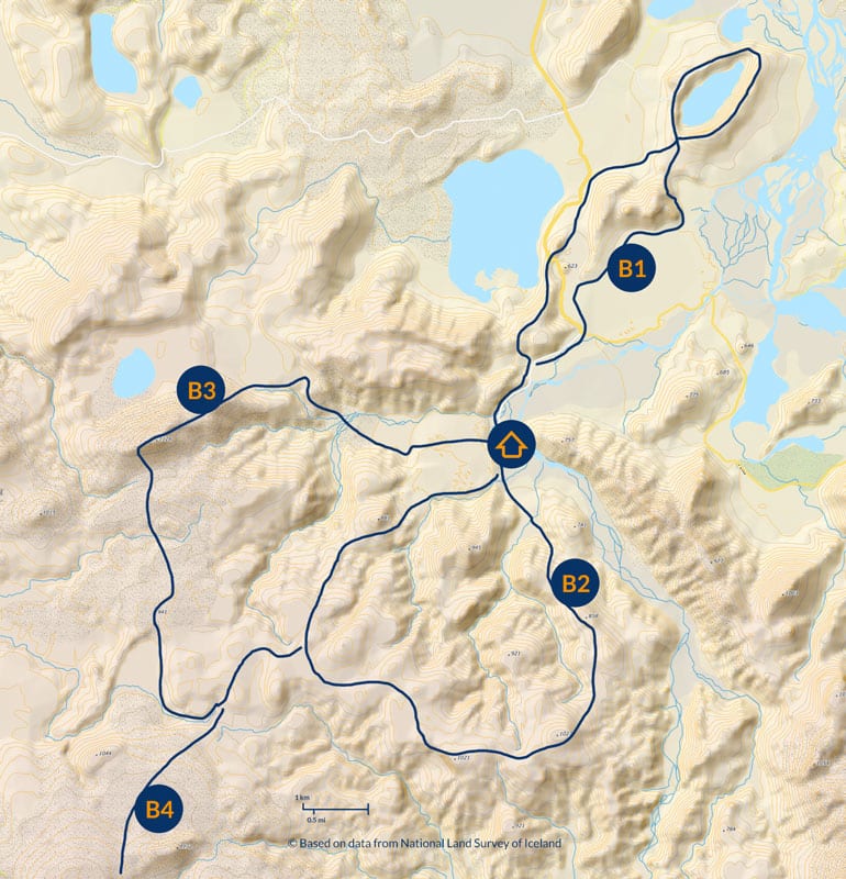
Long day hiking trails in Landmannalaugar
© Based on data from National Land Survey of Iceland
As you can see these are full-day routes (and the last two are poorly marked), so it’s a good idea to notify emergency services or campground staff before setting out on them.
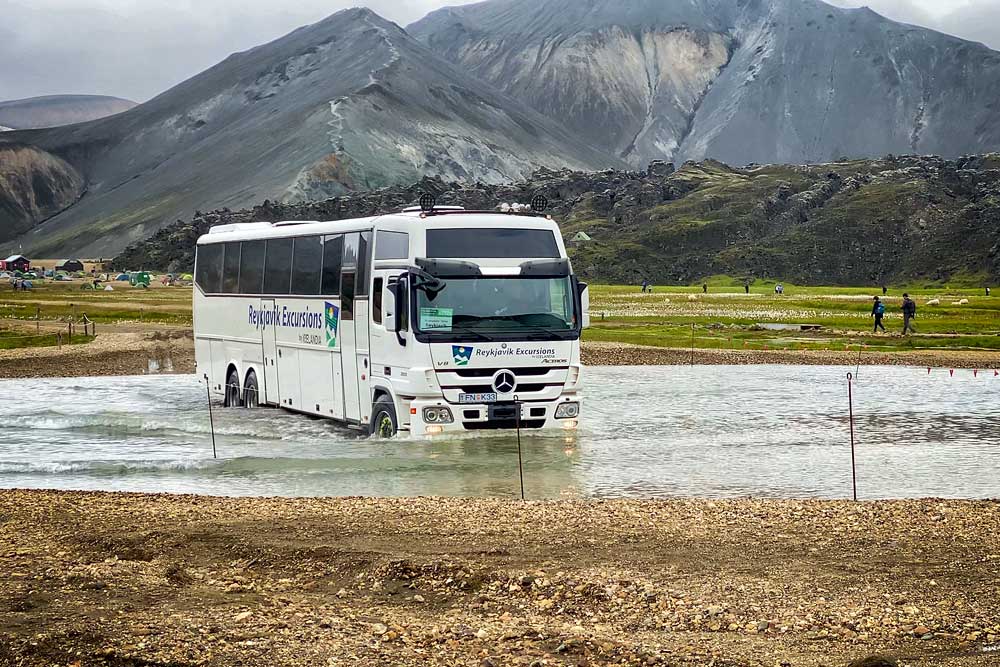
Aside from hiking to here, Landmannalaugar can be quite easily reached by a four-wheel-drive car or a scheduled bus.
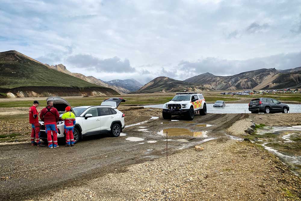
A modern Toyota RAV4 flooded their engine
When assessing the depth of water in the streams you need to cross, remember that it can change during the day – even in a few hours. Just because you get into a campsite doesn’t necessarily guarantee that you’ll be able to get out of it as well. On the other hand, let’s not get crazy either – the water in these fords often reaches up to your knees at most, and motorcyclists also pass through them. Just be careful here.
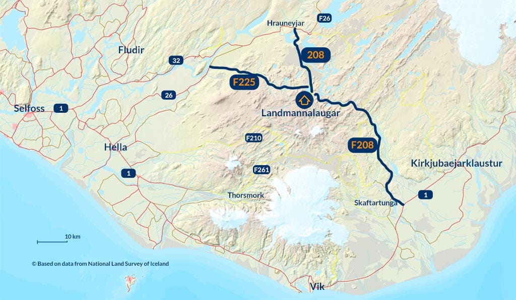
Roads to Landmannalaugar© Based on data from National Land Survey of Iceland
If you want to come to Landmannalaugar in a car without a 4×4 drive or one of the smallest cars equipped with such a drive, this road will definitely be the best for you. Just in case, however, confirm with your rental company whether according to your insurance it is a mountain road or not and therefore whether you are allowed to drive this way. With a car without four-wheel drive you won’t get to the campsite itself anyway, because about 500 m before it you have to cross 2 rather deep streams (i.e., more or less knee-deep, although it depends on many things, of course). Slightly before these fords – at the height of Lake Frostastaðavatn – another difficulty awaits: a rather steep and winding climb. If the road is empty – any car will get in without trouble. If you have to pass someone, then although those entering have priority, for example, buses have even more priority, so you have to expect to have to stop and start uphill on the gravel. It can be done, but without 4-wheel drive it can be a bit of a challenge.
Reykjavik Excursions maintains daily connections to Landmannalaugar from Reykjavik (you can also board at intermediate stops – such as Selfoss or Hella), called The Highland Bus. The entire trip (one way!) takes 4 hours and costs about $75, but Landmannalaugar is really worth the effort. If you go from Reykjavik at 7 am, you’ll get there as early as 11 am and you’ll have up to 7 hours until the last return bus (you’ll be back in Reykjavik around 10 pm). These 7 hours are certainly enough to enjoy the beauty of Landmannalaugar, but be sure to buy your tickets well in advance.
Alternatively there’s plenty of private day trips to Landmannalaugar in a rather broad price range. See the top selection here: Landmannalaugar Day Trips.