G
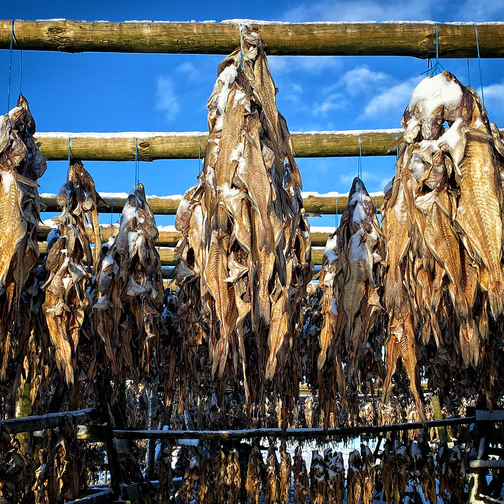
rindavík provides more than 40% of Iceland’s fish production and is one of the most active ports in the country.

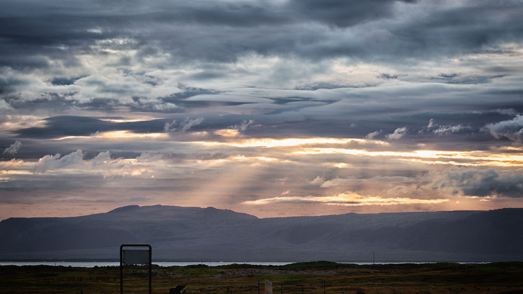
Grindavík is a fishing town located in the southern part of the Reykjanes Peninsula. Not only is it close to Blue Lagoon and the airport Keflavik In 2021, the area’s most famous attraction was the spectacular eruption of the Fagradalsfjall volcano However, even though the eruption is now extinct, there are quite a few interesting places waiting to be seen in the close vicinity.
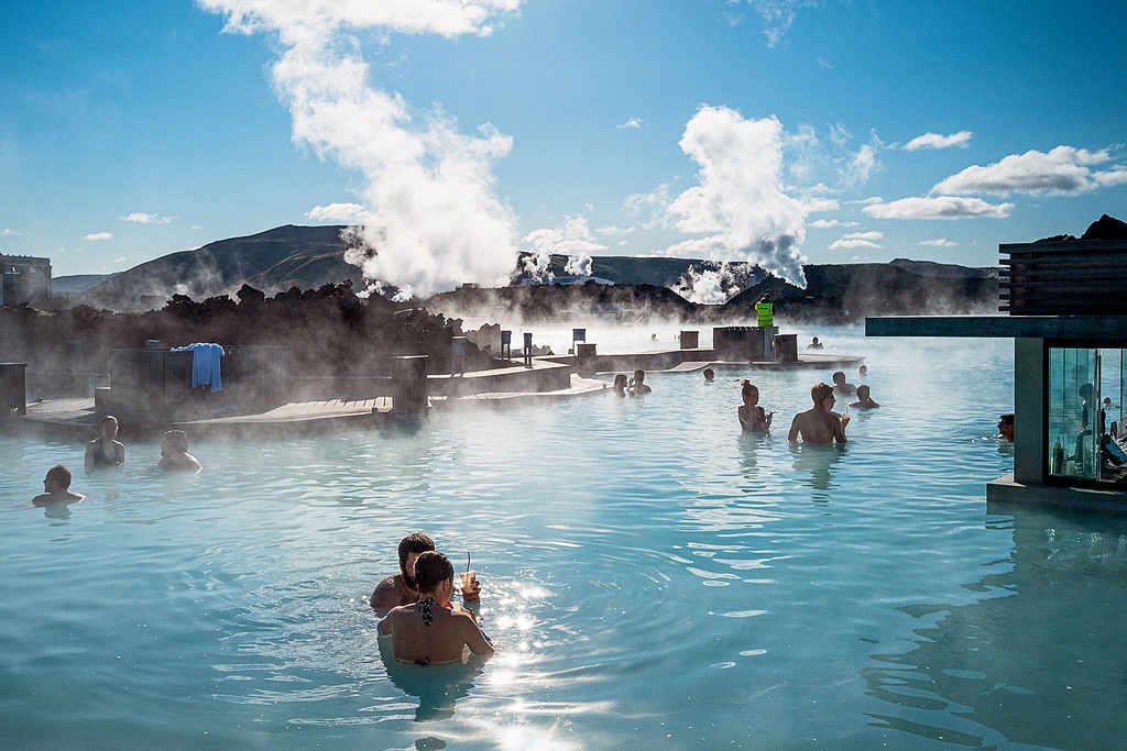
Due to its location and centuries-old traditions, most of Grindavik’s residents are involved in fishing. It is also a popular tourist base. Especially for those planning a trip to one of the most popular attractions on the island – the Blue Lagoon Spa and Hotel complex. Due to its proximity to Keflavik International Airport, it also makes a great alternative to Reykjavik for a first or last night on the island. But there are more attractions in the area.
Grindavík currently has a population of about 3,300, but is nonetheless one of the larger towns in Iceland. It provides a range of activities for fans of sports, local Icelandic cuisine, hiking, culture and art. Proponents of active recreation can enjoy scenic walking trails, a golf course, a horse farm, a swimming pool complex with a Jacuzzi and steam room, and a stadium.
Fans of Icelandic wildlife can enjoy nearby bird watching from the cliffs on the shores of Reykjanestá, volcano exploring, cave hiking and trout fishing.
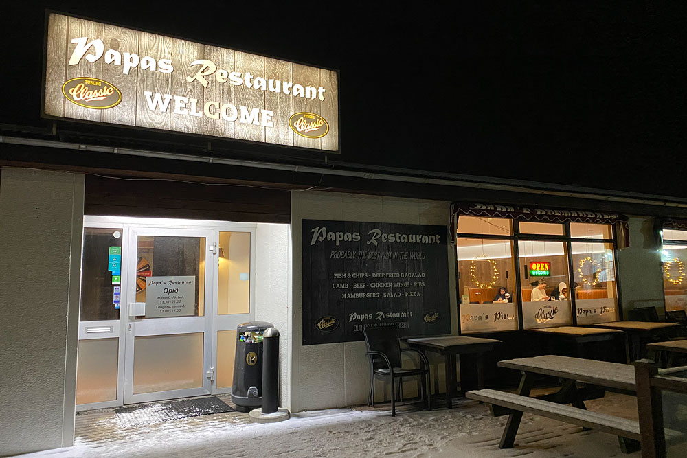
There are also car rentals, the Saltfish Icelandic Museum, banks, stores, hotels, guesthouses and cottages, and a brand-new campground. The campground is one of the best in Iceland and offers visitors a range of amenities. Visitors to Grindavík can enjoy tables at restaurants serving local dishes made from fresh seasonal ingredients.
There are 3 restaurants in town worth recommending within walking distance of the campground:
The surroundings of Grindavík are extremely picturesque. The western part of the country, including Reykjavík, the Snaefellsnes and West Fjords peninsulas and the area around Grindavik, is on the North American tectonic plate. In contrast, virtually all of Iceland east of here lies on the Eurasian plate. The Mid-Atlantic rift runs through all of Iceland; including directly through the Reykjanes Peninsula and the Grindavik area. Recently (especially after 2019), it has even been one of the more seismically active areas of the island.
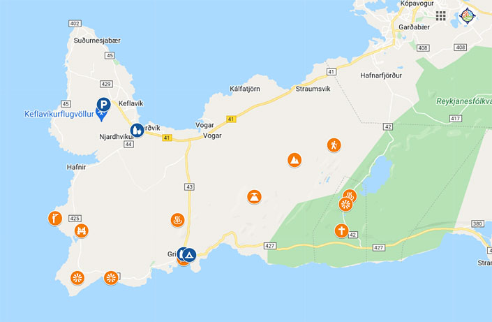
Map: Attractions near Grindavik – Reykjanes Peninsula.
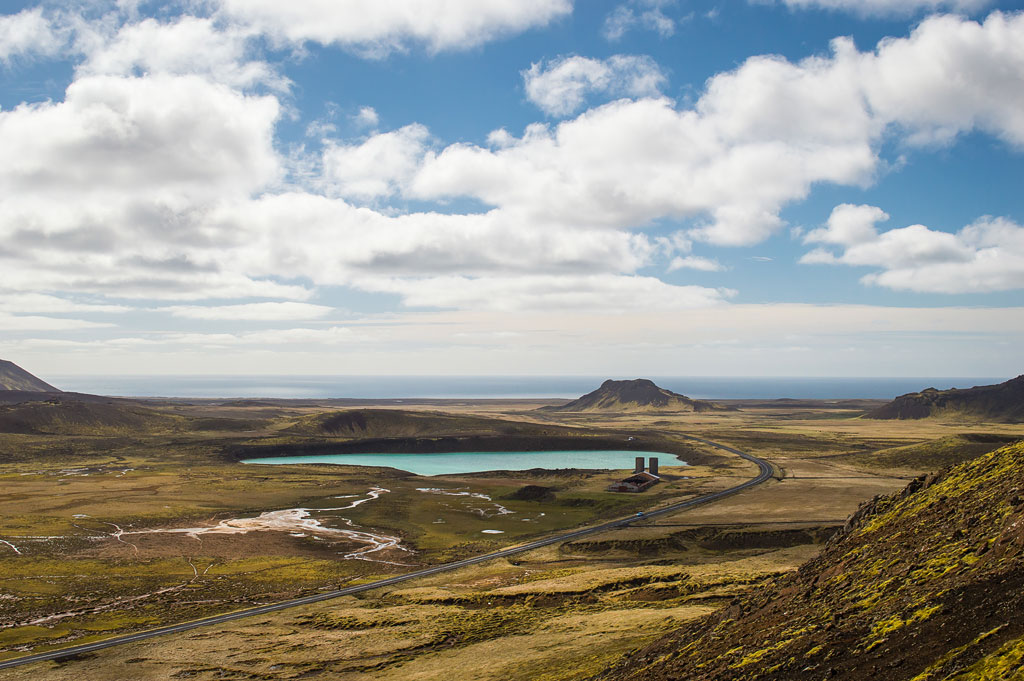
The awe-inspiring landscapes around Grindavik are formed by huge, hardened lava cliffs combined with silky soft islands of moss, deceptively reminiscent of a surreal “pillow” ground. The magnificent effect is completed by razor-sharp hardened lava formations, full of cracks, craters and miniature canyons.
Use the map above if you’re on a self drive. Just click it once activate and then click again on the small star right off the map title. It will be saved in your Google profile and will be available in your Google Maps app whenever you need it.
On the other hand if you’re based in Reykjavik and don’t want to drive or rent a car, you may well choose one of the guided tours to the area. Here are our top picks:
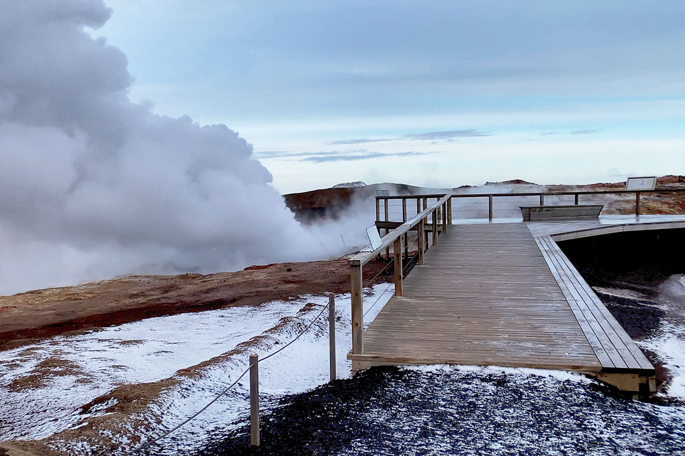
Not far from Grindavik are natural geothermal areas – Krýsuvík and Gunnuhver. Although bathing in them is prohibited, admiring the picturesque views is still possible. However, it is possible to bathe in the nearby wild spring Skatalaug.
Krýsuvík is a geothermal area located on the Reykjanes Peninsula in southwestern Iceland. Its main parts are Seltun, Hverahvammur and Hverahlid.
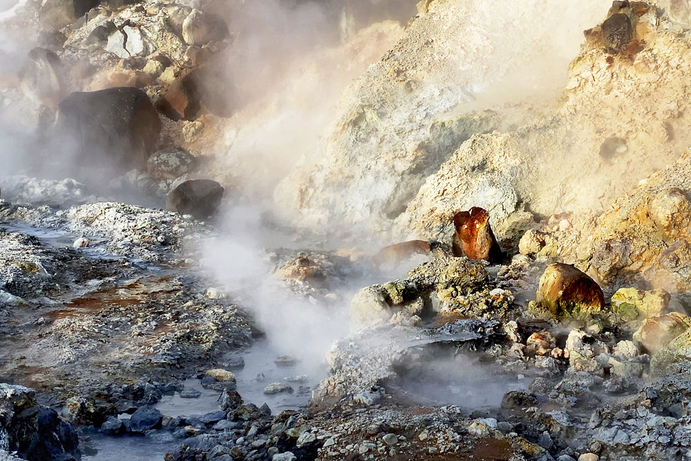
Krýsuvik vents
A well-maintained boardwalk winds through the geothermal fields, and there are informational and educational boards around, explaining the geology of the area. Thirsty for a unique experience, tourists can climb a winding path to the top of the massive smoky hill. The view of the ocean, geothermal fields, and lakes from the top is truly impressive. Do not stray from the marked paths and under no circumstances put your hand in the hot springs. Such “fun” risks serious burns.
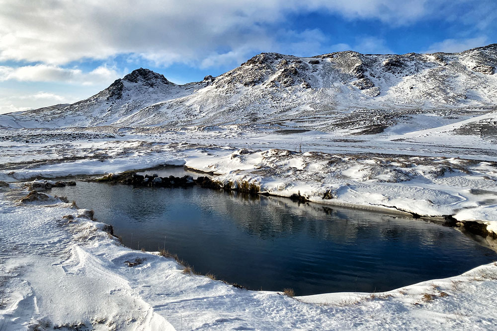
Skatalaug
If you’re turned off by the crowds at Blue Lagoon, and don’t have time to visit Reykjadalur, Skátalaug offers perhaps the closest airport opportunity to take an Icelandic hot bath in nature.
We write about the Gunnuhver spring slightly below, as it is further west.
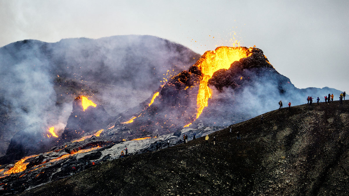
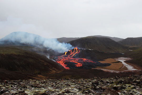
From March to September 2021 and in August 2022 Grindavik was primarily known as the town closest to Iceland’s newest tourist attraction – the Geldingadalir eruption, sometimes referred to as the Fagradalsfjall eruption. The eruption fissures lie only about 10 km northeast of the town. There are hiking trails leading to them, but the start of these trails can be reached by road 427 going east from Grindavik.
The eruption itself was unspectacular on the scale of volcanologists, but for the ordinary tourist it was absolutely breathtaking. This was firstly because it was a lava eruption – so we could live watch the lava field and the new volcano forming. Secondly, the fact that the eruption was small and calm meant that it was relatively safe to approach it at a really short distance. Fame-seeking Instagrammers even tried to fry scrambled eggs by placing a pan directly on the hot lava (the experiment ended with the loss of the pan and certainly gaining lots of likes).
Since the eruption is already over, the two-to-three-hour walk to its site is no longer worth the time, especially on a shorter trip. You can find detailed information about the eruption and how to get there in a separate article: Iceland’s newest attraction – the Geldingadalir eruption
Literally “on the other side of the mountain” northwest of Krusyvik lies the crater of the Keilir volcano and the Lambafellsgja volcanic rift.
Both of these places are nice and interesting, but unfortunately to get to them you have to go all the way around the region. That is, take road 42 out to road 41, and from it take the gravel access road opposite road 420. The trip to Keilir from the nearest parking lot is about 4 km and 2 hours one way. On the other hand, the trip to Lambafellsgja is shorter – about 1 km and 20 minutes one way (from the parking lot at the end of the aforementioned gravel access road).
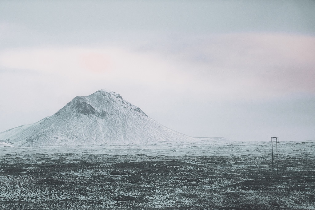
Just north of Grindavík is Thorbjorn (Þorbjörn), a solitary peak easily accessible to hikers. If you’re a fan of hiking, you won’t be disappointed – the views of Grindavik and the Blue Lagoon are really interesting.
The peak is located about halfway between Grindavik and the Blue Lagoon.

Gunnuhver
Interestingly, the hot mud pond located here is the largest such ‘body of water’ in Iceland. It measures as much as 20 meters in diameter. According to legend, it was here more than 400 years ago that one of the local pastors overcame a female ghost haunting the area. The ghost was lured and pressed into a trap in this pond. That’s why the mud makes such a strong noise and boils. At the same time, the name of this area – Gunnuhver – is also said to be the name of the spirit defeated here….
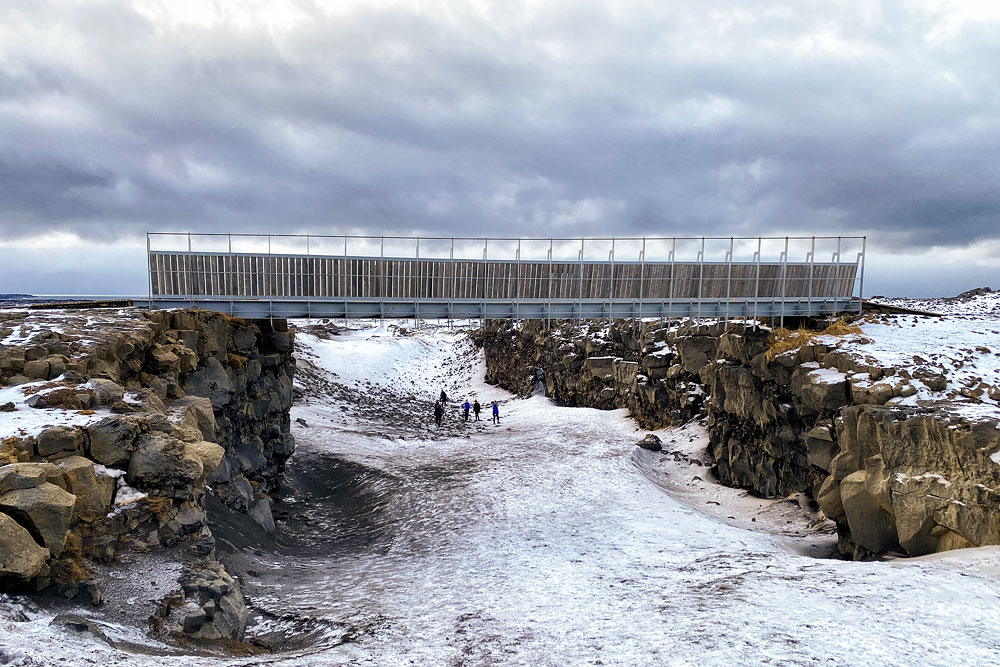
There is also a “Bridge between North America and Europe” near Grindavik. Its attraction is supposed to be that this is where we can get from one continent to another quickly and on foot. Unfortunately, this is a rather stretched interpretation of the facts, but perhaps that’s also why this place is worth mentioning.

bridge between Europe and America
This means that Iceland is indeed on the border between the continent of North America and Europe (or Eurasia), but at the same time two more things are obvious and natural:
However, a strictly scientific geological approach is one thing, and the requirements of modern tourism marketing are another. That’s why a bridge (or rather, a bridge) was erected over one such fissure west of Grindavik and made into a tourist attraction. There’s nothing wrong with that, but let’s not be fooled into thinking that this is where we can get from Europe to America and back particularly easily and quickly.
Thingvellir is a must-see place when visiting Iceland. The America-Europe Bridge, on the other hand, is more of a curiosity to visit if you have half an hour to spare before returning to the airport, or skip it if that time is in short supply.
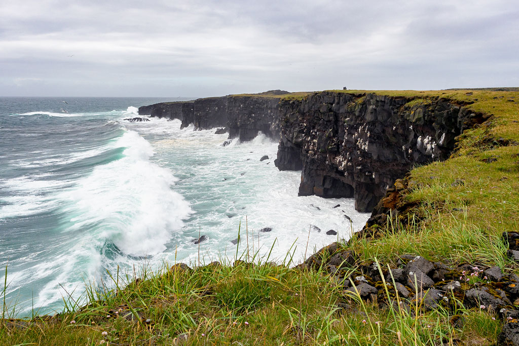
Hafnaberg is a long line of sea cliffs, very popular especially with birdwatchers.
The Hafnarberg cliffs lie south of the old fishing village of Hafnir. Their highest point reaches 43 meters in height. Due to their rocky rock bed and numerous small caves, they provide a cozy breeding ground for many species of birds.
The cliffs are home to some of Iceland’s most distinctive species. The estimated population of seabirds here is about 6,000 pairs. Among them are common guillemots, common alcids, polar guillemots, gulls, the original maskonurs, fulmars and cormorants.
If you have binoculars with you, you may also be able to spot seals and small whales found in the area.
There is also the Bridge between the Continents near Hafnarberg. This is simply a kind of footbridge stretched over one of the clefts of the mid-Atlantic rift. While in the area, we can familiarize ourselves with this phenomenon, though of course the best exposure to it is undoubtedly Thingvellir National Park