• Polski
  • English
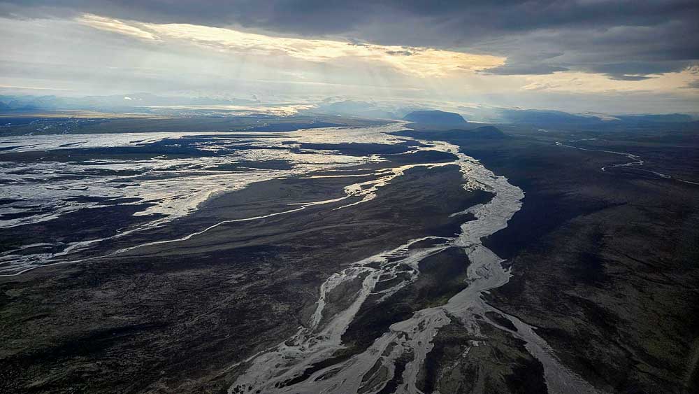
  • Increased activity of the Mýrdalsjökull volcano (which lies beneath the glacier of the same name) on the night of July 26/27, caused a huge outpouring of water and a so-called glacial (glacial) flood near the town of Vik, in southern Iceland.

    On July 27, in the morning, water flooded Road No. 1 (Iceland’s main ring road), and around 5 pm it broke, near the bridge over the Skálm River, about 40 km east of Vik.

    powódź przelewa się przez rzekę w Islandii

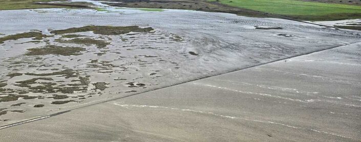
    Road 1 flooded by the Skalm River
    source: vedur.is; by Sveinbjörn Darri Matthíasson

    Road No. 1 from Vik to Kirkjubæjarklaustur has been closed and residents in the affected neighborhoods evacuated. According to ruv.is, repairs to the road continued throughout the day on July 28, and in the evening of that day the road was reopened, although initially only in shuttle traffic. Road workers expect that it will take several days to complete all the necessary repairs to the road.Glacial floods are a fairly usual occurrence in Iceland, but only the largest ones pose a threat to the population and cause damage to infrastructure. A remarkable reminder of the huge flood of 1996 are the remains of the bridge over the Skeiðará River, which was completely destroyed during the flood. We can see the remaining fragments of its pillars near the Skaftafell reserve, a little farther away, about 135 km east of Vik.

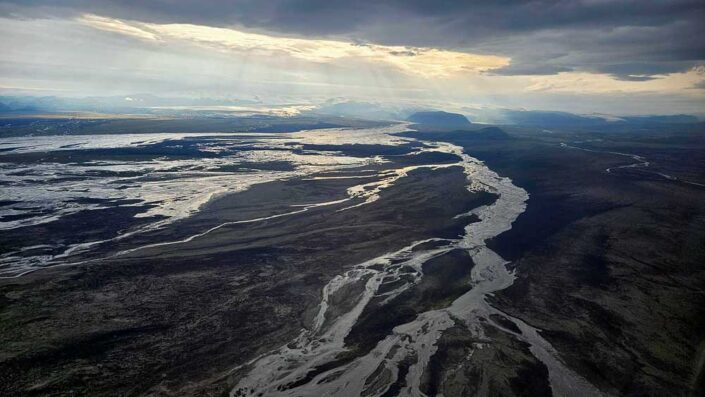
    Flood spilling over the eastern slopes of Mýrdalsjökull
    source: vedur.is, by Public Safety/Björn Oddsson

    The vedur.is service confirms that by around noon on July 29, the flooding of the glacier was already over, no new seismic activity was recorded in the area, and the weather code around Katla (and thus in the flood area) was restored to green – no danger.

    Leave a comment below! :-)
    [comments are moderated and appear with delay]

    Leave a Reply

    Your email address will not be published. Required fields are marked *