Studlagil (Stuðlagil) Canyon is located in northeastern Iceland in the Jökuldalur glacial valley.
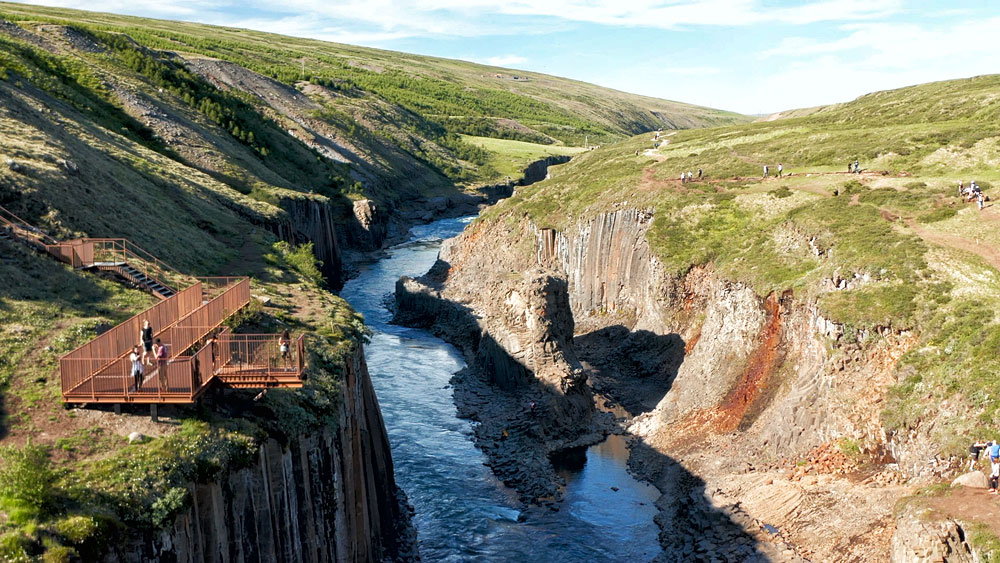
In good weather, its basalt columns of rock cut by a beautiful wild river are extremely photogenic. From the internet, it is clear that this is one of the island’s hidden treasures. The impenetrable fortress of wildlife and hexagonal rock formations is breathtaking, showing the power of nature.
Unfortunately (?) nowadays the canyon is no longer so hidden. All or almost all tourists visiting the island know about it, and it’s also much easier to get to than it used to be. Also, unfortunately, it is not such a gem. The canyon is very nice, but nevertheless it can disappoint. Because in the online photos (including the one in the header of our article…) the canyon looks like a sky-high fortress, while in reality it is rather small, and the beautiful photos bend reality a lot….
There are several scenic hiking trails running around the canyon. Remember, however, that the terrain is still relatively rough, the paths are sometimes steep, and the stones and rocks can be very slippery. Be sure to wear good shoes while walking and take extra caution.
When traveling to Stuðlagil in spring and summer, watch out for nesting birds. In May and June, they often lay eggs along the ravine.
You can also see basalt rock columns, for example, at Reynisfjara or at Borgarvirki, where they are much more easily accessible. However, it is in Studlagil where they certainly look the most beautiful.
How to get to Studlagil Canyon

Studlagil canyon – west (left) vs east (right)
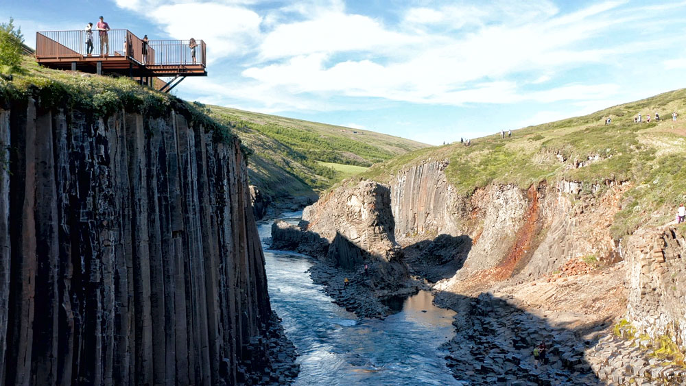
Studlagil western bank – the easy side
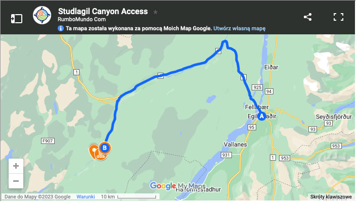
The key to understanding all the access options is road 923 running on the north / west side of the canyon.
This is not an F-road (i.e. not a mountain road) and is easily accessible at least from May to September. It starts as a clearly marked south turn from Road 1. Follow road 923 a little further south-west to the Grund farm. There you will find a parking lot and a path to a viewpoint platform on the canyon west rim. The walk along the path takes about 5 minutes.
Map: Studlagil canyon access.
This, however, is NOT the best place to see the canyon as there is no path to the foot of the canyon from here. To see and appreciate the Studlagil canyon at its best, you need to get to the riverbed and for that, you need to arrive from the eastern / southern bank. And that access is a bit more complicated.
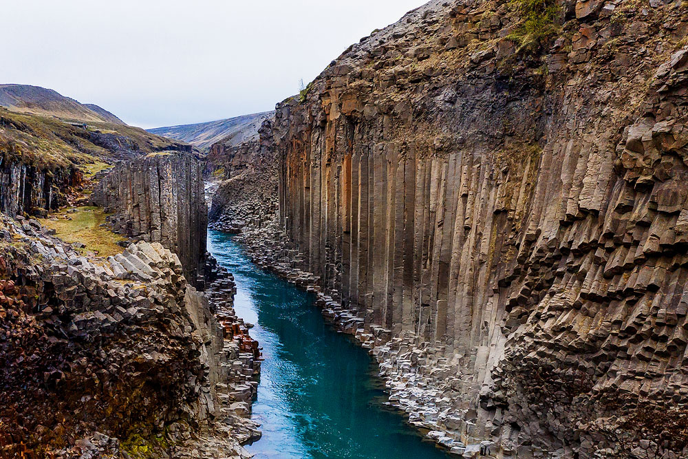
Studlagil eastern bank – the best views
To get to the canyon from the eastern side (the attractive one) you start the same. Take Road 1 and turn off onto Road 923 (clear red sign ‘Studlagil’). Take the road to the bridge by the Klausturse farm (if you’re coming from the Askja canyon side, take the F910 road, from which you’ll exit onto 923).
There you will find a parking lot, where you must get off if the weather conditions are bad (mud, snow), and you are not driving a 4×4. Follow the road and then the trail southwest for about 5 km (3 miles). It’s an easy hike, but at least 1 hour each way, likely 1.5.
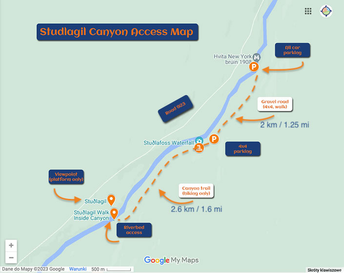
Studlagil canyon access map
After about 2 km / 1.23 mi you will reach another parking lot. Leave your car there and cover the remaining 2.5 km / 1.6 miles on foot. This cuts your hiking by half, more or less.
U
ntil 2020, only a very nice, but small and historic bridge from 1908 stood on the river. It was forbidden to drive over it, so a number of internet sources still say that you must park on the west side and walk from there. As of 2020 this is not true anymore.
Leave your car in the parking lot in front of the bridge only if you believe the gravel road further south is too much for your car (high suspension and 4×4 drive is advisable, but not mandatory).
The parking lot on the east (south) side is accessed by an off-road dirt road, which is not cleared of snow, and during rainfall puddles and mud form on it. A 4×4 car can handle it without trouble, but if you are driving a car without 4-wheel drive – exercise heightened caution.