Kerlingarfjoll (Kerlingarfjöll) is a real gem for all nature and outdoor enthusiasts.
Colorful steaming mountains
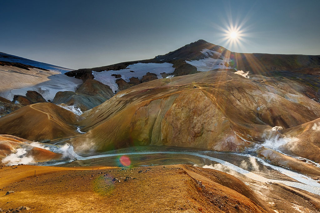
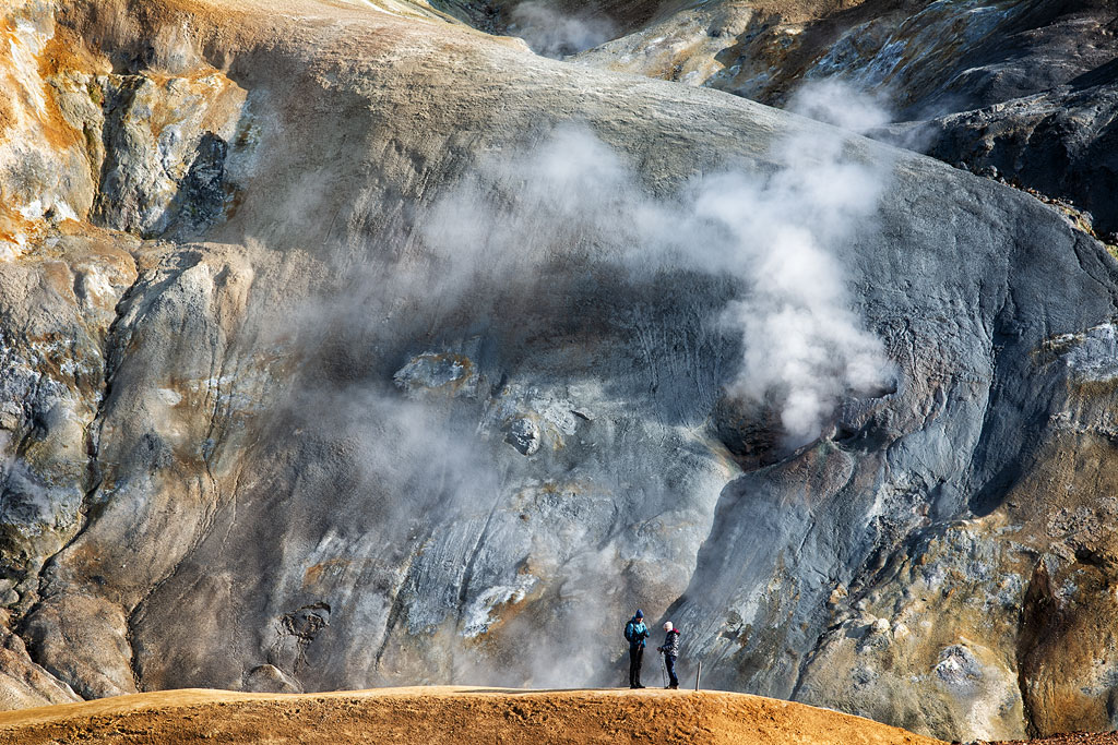
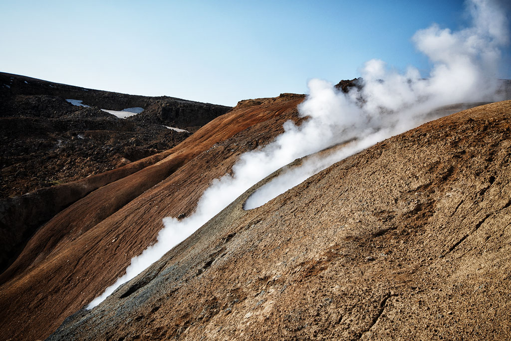
Kerlingarfjoll is a beautiful, extremely colorful mountain range (of volcanic origin, naturally), not far from the F35 road in the Icelandic highlands. Between the fabulously colorful mountains here flow hot streams with temperatures exceeding even 100 ºC / 212 ºF, shrouding the entire area in thick clouds of steam. At the same time, hissing, bubbling and boiling noises come from the many fumaroles and mud springs all the time to the ears. Even a short walk in the Hveradalir Valley leaves wonderful memories for a lifetime.
K
erlingarfjoll is the third-largest geothermal area in Iceland, but it is here that the highest surface water temperature in a geothermal spring has been measured: as much as 150 ºC / 302 ºF (sic! that’s no mistake!). That’s in area called Hverabotn, between the peaks of Maenir, Ogmundur and Hottur. Hiking access only.
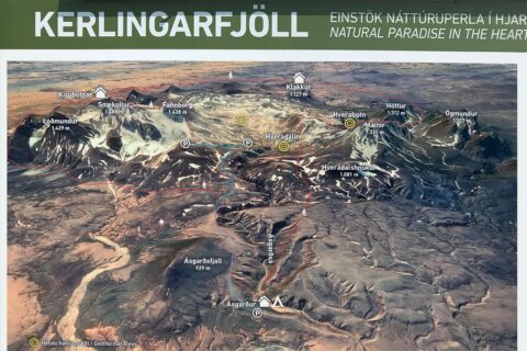
Map of Kerlingarfjoll region
- the entire region is called Kerlingarfjoll (Kerlingarfjöll);
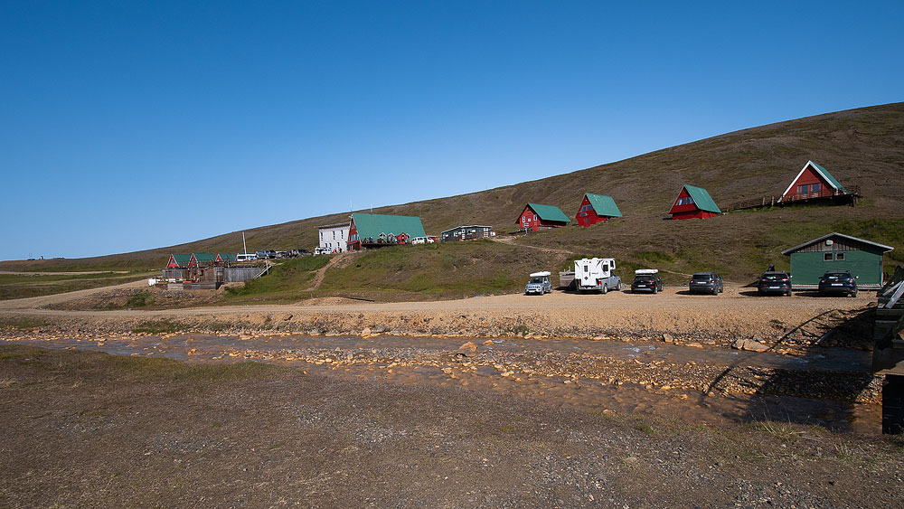
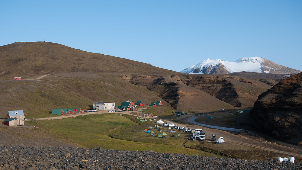
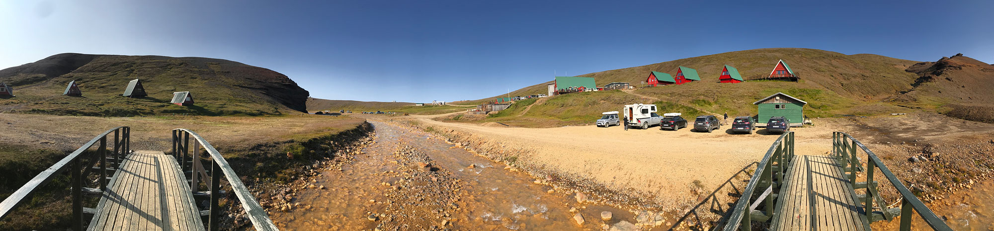
- The region’s main refuge is Asgardur (Ásgarður), although the name Kerlingarfjöll Mountain Resort is often used;
- The most accessible geothermal area (boiling mud, streams and smoky mountains) is Hveradalir;
- The hottest geothermal area, the one where water temperatures as high as 150 ºC / 302 ºF have been measured, is Hverabotn;
- However, the hot spring where you can bathe is not marked on the plan, and is located about 1.5 km north of the Asgardur hut;
In blue on the plan is marked the road available for cars (4×4), in red – hiking trails.
A
sgardur from https://www.asgardurinn.is/ is a completely different place – in Hvolsvollur, in southern Iceland.
Video: The colorful, boiling mountains of Kerlingarfjoll.
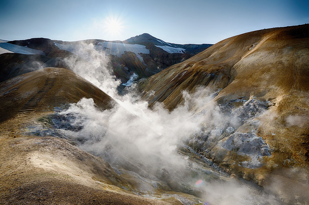
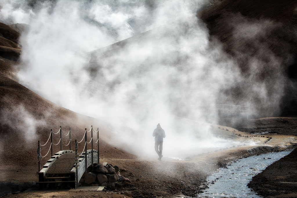
The picturesque geothermal area of Hveradalir
The heart and most popular attraction of the Kerlingarfjoll area is the Hveradalir geothermal area. From the Asgardur hut, Hveradalir can be reached by a short and comfortable, but nevertheless quite steep road (4×4!).
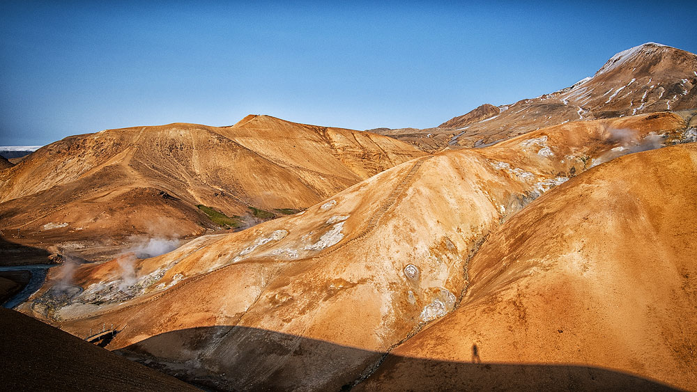
The uniqueness of Hveradalir is primarily due to its geology and picturesque surroundings. The area is surrounded by rhyolite mountains, so the surroundings are spectacularly colorful and look like from another world. Perhaps it is even more colorful here than in the famous Rainbow Mountains in Landmannalaugar
The mystical atmosphere of Hveradalir is complemented by bubbling springs, steaming rivers, volcanic smoke rising directly from the mountainsides, snow-capped mountain peaks and luscious green moss covering the brown ground. This is one of the few places that truly captures the head…
H
veradalir is a photographer’s paradise. It provides brilliant conditions for landscape photography as well as macro photography. I also saw a wedding session of an Asian couple here…
The area is well maintained and rich with safe, well-marked walking trails and viewpoints. All of the main hot springs, are accessible by stairs. They are a great convenience especially for the elderly.
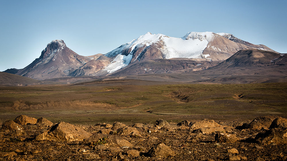
Genesis of the Kerlingarfjoll mountains
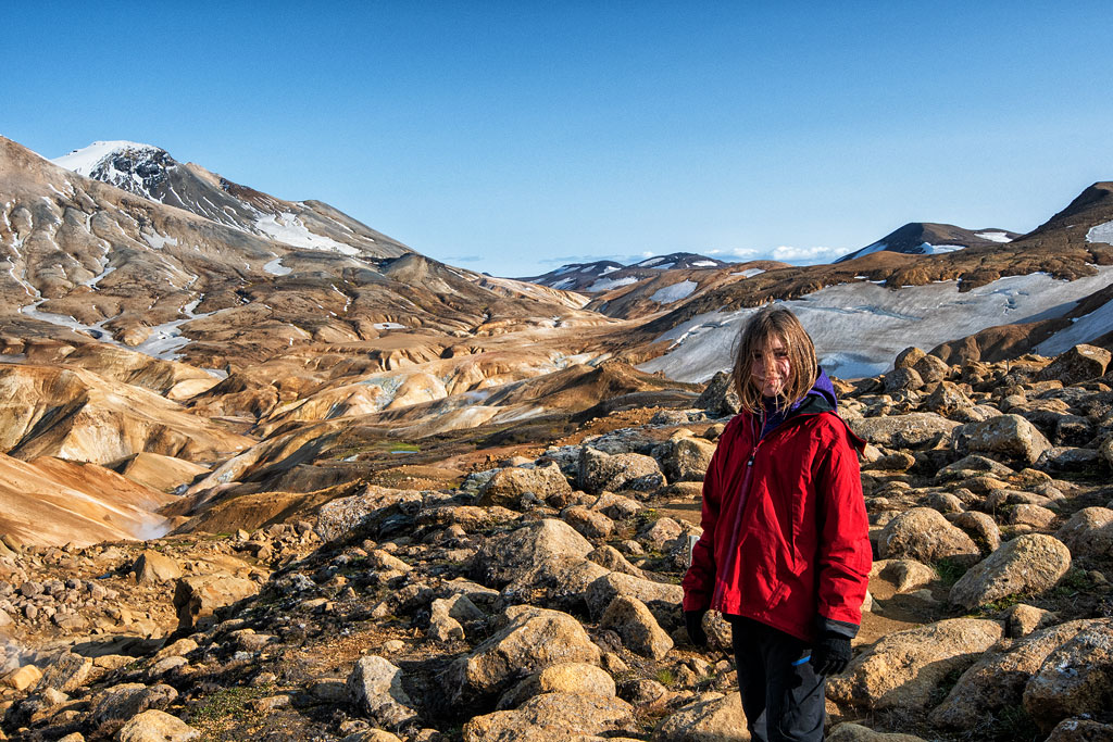
Kerlingarfjoll is a young volcanic range, formed of rhyolite rocks and dark and light volcanic ash rocks. Due to its structure, majestic and extremely colorful landscape, and high geothermal energy, the area has a very high natural value. The peaks here are adorned by several small glaciers, and the mountains constantly change colors depending on the light, season and time of day. The highest peaks in the area rise to 1,477 meters above sea level, but the lowest places are even at only 6 meters above sea level, so the views can be truly magnificent. The Kisa and Asgardsa (Ásgarðsa) rivers flow between the mountains, dividing the range into two parts: east and west.
Vegetation in the area is rather sparse and rare. Only the simplest thermophilic (thermophilic) mosses and lichens can survive here, such as the segmented rush (juncus articulatus), the bloated naga (gymnocolea inflata), the stiff crinoid (umbilicaria vellea), and the clay loam (thrombium epigaeum).
A
ccording to folk tales, the Kerlingarfjöll mountains have always been a refuge for all sorts of outcasts and trolls. The word ‘kerling’ itself means an old hag (witch?). According to legend, the 30-meter rock chimney in the western part of the mountains is a stone-turned troll woman, daughter of the fire giant Surtur, who failed to make it home before dawn and was turned to stone… (Well, I guess every lonely rock in Iceland is a stone-turned troll, according to some legend.)
As
of 2024 you have to book your stay in advance not only if you’re looking for accommodation in huts, hostel or hotel, but also in the Kerlingarfjoll campsite. So far this is the only campsite in Iceland that requires booking in advance. You can do that via the
Parka app.
- The season here lasts from mid-June to early September;
- The Ásgarður Mountain Resort (labeled ‘Kerlingarfjöll Mountain Resort’ on Google maps) is operated in the Kerlingarfjoll area, providing dining, accommodation and camping services;
- From Ásgarður, it’s easy to get by car (4×4!) to a parking lot in the Hveradalir valley, where you can stroll the colorful hills between boiling streams.
- There are also two hiking trails in the surrounding mountains, with the longer one being as long as 47 kilometers and designed for a 3-day hike with overnight stays at the Kisubotnar and Klakkur mountain huts. The shorter one involves 2 days of walking, with an overnight stay in Kisubotnar.
- In Kerlingarfjöll you can also experience swimming in an outdoor pool, which, however, is located as far as approx. 1.5 km (1 mile) upstream from Ásgarður hut and campground.
- The strongest hot spring is located at Hverabotn, the place with the highest geothermal surface temperature measured in Iceland (about 150 degrees Celsius / 302 Fahrenheit (yes! that’s no mistake!). The hot spring is surrounded by unique vegetation, including geothermal mosses and lichens, which have a high protective value.
- Because of the unique nature of the area, we walk here only on designated paths.
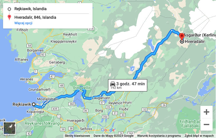
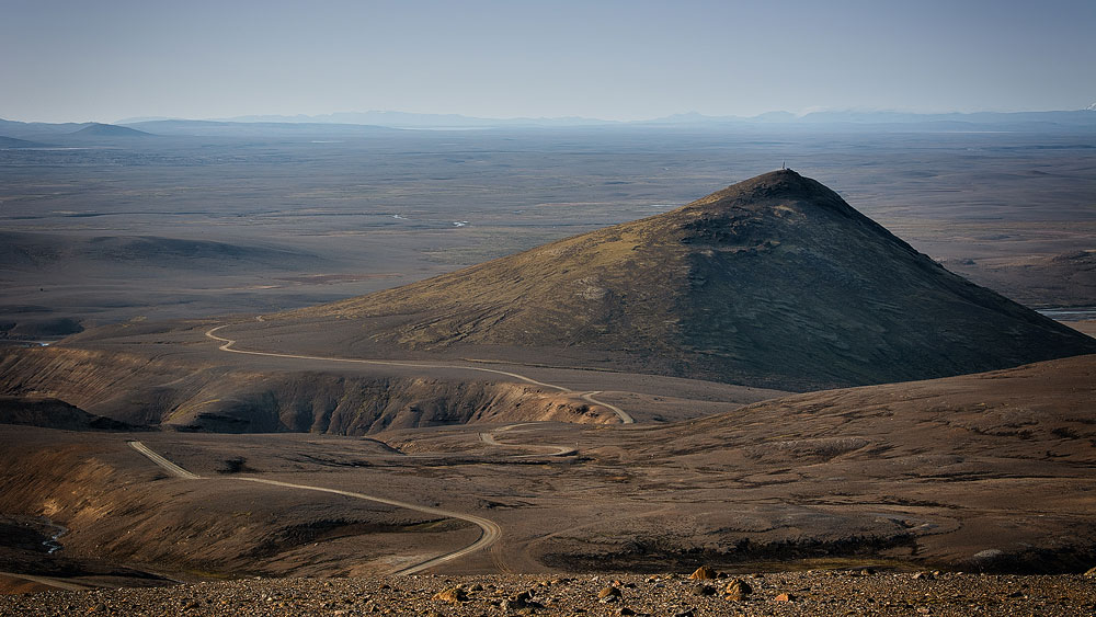
How to get to Kerlingarfjoll
To get to Kerlingarfjoll, take Route 35 (Kjalvegur, F35 on Google maps) and then turn east on F347. The intersections and roads are brilliantly marked – it’s impossible to get lost here – but this road usually doesn’t open until early June and may already be closed around September 20 due to snow. If you want to get here in spring or autumn, check the road condition on road.is, but from October to May, 99% of the roads will be closed.
Map: Access to Kerlingarfjoll (click to activate).
Kerlingarfjoll, and even more so Hveradalir, will be difficult to reach with a car that does not have a 4×4 drive. Although in the Photos in the gallery below you can see that as much as possible, but insurance companies and car rental companies usually forbid driving non-terrain vehicles on mountain roads. Kjalvegur “lost” the status of a mountain road (F) and is officially an ordinary road 35, but check with your rental company to see how they approach this.
In addition, the F347 road connecting Route 35 to the Asgardur hut is already a mountain road for sure. You only have to drive about 10 kilometers on it, and it’s not very steep, and there are no fords across streams on it, but still, for an ordinary car it’s certainly a challenge. Without a two-wheel drive, I would rather not recommend it.
On the other hand, for cars with two-wheel drive, getting here (in summer!), although the road is gravel and at times quite steep, poses absolutely no challenge.
It is also possible to get here by SBA 610 bus from both Reykjavik and Akureyri (see SBA 610 timetable (Kjolur Route)).
Photos from Kerlingarfjoll and Hveradalir