In the separatearticles you will read about the trails north of Fimmvorduhals – Laugavegur and Hellismannaleid – and all the shelters and campsites on these trails.
Fimmvörðuhals is a beautiful two-day hiking trail in southern Iceland. In many ways, it is even more attractive than its famous “neighbor” – the Laugavegur trail. Sections of this trail are also worth seeing as part of a typical car tour.
Course and profile of the Fimmvorduhals trail
The Fimmvorduhals trail takes its name from the pass through which it passes. It is a high mountain pass between the peaks of two glacier-covered volcanoes. The larger of the two is Mýrdalsjökull, and the smaller, but more famous, is Eyjafjallajökull (the same one that halted air traffic over Europe for several weeks with its 2010 eruption). The Fimmvorduhals Pass divides the trail into two, relatively equal parts – north and south.
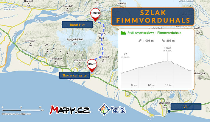
Map: the course and profile of the Fimmvorduhals trail (compiled on the basis of maps.cz)
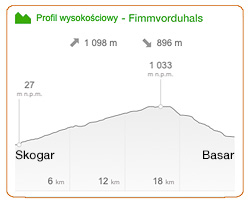
Fimmvorduhals – profile (maps.cz)
Nominally, therefore, this is a route for 10 to 12 hours – after all, you also have to eat at some point, and stop occasionally at a nice view. On the other hand, a day in Iceland in summer lasts up to 20 hours, so many people walk this trail “at once”. – they start really early in the morning and finish towards evening. The fastest ones are able (supposedly) to walk south to Skogar in time for the 3pm bus…
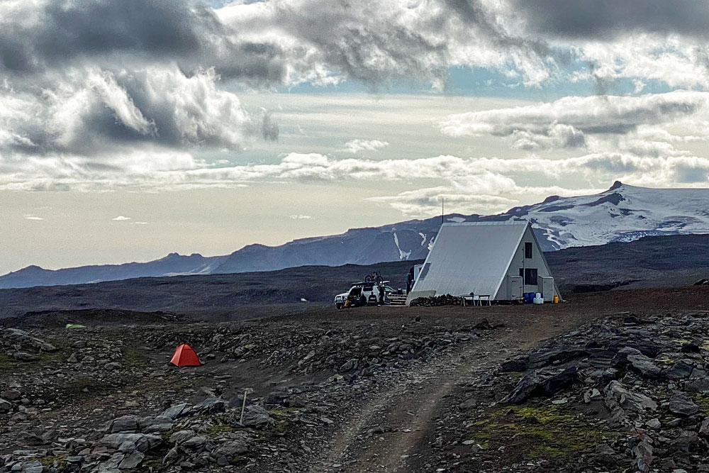
Baldvinsskali hostel and campsite
In the separatearticles you will read about the trails north of Fimmvorduhals – Laugavegur and Hellismannaleid – and all the shelters and campsites on these trails.
What to see on the Fimmvorduhals trail
Fimmvorduhals is an extremely scenic trail. Walking from the south, we start with more than a dozen smaller and larger waterfalls on the Skoga River. Some of them can successfully compete in their attractiveness even with the largest and most famous Skogafoss, from which this trail begins. Certainly, this “day of waterfalls” is a huge advantage of the trail and the reason why it is really worth going .
If you came to Skogar by car to see the famous Skogafoss, COMPLETELY walk at least a bit up the Fimmvorduhals trail. In about 45 minutes (maximum 1 hour) you will reach the beautiful Skalabrekkufoss, passing several other waterfalls along the way. It’s really worth it!
The way to the last of the waterfalls by the trail (there are as many as 20 here in total) and back is almost 15 km (20 GOT’s), so if you do not walk very fast, this is a route for 5 to 7 hours (total round trip). Continuing north, we reach the Fimmvorduhals Pass, which is quite high for Iceland. Its 1,000 meters above sea level is colossally impressive, as the base of the mountains among which the pass lies rises directly from the nearby ocean (in a straight line it is only about 15 km). Thus, the difference in height between the Skogar campground and this pass is almost identical to that which separates the center of Zakopane from the top of Giewont
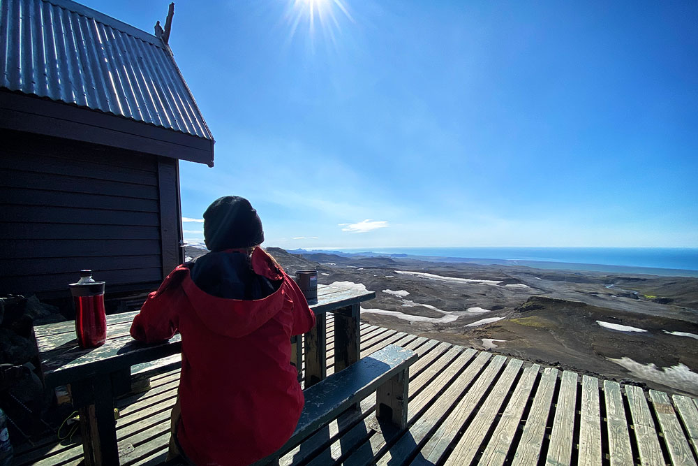
view toward Skogar and the Atlantic
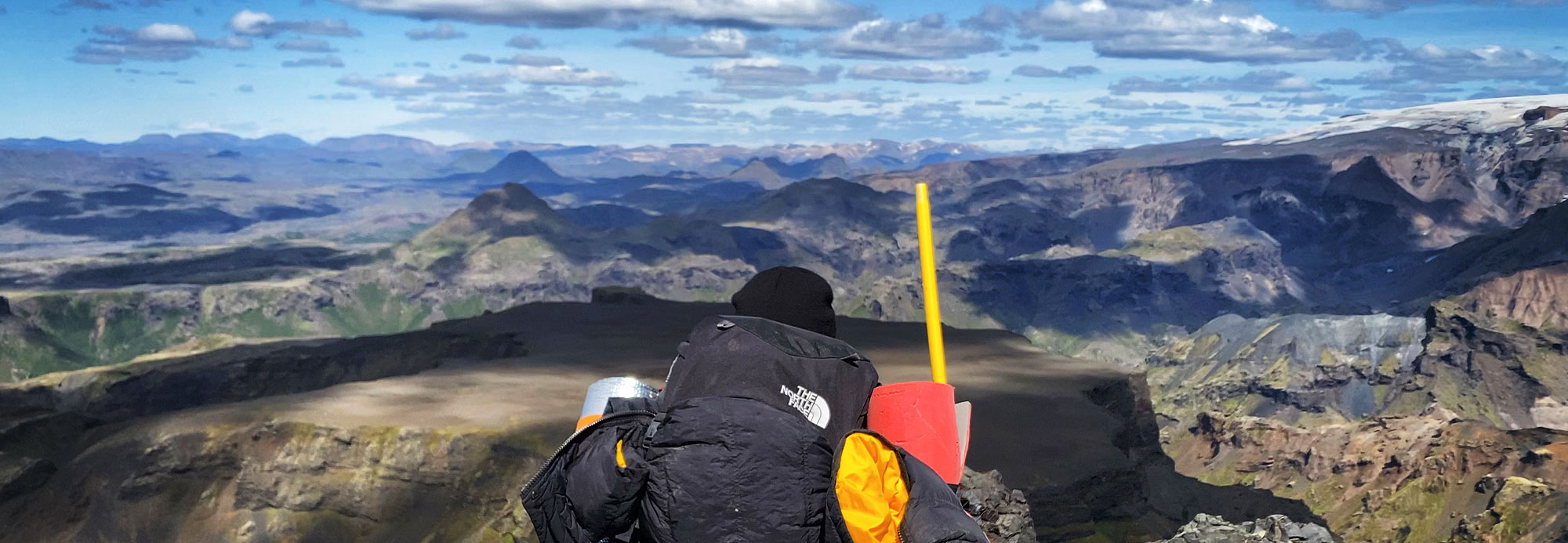
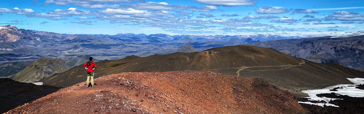
panorama of Thorsmork from the Fimmvorduhals trail
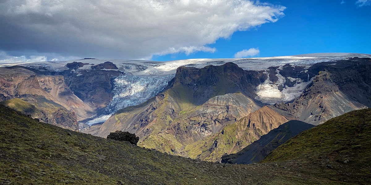
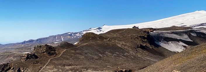
In addition to beautiful panoramas of glacier-covered mountains, you will also see the Magni and Modi (isl. Móði) craters in this part of the trail. Their names come from the names of Thor’s sons, and the craters themselves were formed and spit lava between March 20 and April 13, 2010. – During the aforementioned eruption of Eyjafjallajokull.
In the lower / farther part of the trail, two beautiful canyons – Hvannargil and Strakagil – are of particular interest. The Fimmvorduhals trail does NOT pass through them, but you can turn off the red trail to Hvannargil, and from the Basar Hut campsite you can take a separate trail to Strakagil.
IFyou’ve come to Thorsmork by car and the weather is beautiful and sunny, then you MUST hike the Fimmvorduhals trail to the Magni and Modi craters and return from there via the trail through Hvannargil. This is probably the most beautiful 1-day hiking trail in all of Iceland! (For details, see the Basar Hut article)
How to get to the Fimmvorduhals trail
Both the northern and southern ends of the Fimmvorduhals trail are relatively easy to get to. Unfortunately, getting from Skogar is a bit more difficult.
Getting to/from Skogar
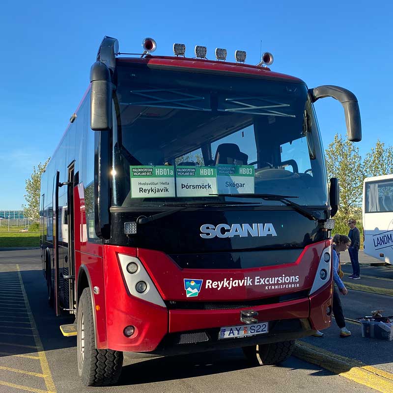
Bus to Thorsmork (and Skogar) at BSI Station
Czasem (sic!) and without warning or announcement the bus from Skogar goes straight to Reykjavik, without a long stop in Hvolsvollur. Unfortunately, this is impossible to plan or predict ?♂️
One sure saving grace here is the state buses – Straeto. Line 51 (to/from Hofn) departs from Skogar towards Reykjavik at 16:25 and arrives as early as 18:45 (on Saturdays and Sundays: 15:07 -> 17:24), but:
- goes neither to BSI nor to the campground, but to Mjódd station (eastern Reykjavik);
- requires a transfer in Selfoss (although it’s a b. quick/short transfer);
- it is not possible to reserve a seat for this bus (usually there are seats, but not always, unfortunately);
For the record: line 51 DO Skogar goes in the middle of the day. Departure from Mjódd station is at 11:30 a.m., and arrival in Skogar (scheduled) at 1:42 p.m. The ride also requires a smooth transfer at the Selfoss-N1 stop. So from a tourist’s perspective, this probably only makes sense if your plane arrives in Keflavik late enough to miss the aforementioned morning buses, but early enough to catch the 11:30 one from Mjodd station. Going out on the trail at 13:42 doesn’t make much sense – it’s probably better to leave it then for another morning. On the other hand, you can then use the remaining half day to hike to the nearby Kvernufoss waterfall or hitchhike to the DC-3 wreck or Seljavallalaug pool.
Getting to/from Thorsmork
Bus in Thorsmork
Thetwo campsites mentioned have quite similar names, but lie in completely different places. Laugardalur is a campground in the center of Reykjavik, right next to the Laugardalslaug pool complex. Langidalur, on the other hand, is a campsite in the Thorsmork region, on the north shore of the Krossa River.
You can also get to Basar Hut in your own car, but it’s essential to have a 4×4 (more on this in the article about Basar Hut).
Drive between Thorsmork and Skogar
Unfortunately, at present (2023) there is only one direct connection between Thorsmork and Skogar: a bus from Southcoast Adventures leaving Basar Hut at 20:30 and arriving in Skogar at 22:00. If you want to leave your car in Skogar, walk the entire Fimmvorduhals trail and return to your car for the evening (night), this is your only option, other than hitchhiking. It is much easier to arrange a trip to Fimmvorduhals directly from Reykjavik or from Hvolsvöllur (about 110 km east of Reykjavik). From there, we have several (aforementioned) buses each morning and evening going to/from Skogar and Thorsmork.
Accommodation on the Fimmvorduhals trail
At both the ends and the middle of the Fimmvorduhals trail, we have several lodging options available to us.
Accommodations at the southern end of the trail
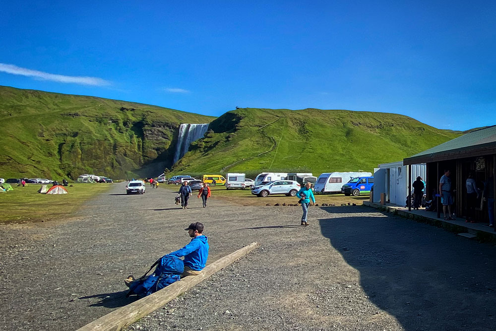
Camping in Skogar
The Skogar campground is not one of the best. It’s actually a separate section of the parking lot below Skogafoss and simple, small sanitary facilities. In addition, it happens that the camping area is waterlogged. In contrast, the guesthouses mentioned are relatively good, but quite expensive. The Skogafoss area is such a popular place that it is better to avoid staying overnight here.
Accommodation at the northern end of the trail
On the northern side, in Thorsmork, the Fimmvorduhals trail formally ends and begins at Basar Hut campground. This is certainly the best ‘base camp’ on the trail and also the first campsite after leaving the trail. However, there are still Langidalur and Volcano Huts campsites available in the close vicinity. All three of these places are close to each other, all offer shelter accommodation and there is also a campground at each of them.
Basar Hut can be reached by one’s own car (but not everyone’s – see the article about the campground), and this is also where we will meet the most Icelandic families. Volcano Huts, on the other hand, offers the highest standard (sauna, restaurant, store, electricity, unlimited showers), and Langidalur is the smallest and most strongly profiled for the so-called qualified tourist – mainly people going to or returning from the Laugavegur trail. A detailed description of each of these places can be found in the linked articles.
Accommodation in the middle of the trail
Fimmvorduhals – as we mentioned at the beginning of the article – is quite a long trail if you want to hike it all at once, in one day. Fortunately, this is not a necessity
Fimmvorduskali against the backdrop of the Eyjafjallajokull volcano
In neither of them can we use either electricity, a shower or a trash can (with few exceptions). The camping toilets are so-called “dry toilets” – Icelandic versions of our Slawojeks. There is no running water in the huts, but water in cans is provided, for cooking and washing (and possibly minor washing). There is “not always” water in Fimmvorduskala, and the nearest stream is approx. 100 m below
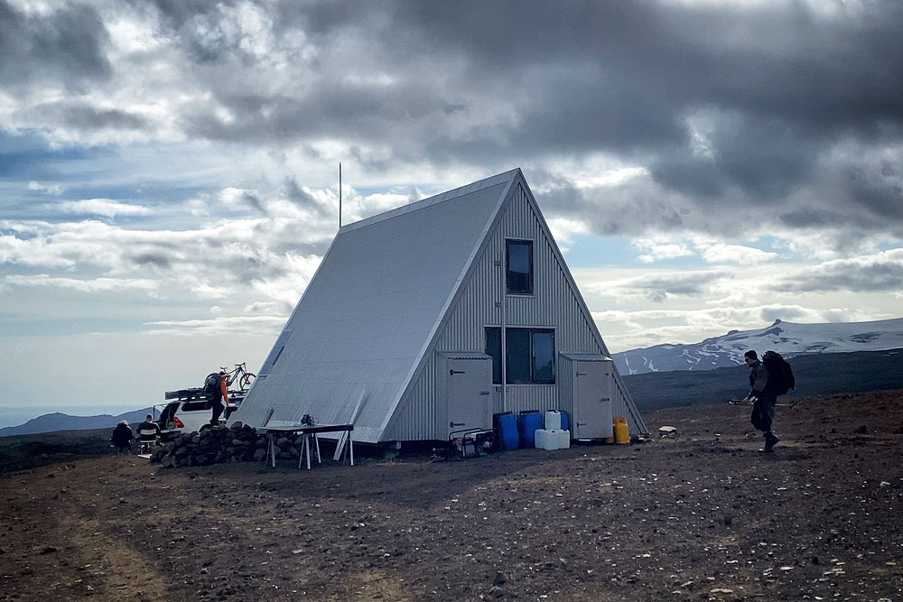
Baldvinsskali shelter
You can read more about the conditions and prices of these accommodations (as well as stores, toilets, etc.) in the linked articles about both huts.
Hazards on the Fimmvorduhals trail
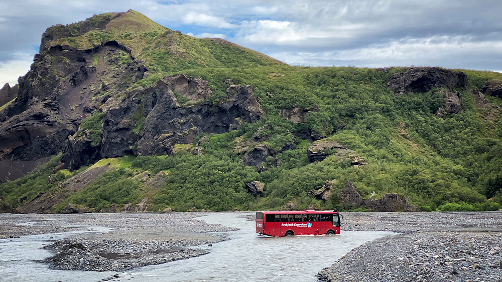
The Fimmvorduhals trail is not only beautiful, but also safe and comfortable. We don’t ford any streams here that force us to take off our shoes (unless shortly after a major rainfall), and usually the biggest challenge is the wind.
Most of the time, the wind only forces us to put on a hat and gloves, and in return provides excellent cooling even on the roughest sections. However, if a storm is currently sweeping through Iceland, you can expect very strong, even hurricane force winds on the pass itself.
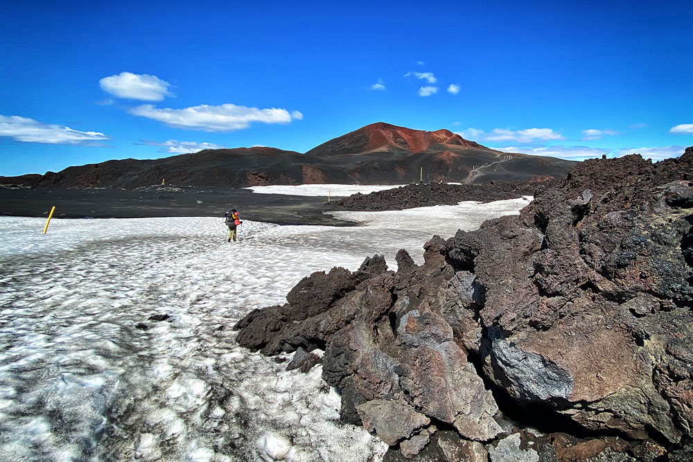
Summer snow near Modi
Onlytwo places on the trail really require heightened caution (of course, heightened above the caution that should always be exercised in the mountains anyway). These are the short chains and the so-called cat ridge. Both places are located on the northern part of the trail.
Chains
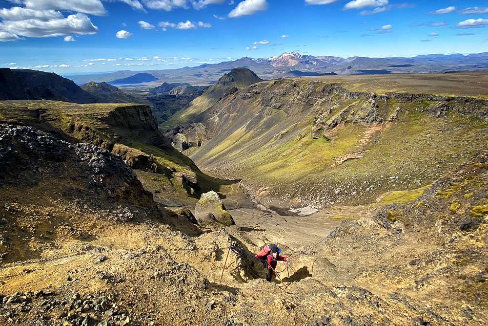
Chains on the trail
It is indeed a very steep section and with a lot of exposure, but it is also very short and protected by ropes and chains. Admittedly, the rock and scree here are quite slippery, and the chains themselves, unfortunately, do not stick to the rock with every catch, but a fit tourist will overcome this place in a dozen seconds (sic!). Unfortunately, this place is “within the range” of day trips from Thorsmork, and the elderly and those unaccustomed to walking on chains overcome this section very slowly and often with undying fear. Therefore, a kind of mountain “traffic jam” can form here.
Cat’s back
Cat’s ridge
What to add to a trip to Fimmvorduhals
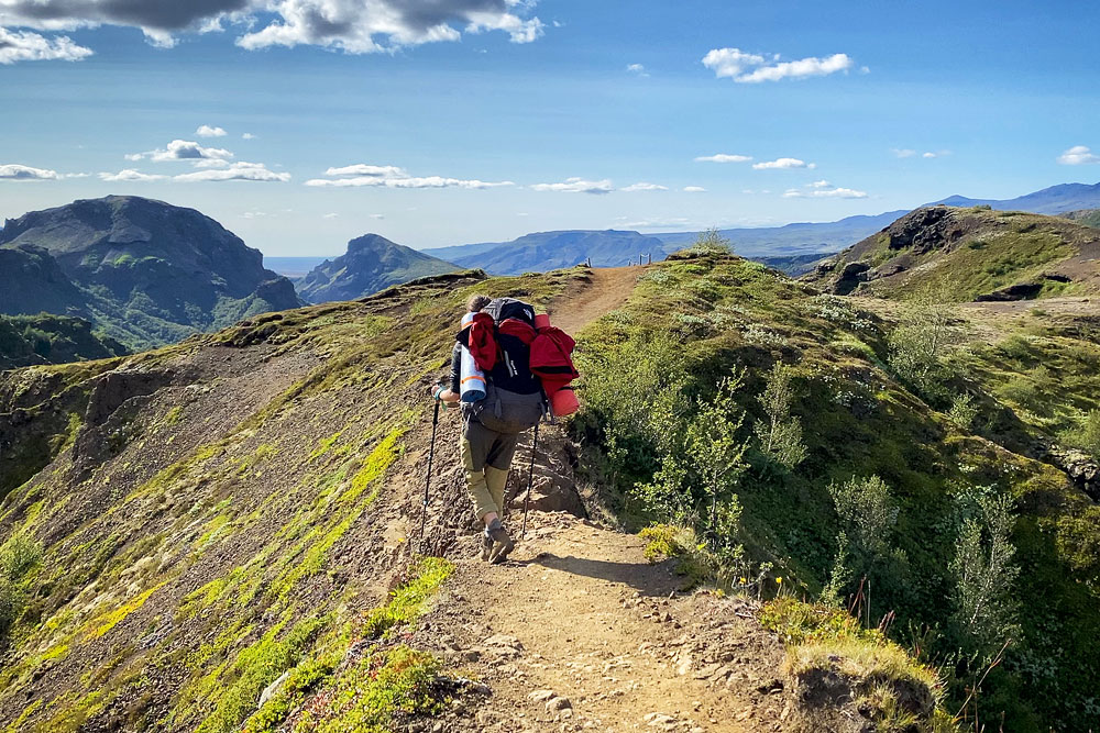
The Fimmvorduhals trail is often treated as an ‘add-on’ to the longer, neighboring Laugavegur trail. And indeed it works well in this role (more: Laugavegur – Iceland’s most beautiful trail). In addition, it is also really worth combining it with 1 or 2 days spent on the trails in Thorsmork and Godaland (see more about them in the articles on Basar Hut and Langidalur). Such an extra day (or two) also give you valuable flexibility in planning the main route if the weather breaks. On the Skogar side, in addition to the famous Skogafoss itself, it’s worth setting aside some time to see the Kvernufoss waterfall. It’s a very nice waterfall, and you can read more about it in the article Skogafoss – a spectacular waterfall on the south coast. You can also try to get (hitchhike?) to the DC-3 wreck to the west and/or to the Seljavallalaug basin east of Skogar.
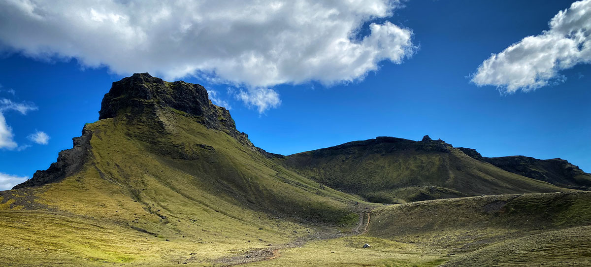
Photos from the Fimmvorduhals trail