Reykjadalur is a beautiful valley with a hot mountain stream. It lies above the village of Hveragerdi (Hveragerði), 45 km east of Reykjavik.
For fans of hot baths and mountain hikes
Filled with hot springs and mud pools, the Reykjadalur Valley is an ideal recreational area, famous for the hot stream that flows through its center and can be enjoyed all year round. It is certainly, for example, a great and much more natural (but also “wild”) alternative to the well-known Blue Lagoon complex
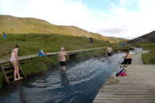
Boiling water from dozens of hot springs in the hills pours into a single stream also fed by glacial and rainwater. All you have to do to get the perfect bathing temperature is to enter the stream at the right altitude – the higher you go, the warmer the stream is (even over 40 oC!), and the lower you go, the cooler it is.
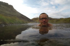
Bathing in a hot stream “just” flowing through a beautiful mountain valley is an absolutely unforgettable experience.
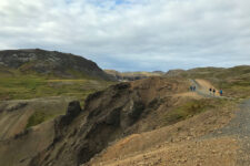
However, the entire Reykjadalur valley is a popular place not only for hot baths, but also for hiking. The surrounding trails are not particularly demanding and are an excellent attraction also for people who do not boast special physical fitness. The trails lead among hills and hillocks and abound with bubbling and strongly steaming springs and beautiful views of unspoiled nature.
Fauna and Flora
The valley was formed by glacial erosion in the crater of an extinct volcano (the volcano was active about 120,000 years ago). Thus, it was formed by the two most important forces in Iceland.
The vegetation of these areas has been shaped by geothermal activity and includes lush wetland plant communities thriving near hot streams and warm springs, as well as mossy areas in drier parts. The area is home to various thermophilic moss species (some endangered) and very rare colorful microorganisms.
Reykjadalur – tips and practical information
- at the place where the stream reaches useful temperatures, piers, wooden descents and wind shields have been built, at which it is a little easier to change;
- Be sure to bring everything you need for swimming – a swimsuit, a towel, something to eat and drink – there is no store, etc. at the top (periodically there are some open at the parking lot below); it’s also worth being prepared for a possible change in the weather;
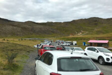
- The trail to the valley begins at the clearly marked parking lot behind Hveragerdi (at the northwestern end of the town); in high season the parking lot is quite busy and sometimes you need to leave your car a little earlier;
- the climb to the valley itself takes about an hour, at a brisk pace probably about 45 minutes; the trail is well-maintained and wide, but in the initial part, visible from the parking lot, a bit steep;
- there are no fees to enter the valley or use the stream;
- due to the rather long access to the bathing area, the best time to visit Reykjadalur is in summer and early autumn;
- do not deviate from the designated trail – this is for both nature conservation and your safety on the steep slopes and near the hot springs;
- when hiking in Reykjadalur, be sure to read the signs – not all hot springs are suitable for swimming; however, the main bathing area is impossible to miss;
In the town below (Hveragerdi) there are all the amenities tourists need: a supermarket, a gas station, an information center, as well as several cafes and restaurants. Interestingly, some of them use geothermal forces to prepare food. By placing food in boiling water underground, they make it cook all the way through.
The geothermal region of Hverasvaedid (Hverasvæðið) in the center of the city is also worth a walk.
How to get to Reykjadalur
Hveragerdi is reached via the country’s main ring road, Route 1. To reach Reykjadalur, you need to take the 1 to the town and drive through it, in the final stage following signs to the north.
From the parking you have a 45-minute hike in front of you (30-minute if you’re quick, or 1-hour if you’re with family 🙂 ). The trail is really easy and the part you can immediately see from the parking lot is the most steep one. Once you’re on top of it, it’s an almost flat trail onwards.


